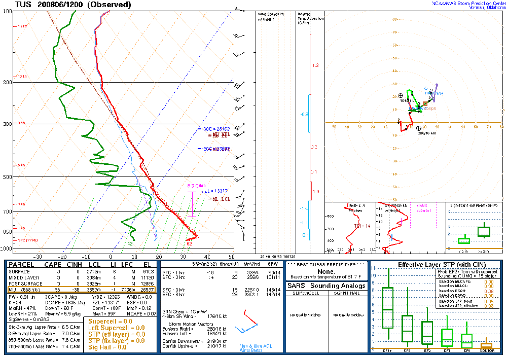
Another day of almost no activity.
The 6Z WRFGFS had a bit too much activity for far SE Arizona. The rest of the runs were OK.
Discussion
Another discussion on how the current situation "does not look like the peak of the monsoon season". Exhibit A:
Exhibit B:
And C:
Yesterday, I got all excited as the model consensus was for an increase in CAPE and moisture for southeastern Arizona, as far west as Tucson. That isn't the case this morning as the only moisture increase is over far southeastern Arizona and into southwestern NM. PW data indicates moisture has decreased around the Tucson area. I should have stayed in bed today.
Initializations
There is a cloud band from eastern Sonora up into southern NM which was initialized well. Elsewhere, it's clear. No inverted troughs or MCV's were noted. PW was well initialized by the 6Z GFS and 12Z RR. The NAM was pretty good too and only had minor wet bias at a few locations. Thus, there is no favorite, and model performance should be pretty good.
Day 1
Yesterday
While writing about the storm forecast yesterday, I had a nagging doubt regarding where all this moisture and instability was going to come from as PW in northern Sonora (Moctezuma) had dropped to 35mm or so. However, run after run insisted on increasing CAPE and developing widespread storms, thus I ignored it.
The moisture has now increased at Moctezuma to 42mm so that is an improvement. By early afternoon, this moisture starts to move into far southeastern Arizona. Much of the rest of the state is dominated by dry air.
CAPE is minimal, even along the border so don't expect much activity, even there.
The WRFNAM and RR manage to develop a few storms right along the border by late afternoon.
At least the storms continue for a while, into the evening.
There could be an outflow that moves int eastern Pima County this evening. DCAPE on the sounding was very high, thus outflows from what storms form could be strong.
Day 2
The situation is similar tomorrow as very dry air dominates most of the state. The southeastern corner has enough moisture to support a few storms.
CAPE is a bit higher and as far north as the White Mountains so there should be somewhat more activity there.
The higher CAPE along the border results in a few stronger storms by later in the afternoon in Cochise County.


No comments:
Post a Comment
Note: Only a member of this blog may post a comment.