Previous Forecast
The model runs were generally accurate. Most got the stronger activity west of Tucson and even the WRFNAM was able to predict the storms on the west side of town. Light precipitation also fell around Phoenix which was forecast by some of the runs. QPF is still running on the light side for stronger storms. The 15Z RR has shown some improvement after made a minor change. We'll see if that continues.
Discussion
Tropical depression Hernan turned out to be a bit of a bust as it's been downgraded but has enough circulation and in a favorable location to trigger a Gulf Surge. More moist air can be seen moving northward, up the gulf and along the coastal plain.
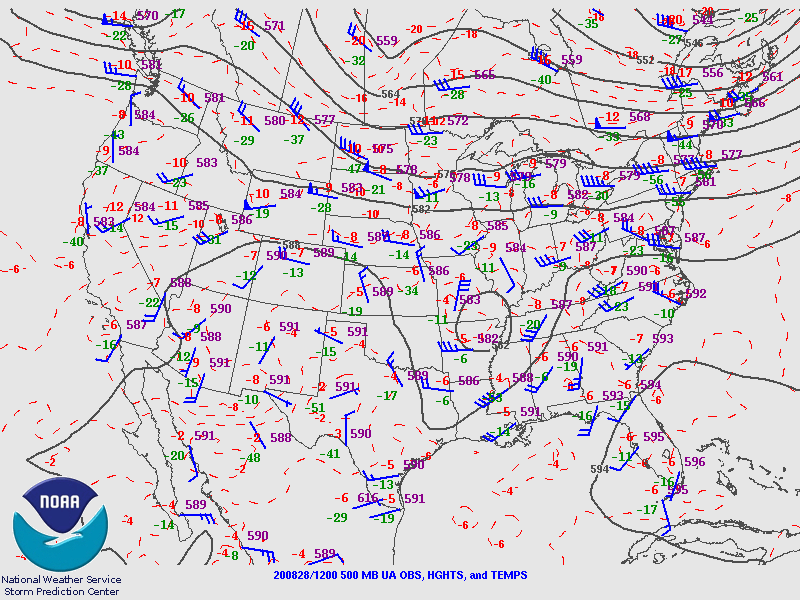
The 500mb pattern is mostly unchanged with the center of the anticyclone centered over northern NM. There is a broad weak trough over the far western CONUS resulting in mostly southerly to southwesterly mid-level flow over the state. The Tucson sounding reported a surprisingly cool -9C, but much warmer air isn't far away in Mexico.
In spite of the slight increase in moisture, and mid-level cooling, CAPE is still minimal. All the 500mb cooling has done is to increase the strength of the mid-level inversion. So, unless there is an increase in moisture, which is likely, it's not looking favorable for any significant activity around Tucson or Phoenix.
Initializations
A band of clouds and light showers over and north of Phoenix this morning. All initializations were able to correctly place this feature. 6Z NAM PW errors were not as high as they typically are, but I'm still not going to use that run. 6Z GFS had some issues too but should be OK. Both the 12 NAM and RR had minimal errors.
Day 1It looks like an interesting few days are ahead for Arizona. Finally! However, it's a transition event as a broad west coast trough moves into Arizona, bringing an end to the monsoon, at least for a while. The Gulf Surge doesn't kick in until around mid-day. Will it be soon enough to increase the number and intensity of afternoon storms?

A major positive change from yesterday is that the low-level easterlies that have plagued southeastern Arizona are over and moisture has increased. While not a lot, it should be enough to get storms going over the higher terrain.
CAPE does increase over southeastern Arizona but is still less than 1000 J/kg anywhere over the state. Still, it's enough to supports showers and storms over the higher terrain. As we've seen on previous days, even CAPE around 500 J/kg has been enough for some strong storms at higher elevations.
Showers and a few storms develop this afternoon mainly over eastern and southeastern Arizona where CAPE is the highest. Storm motion is generally to the NNE.
It looks to me that there isn't enough CAPE for Tucson area storms to make it into the valley.
And that is about it for today/tonight except for some weak activity in far southern Cochise County.
Day 2
This is more like it! TD Hernan slowly moves westward and continues to be in a very favorable location to advect significant amounts of moisture into Arizona. How many times have I been able to write the previous sentence this season? Maybe once or twice. PW is above 50mm over southwestern Arizona by mid-day. I think that is only the second time it's been this moist.
850mb dewpoints are very impressive and this might be the highest of the season so far. Note the reverse "Chiricahua Gap" flow into SW NM.
Umm, OK. This summer, we've seen CAPE like this a few times before and little or nothing happened. Is this going to be the case again this time? It reminds me of Charlie Brown and Lucy with the football again.
By tomorrow, the high is suppressed into far southeastern Arizona and southwesterly flow dominates. What interests me is the weak trough of cooler air over western Arizona along with a weak jet ahead of a cutoff low off the coast. That may be all we need to kick off a period of severe weather.
This forecast Skew-T for Tucson is locked and loaded. While the CBL is not mixed much this early, there aren't any significant inversions above, so it won't take much to mix to the LFC. The other notable feature is the excellent directional shear profile for organized and severe storms.
The model runs all have the general idea of developing intense storms somewhere over southeastern Arizona during the late afternoon hours. The WRFNAM develops them right over Tucson. Strong storms also are underway over much of northern Arizona and perhaps even out near the Colorado River.
The WRFRR is a bit farther to the SE, but still in the same general area.
The southeastern Arizona activity ejects a moderate outflow boundary into central Arizona resulting in strong low-level convergence due to the westerly flow from the surge. This will provide the needed lift to expand the area of storms to the west through the north.
The Phoenix Skew-T is also ready to go. It does have a pronounced inversion on top of the mixed-layer, but outflow induced convergence is strong enough to break the inversion. Fortunately, there is more than enough CAPE to also overcome the very warm layer around 400mb. Lastly, there is quite a bit of directional share above the mixed-layer providing a good situation for storm organization and rotation.
The various runs have all sorts of solutions for Phoenix from a large area of strong to isolated severe storms, to what looks to me like a mini-supercell!


No comments:
Post a Comment
Note: Only a member of this blog may post a comment.