Previous Forecast
Low CAPE and warm air at and above 400mb conspired to keep storms mainly weak across much of the state except for far southern Arizona where some heavier precipitation fell. Northern NM had more activity, which has been the case for much of the monsoon season.
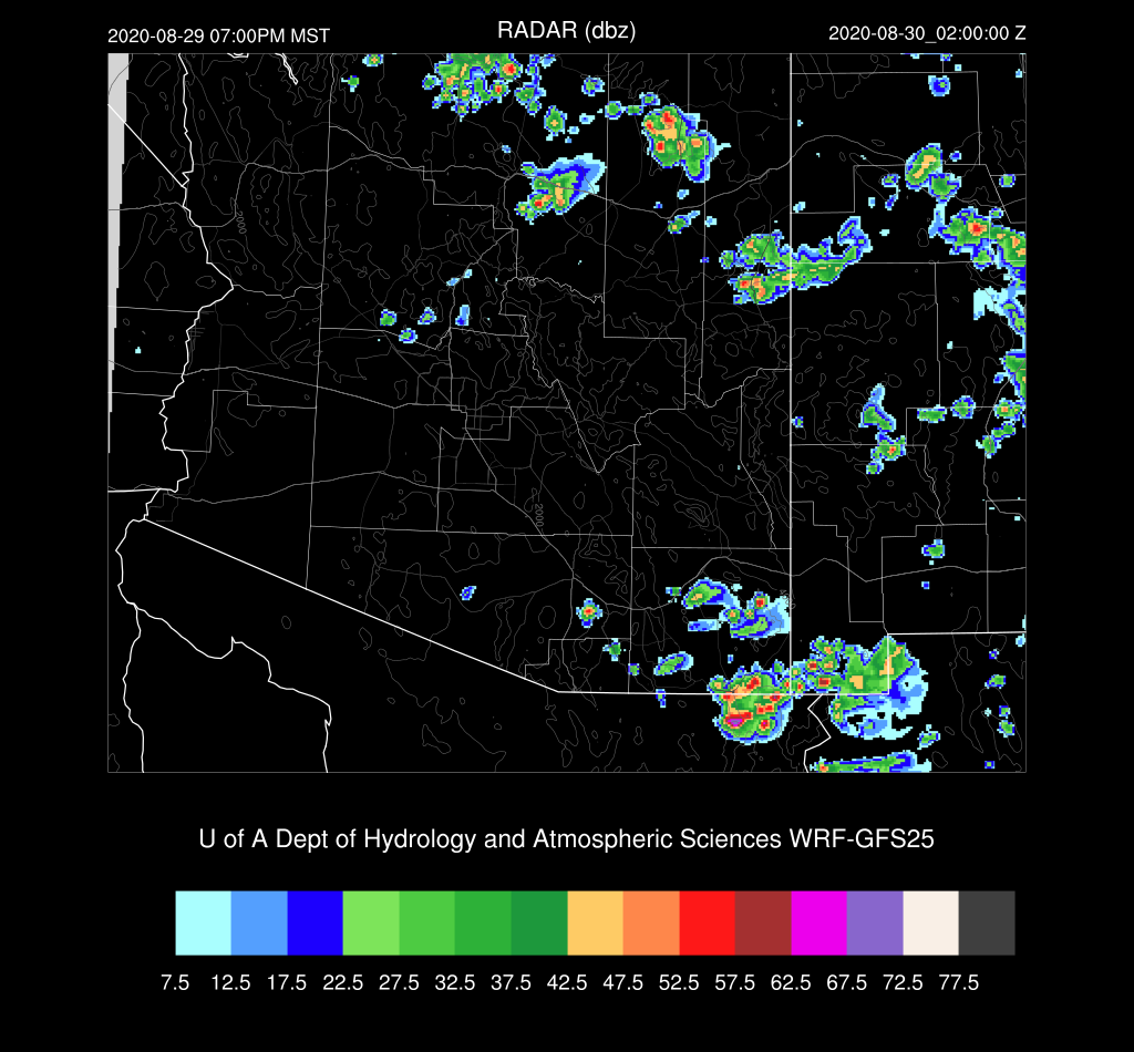
All the runs were again quite accurate with locations and even amounts weren't too far off.
Discussion
The advertised increase in moisture is here as PW has increased over all of the southern 1/2 of the state. PW is in the low 40's over southwestern Arizona and up to 38mm at Tucson. Remnants of Hernan is in an unexpected position over central Baja this morning as models had it moving more northwesterly, and off of the southern Baja Coast. 50mm+ PW has made it to the northern end of the Gulf of California.
The 500mb map has a broad area of light winds at the center of the anticyclone from Sonora ll the way to NE Texas. Arizona is mainly under southwesterly flow and cool air, with temperatures from -9 to -7C. The cutoff low continues off the coast of California and a weak shortwave is present over far western Arizona, which may or may not help with deep convection today/tonight.
At 300mb, a 50-knot jet is present over northern Arizona placing southern Arizona near the favorable right rear entrance region as the jet moves eastward.
Mixed Layer CAPE has improved, but is still not that high as Tucson has only about 700 J/kg. Also, a set of nasty inversions are present just about 500mb, which will keep convection relatively shallow without more CAPE. The wind profile is starting to show some speed and directional shear above 600mb, but the winds are light and variable below that. In summary, better, but not good enough, yet, for a major outbreak.
Phoenix has a bit more speed shear, but not much directional shear. The inversion is even stronger and CAPE is lower so the situation is worse there.


InitializationsThere were scattered to broken clouds, as well as a few showers around the Phoenix area this morning. The clouds are slowly dissipating as the morning goes on. All the initializations missed the area of showers. The 6Z GFS did a fairly good job with clouds, but the 12/15Z RR and 12Z NAM were too cloudy over southern Arizona. The 6Z NAM also did better with respect to clouds, but as usual, initialized too moist, but not as bad as usual. I'm worried about all the model clouds over southern Arizona will restrict heating too much and am leaning towards the 6Z runs.
Day 1
The model forecasts have been notorious this year for the overpredicting storm activity for the Day 2 timeframe. It is starting to look like that is the case again. One part of the forecast from yesterday that has verified is the moisture increase, and it continues to do so throughout the day. PW increases to nearly around 50mm over much of central and western Arizona by early afternoon.
CAPE also increased to moderate to high, so the ingredients are there for a very active period.

The Tucson Skew-T certainly looks good with a lot of CAPE, a well-mixed CBL, and some shear in the mid-levels. There is more than enough CAPE to overcome the warm air above 400mb. Will there be enough heating to overcome the weak inversion on top of the mixed layer?
The best the model runs could do was the 6Z WRFGFS as it has strong to severe storms from about Tucson eastward by late afternoon/early evening.
The 12Z WRFNAM had only isolated, but intense storms, over eastern Pima County.
Because of the cloud errors, there will be too little surface heating by the model forecasts. I took a look at observed vs forecast temperatures at 17Z and the 12Z forecasts are all from 3-5F too cool. I believe there will be more activity, more like the 6Z WRFGFS run. I've been waiting for the 12Z WRFGFS to run and at this point in the discussion, it is far enough along to include. It doesn't have as many clouds as the other runs, but still somewhat too cloudy. The 17Z surface temperatures in SE Arizona are only a degree or two below observed. This is the best it could do.
Only the 12Z WRFNAM does manage to move an area of intense storms into Pinal County during the evening.
The storms die out as they get near Phoenix as the inversion at the top of the mixed-layer is just too strong.
It's time for a second opinion and it couldn't be more different. The HRRR develops widespread strong storms over much southeastern Arizona and even in Pinal County by 22Z. This seems too early for Pinal County.
The HRRRx is similar, but a bit later in the afternoon. It has less activity in Pinal County which makes more sense to me. Southeastern Arizona is active, much like the 6z WRFGFS.
Needless to say, confidence is low in any forecast today and tonight. Day 2 will follow later, once I compose myself.


No comments:
Post a Comment
Note: Only a member of this blog may post a comment.