Once again, a relatively quiet day with storms restricted to central Pima County and over the White Mountains and Rim. Most runs generally had the right idea. Eyeballing the forecasts, the WRFRR and WRFNAM looked like they had the best forecasts except they were wrong about precipitation over Mt Lemmon.


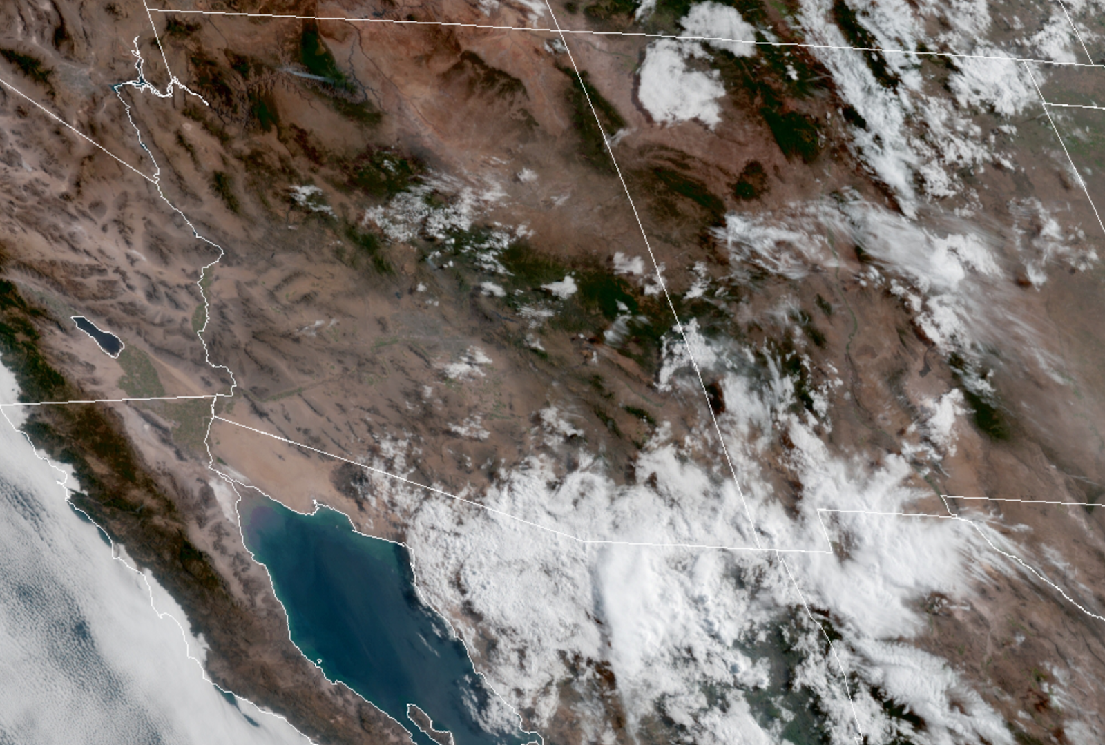
Arizona continues to be under weak mid-level flow and 500mb temperatures of -6 to -8C. The trough from yesterday appears to be somewhere over northern NM, and a weak MCV is visible over Sonora, accompanied by clouds and a few showers that are moving into far southern Arizona. The clouds are likely to retard heating for southern Arizona and decrease chances for storms. Morning MLCAPE from the Tucson sonde is a pathetic 200 J/kg, and winds are light and variable up to 400mb. It looks like the forecast from yesterday of little or no storms is on track, unfortunately.


Only the 12Z RR was able to initialize the area of clouds and showers in far southern Arizona correctly. All initialization had some sort of cyclonic circulation south of the border in Sonora. The RR also had the best PW initialization. The NAM was again a bit too wet in Mexico and Arizona. The WRFRR and WRFGFS are the favorites today.
The atmosphere around southern Arizona continues to be moderately moist as weak moisture advection continues due to a weak surge. PW is in the 30-34mm range during the early afternoon. Typically, this would be sufficient for a moderate amount of storm activity.


Day 2
It's the same story tomorrow: some moisture, but no CAPE except for a little over far eastern Arizona.

The WRFNAM has a bit more moisture and CAPE (it did initialize too moist) and does develop more activity for far SE Arizona later tomorrow. This is the best-case scenario and probably less likely to happen, but I need something to motivate me to write about Day 2!

And it will be hot.

No comments:
Post a Comment
Note: Only a member of this blog may post a comment.