Wednesday, July 17, 2019

20190717


Previous Forecast
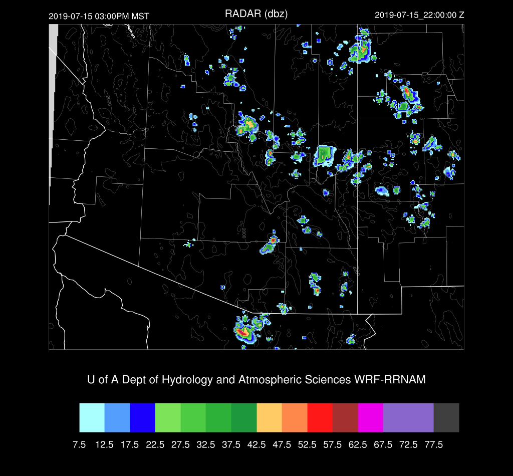
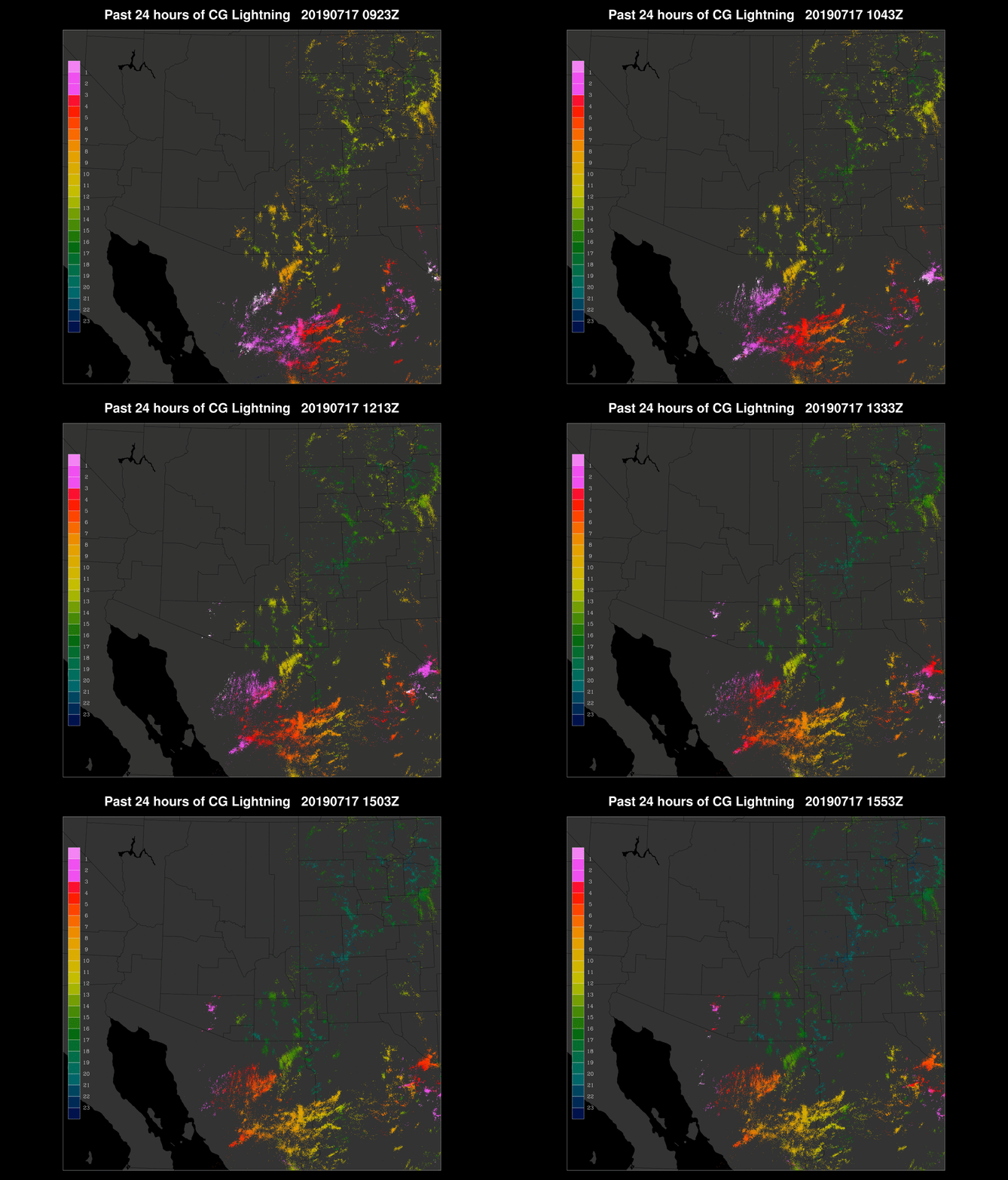
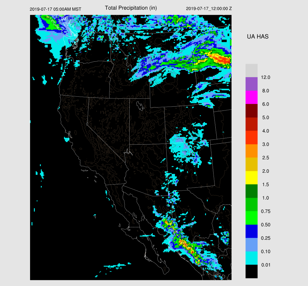
Not much to say about yesterday as there wasn’t much activity.  The WRFGFS and WRFRR did the best job, at least in NM and AZ.
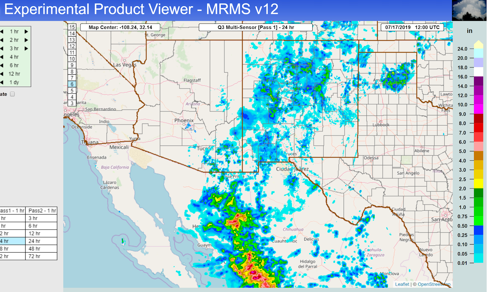

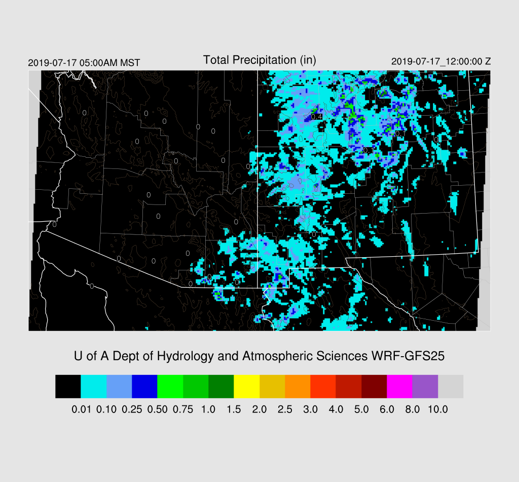
A large and long-lasting MCS developed overnight in Sinaloa and then moved/developed into Sonora.  I looked at how the outer domain did as these features can really impact our next day weather due to clouds and moisture surges.  The WRFGFS (below) was not very good as it had only scattered deep convection.
The WRFNAM was a bit better, but the best was the WRFRR.  Still, it looks like even the WRFRR didn’t have enough activity and some time in the future I’m going to look at either increasing the outer domain resolution or another high res domain over NW Mexico to see if it helps improve the day 2 forecast for Arizona.
Initializations
The big MCS (best of the year so far) has left behind a large area over southern Arizona and even a few showers/storms developed in central Pima County this morning.  Most of the clouds are thick cirrus, and they continue to dissipate; thus, heating may not be reduced that much. A large MCV is spinning roughly over Hermosillo as well as another MCV or IT over the south-central Gulf of California.  It’s a complicated mess!


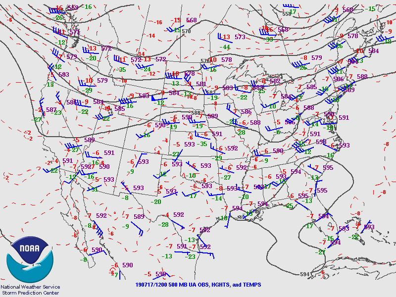
The 500mb map has a weak trough along the west coast that has turned mid-level winds to the SW.  The big issue is the possibly anomalous 35-knot wind at Empalme which was probably from being in the vicinity of one of the MCV’s and storms.
12Z RR clouds were not initialized well as there was not nearly enough coverage.  The NAM cloud initialization was actually quite good as was the GFS. The 12Z RR really struggled with the dual circulations as the northern one was very weak while the southern one had 20-35 knot winds, thanks to the nearby sounding data.  The NAM was better as the northern one was stronger and the southern one weaker, but still too strong, IMO. The GFS was similar to the NAM. WRFNAM below.

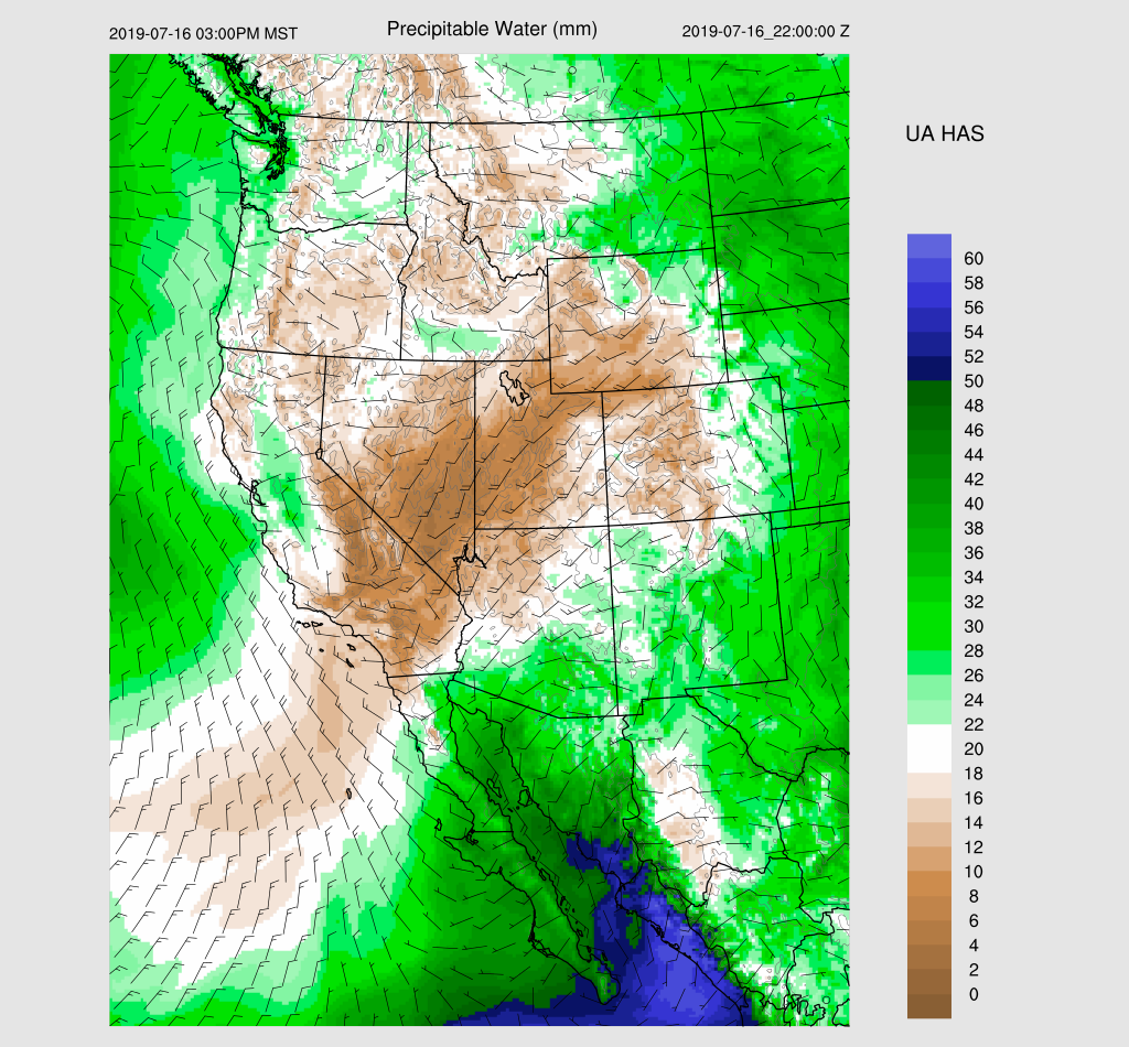
Another problem is that the PW initialization in NW Mexico was very poor.  The NAM was too wet by 12mm in Sonora. Part of this might be localized drier air post convection, but all of this makes the confidence in the WRFRR and WRFNAM quite low.  The GFS errors were much smaller and were actually not bad. We’ll see later this morning if the 15Z RR improves, but at this point, the WRFGFS should be the best performing run.

Day 1
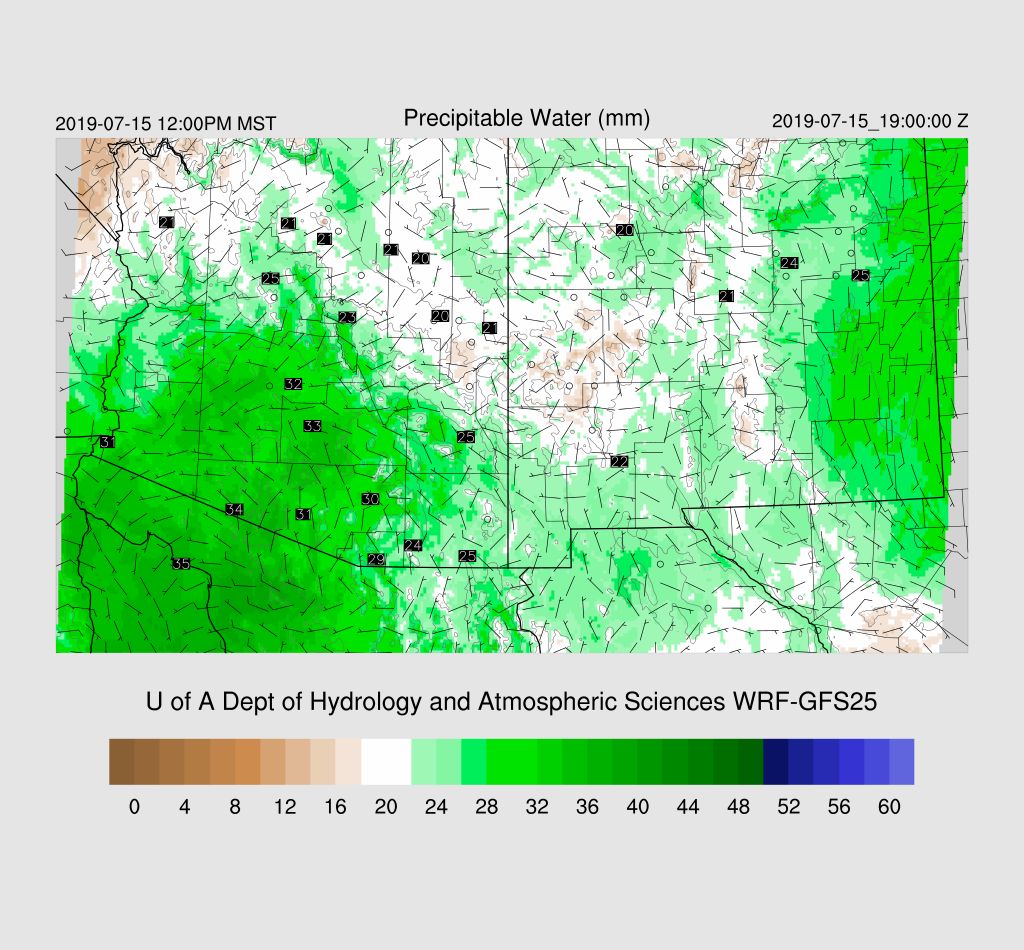
The surge is underway with strong southerly winds and blowing sand at Yuma.  Dew-points are in the low 70’s there. PW has increased over southern Arizona and is in the upper 30mm range.  The strong surge continues today and wet air continues to advect into the state. 850mb dew-points increase into the 10-14C range; thus, there is a threat of heavier rain compared to the recent storms, assuming storms develop.

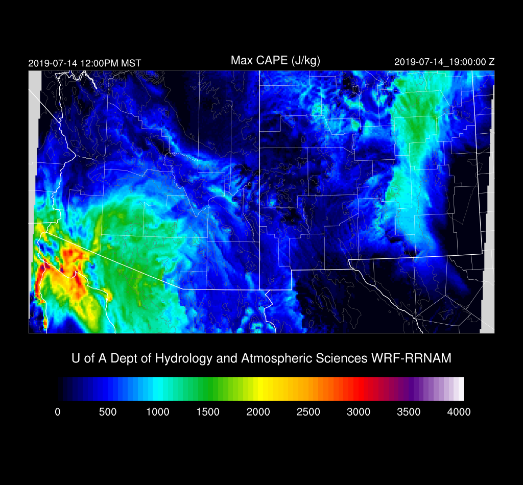
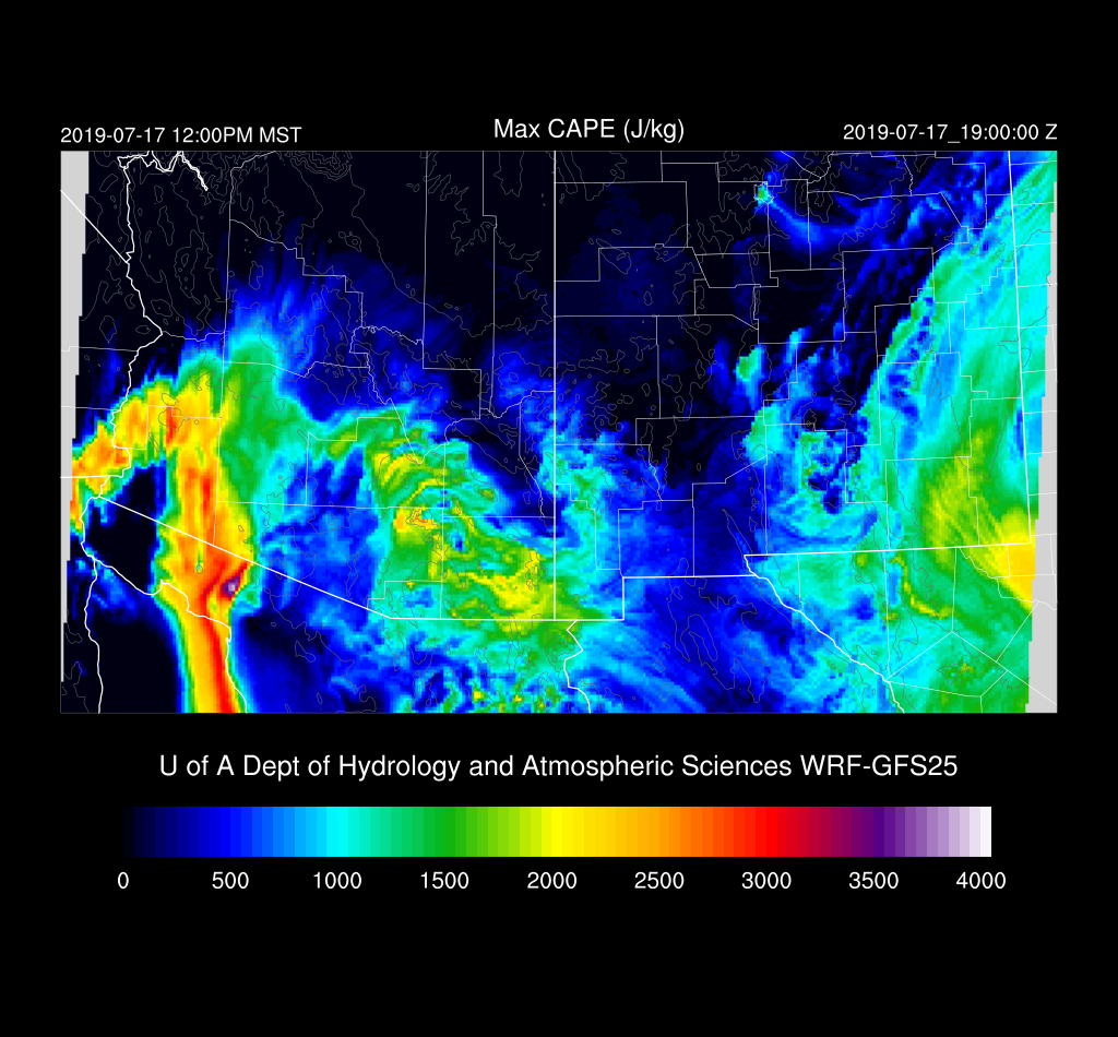
CAPE is quite high over southeastern Arizona and out in western Arizona.  The question of the day is if there is going to be enough heating to overcome the cooling in the PBL?  Just from previous experience, I’d say no for most lower elevation areas.
The cooling in the PBL can really be seen at Phoenix where it almost looks like a mid-west style cap.

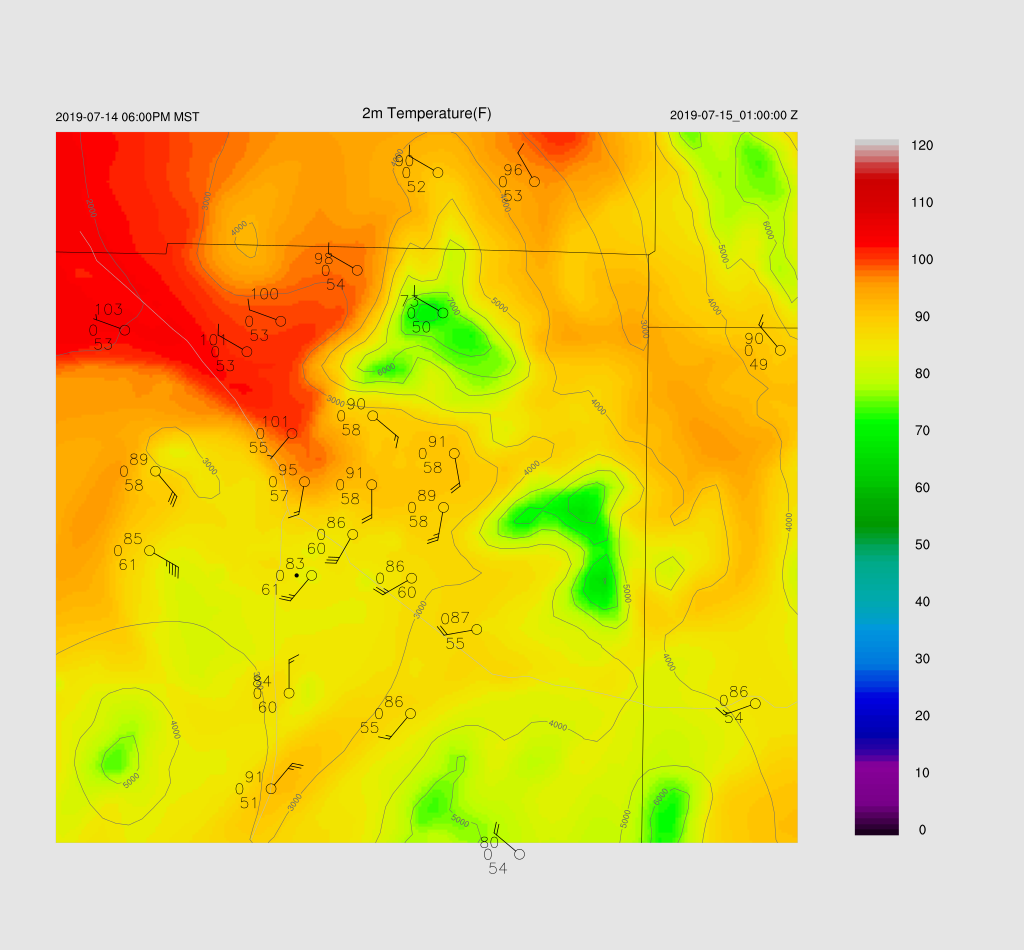
The situation in Tucson isn’t as bad as the inversion seems pretty weak so there may be some activity around later this afternoon or evening assuming decent heating. I looked at 16Z observed vs. forecast and in general, the 3 models are 3 degrees or so too warm in southeastern Arizona.  There is plenty of CAPE and moisture, so any storms that form could produce very heavy rain and along with very light steering, storms won’t move all that much. As steering is weak, it’s going to be challenging to get storms to move into the lower elevations of SE Arizona and will have to develop on outflow boundaries instead.

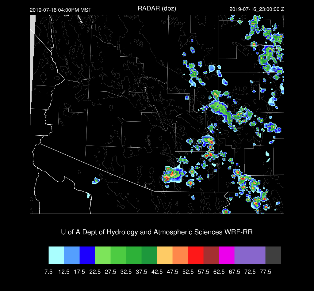
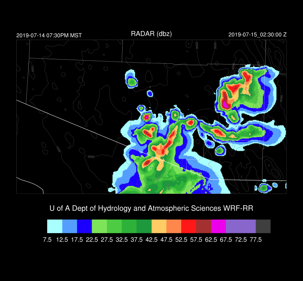
All runs have strong storms underway by mid to late afternoon in Santa Cruz and Cochise Counties.
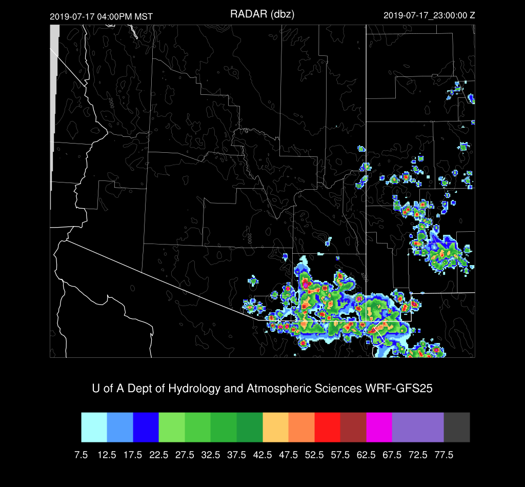
Storms generally move to the west due to some week easterly steering and strong storms move into eastern Pima county during the early evening.
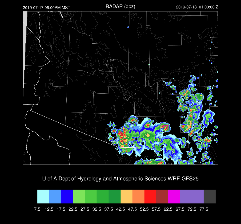
It’s really a tough call for Tucson.  Thunderstorm outflows move into the valley early this evening and some runs do develop a few storms.
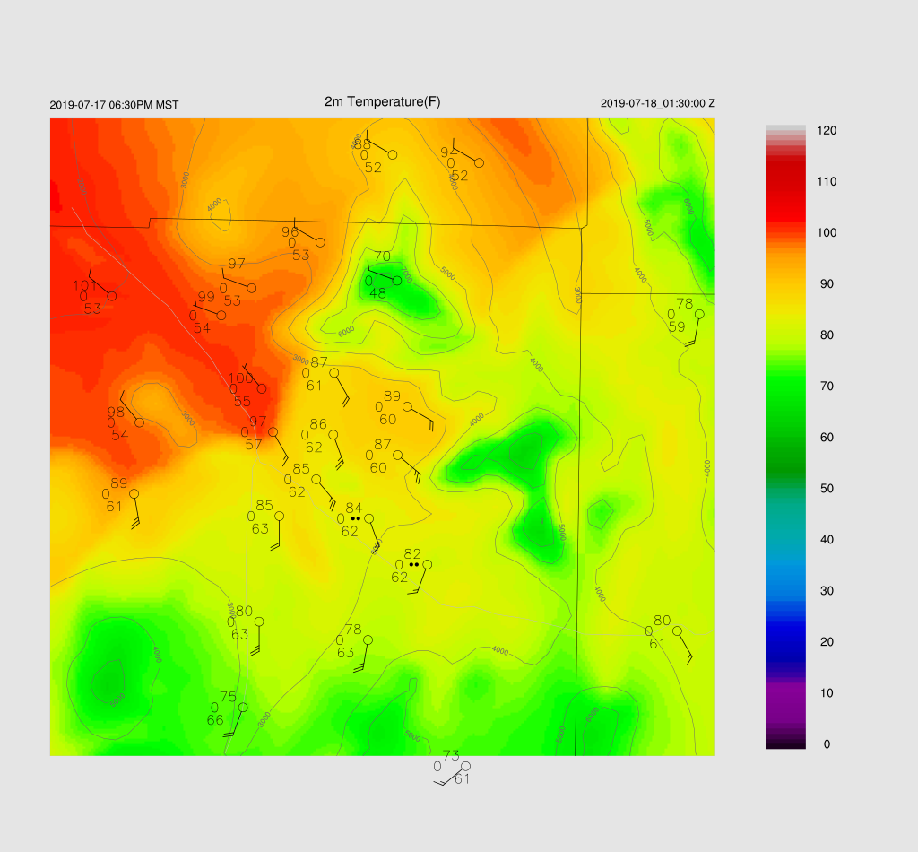
A storm or two may pop up over central Pima into southern Pinal Counties later in the evening and perhaps generate some blowing dust in Pinal County.  Far SE Arizona and SW NM stay active.


Day 2
The wettest air of the monsoon season (which isn’t saying much so far) is present over southern Arizona as the gulf surge continues.  Again, the problem for storm formation will be the cooled PBL and warm air aloft.

CAPE is quite high over much of eastern and southeastern Arizona; thus those will be the most active areas.
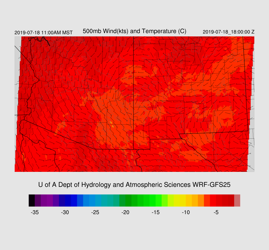
A mid-level anticyclone center is over eastern Arizona thus putting southern Arizona in light southeasterly steering flow which isn’t too bad.
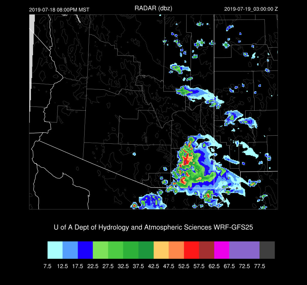
There isn’t much activity until late in the afternoon.  Storms form mainly in the high CAPE areas and elevated terrain.

Storms move to the west and into Cochise county and threaten eastern Pima but dissipate before moving into the Tucson area.  All of the runs have a similar solution; thus, confidence is reasonably high, considering this is a Day 2 forecast.
Tuesday, July 16, 2019

20190716

Ken Howard send me a correction regarding some of the things I said the other day about the possibility of a new radar for Arizona.
"For clarification, there is a new 5cm dual pol radar (NOT a NextRad) installed in Alamosa, CO which will be part of MRMS real time data flow in late September.

The operational MRMS system is being updated at NCO in September 2020.  However, the experimental MRMS v12 products are reviewable at https://mrms.nssl.noaa.gov/qvs/mrms_v12/.  Individual forecast offices can tap the real time experimental feed by contacting Paul Kirkwood at SRH.  

There is a plan to install a new 5cm dual pol radar in the Durango area (again not a NextRAD) as soon as a year from now.  Once this radar is built it will be come part of the MRMS data flow as well.  

I have no knowledge of what ADOT is doing nor ASU.  Our primary interest and effort is on operational radars.  The Alamosa and the forthcoming  Durango radar will be operated in a operational mode and will be part of MRMS product suites."
Previous Forecast
The WRFRR performed reasonably well on Sunday as quite a bit of activity was present over central and western Pima County.  The 15Z WRFRR was the best as it had both the intensity and coverage forecast accurately. 


The forecast for yesterday was also accurate as what looked like it could have been an active day for the lower elevations of SE Arizona due to moisture and CAPE, turned out not to be as drying kicked in during the afternoon. This resulted in deep convection only over the higher terrain.

Art Douglas sent me an updated Mexican precipitation anomaly map, and it’s not gotten any better as much of the country is below average with some areas way below normal.  While some MCS activity has been present over NW Mexico the past few days, it’s still been relatively inactive. One recent period of activity was able to send an outflow driven gulf surge into Arizona this past weekend.

Initializations
Clouds and a few showers were present over southern and up into east-central Arizona this morning, and as time has gone on, coverage has decreased, so it’s now mostly clear.  Neither the RR or NAM had any clouds while the GFS was better as it had scattered/broken clouds over southern Arizona. These errors shouldn’t impact the forecast too much as mentioned earlier, the clouds are dissipating.   Not much to see on the 500mb map as no inverted troughs are apparent.  


The NAM has a general wet bias across much of the SW US and into Mexico.  The GFS and RR have minimal errors and are the favored initializations today.


Day 1
A new gulf surge is forecast to begin today, which should result in increased activity in southern Arizona.  I’m not sure of the mechanism as the storms in Sonora and Sinaloa weren't that strong to generate significant outflow into the Gulf.  The outer domain indicates the surge is present all along the Gulf of California. It appears that the recent activity over the southern Gulf combined with the very hot temperatures in the SW US has triggered a traditional surge.


850mb dew-points are too low to support much activity except for SE Arizona.


Tucson’s PBL is mixed deeply, and along with a little CAPE, there is likely to be storm activity nearby.  Will it make it into the valley? My guess is probably not as the steering flow is pretty weak. The upper part of the vertical wind field is starting to look like the monsoon as the southwesterly flow has become light and variable.  


The spread for the various runs goes from almost no activity, to very active for southeastern Arizona.  The 15Z WRFRR is somewhere in the middle and has mostly higher elevation activity for southeastern Arizona later this afternoon.


Day 2
The surge continues overnight and results in much higher PW by tomorrow.  It’s the highest so far this season as PW is in the mid to upper 30mm range over southern Arizona. 


 The surge is deep as at 850mb, dew-point temperatures are the highest of the year, ranging from 10 to 15C which should support widespread activity especially for southeastern Arizona.


Along with the moisture increase, CAPE is very high over southeastern Arizona, which will support some very strong storms with heavy rain. 


The Tucson forecast Skew-T plot has an enormous (for us) amount of CAPE.  The common problem with the first day of a surge event is the cooling of the PBL and the presence of a weak cap/inversion keeping lower elevation convection to a minimum.   The wind profile is bad as there is no steering; thus, storms will have a difficult time moving much. In situations like this, it’s usually the higher elevations that get pounded with only isolated activity for the lower elevations where storms might form on outflow boundaries.


Intense deep convection gets underway over Santa Cruz and southern Cochise Counties during the mid-afternoon.  With this much CAPE, I’d expect to see some small hail with these storms. All of the 12Z runs are very similar to the intensity and location, so confidence is high.  Some of the storms could produce isolated severe winds due to hybrid microbursts.


Storms continue over the higher terrain into the late afternoon.  


At this point, it looks all Tucson will get is a big outflow from the activity from the south.  No runs develop deep convection in Tucson.


Sunday, July 14, 2019

20190714

Previous Forecast
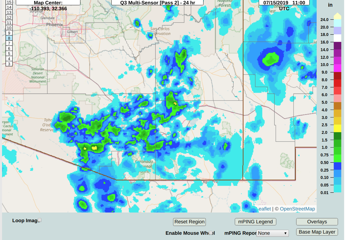
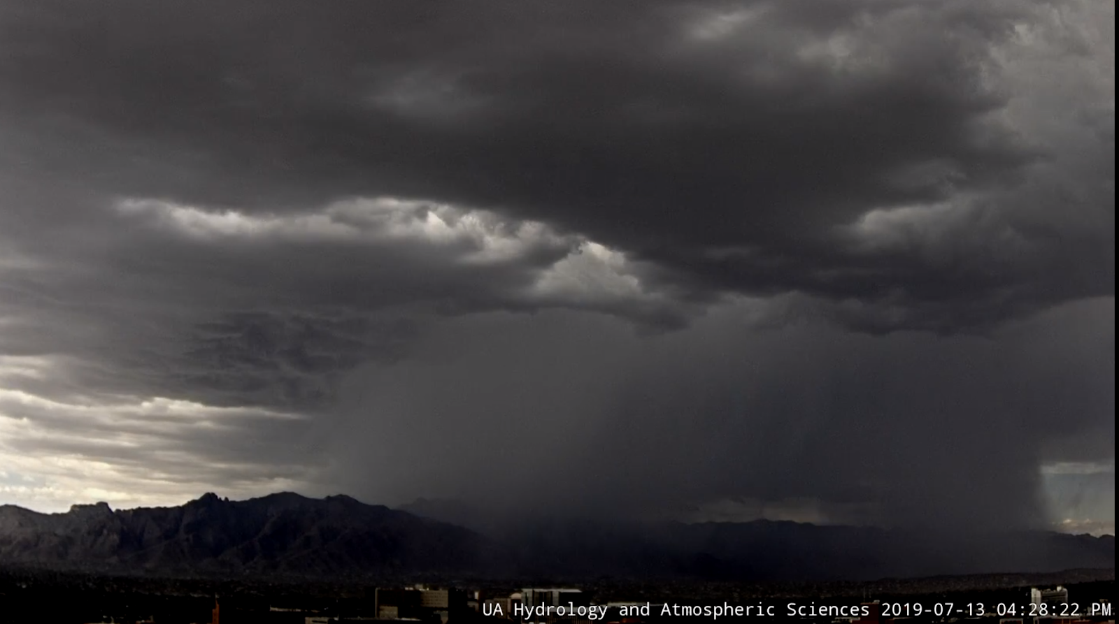
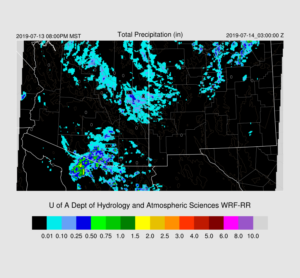
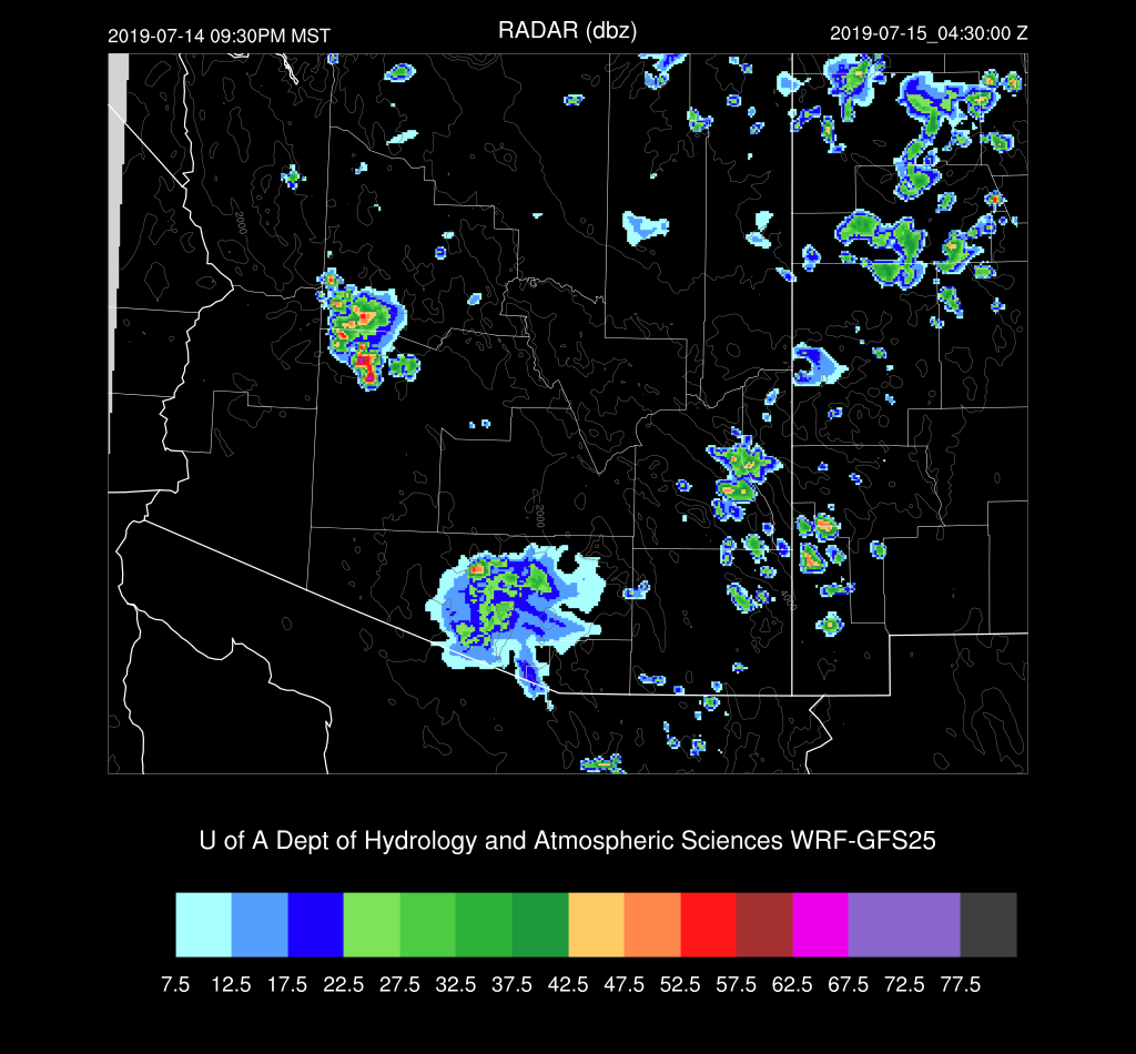
While some of the details were wrong, some of the runs verified fairly well (WRFRR and WRFNAM).  Strong storms formed across eastern Pima and Santa Cruz counties during the afternoon and drifted west-northwestward.  Many of the runs moved the storms into central Pima county which did not happen. The west side of Tucson had a very strong storm with a flash flood warning issued.  The forecast was for a strong outflow to come in from the SW, but it appeared that storms were triggered by a strong northeasterly outflow from earlier activity over Mt Lemmon.  The new cloud camera animation is here.  It’s the first exciting animation of the year.
The 15Z WRFRR was best but had the strongest storms a little too far to the west. Most runs missed the evening activity east of Phoenix.  The 15Z WRFRR had some, but not enough.


Initializations
Yesterday’s runs didn’t look very promising for today, but when I looked at the 12Z data, there was a bit more CAPE at both Tucson and Phoenix than I expected.   The Phoenix MUCAPE calculation was too high, but there was over 300 J/kg of MLCAPE thus just based on the soundings, there could be some activity in and/or near Tucson and probably Phoenix too.

The 500mb plot shows that the center of the anticyclone has moved a bit to the east as another trough moves into the NW CONUS.  Again, a full complement of NW Mexico upper-air data. ¡Viva México! The analysis indicates a weak IT over Arizona, which may or may not exist as it doesn’t seem to be present in the wind field. 
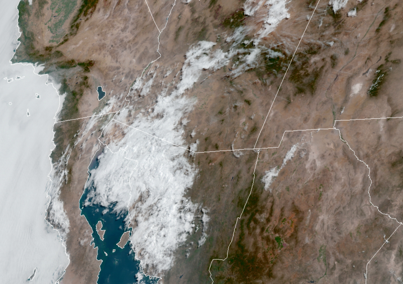
There is a significant MCV over NW Sonora with widespread clouds into SW Arizona.  The rest of the state is mostly clear. Neither the 12Z RR or NAM initialized the cloud or MCV very well while the GFS had more cloud but no real circulation.   The MCV is moving away from eastern and central Arizona so this error should be no factor.
The NAM had a large scale wet bias of 3-5mm over much of the SW CONUS and into NW Mexico.  There were no substantial errors so the correction routine should be able to fix much of the bias.  The GFS was also too wet by 3-5mm over southern Arizona into northern Sonora. Based on all of this, I’d say the WRFRR would be the favored run(s) today.

Day 1
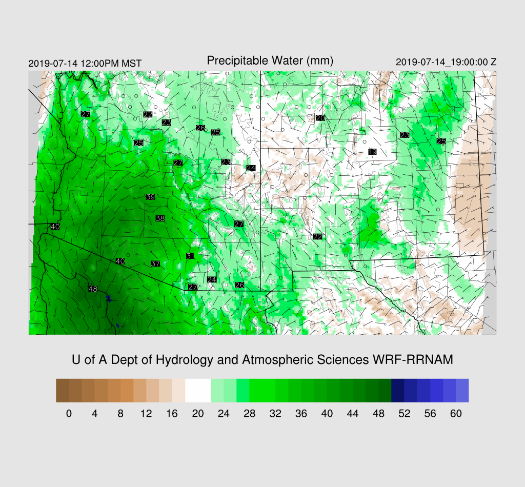
It is certainly wet at the surface as dew-point temperatures are mainly in the 60’s in the lower deserts.   PW is moderate with around 30-40mm with the highest being out in SW Arizona where a weak surge continues. Yesterday’s forecast was for it to weaken today but the morning runs have it continuing.  It turned out to be quite strong as moisture has made its way over much of the state by mid-day. Far eastern Arizona is still under light easterly flow which is advecting in drier air from NM.

The surge is relatively deep as it’s seen at 850mb.  Also, it’s now quite wet at 850 as dew-point temperatures range from 10 to 15C by mid-day.  So far, it’s looking like it might be more active today than I thought it was going to be.

Both the WRFRR and WRFGFS have moderate CAPE over much of southern Arizona today.  In some ways, it’s looking much like a repeat of yesterday for southern Arizona.

Activity is underway during the afternoon in the usual locations.  Like yesterday, storms form over the higher terrain of eastern Pima and Santa Cruz counties.

There is quite a bit of CAPE in the Tucson area this afternoon as well as a good wind field with low-level NW flow and light SE steering flow.  The problem is that there is a weak inversion at the top of the PBL thus some sort of convergence/lift will be needed to get deep convection going over the lower elevations of SE Arizona.

Both the WRFRR and WRFGFS become quite active over mainly central and eastern Pima county late this afternoon and into the evening.  The main difference is timing as the WRFRR delays most activity until the evening while the WRFGFS is late in the afternoon.

It looks to be another active evening for the Tucson area.  
WRFGFS

WRFNAM

Outflows move into Pinal County during the evening, but they don’t appear to be strong.

The WRFGFS is of interest for parts of Maricopa county as it develops some evening activity when the outflow boundary moves through.  Phoenix has some CAPE to work with plus the PBL is mixed deeply. Steering is light and variable so storms will have to form in place and won’t go far once underway.

A few storms may pop up west of Phoenix later this evening.  It’s not a high probability event as only the WRFGFS develops storms.

This just in from the 15Z WRFRR….It has quite a bit of activity in eastern and central Pima County this evening as well with some storms being very strong to severe.

The 15Z WRFRR produces a much strong outflow boundary that moves into Pinal County later this evening.
Day 2
The surge weakens and PW decreases, but it’s likely that the higher terrain will see afternoon showers and storms again.  
CAPE is mainly low over much of the state thus a less active day.

Only isolated activity is expected, even for the high elevations.