Previous Forecast
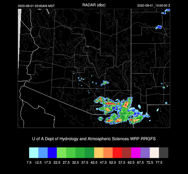
Most precipitation occurred west of Tucson and Phoenix.
Some good, some bad. The WRFGFS was, by far, the best run as it had both the activity that moved north from western and central Pima County and the activity west though north of Phoenix. It also did not have any activity this morning in the Tucson area, which also verified. The bad was the WRFNAM (and some earlier WRFGFS) forecasts for a heavy rain event for Tucson. Tucson awoke to mostly sunny skies! The WRFRR had issues as it completely missed the central/western Pima County activity. The HRRR wasn't anything special either as no storms materialized in eastern Pima County and there was no strong activity in Phoenix. The storms got close but fizzled as they moved into the valley. The HRRRx had nothing west of Phoenix.
Discussion
This is really hard to take having all the moisture around and having little or nothing happen in the Phoenix and Tucson areas. Even worse is how the model runs are teasing us with their forecasts for big events for the next day and then having the rug pulled out. I'm ready for the end of the monsoon.
It looks like that's it for the moisture from the tropical systems as dry air has moved south over western Arizona and PW has decreased significantly. The only moist air is over far SW Arizona and into southern Arizona.
CAPE is back down to zero at Phoenix. Tucson is better, but not great at 750 J/kg of MLCAPE. The profile is nearly saturated to just above 500mb where a strong cap exists. This cap is probably the reason that none of the WRF forecasts for heavy rain verified. Winds around 700mb are still southeasterly so a weak IT is still located somewhere to the south.
The 500mb ridge continues to flatten and move south and winds over Arizona continue to be southwesterly. A weak jet continues south of a weak trough over NW Arizona. Temperatures have increased and unfavorable -6 to -4C air is over southern Arizona and northern Mexico due to the dissipating tropical systems. It's not looking good for today.
Initializations
Clouds and PW were initialized well, except for the 12Z NAM which was too west over western Arizona and southern CA.
Day 1
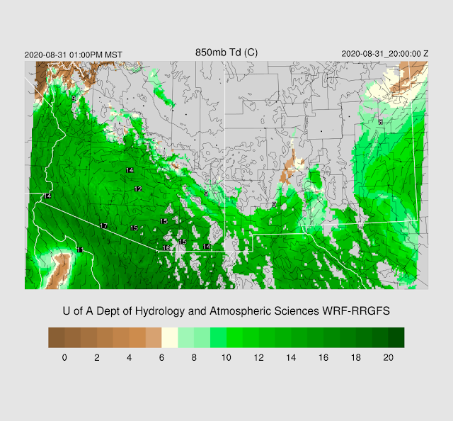
In spite of decreasing PW for much of western Arizona, 850mb dewpoints are still high, indicating the moisture layer is quite shallow. The high dewpoints are just taunting us.
CAPE is much lower today but is sufficient to support isolated storms over the higher terrain, and perhaps, southeastern Arizona.
The WRFNAM has little or no activity.
The WRFRR is a bit more interesting for southeastern Arizona as it develops some scattered storms by later in the afternoon.
There is just enough CAPE to support some storms. Plus, southern Arizona is located under the favorable right entrance region of an upper-level jet streak centered over NM.
The WRFRR continues to redevelop deep convection in this area into the early morning hours. Both the WRFNAM and WRFGFS get on board by this time too, so maybe this will actually happen.
With the training of echos, the potential is there for a heavy rain event for SE Arizona overnight into the morning hours tomorrow.
Even the HRRR is on board with storms over southern Arizona this afternoon. However, it has activity as far wast as western Pima County. I doubt it as that area is probably quite worked over after a couple days of heavy precipitation. 23Z Ensemble Composite.
A strong trough, especially for this time of year, drops rapidly south overnight, into northern Arizona.
The 15Z WRFRR does develop a few storms strong storms north of Phoenix.
Day 2
The shortwave closed off into a cutoff low over NM. How strange is that!?
This results in a line of organized convection over western NM during the morning hours, along the cold front.
This passing shortwave also seems to initiate a new surge of moisture into southern Arizona.
CAPE also increases for much of southern Arizona.
The tail of the front is near the White Mountains by late afternoon which results a few strong storms. Other activity may form over the higher terrain of southern Arizona where CAPE around 1000-1500 J/kg.


No comments:
Post a Comment
Note: Only a member of this blog may post a comment.