Previous Forecast
Storm activity was restricted to southeastern Arizona and the higher elevations of the rest of the state. Storms made a run at both Tucson and Phoenix but were unable to overcome the somewhat shallow mixed layer and weak inversion at the top of the mixed layer.
The WRF RR continues to has a low precipitation bias, but typically has the right idea os when and where. The WRFGFS was the winner as it had fairly good amounts and coverages.
Discussion
The center of the western CONUS ridge had drifted a bit to the east resulting in more favorable steering flow over Arizona as wind speeds have increased to 15 to 25 knots. Temperatures have increased a little, but a little cooler air is upstream as El Paso reported -9C. Hopefully, that will move into Arizona later today.
Arizona has dried out a little as surface dewpoints are now mostly around 60F for the lower elevations. PW has decreased especially out west and to our south. Hermosillo has decreased to 38mm which is quite dry for them. Dry air has moved into southeastern Arizona, again, from southwestern NM.
Initializations
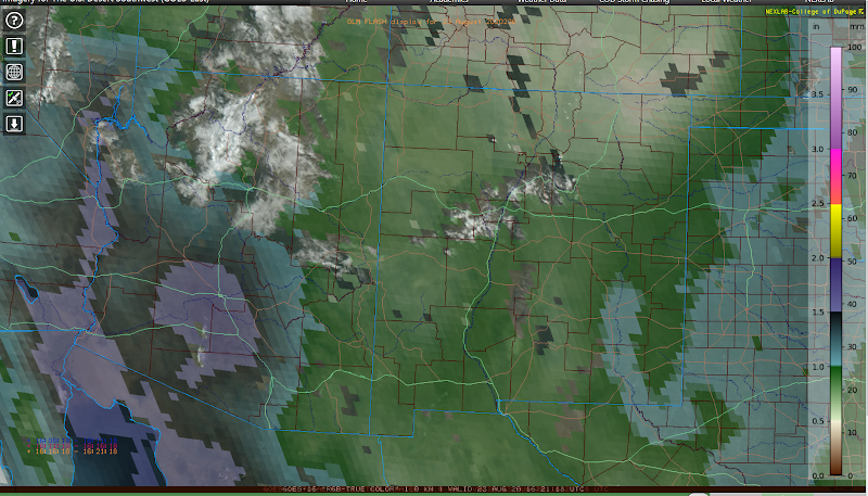
The morning synoptic and mesoscale conditions are quite straightforward as there are no clouds and no inverted troughs. The lack of inverted troughs has been one of the (negative) features of this monsoon season, and generally more typical the past (10?)years as the strength and size of the midlevel anticyclone keeps any inverted troughs from moving into Arizona. These features enhance and organize monsoon thunderstorms. (Lahmers 2016)
PW initialization was very poor for the 6Z NAM. The 6Z GFS was better but still had some large errors around the Tucson area. The 12Z NAM wasn't quite as bad. The 12Z GFS had a slight wet bias over much of the domain but should be usable. The RR is good, but it continues to exhibit a low precipitation bias.
Day 1
Moderately moist air continues over much of central and western Arizona and even has advanced over the higher elevations.
CAPE is moderate over much of central and western Arizona, and over the high terrain of the Rim.
Stronger storms form in Yavapai and Coconino Counties later this afternoon and move generally to the NW. Other scattered activity developed over eastern Arizona and moves westward. I would have expected more storms considering CAPE is moderate.
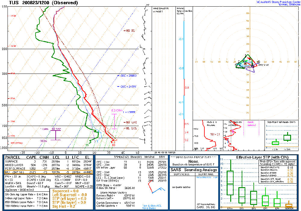
Tucson has a good vertical profile with some low-level shear, good ESE steering flow, and northerly at upper-levels. CAPE is high at 1500 to 2000 J/kg. The negative is the CBL is not mixed deeply and needs to get to the LFC at ~675mb, which isn't too high.
Phoenix is in a similar situation but has even farther to go to reach the LFC, which IMO, looks doubtful without multiple intersecting outflow boundaries providing mesoscale lift. The pathetic nature of the thunderstorms at 0Z makes this scenario look impossible.
Only the WRFRR moves storms into eastern Pima and Pinal Counties tonight. The WRFNAM and GFS have very little activity during the evening hours. With the fairly good initialization at 12Z, I would have thought there would have been more of a model consensus.
Day 2
Well, we are back to the drying downslope easterly flow for much of eastern Arizona. This is another "feature" of the monsoon over the past few years. This phenomenon did not occur as frequently as it has over the past few years. Time for another paper? The western 1/3 of the state remains moist.
As a result, CAPE is low over much of the state. So much for the moisture from the hurricane and Gulf Surge. Sigh.
Scattered weak storms develop over the high terrain and over central and western Pima County during the afternoon.
Activity continues over western Pima County into the evening where CAPE is moderate. A few storms could be strong.


No comments:
Post a Comment
Note: Only a member of this blog may post a comment.