Previous Forecast
It was a quiet day for the lower elevations.
Almost all the runs had precipitation too far to the west in southeastern Arizona. However, they accurately predicted the second wave of storms there during the overnight hours.
Discussion
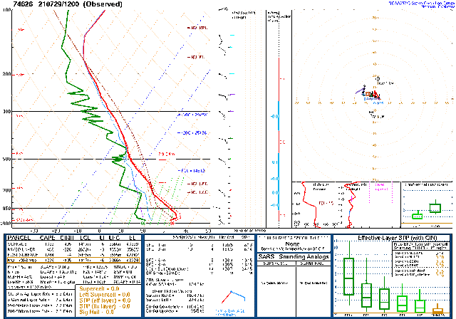
Not much change in the synoptic-scale pattern. Cooler temperatures are still over the state, at -6 to -8C. The Mexican IT is slowly inching its way closer. Too bad both Guaymas and Chihuahua upper-air data is missing. Guaymas has been missing for a while now. Maybe they ran out of consumables?
The 300mb shows southeastern Arizona under divergent flow. Perhaps that is the reason for the early morning activity in southeastern Arizona.
Getting an accurate initialization will be a challenge as widespread cloud and some showers are ongoing this morning. A weak cyclonic rotation was observed over southern Arizona, perhaps an MCV?
The 6Z GFS and 12Z RR did a good job initializing clouds and the weak activity. The 9Z RR didn't have enough of either. The 6Z GFS also had a weak inverted trough over southern Arizona, as did the 12Z RR. Those are the favored initializations today, but the overall confidence is low. Suominet PW data was missing at 12Z.
Day 1
The ongoing clouds and showers will throw a monkey wrench into the previous forecast of a big day/evening, as they are going to restrict heating, at least this morning, for much of the Tucson and Phoenix areas. 850mb dew point temperatures are around 10C, which should be enough to support some activity. Drying easterly downslope flow is present over far eastern and southeastern Arizona, which is likely to keep deep convection to a minimum out there. The boundary is again over the Pima/Cochise line, which may help trigger and organize deep convection.
The 12Z WRFRR seems to have CAPE better forecast, at least compared to the morning soundings. The 6Z WRFGFS has quite a bit more, which appears to be in error. I don't see much happening for Tucson and Phoenix with marginal CAPE.
CAPE is sufficient to support some strong storms over the higher terrain, though.
There haven't been even two runs that are similar with their locations and timing of thunderstorm activity. It's possible for a few storms this afternoon around Tucson as there is just enough CAPE. It's more likely they'll remain over the higher terrain.
Phoenix looks a little better as CAPE could be as high as 1300 J/kg, which would support some storms, as long as there are some outflow boundaries.
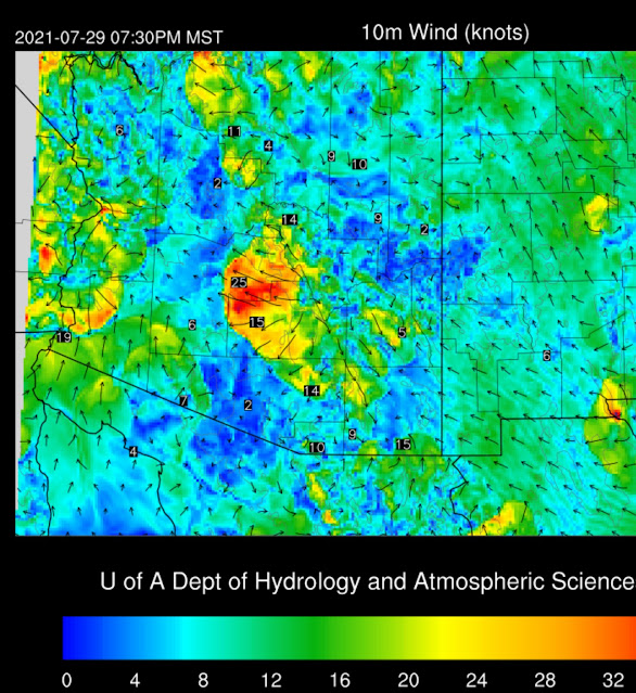
The 6Z WRFGFS moves a strong line of storms towards the Phoenix area by early evening, but it weakens as it moves into the valley.
A large outflow boundary does move across Phoenix, but little or no deep convection forms.
Activity continues into the evening over western, southern, and northwestern Arizona.
The upper support is there over Arizona as the IT moves to around Chihuahua by this evening, providing divergence/difluence. This should help scattered activity to continue for much of the night.
Day 2
The IT shears out, and what is left of it moves towards Arizona.
At 500mb, the IT is located just south of Nogales, with some cooler air over southern Arizona.
A weak surge begins overnight, which results in slightly increased moisture and more favorable 850mb dew points of 10 to 12Z. Dry air continues over far southeastern Arizona and into NM.
CAPE is a bit higher by tomorrow, and hopefully, will result in more activity.
Most runs have a surprising lack of activity tomorrow.
Tucson is under the influence of the southeasterly low-level flow, resulting in low to moderate CAPE and unidirectional wind profile. Maybe a storm or two in the area, but overall, not much activity.
It's the same story at Phoenix, with somewhat drier air moving in from the east. CAPE is limited, but the PBL is mixed deeply, so some late afternoon or evening storms are possible. What a waste of a good IT.


No comments:
Post a Comment
Note: Only a member of this blog may post a comment.