Previous Forecast
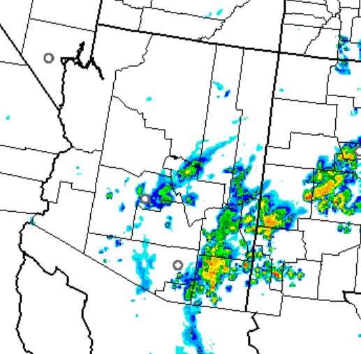
There was an uptick in activity for Arizona include the Phoenix area. Weak storms moved through during the late evening hours.
Generally, the model forecasts were pretty good. There could have been a bit more activity over SE Arizona. The runs had it a bit too cloudy in real life; most of the clouds burned off by afternoon. Most/all runs picked up on the Phoenix activity.
I quickly looked at the "competition," and the 12Z HRRR had no activity at 5Z. At least, in this case, the WRFRR outperformed the HRRR.
Discussion
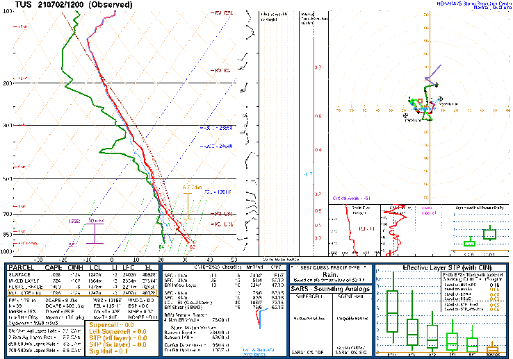
Widespread clouds and some showers are present over much of southern Arizona this morning. They are associated with a weak inverted trough that is located just south of Nogales. The 700mb map indicates that there is a broad area of cyclonic circulation present over NW Mexico.
The 500mb pattern looks more normal as the central CONUS ridge has weakened, with a second, diffuse center located somewhere around the Four Corners. Temperatures have increased slightly to an unfavorable -5C over southern Arizona, but increased moisture should offset mid-level warming.
Phoenix looks much the same.
Initializations
Clouds are the key today. Both the 12Z RR and NAM have a good initialization of existing clouds. The 6Z GFS was too cloudy over eastern AZ and SW NM. The 12Z runs have quite a sharp 700-600mb IT initialized over NE Sonora, and this appears accurate according to maps and satellite imagery. PW was initialized well by the 6Z GFS and 12Z RR. The 12Z NAM was generally too wet over Arizona. IMO, the 12Z RR seems to have the most accurate initialization.
Day 1
As mentioned previously, a very moist air mass is present over the state. By early afternoon, PW is still in the mid 40mm range over much of southern Arizona.
It looks like CAPE is a bit higher today, despite the warming aloft. This will result in a bit more activity today, especially in areas that can get some sun. When the air mass gets this wet, it won't take much heating to trigger storms and associated clouds earlier in the day. This can cut off additional heating and keep additional storms from forming. "Too wet to rain."
The Sonoran IT is mainly stationary and results in moderate 10-20 knot easterly mid-level steering flow over the state. Hence, storms that manage to form over higher terrain can make it off the mountains into the lower elevations.
Storms get going late due to all the morning debris clouds.
They make their way towards the lower elevations of central and south-central Arizona by early evening.
Same for Phoenix.
Both the WRFRR and WRFNAM move storms into the lower elevations later this evening.
Storms mainly go south of Phoenix, but it's still possible there could be activity there.
The WRFNAM ejects a good outflow boundary across Pinal and Maricopa Counties this evening. Strong enough for a haboob?
The HRRR has only dissipating activity during this time. 5Z.
The WRFRR and WRFNAM keep the activity going into the early morning hours.
It looks like a 1/2 way decent precipitation event with some areas getting over 1" of rain. Bring it!
Day 2
Tomorrow's forecast is going to be tough due to the complex nature of what happens overnight tonight. PW remains very high, so the potential is there.
CAPE isn't all that impressive as it appears the air mass has been worked over. If there is sun, it may be able to recover by later in the afternoon. Lots of "ifs" for tomorrow.


No comments:
Post a Comment
Note: Only a member of this blog may post a comment.