Previous Forecast
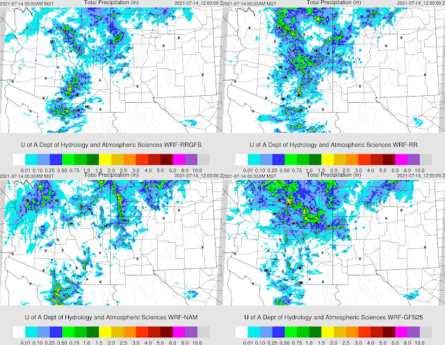
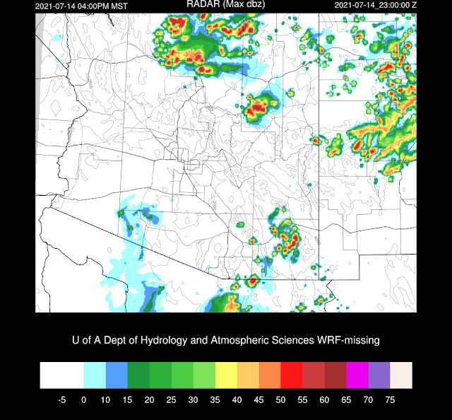
It was one of those days where the forecast accuracy depended on where you lived. Most, if not all, the runs forecast activity in the lower elevations in and around Tucson. Storms remained mainly over the mountains and didn't make it into the valley as there wasn't enough CAPE available, only about 300 J/kg. So, this was a case where ignoring the traditional rules (down day after an active day) came back to bite me. Perhaps there was some mid to high-level warming due to the absorption of shortwave radiation? Perhaps soil moisture and temperature were too high? Both?
Some runs did predict the early morning activity around Phoenix and now Tucson. (WRFGFS)
The HRRR did a better job around Tucson as it kept storms out of the valley. It did develop the early morning showers and storms, but it was too far north, in Yavapai and Coconino Counties.
Discussion
Rain and thunderstorms are present over much of south-central Arizona this morning in response to a shortwave that dropped down into the state, east of the anticyclone center, located over southern California.
The 12Z Tucson sounding indicates a heavy rain situation with a very moist and unstable air mass. MLCAPE is over 2300 J/kg, PW is 45mm, and steering flow is light and variable. Phoenix is not available.
Initializations
It's going to be a challenge to get the initial conditions correct, that is for sure. 6Z initializations were poor as neither had the early morning activity. 9Z RR did a fair job of initialization the ongoing activity. The 12Z NAM and especially the RR did well. PW was initialized mostly well by all runs, including the NAM. Despite that complicated situation, the 9 and 12Z RR and the 12Z NAM initialized quite accurately.
Day 1
Moisture is certainly not lacking. The number of days that moisture advection up the Gulf of California has been impressive. I took a look at Suominet data from SW Arizona, which indicates the surge has been underway for about a week, and it continues today.
Clouds and showers/storms continue over southern Arizona into the early afternoon hours but slowly decrease. The air mass has been worked over, and CAPE is nearly 0. Areas on the periphery have moderate to high CAPE, so it looks like these are the only areas of activity today.
A few storms develop over the high elevations from Flagstaff and along the Rim. A few storms develop in far SE Arizona, where it's also clear.
The trough continues to move slowly to the south and east. In areas of decent CAPE/heating, it should help initiate and organize storms.
The activity decreases into the evening, except some activity continues north of Flagstaff and into NM. Perhaps some good lighting in/around the Grand Canyon?
Due to the approaching trough (see Day 2), activity continues over northern Arizona into the early morning hours and tries to move into the lower elevations. Some runs have enough CAPE to support early morning activity, and others do not.
Day 2
Another trough drops down into northern Arizona and is likely the reason for all the activity north of Flagstaff overnight. The 500mb anticyclone remains over far southern California resulting in a generally northerly or northeasterly flow. As we've seen, this allows for weak shortwaves to drop down into the state and help trigger and organized storms.
The model runs are all over the place regarding overnight storms, so confidence in the Day 2 forecast is low. I can say, at least, that moist air advection continues into Arizona due to the surge. PW is again very high. Thus, heavy rain and flash flooding are likely with storms.
It's hard to say what CAPE will look like. In this run, south-central Arizona appears to be most favorable for storms. I don't feel like I can be any more specific than that.


No comments:
Post a Comment
Note: Only a member of this blog may post a comment.