Previous Forecast
Not much activity except for far western Arizona. Sonora was quite active and is responsible for producing outflow surges into SW AZ where dew points are now in the 70’s.

The WRFGFS (below) and the WRFNAM forecast performance was good. Both runs of the WRFRRx were way too active.

Initializations
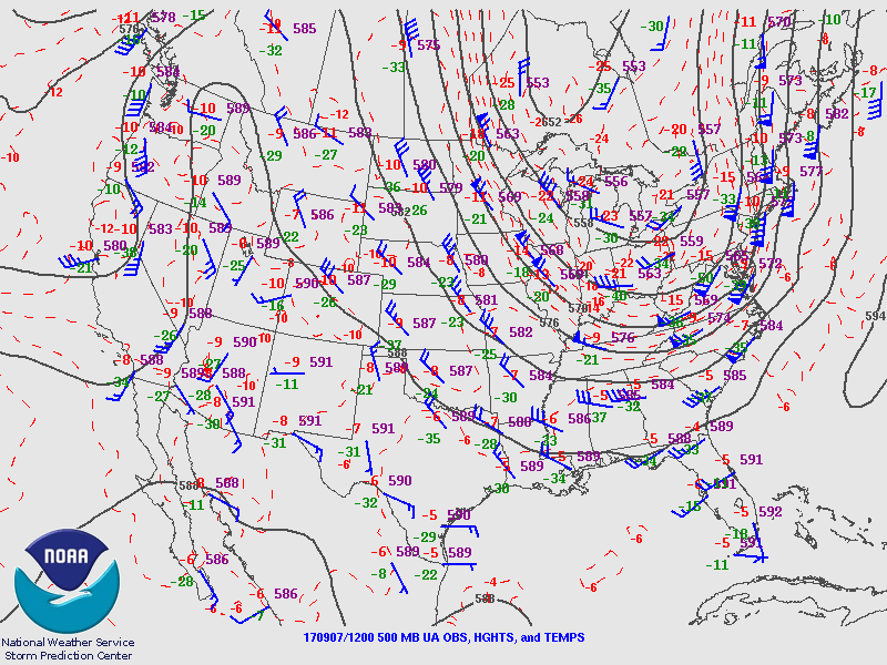
Mostly the same story as yesterday with a big trough in the east, a ridge in the west, and a weak trough along the California coast. A weak IT is located somewhere around far southern Baja. Skies are mainly clear except for far western Arizona where a few showers and storms are still ongoing. I didn’t mention it yesterday but both the WRFGFS and WRFNAM kept activity going into this morning over western Arizona. All model initializations look good except for none of them had enough western Arizona activity. That shouldn’t be a problem as the activity is decreasing and in a location that won’t impact Tucson or Phoenix. IPW initialization errors were fairly high in the NAM as much of NW Mexico initialized too wet as well as much of CA and NM. The GFS and NAM were better but also too wet in NM Mexico. The correction routine should account for this bias, though. In general, initializations are OK and model performance should be good except for maybe the WRFRRx as it has been much too active the past few days.
Day 1
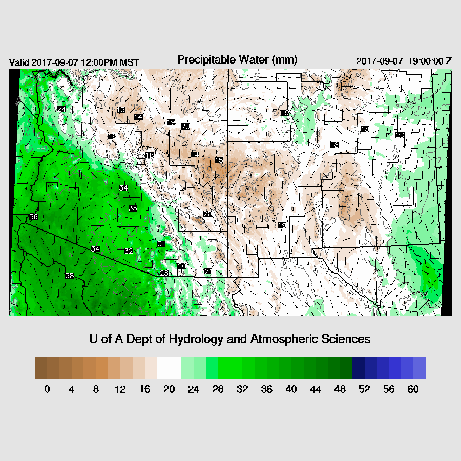
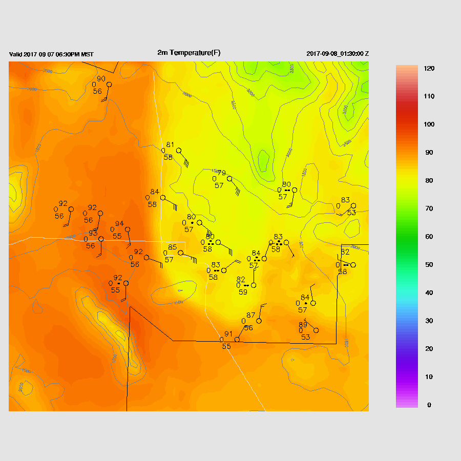
Moisture has increased overnight over much of southern Arizona as IPW is now 25mm at Tucson and 30mm at Phoenix. The Gulf Surge is quite shallow on the Yuma sounding but better than nothing. The surge continues and advects moisture into the western ⅓ of the state during the day increasing IPW by another 5mm or so. Dry SE winds continue over the eastern ⅓ of the state and again. There is a dry line like feature from around Tucson to the east of Phoenix which may act as a focus for convective development today.
All model runs agree that CAPE will be moderate to high over much of SW Arizona and as far east as Tucson and Phoenix. This will support some very strong to severe deep convection today.

Upper-level difluence and divergence due to a weak west coast upper-trough will help with thunderstorm organization and intensity this afternoon and evening.

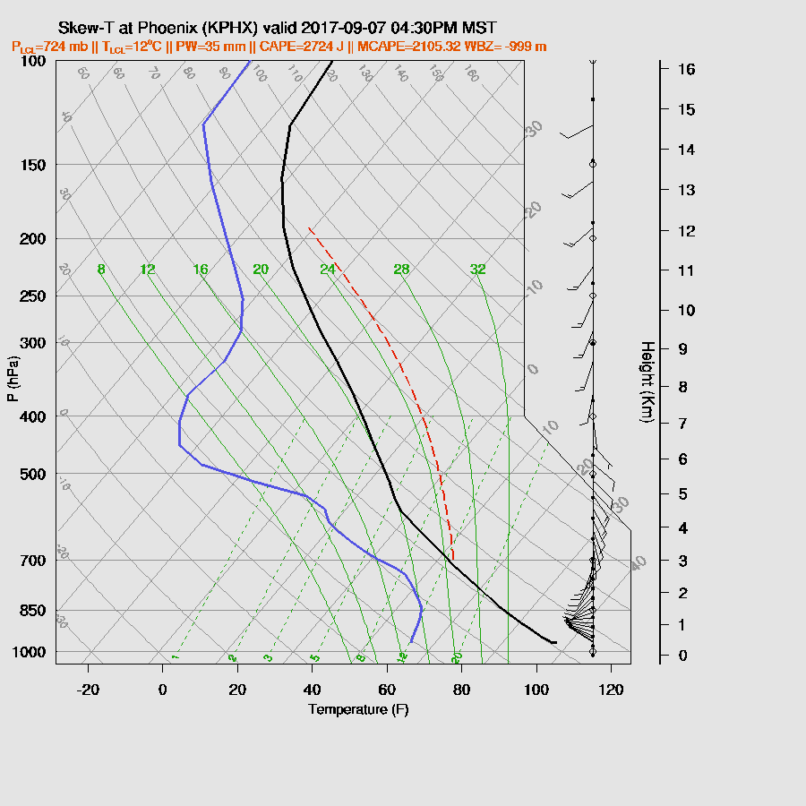
Tucson IPW is forecast to be around 30mm this afternoon which results in moderate to high CAPE. Low-level westerlies are advecting moisture into the area while steering flow is favorable from the SE and 15 to 25 knots. There is also some low-level shear present. The only negative issue is that anvils may blow across the Tucson area and restrict deep convection. Other than that, it is likely to be an active day in the region especially just west of Tucson.

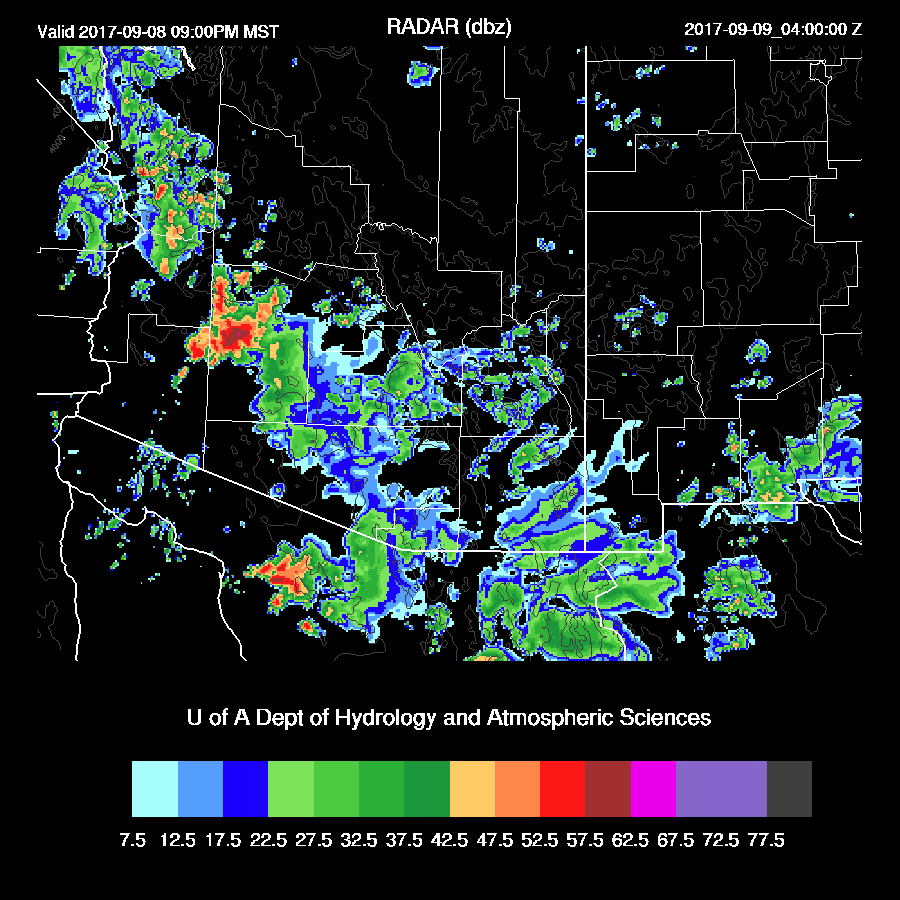
All runs are quite similar as they develop strong to possibly severe storms over Pima County by afternoon.

Tucson is right on the edge as the runs disagree on how much activity there will be there. The middle of the road (WRFGFS) predicts a strong outflow coming through during the afternoon with a few weak storms developing. Could be more, could be less.
Pima County storms send strong outflows toward the Phoenix area during the late afternoon. It sure looks like there is going to be a big haboob in Phoenix at a minimum.

Wow! Both the WRFNAM and WRFGFS have from around 1400 to 2000 J/kg of CAPE for Phoenix by late afternoon which is some of the highest of the summer. The WRFGFS (below) also has decent low-level shear with westerly low-level winds and southeasterly mid-level winds.
All three model runs develop strong to severe storms on the outflow boundary as it moves north into Pinal and Maricopa counties during the late afternoon and early this evening. (WRFNAM and WRFGFS) The two are nearly identical except for the timing, so confidence is high.


Big storms continue over much of central Arizona into the evening.
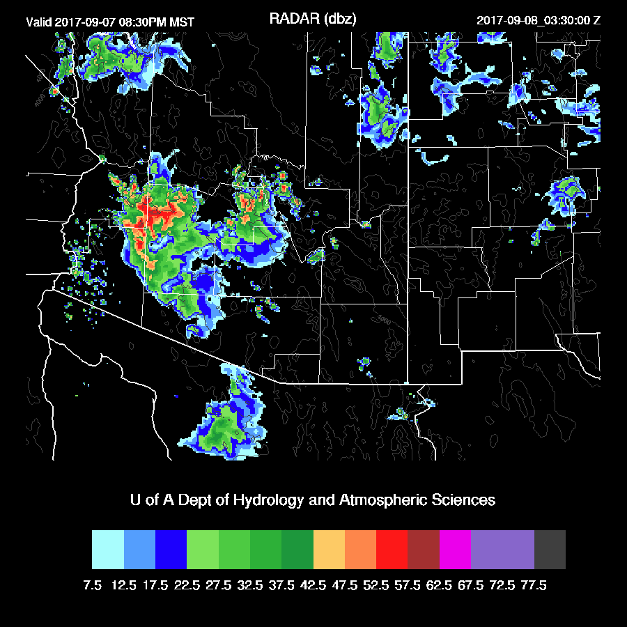
It looks like parts of Phoenix will see some strong to severe weather this evening.
The strong outflow boundaries continue to move to the NW later in the evening and trigger additional deep convection and possible severe weather in western Arizona.

Day 2
The Gulf Surge is forecast to continue tomorrow thus it’s likely to be another active day.

There may be problems with debris clouds restricting heating and also with the cooling in the lower troposphere due to the surge and the previous day’s activity. CAPE is also forecast to be lower but still sufficient to support storm development.
Storms initiate again over the higher terrain of Pima county and are steered towards central Arizona due to SSE mid-level flow.
Strong to severe storms are again possible tomorrow evening in central and western Arizona.
No comments:
Post a Comment
Note: Only a member of this blog may post a comment.