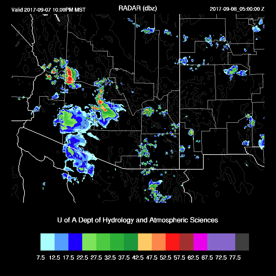
Previous Forecast
A fairly active day over NW and NC Arizona and far SC Arizona. The WRFRRx runs were too active around the Phoenix area as only a few showers formed when the outflows moved through. The WRFGFS and WRFNAM (below) were the best runs but still had a bit too much activity west of Phoenix.


Initializations
The long wave pattern over North America has become highly amplified with a big ridge in the west and trough in the east. The leftover mid-level circulation of Lidia continues to drift slowly to the southeast off the coast of CA and will be a big player in our weather in a day or two. A weak inverted trough is located over the southern Gulf of California. It is clear in Arizona/NM and into NW Mexico. All of the 12Z model initializations have the main features initialized well and IPW initializations have only minor errors.
Day 1
For the most part, yesterday's model runs dried out much of central and eastern Arizona and this is the case as IPW is down to 19mm at Tucson and 25mm at Phoenix. It is still fairly wet out along the Colorado River Valley as Yuma is 36mm and Blyth is 32mm. This boundary remains approximately in the same position during the day as dry easterly winds continue to dominate the eastern ½ of the state.
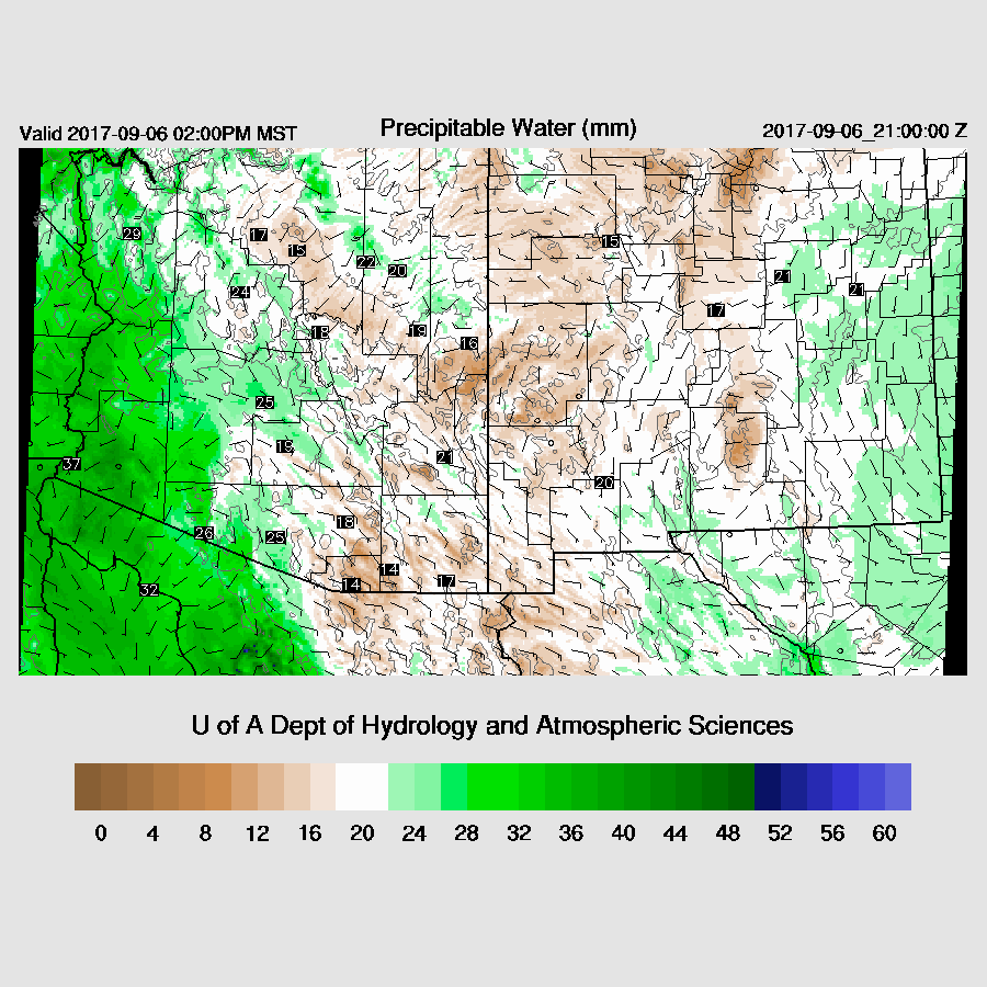
Moderate to high CAPE is present this afternoon along the CO River Valley and this dryline-like feature is likely to again act as an initiation point for convection over the higher terrain of the area.

There is some upper difluence/divergence over the state provided by the west coast trough thus some of the storms that form in western Arizona may exhibit some organization.

Model runs mostly agree on developing a few storms over NW Arizona and SW Arizona by later in the afternoon.
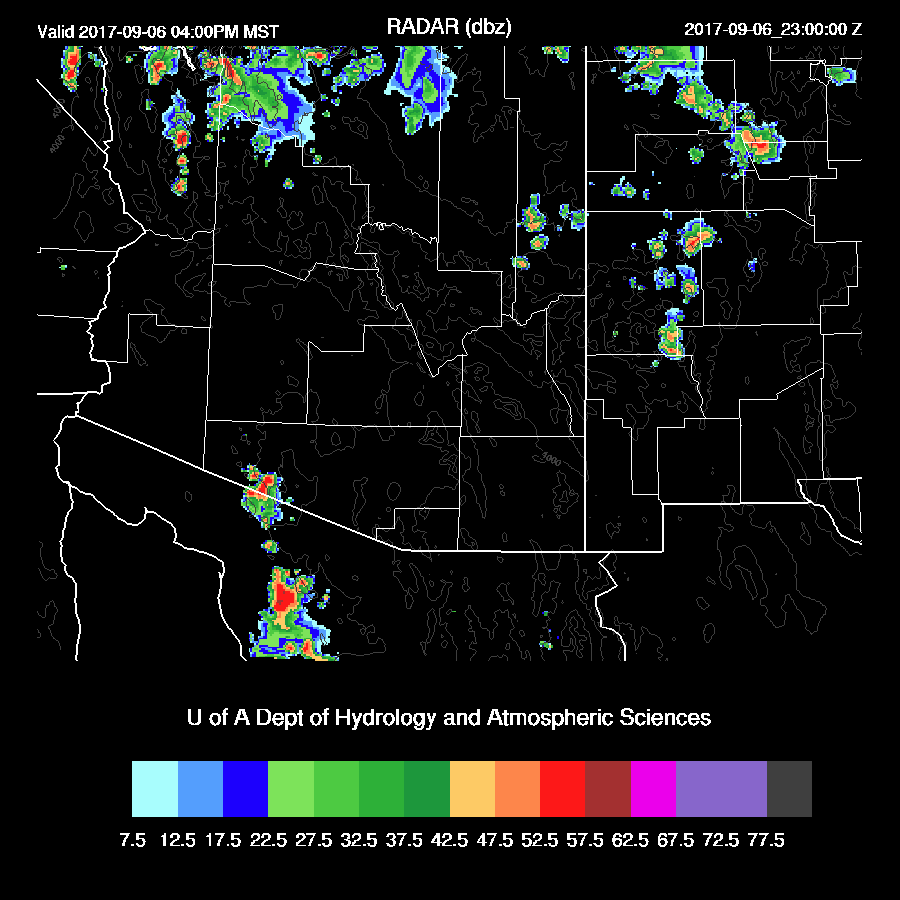
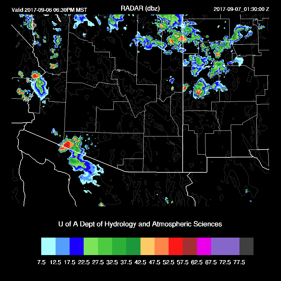
A few strong storms continue into the evening.
Day 2
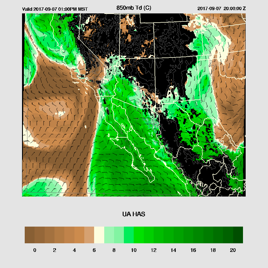
The west coast trough continues to remain about where it is which puts Arizona under moderate mid-level southeasterly flow. The Mexican IT moves off the coast thus the winds in the lower gulf are also southeasterly.

Winds at 850mb are also generally from the SE along the Gulf of California and up into Arizona thus some moisture returns to most of the state.
Moderate CAPE is forecast to be over the SW ½ of the state which should support a more active day.

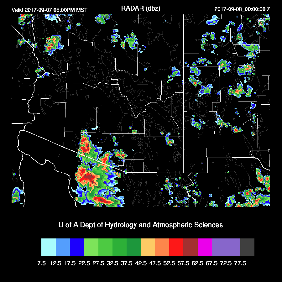
Storms develop south and west of Tucson and Phoenix during the late afternoon.

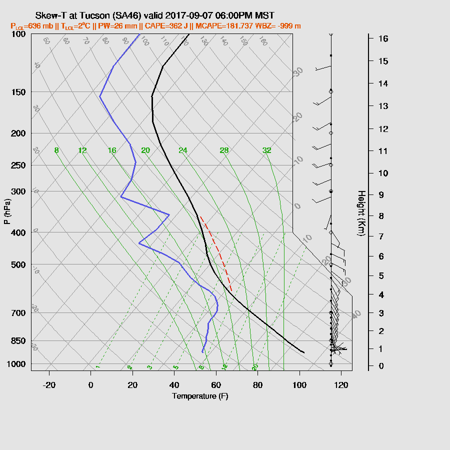
In spite of moisture increasing at Tucson, CAPE isn’t sufficient to support much activity. The vertical profile does exhibit a deep inverted V signature thus storms west of Tucson are likely to produce strong outflow winds.
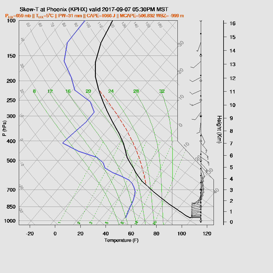
Phoenix looks a bit better as the WRFGFS has some CAPE present during the late afternoon/early evening as well as a deeply mixed layer with a deep inverted V profile and a bit of shear.
The WRFNAM has very strong/severe storms during the late afternoon mainly in central and western Pima county.
Both runs have strong outflow boundaries moving toward Phoenix during the evening with the WRFNAM being especially strong.
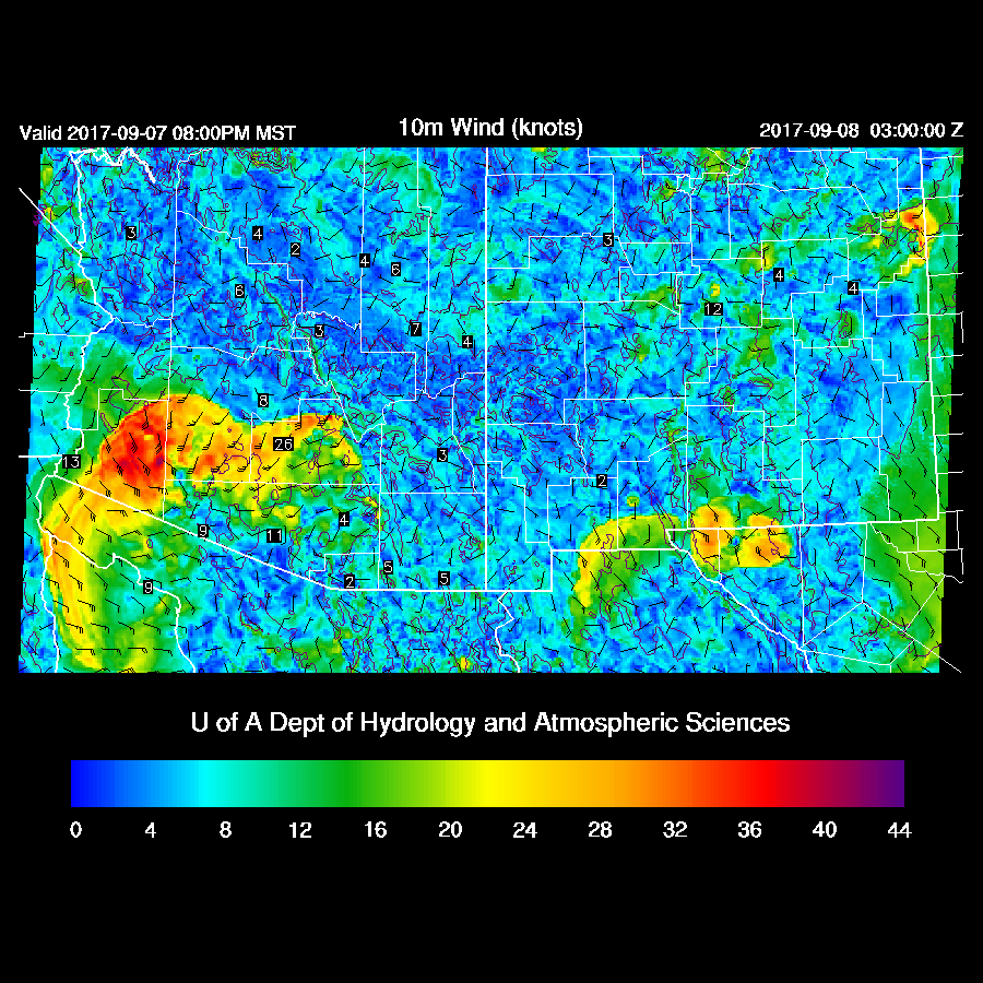
As this outflow moves north, a few storms manage to form in and around the Phoenix area.
ReplyDeleteAre you looking for quick an urgent loan with relatively low interest rate as low as 2%? We offer business loan, personal loan, home loan, auto loan,student loan, debt
shortest time possible, contact our specialist for advice and finance planning. If you need a quick loan contact us via Email
housingfinance22@gmail.com
Contact us on whatspp +447513195409
Mr Osman Ibrahim