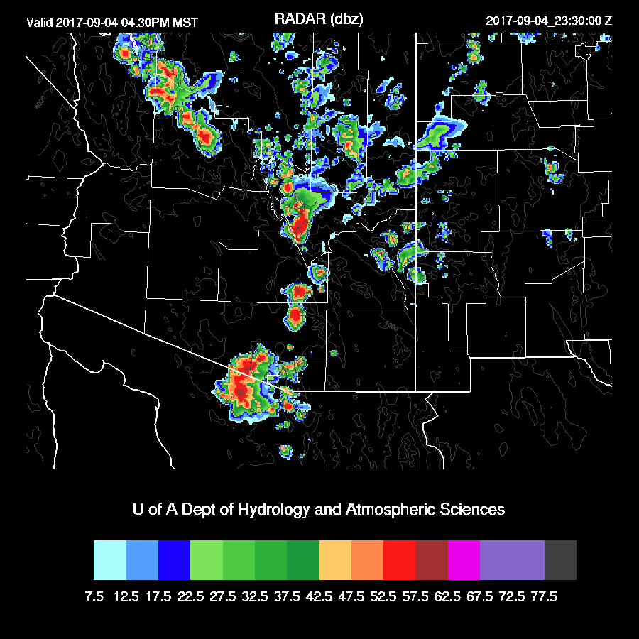
Previous Forecast
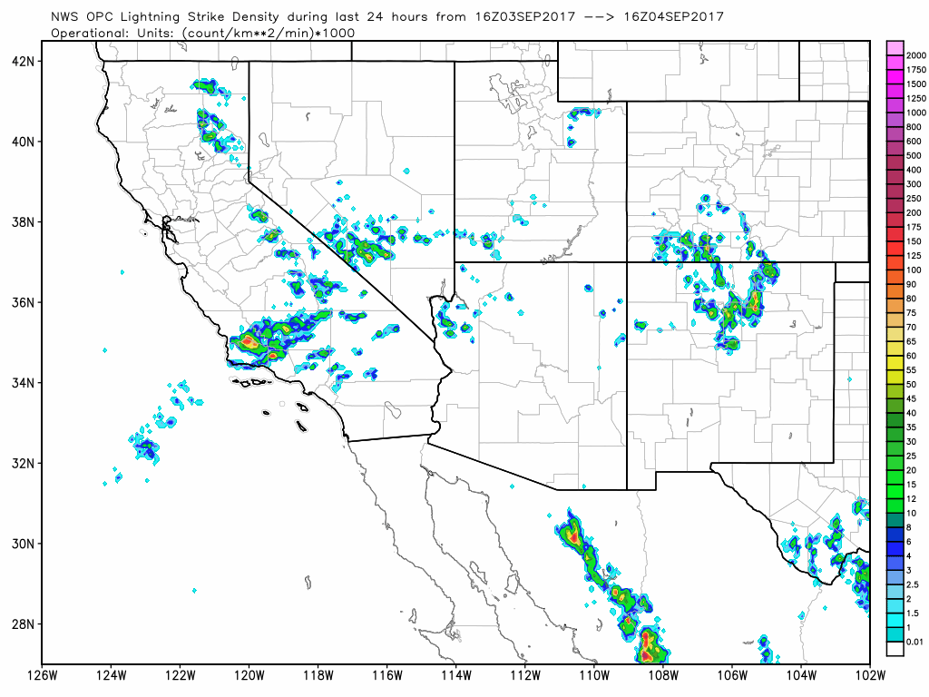
As expected, the 12Z WRFRRx was too active and there was only minimal activity except for NW Arizona. All the other model runs performed well.
Initializations
The dominating ridge over the western CONUS continues with the center stretching from Idaho to the Four Corners. The Big Bend IT is now somewhat stretched out over Chihuahua and northern Sinaloa. An area of clouds is present over far eastern Arizona and is associated with a possible weak wave. All initializations look good as they have all the main features initialized well. IPW also was initialized well. Model confidence is high today.

Day 1
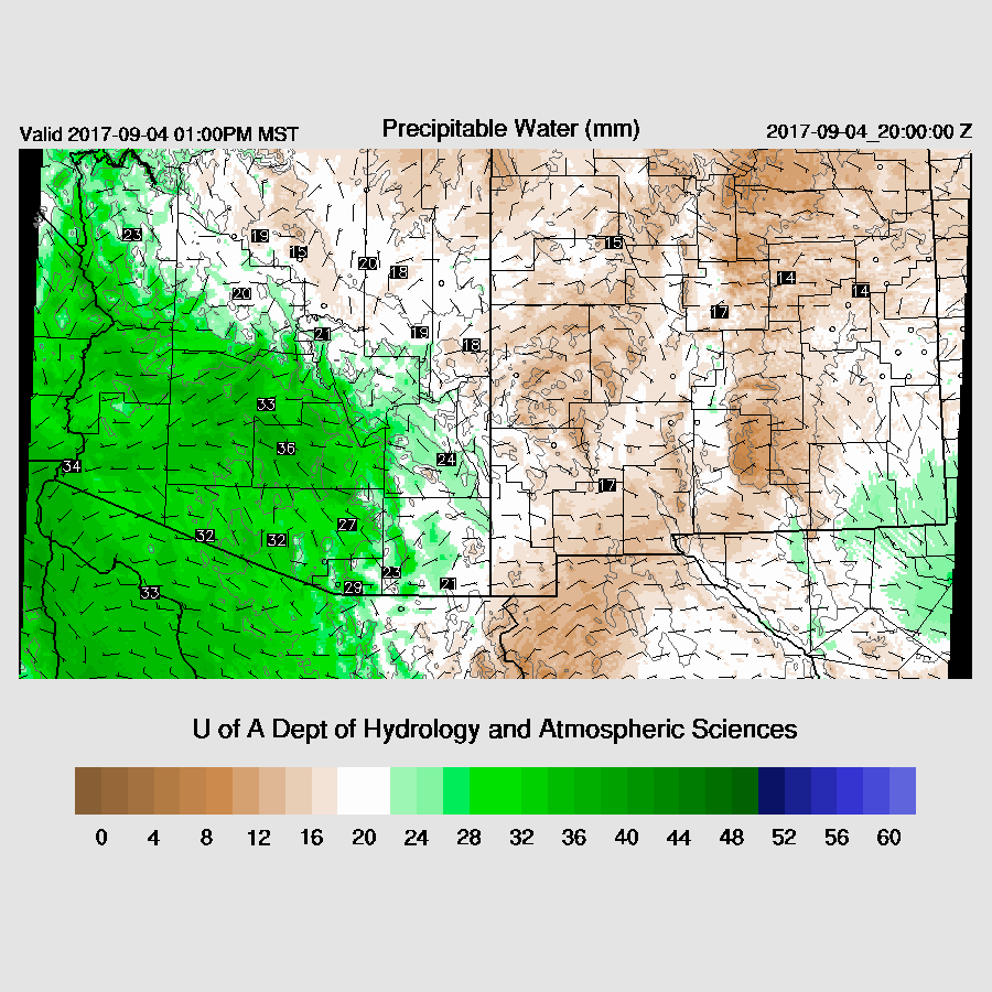
The forecast for yesterday was for increasing moisture for eastern ½ of Arizona as the dry east winds that have plagued Arizona recently have finally stopped. Surface dewpoint are mainly in the 60s in the low deserts and 40s in the mountains. IPW is only 29mm at Tucson and 33mm at Phoenix, thus the moist layer is shallow and this is verified by looking at the morning soundings. A weak surge continues to advect in moisture during the day keeping IPW about the same.
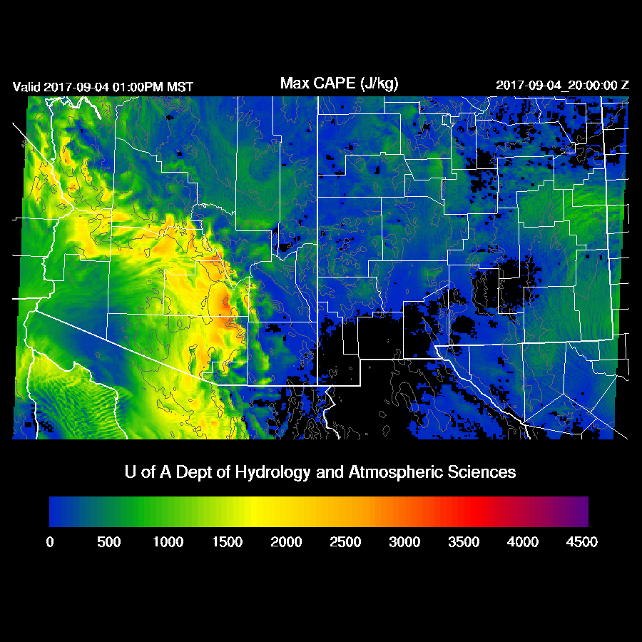
Mid level temperatures are a coolish -7 to -8 thus with only moderate amounts of moisture, CAPE is quite high from NW Arizona down to the south of Tucson and some storms are likely to be very strong today.
Mid level winds become favorable for steering higher elevation storms into the lower deserts today as winds are easterly or northeasterly at 10 to 20 knots. CAPE is low over the higher terrain but probably enough to support some storms. Mid level temperatures continue to be cool at -7 to -9C.

All the model runs do develop storms over the Rim and White Mountains during the early afternoon.

An impressive amount of surface based CAPE exists over Tucson this afternoon as it’s over 2000 J/kg. Mixing it out gives about what I would estimate about ½ that. A weak inversion is present on top of the shallow mixed layer so some lifting via an outflow boundary is going to be needed to trigger convection. 
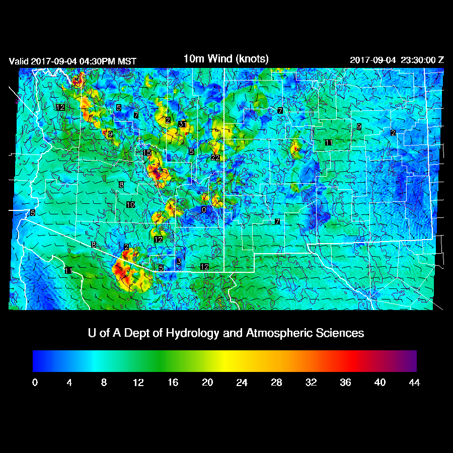
The various runs are in general agreement about moving scattered storms towards the lower elevations during the afternoon. Outflow winds are forecast to be very strong and will provide the lift necessary for some storms in the lower elevations.
By later afternoon scattered strong to severe storms continue with storms present in the Tucson area.
There is a spread of 10 mm for the forecast of IPW at Phoenix. The middle of the road is 34 mm, which results in around 1200-1500 J/kg and is plenty to support storms. As in Tucson, a strong outflow boundary or multiple intersecting ones is necessary to trigger deep convection.

Scattered strong/severe storms continue into the evening over central Arizona. WRFNAM below.

The WRFGFS has an especially strong storm just north of Phoenix. I just took a quick look at the WRFRRx 15Z and it is similar. All of the model runs have only limited low elevation activity as the inversion on top of the shallow mixed layer doesn’t break in spite of strong outflows.

This storm ejects a strong outflow into Phoenix which should be able to trigger a few storms there and blowing dust, of course. 
Storms this afternoon and early evening are likely to be severe with hail due to the deep mixed layer, high CAPE and cool mid level temperatures.

Day 2
Winds remain favorable for steering higher elevation storms into the lower elevations around Tucson and Phoenix. Temperatures continue to be a cool -9 to -7C.

It’s the “Return of the Dry Easterlies” as dry air moves into much of eastern Arizona. This is one sequel I don’t want to see! There is some disagreement among the runs so maybe the WRFNAM (below) is too dry.

Storms mainly over NW and SW Arizona where moisture is highest.

No comments:
Post a Comment
Note: Only a member of this blog may post a comment.