Previous Day
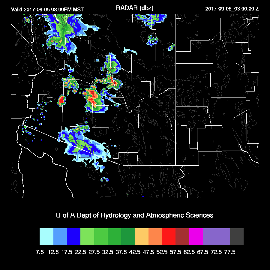
The model runs were a bit too optimistic with their storms around the Tucson area as the strong storms that were over the higher elevation did not make it into the city. No wonder as the LFC was very high at around 650mb and I should have picked up on this earlier. The forecast for big storms north of Phoenix did verify as well as a moderate outflow through the city. Severe winds did occur as a site north of Phoenix had a wind gust to 78mph.
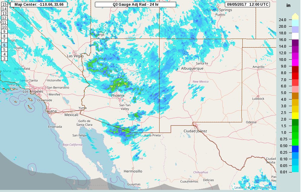
The 12Z WRFNAM and WRFGFS performed well as did the 15Z WRFRRx (below).

Initializations
No significant change in the long wave pattern since yesterday as a 595dm ridge is centered over northern NV and a broad inverted trough is located across northern Mexico. The remnants of Lidia are located off the CA coast as a weak low to mid level cut off low. This feature may be of interest as longer term model runs have it moving south over the next few days. All three 12Z model initializations have the large scale features initialized well.

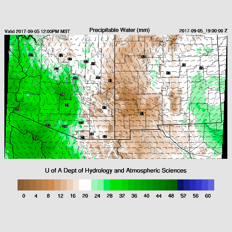
Much of the SW US is clear so no problems with clouds in the initializations. IPW is initialized well by all the 12Z model initializations. Model performance should be good today.
Day 1
It is a battle again between dry air to the east and somewhat wet air to the west. Tucson has been slowly drying since yesterday. The Phoenix area is still holding on to some moisture but the 12Z sounding showed very minimal CAPE and a high LFC. This setup continues today with a pronounced dryline from Nogales up to around Winslow. This has been one of the longest lasting low-level dry easterly events I can remember. I said the same about the 3+ weeks of very high IPW back in July too so either this has been a very unusual monsoon season or my memory is bad. It could certainly be the latter!
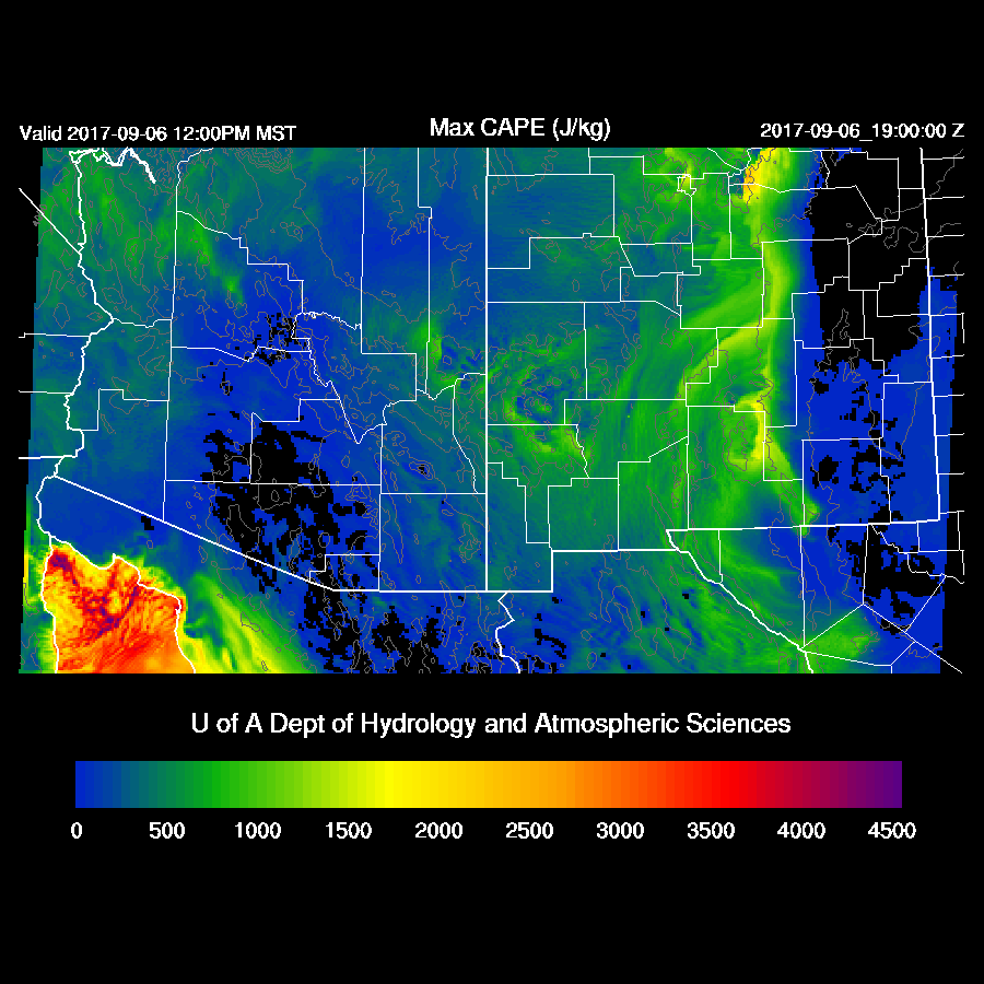
Moderate amounts of CAPE are forecast for just west of this line thus some of these areas could be quite active again today, mainly north and south of Phoenix. Maybe in Phoenix, if there are some intersecting outflow boundaries.
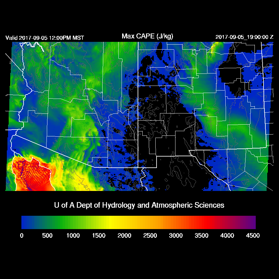
Steering flow is again favorable for moving storms from the high terrain into the deserts. Temperatures continue to be cool thus even with marginal moisture, there will be some CAPE.

In general, model runs develop deep convection to the west of the dry line over the higher terrain of far southern Arizona and north of Phoenix. The 12Z WRFRRx goes especially wild over southern Arizona which seems unlikely. The 12Z WRFRRx has been unreliable at times while the 15Z WRFRRx is usually one of the better runs. I attribute this to additional data assimilation as the 12Z RR runs are so early that all the 12Z upper air data may not get in. WRFGFS below.

It looks unlikely for any activity around Tucson today as IPW is less than 24mm and CAPE is nearly zero as dry easterlies dominate the PBL.

Phoenix remains in the somewhat shallow low-level moisture which results in a moderate amount of CAPE. Again, it’s going to take significant lifting to realize deep convection in the valley due to the high LFC as well as the relatively shallow moist layer. Areas over higher terrain near Phoenix are likely to see storms that produce very strong winds and maybe some hail today.

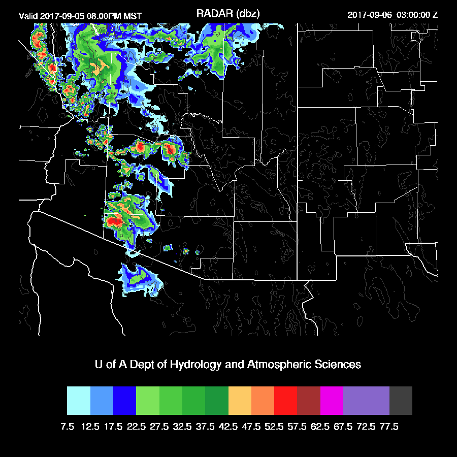
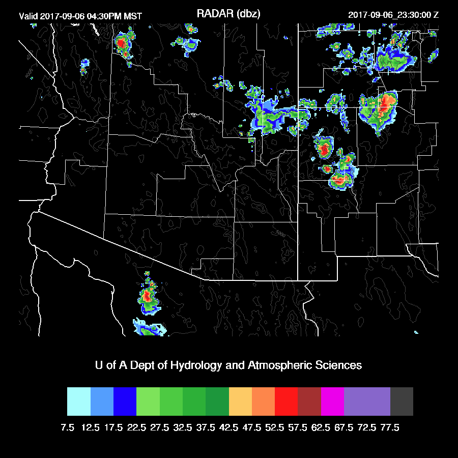
By early evening, strong storms continue to move slowly west and into the lower elevations of central Arizona.

Thunderstorms will have some very strong/severe winds associated with them again today. The WRFGFS (below) does forecast intersecting outflows over the Phoenix area by early evening.

The WRFNAM keeps most deep convection over the higher terrain over SW and NW Arizona and only weak outflows into the Phoenix area. It will be interesting to see the 15Z WRFRRx.

The WRFGFS does develop a few storms in and near Phoenix this evening but not anything widespread.
Both the WRFGFS and WRFNAM continue deep convection into the late evening over western Arizona.

This just in…..
The 15Z WRFRRx is nearly as active around Phoenix as the 12Z run. I still think it’s too active but who knows!?
Day 2
The dry air wins the battle as low-level easterlies push farther to the west. This time of year it is supposed to be the westerlies that cause drying, not easterlies! There is some spread with the model solutions so perhaps the dry air won’t push as far to the west as the WRFNAM forecasts below.

Of course, CAPE is minimal for most areas.
Very little activity expected tomorrow.
No comments:
Post a Comment
Note: Only a member of this blog may post a comment.