This is an update to the earlier discussion, written around 2Z.
Previous Forecast
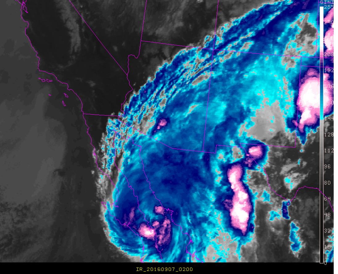
So far, the 12Z WRFGFS and 12/18Z WRFNAM are close to the actual position of Newton. Satellite imagery shows the center of Newton over the Gulf of California, just to the north of Loreto while the runs have it about 50 miles or so to the southeast. The various WRFRR runs are too slow and too far to the southwest. A few areas of deep convection have redeveloped, but no eye is visible in the satellite imagery. The 21Z NHC advisory was ‘generous’, estimating the peak sustained winds at 65 knots. This is close to the model runs but maybe slightly on the low side, thus the runs may be slightly too strong. Model IR clouds from the WRFGFS/NAM are very similar to the observed satellite clouds.
Initializations
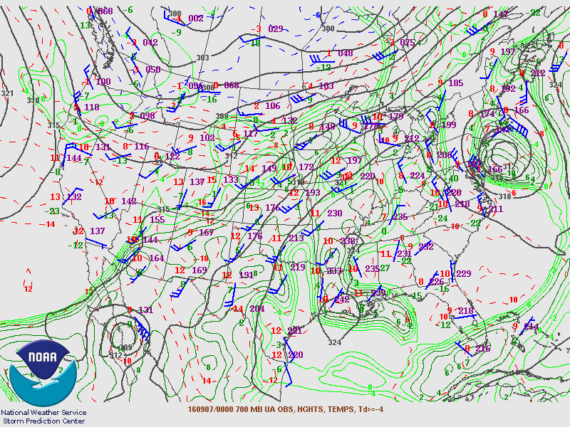
Only the 0Z NAM will be used for this discussion. The initial location of hurricane Newton looks to be accurate while the wind speeds may be a bit high as surface winds are as high as 55 knots and 700mb are as high as 80 knots. Typically, there are no soundings at 0Z from Mexico. However, one brave individual sent up a balloon at Guaymas. Fortunately, the surface winds in Guaymas were not strong yet, but at 925 mb winds were already 35 knots. I’m sure that this data point is going to be of great help to the model runs at 0Z. The 700mb trough continues to be present over southern California but looks quite weak. Maybe with weaker flow Newton will take a slightly more west path? We shall see what the WRFNAM says below.
(barely) Hurricane Newton remains over the GofC for about 8 hours before crossing Isla Tiburon and coming onshore. This is a major difference from the 12Z WRFNAM and GFS runs as they already had it inland about 75 miles to the northwest. It is also very similar to the location of the 15Z WRFRR. The only difference is that the WRFRR is quite a bit stronger.

This westward shift in the track means that the circulation will 1) remain over the warm and low friction water longer and 2) avoid the high friction, higher terrain in eastern Sonora. So, a stronger storm that remains intact longer. By 18Z, it’s still not across the border and in a nearly identical position as the 15Z WRFRR. The main difference is the 0Z WRFNAM is stronger!
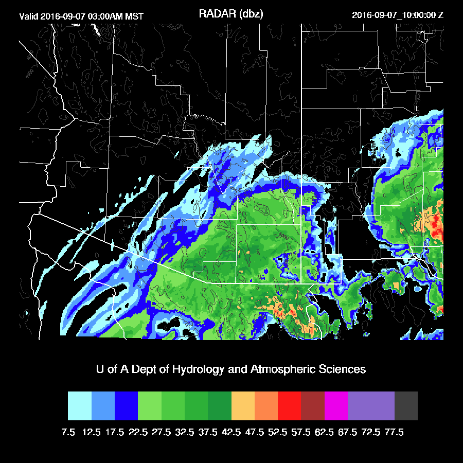
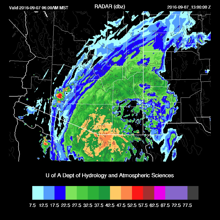
During the late evening into the early hours, light rain develops over much of the SE part of the state.
Heavy rain begins over central Pima county by late morning as the center of circulation approaches. This is quite a shift from earlier and I’d like to see more 0Z runs before fully buying into it. Check for yourself! Certainly, this increases the risk for very strong winds and very heavy rain in the Tucson area.
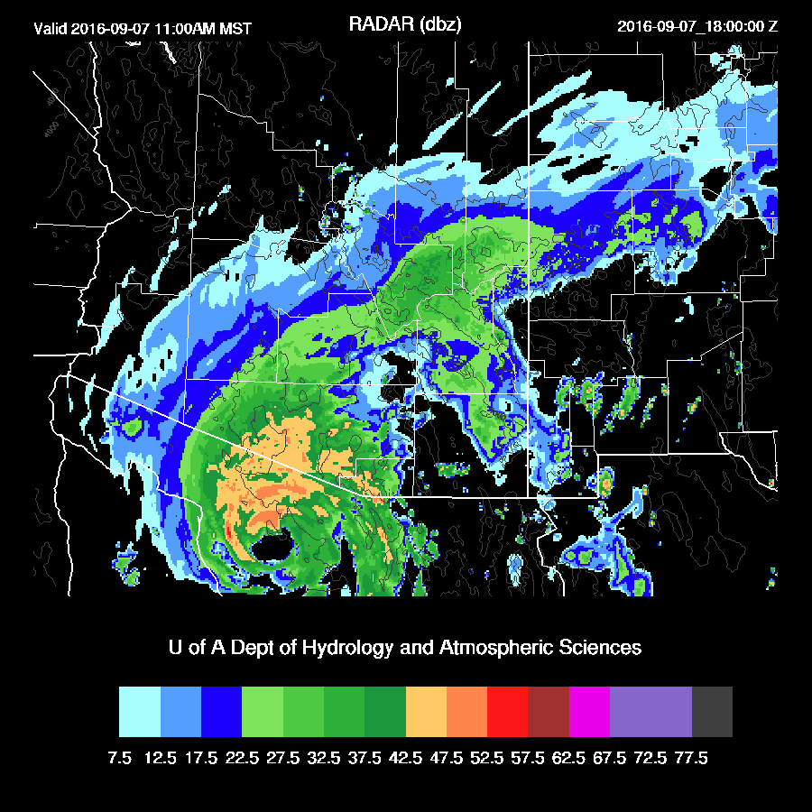
After moving quite quickly, Newton slows down over far NW Sonora and finally crosses the border into central Pima county during mid afternoon (must be backed up at the Port of Entry at Lukeville due to Labor day)

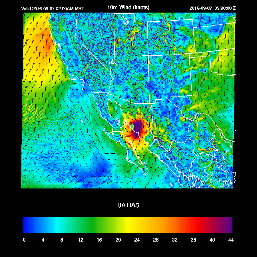
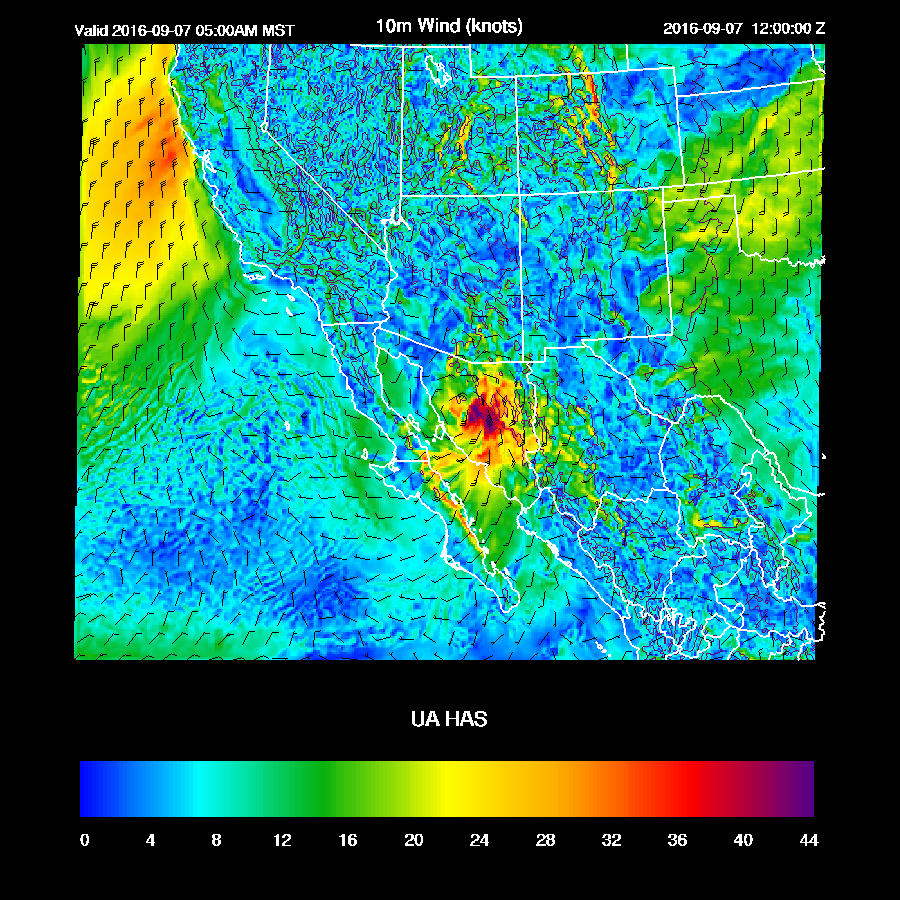
As depicted by the WRFRR, the center passes just to the west of Tucson with very strong winds for much of eastern Pima county during the late afternoon with gusts perhaps as high as 50mph.

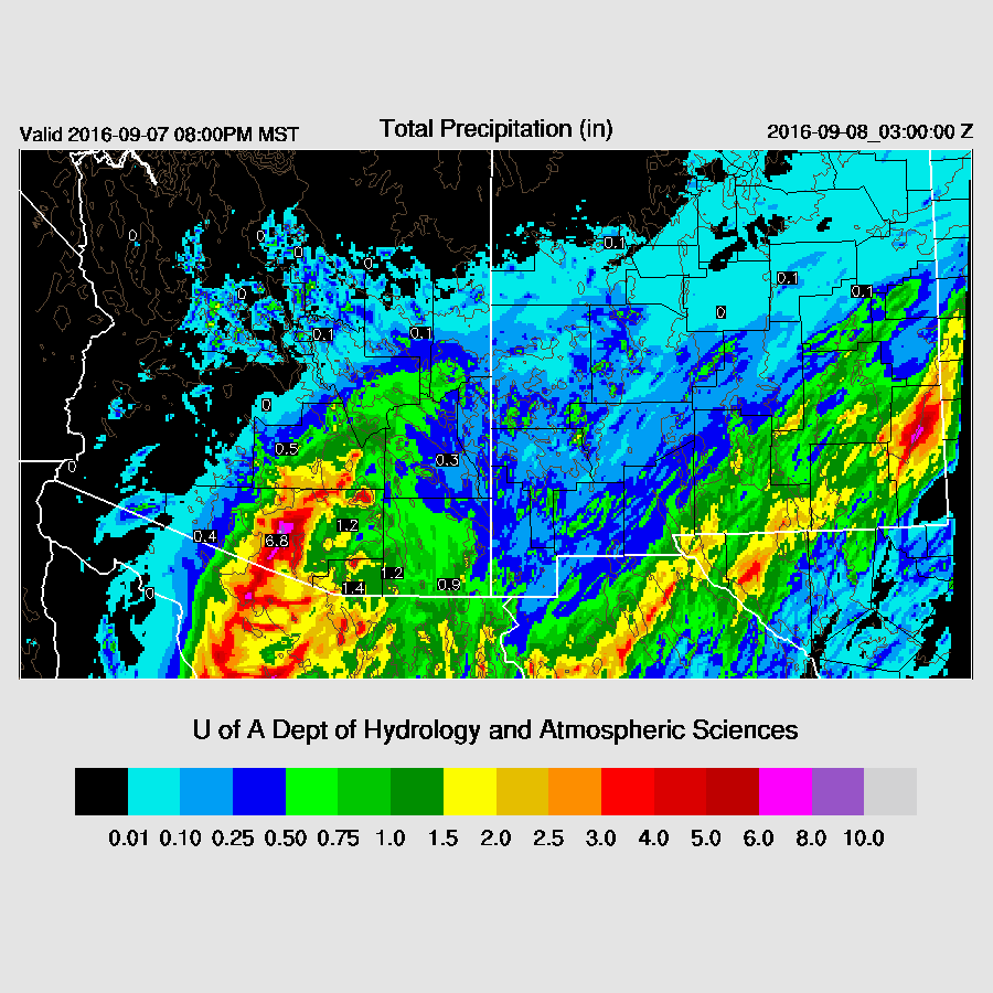
The only positive with this run is that the most intense precipitation remains to the west of Tucson. However, this band of 6+ inches could certainly be another 25-50 miles to the east.
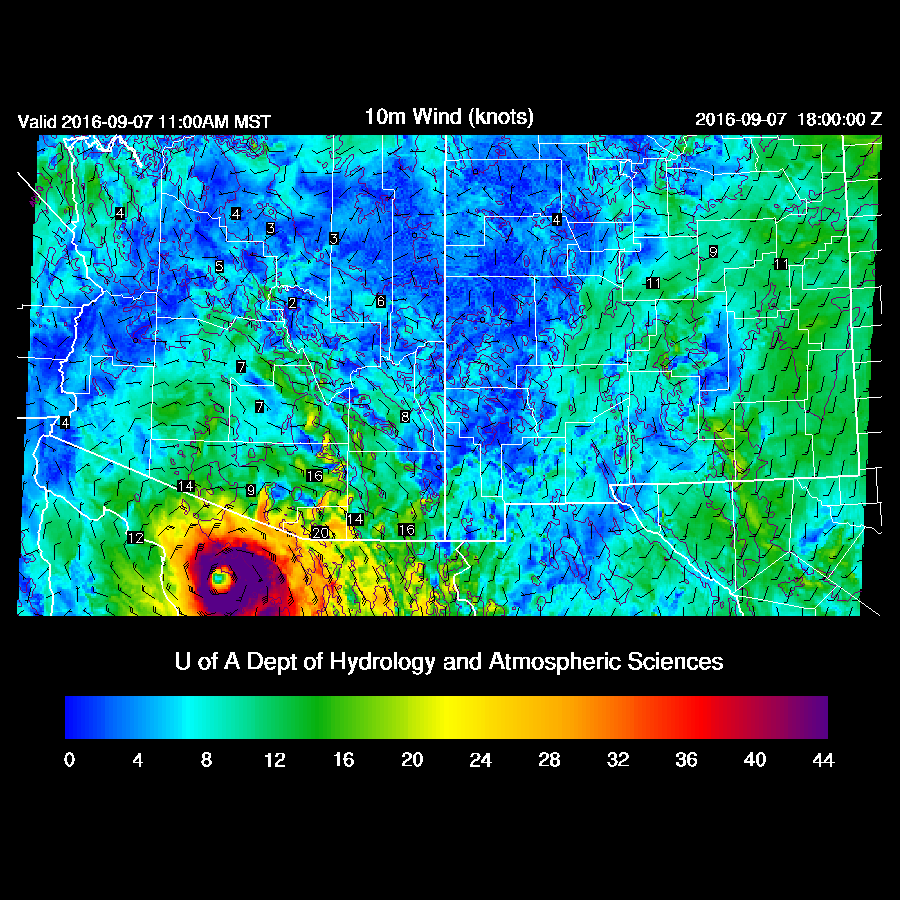
Strongest winds in the Tucson area are around late afternoon with some areas with sustained winds as high as 40 knots with higher gusts maybe around 50 knots.

0Z WRFRR
It is currently running and a quick look at the initialization shows it did well with the placement of Newton. Just to throw more uncertainty into the mix, it rapidly moves Newton across the GofC and comes onshore around 9Z about 75 miles to the SE of the WRFNAM.
This track causes Newton to spin down over the higher terrain of central and eastern Sonora. So, in spite of such a short time to the event, the models continue to have a wide spread in their solutions with no clear favorites.
Heavy precipitation begins over far southern Arizona around 12-14Z.
The heaviest rain remains just south of the border. So, the message continues to be the same as this morning which is some areas of southern Arizona will get a lot of rain: up to 6 inches. There is a possibility that areas from central Pima county all the way to western Cochise county could get tropical storm force winds. When and where? We’ll have to “wait and see”.

No comments:
Post a Comment
Note: Only a member of this blog may post a comment.