Previous Day
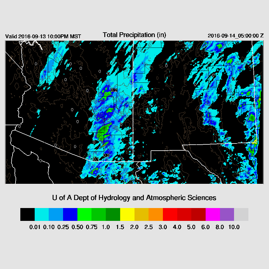
A very active day for much of eastern Arizona as there were widespread thunderstorms, with some severe winds and large hail. Precipitation was heavy, but only for short periods as storm motion was quite rapid.
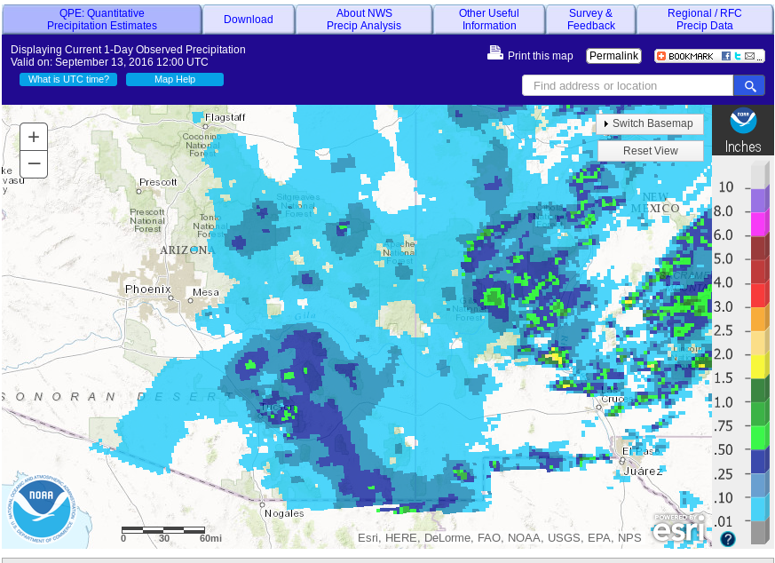
Both 6z runs were good as well as the 12z WRFNAM. The model runs were correct on predicting repeated development of storms throughout the afternoon as it rained 3 different times at my house. The 12Z WRFNAM had a bit too much precipitation, but location and timing were good. The 12Z WRFGFS had too much activity and was too far west (in and around Phoenix), as usual. It didn’t always use to be like this as a few summers ago, before the GFS upgrade, the WRFGFS (subjectively) performed as well or better than the WRFNAM.
Initializations
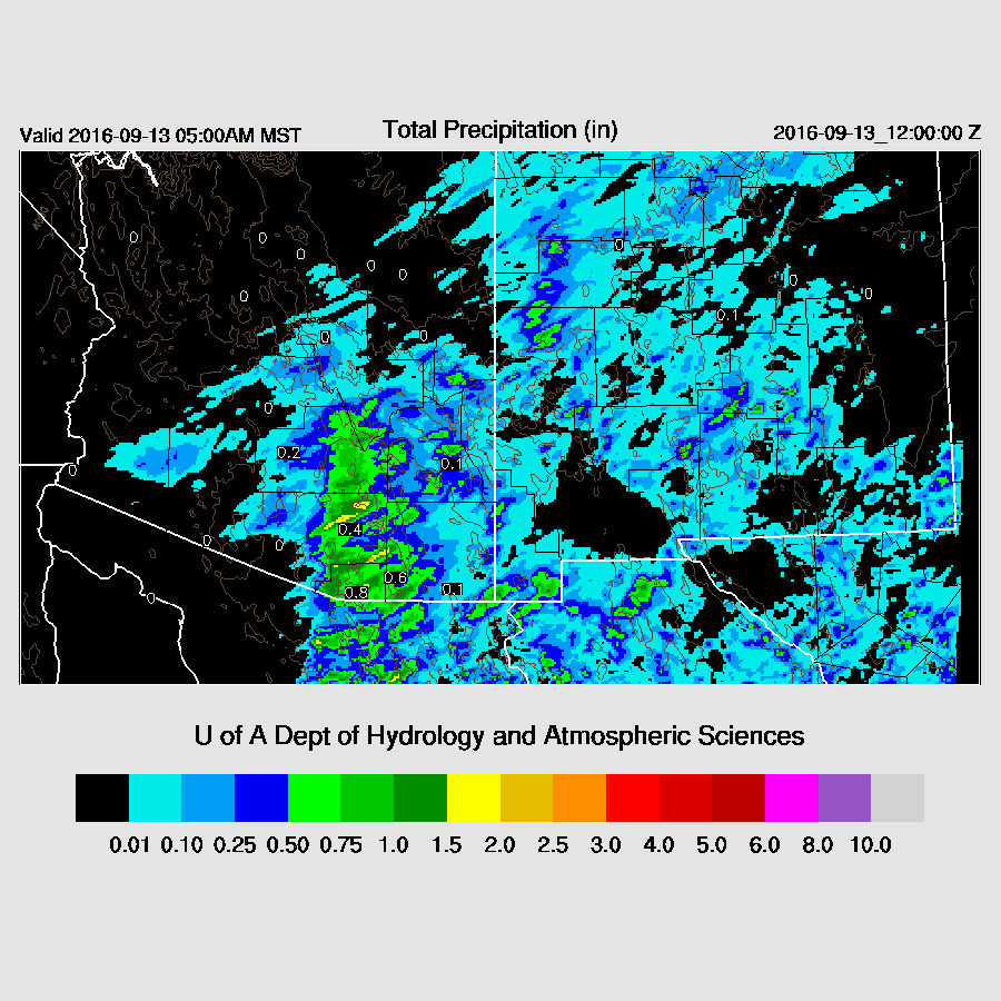
Enough moisture has leaked into southern Arizona ahead of the west coast trough to support storms again today. Mid-level morning clouds are again present over central Arizona along with an area of high clouds over SW Arizona associated with a strong jet passing over the northern Baja mountains. The 6Z runs were mainly devoid of clouds while the 12Z NAM had some, but not enough. The RRx has been missing from ESRL the past few days.
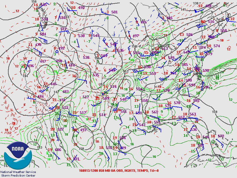
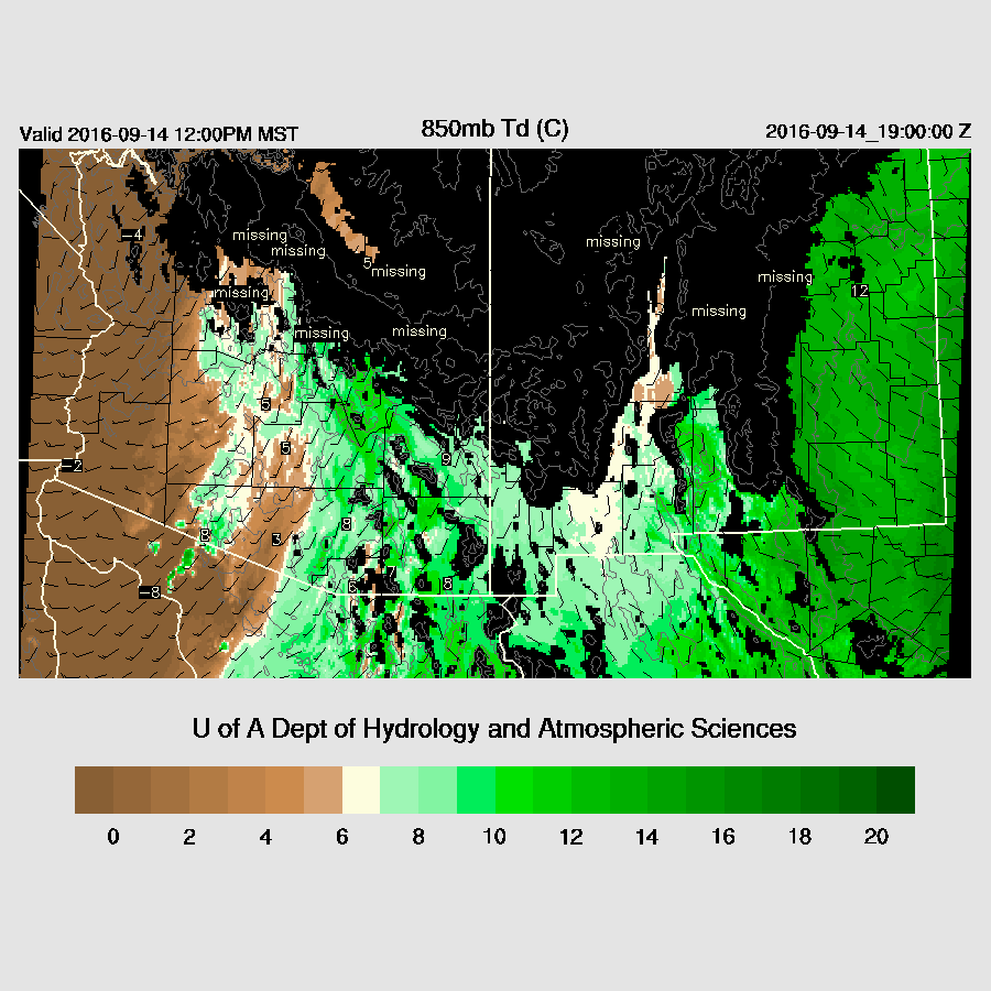
A fairly strong area of low pressure is present at 850mb over southern NV is helping to advect moisture into the eastern part of the state.
There were no major IPW initialization errors by any of the 6 or 12Z runs. Again, clouds are an issue over central Arizona. However, this shouldn’t impact the forecast much as low-level moisture is insufficient. The model runs should perform well across eastern Arizona.
Day 1
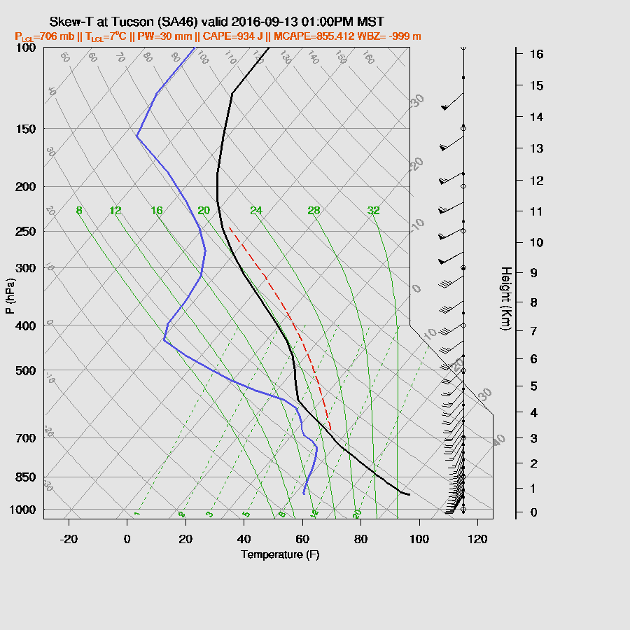
Moisture continues to advect into southern Arizona ahead of a strong west coast trough. The model runs from yesterday had much drier air across the state for today, but the wet air was never far away in Mexico and it doesn’t take much to advect it into the state. Goes to show you how quickly the forecast can change. By late morning, there is significant low-level moisture over southeastern Arizona as dewpoint temperatures are above 10C.

The model runs disagree where the most unstable air is located. The WRFNAM has it over far SE Arizona while the WRFGFS (below) is most unstable over Santa Cruz/eastern Pima. A close look at the 15Z Suominet data indicates that the WRFGFS seems to have the best handle on the moisture as the WRFNAM is too wet over Cochise county. However, it is quite wet due south of Cochise county at Moctezuma (PW is 31mm). In fact, all of northern Sonora has IPW values in the low to mid 30mm range. WRFGFS below.
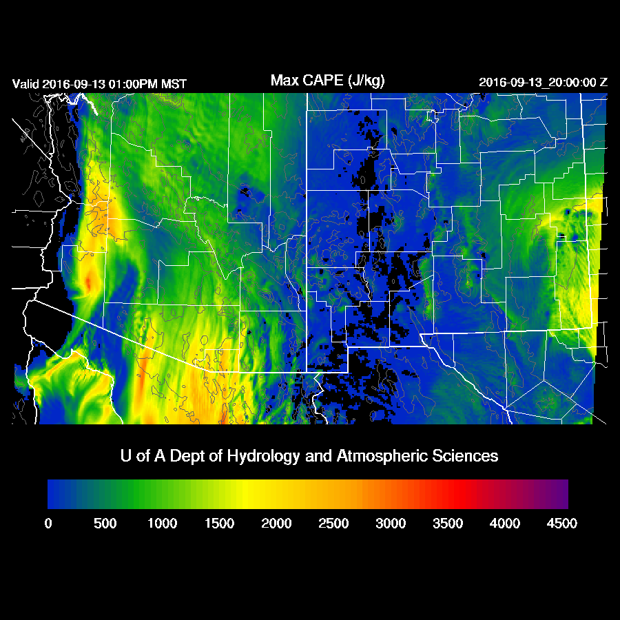
Are we going to have a repeat of yesterday? Early afternoon CAPE around Tucson is around 900 J/Kg and the PBL is mixed deeply. What is different from yesterday is that the directional shear is somewhat less by early afternoon. Speed shear in the WRFGFS (below) is a bit better with mid-level winds about 5-15 knots stronger, but the WRFNAM winds are similar to yesterday. So, it’s looking favorable again for fast moving and organized convection from Tucson and to the east, Hail is again a possibility.
The 2 12Z runs are nearly identical in developing deep convection during the early afternoon N/S of Tucson as well as over NW Arizona where there was also sufficient CAPE.
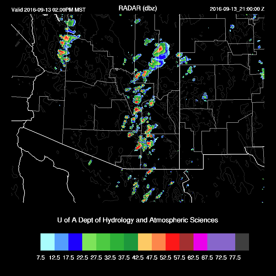
Big storms continue to develop and move to the NE along this line throughout the afternoon. Quite similar to yesterday but offset to the east by about 50-100 miles.

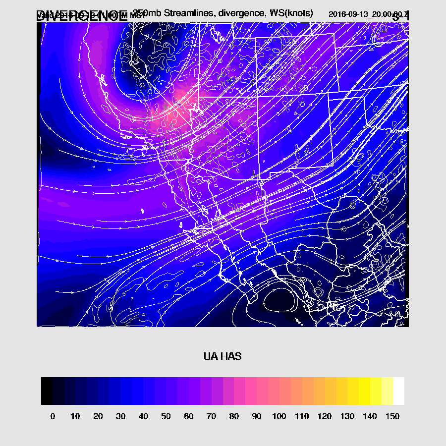
In some ways, today looks even better for severe weather as there is more upper support as a strong jet associated with the trough moves towards the state. Upper difluence and divergence are present over much of the state during the afternoon.
Wet air continues over the eastern part of the state into the evening.

As they did last night, storms continue into the evening hours, east of Tucson.
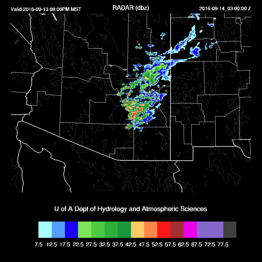
Note that storms redevelop over the same locations throughout the day into the evening. Some areas could get quite a bit of rain, like the mountains around Tucson.
Day 2
Some moisture continues to hang around eastern Arizona but should be insufficient to support much deep convection.
No comments:
Post a Comment
Note: Only a member of this blog may post a comment.