Special Hurricane Newton Discussion
The various runs of the UofA Regional WRF are now quite consistent with bringing Tropical Storm and now Hurricane Newton on a track across southern Baja, into the Gulf of California, and then up into south central Arizona.


The various runs of the UofA Regional WRF are now quite consistent with bringing Tropical Storm and now Hurricane Newton on a track across southern Baja, into the Gulf of California, and then up into south central Arizona.
Initializations
As the storm has become better organized, there is less uncertainty with its initial position. At 12Z the center was not yet into the outer domain of the WRF. However, using the outer wind field, both the NAM and GFS do seem to have the position quite close to observed. Where they differ is the strength. There is a recon flight ongoing as of this writing at 21Z. 700mb peak winds are 75 knots which are close to the WRFGFS, (image from tropicaltidbits.com). The first ½ of the plot was at 400mb, then dropping down to 700mb at around 20Z.
At 0Z, both the WRFGFS and WRFRR have wind speeds quite close to observed. (WRFRR is now using the new operational RR and goes out to 39 hours.) WRFGFS below.
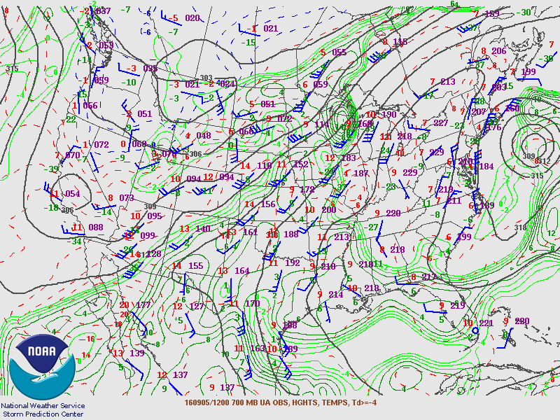
The other important factor is the upper air initialization for NW Mexico and SW US. All I can say is thank goodness for the availability of the 12Z upper air data from Guaymas as that site is going to be critical. The 700-500mb trough seems well initialized except for maybe slightly too cold at 500mb vs observed. This feature is going to play a critical role with the direction and speed of Hurricane Newton.
Day 2 and beyond
By 6Z on the 6th, the hurricane is just south of the southern tip of Baja. All three runs are quite similar in their location. What worries me is that the storm has already exceeded the maximum modeled strength in all of the runs. The latest NHC forecast calls for 75-knot surface winds at 6Z. [Edited at 20160906 0Z: The NHC has issued Advisory 5A, raising the initial intensity to 85 mph.] The model runs max out at around 60-70 knots at 700mb. The strongest is the WRFRR (below).
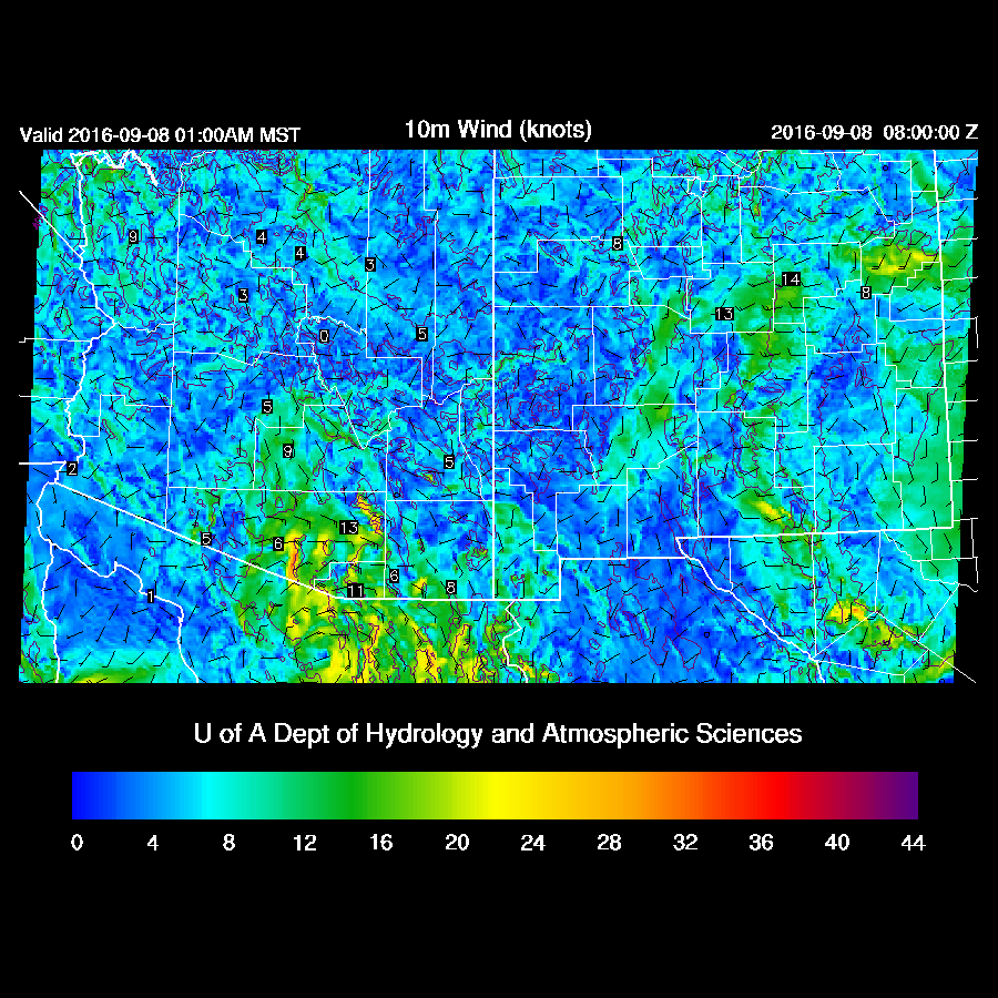
Surface winds speeds exceed 55 knots at 6Z.
By 18Z, Newton is over southern Baja and in spite of being over land, 50+ knot winds continue on its east side. The 700mb trough moves only slightly east.
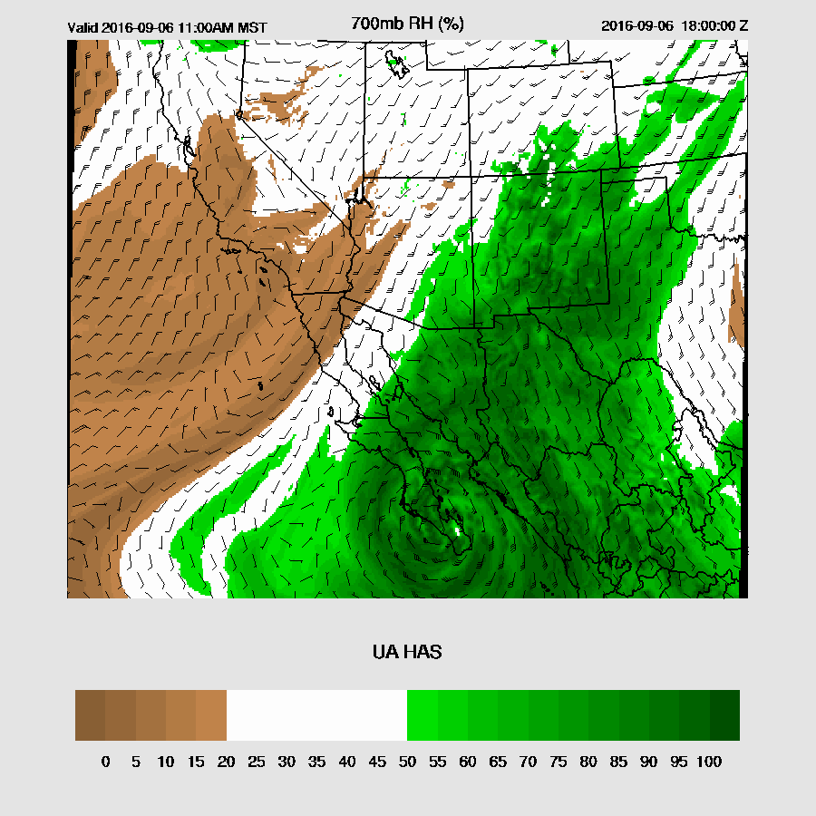
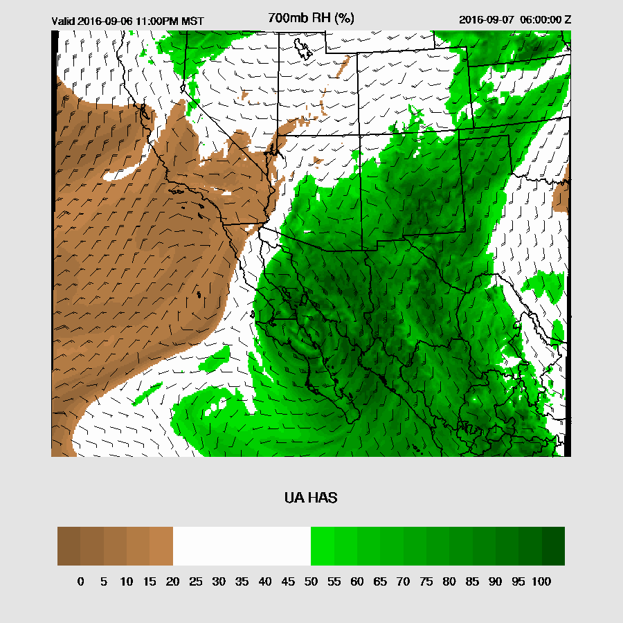
There is a chance for deep convection to form as early as tomorrow afternoon over SE Arizona as moisture surges into that area ahead of Newton. Surface heating and moderately cool air aloft should assist in storm formation.
By 6Z on the 7th, Newton is back over the (narrow) waters of the GofC. With the GofC around 30-32C, even this narrow strip of water will continue to support Newton. There have been a number of tropical systems in the past that have taken this path and maintained their strength. Both the WRFNAM and GFS are quite similar with the track and strength at this point.
Typically, a forecast for a cyclone in the GoC much farther than 48 hours ahead is somewhat of a guess, but the various model runs over the past 24 hours have been relatively consistent thus there is some confidence in the forecast. By 12Z on the 7th, the WRFGFS again brings Newton onshore in central Sonora while the WRFNAM still has it out over open water, about 50-100 miles to the south.
The WRFGFS continues to be a bit stronger and indicates that Newton may still be at hurricane strength when it comes onshore.
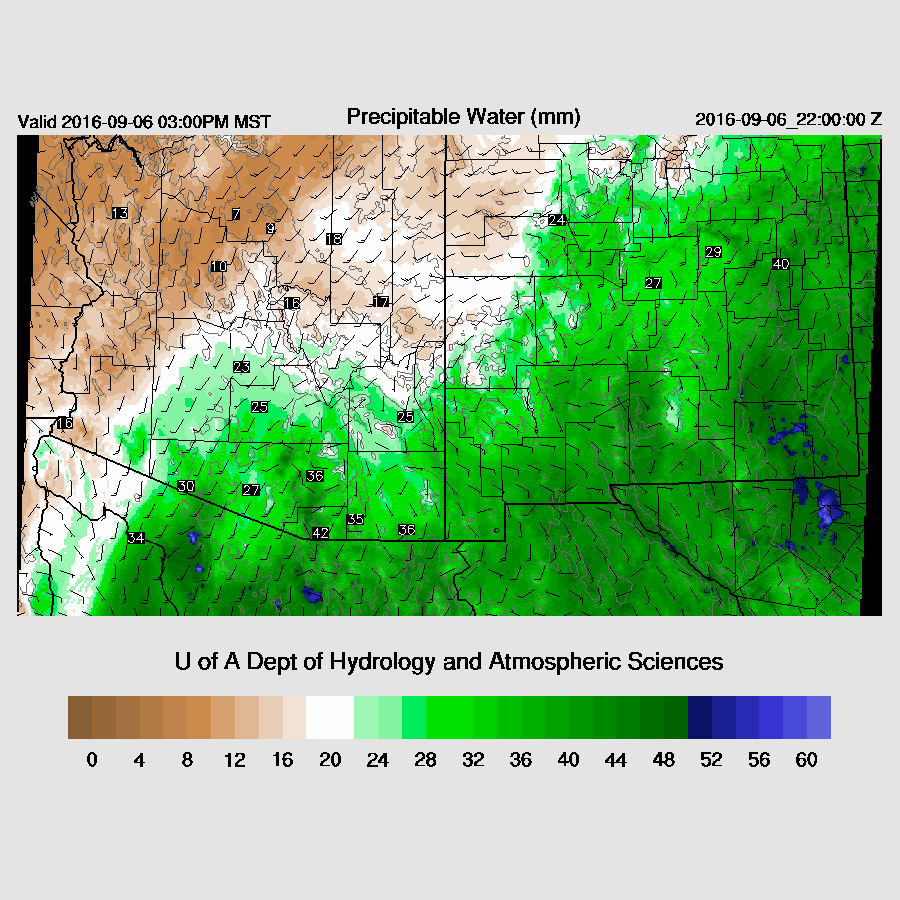
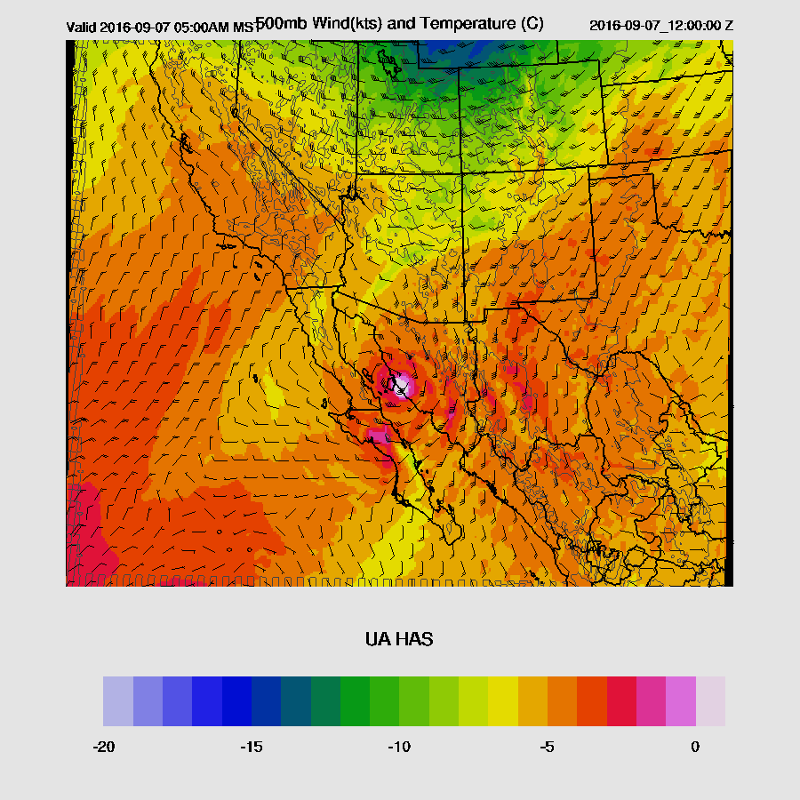
Now is when it gets tricky for Arizona! Many things can happen that cause tropical storms to not live up to their hype. If the tropical system loses its low-level circulation too rapidly (thus lifting mechanism), precipitation amounts can be significantly below the forecast as it is so warm aloft no CAPE is present in spite of super high PW values. Note the above 0C 500mb temperatures!
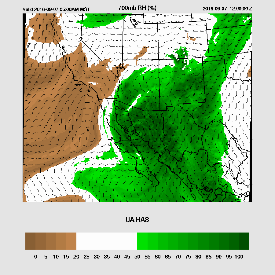
This case does seem a little different as there is weak synoptic scale support with slightly cooler temperatures over Arizona associated with the trough. IPW values become very high by the morning of the 7th with easterly winds increasing over far southern Arizona. If the forecast track is correct, Newton will mainly remain over the coastal plain of Sonora thus able to keep its low-level circulation going a bit longer.
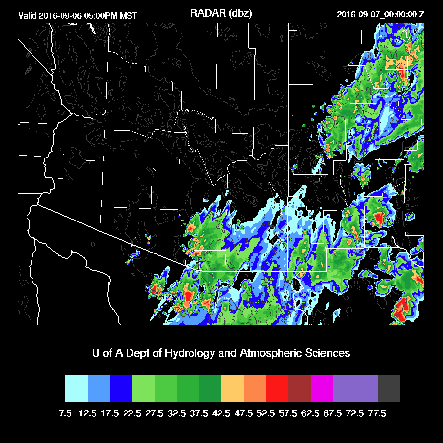
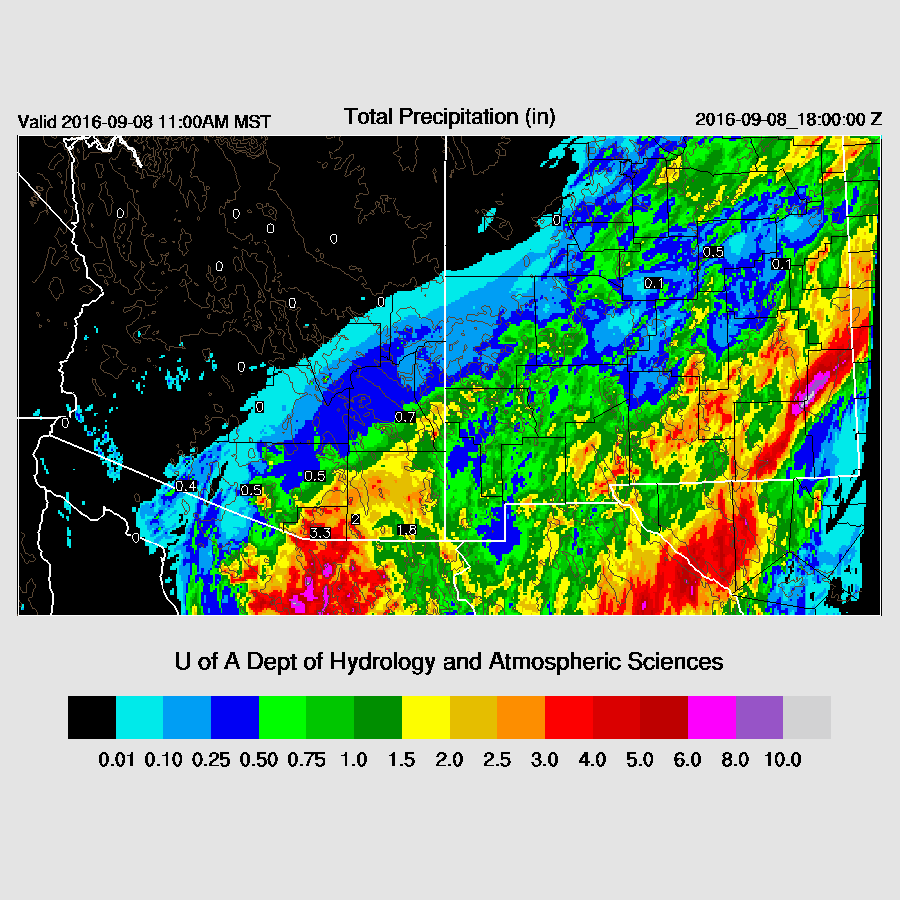
Precipitation coverage continues to increase overnight with maybe some deep convection.
The WRFGFS and NAM really diverge by this point. The 10m wind plot from the WRFGFS (below) is almost unbelievable. Newton maintains 50 knot plus winds into far northern Sonora as the path remains over the somewhat flat terrain in that area.
The WRFNAM (below) has Newton making landfall around 18Z.
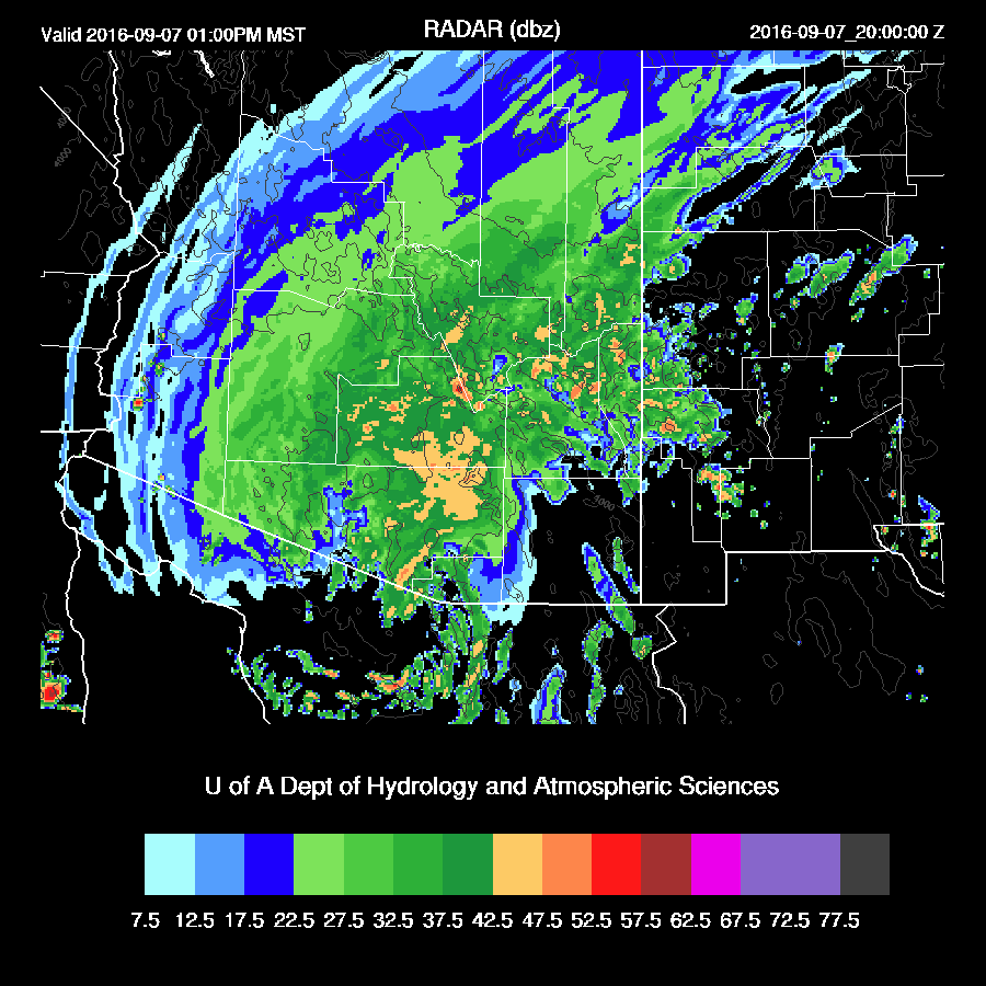
By afternoon the WRFGFS moves Newton to just southwest of Tucson with an area of 45-knot winds. A very unusual forecast thus unlikely, but not impossible! Not impossible because the system is moving quite fast in the WRFGFS thus it does not have as much time to lose strength.
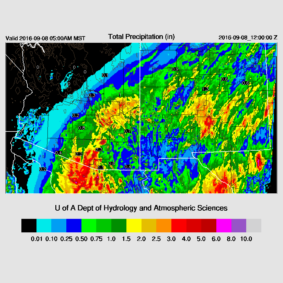
Moderate to heavy rain continues into the early afternoon. Of course, the main threat from these systems is heavy rain and the most precipitation falls across eastern/central Pima. The amounts have varied from run to run with some areas receiving over 4 inches.
There is much uncertainty beyond 48 hours as the two runs are so different. The WRFNAM brings a slower and weaker Newton close to Arizona after 6Z on the 8th.
The heaviest precipitation remains just to the south of Arizona. As is many times the case, reality may be between the two runs. Saying that, it does appear that the storm is moving faster and stronger than the WRFNAM so I’m leaning towards the WRFGFS, unusual as it is. It’s going to be a very interesting 72 hours that is for sure!
No comments:
Post a Comment
Note: Only a member of this blog may post a comment.