Previous Day
The 15Z position of Newton is about due west of La Paz, just onshore on the Pacific side. The 12Z WRFNAM from yesterday is about 6 hours behind and too far east, but does have the hurricane at about the correct intensity. The WRFGFS was also too slow while intensity looked about right.
Initializations
The 12Z WRFNAM has the storm too far east, over La Paz at 15Z. The WRFRR 12Z and 15Z have the location initialized well. The WRFGFS is similar. It’s a bit hard to judge initial intensity as an aircraft has not been in the storm recently. The model runs have 60-70 knot winds as of 15Z which looks about right.
The 700mb trough continues along the west coast with steering flow favorable for steering Newton into southern Arizona. Initializations look good.
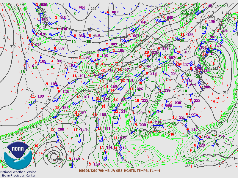
There are some IPW initialization errors in the 12Z NAM and RR as they are over 5mm too wet over central and southern Sonora. The GFS had only minor errors. Overall, I’d say the WRFRR or WRFGFS are the favorites as they’ve had a somewhat better success with the speed and intensity of Newton, but as is the case with any tropical system, an error of only 50 miles or so can mean the difference between a lot of rain or only a little. In this case, the strength of the winds will also depend on the track and speed as a faster and slightly to the west path will lead to much stronger winds in Santa Cruz and eastern Pima counties.
Day 1
Newton’s cloud presentation has lost much of the organization that it showed earlier this morning as it is over land. These systems gravitate towards warmer water and once enough of the circulation is over the GofC, deep convection should resume as water temperatures there are above 30C. It looks like it’s getting close at 18Z both in real life and in the WRFNAM and GFS.

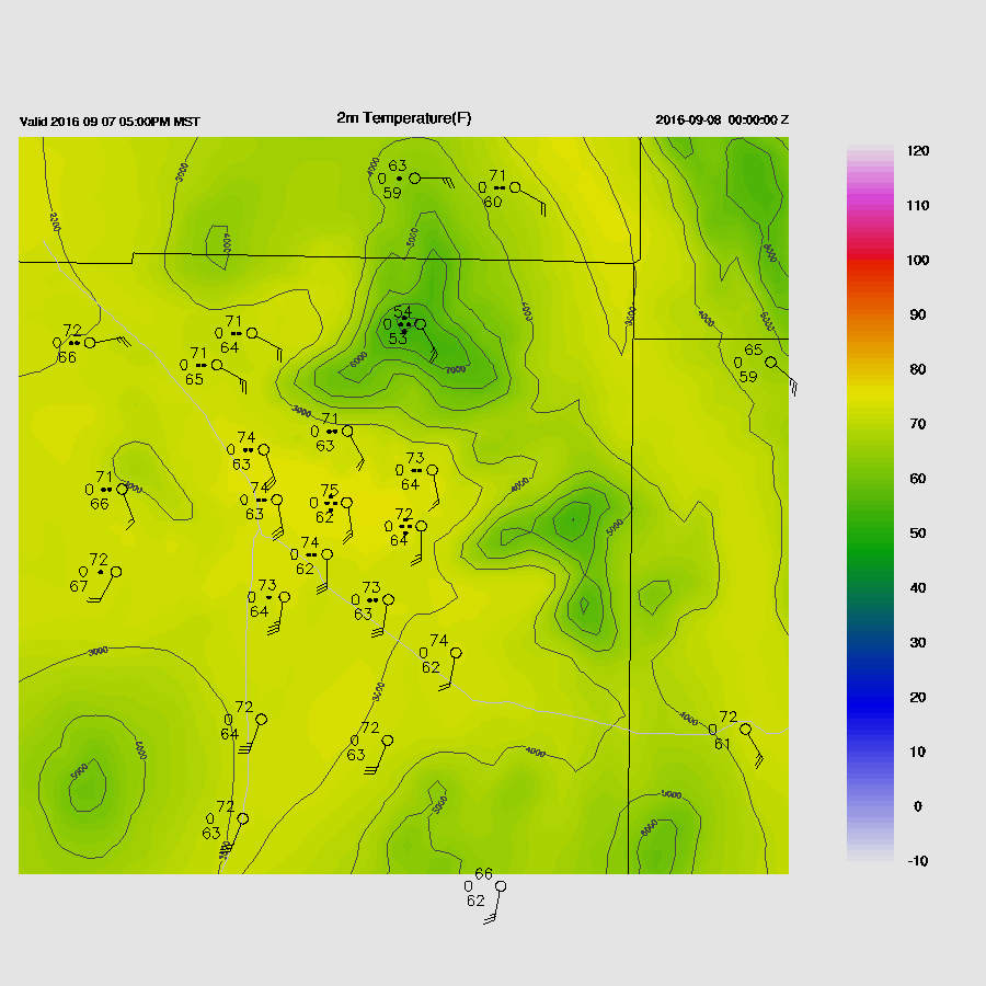
Moisture increases rapidly over southern Arizona during the late morning and into the early afternoon.

The thinking yesterday was for some deep convection to form later this afternoon over SE Arizona. Only the WRFNAM is forecasting this today and is probably overdone as it was somewhat too wet in Sonora. The WRFGFS/RR have hardly any CAPE around Tucson this afternoon.

This evening CAPE does increase from a surge of moisture coming in from the Gulf of California. Areas between Tucson and Phoenix could see some evening storms.

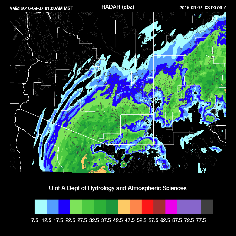
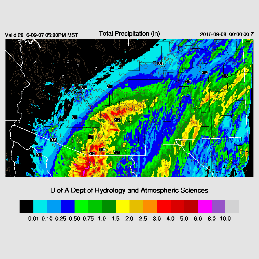
Light to moderate precipitation begins over most of SE Arizona this evening with some storms possible along the western edge.

By this evening, Newton is back over open water and looks fairly well organized. The WRFRR has it taking a more westerly track and is still over land at this time. Possible, but I’m going with the other two model runs as I said earlier, these systems gravitate/reform towards the warm waters of the GofC.

Day 2
A second landfall is made over southern Sonora around 7Z. Remarkably, the WRFGFS and NAM are identical with the timing and location. The WRFGFS (below) is slightly weaker.

The odd man out is the WRFRR as it doesn’t come ashore until 11Z and it does so about 75 miles or so further to the NW. This solution is very similar to yesterday’s model runs and will mean more rain and wind for Tucson if true.

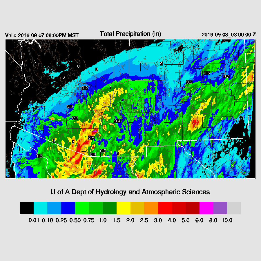
In any case, mostly light rain continues over much of SE and far southern Arizona.
As I said yesterday, now it gets tricky. The WRFNAM and GFS are about identical as they bring the center of circulation very near Nogales by 16Z. Winds are still above 40 knots on the east side of the circulation, but rapidly weakening due to the interaction with the terrain.
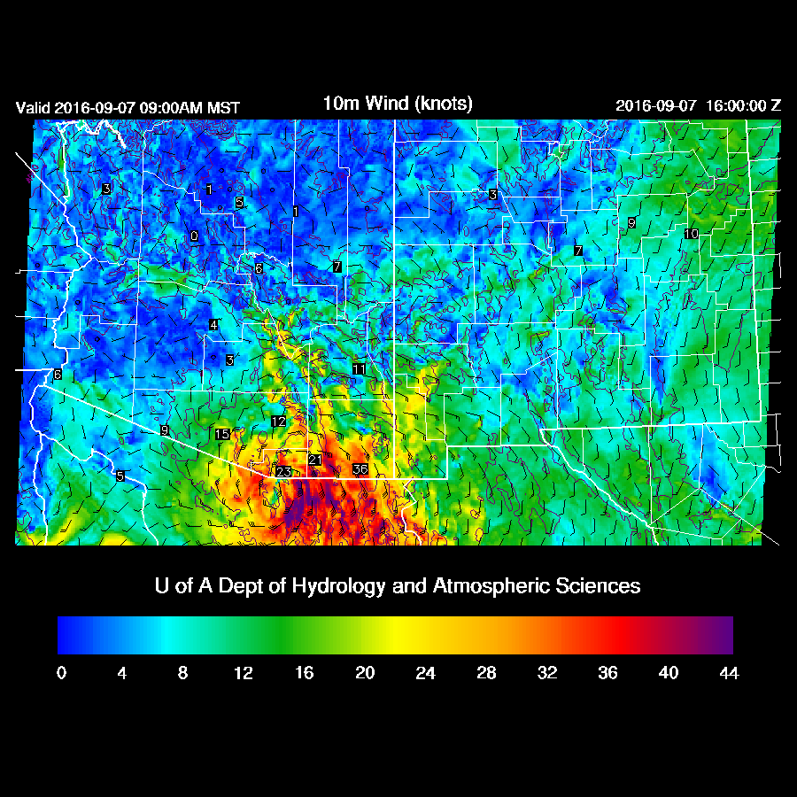
The WRFRR is about 3 hours slower and 100 miles or so to the west. This track will brings stronger winds into eastern Pima/Tucson during the afternoon. I believe this is less likely, fortunately.

The other major threat is very heavy rain. WRFNAM and GFS have most of the rain falling tomorrow morning with some isolated areas of very heavy rain.
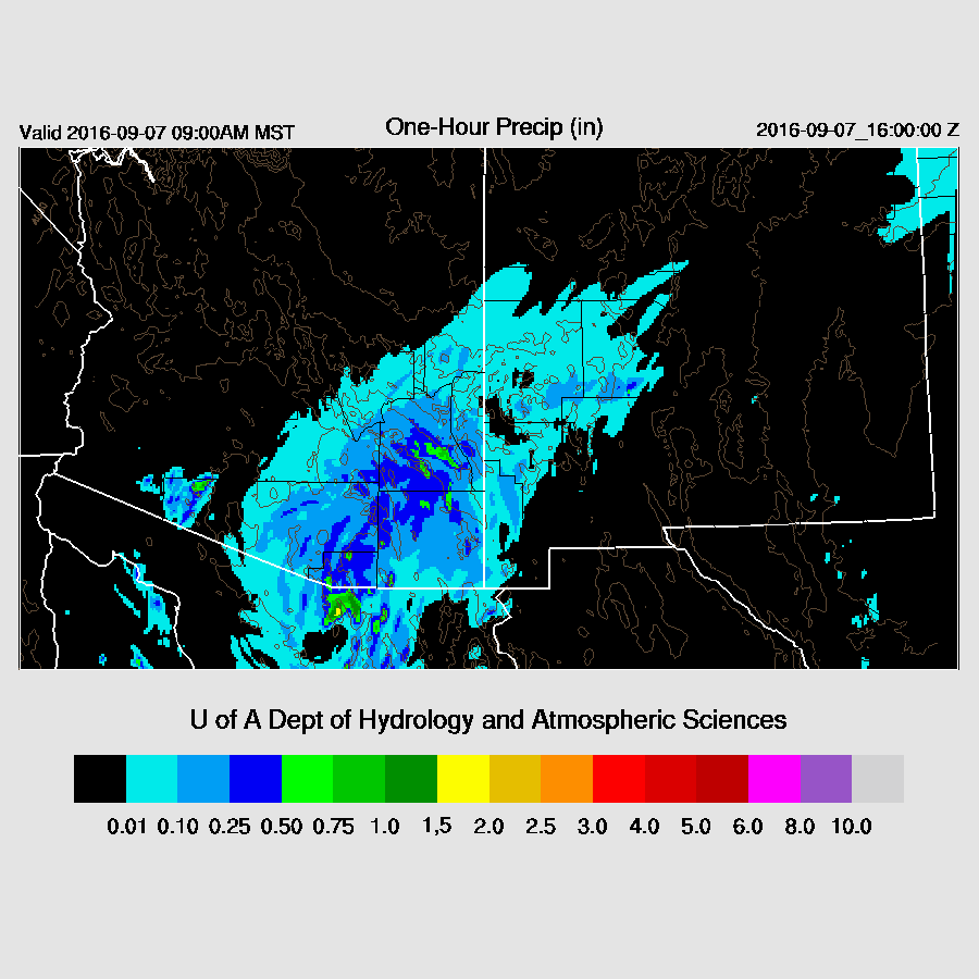
Heaviest rain is just east of the Tucson area. Certainly future model runs may put this band back towards the west -- we’ll just have to wait and see. Again, only a 50 mile difference between locations can mean the difference between ½ inch and 2-4 inches. That is why this is so difficult. What does seem certain is that some locations in SE Arizona are going to get a lot of wind and rain tomorrow morning.
The WRFRR has the most rain about 50 miles to the east of the WRFNAM/GFS.
This isn’t something you see everyday! The center of circulation is just west of Tucson in the WRFRR
Comparison of precipitation through Wednesday midnight. (high res link)

Comparison of wind speeds at 20Z / 1 PM MST Wednesday afternoon. Note that that the 0Z and 6Z GFS maintain near hurricane force winds into AZ -- not a likely scenario. (high res link)

No comments:
Post a Comment
Note: Only a member of this blog may post a comment.