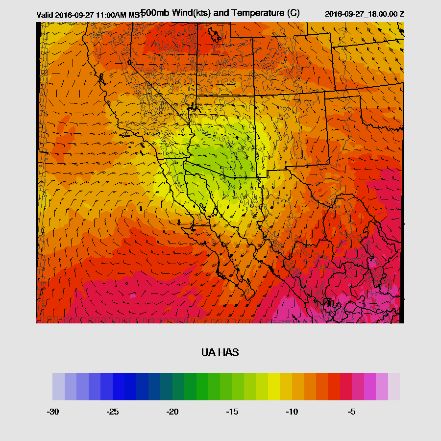
This discussion will cover the potential for severe weather tomorrow. An anomalous retrograding cut-off low has moved to a position over the Baja spur this morning. Guaymas is reporting a -12@ 500mb and the low was analyzed at 5760 m. There is a moderate amount of moisture to the south and east of the low in the range of 25-35 mm. Plus, there is a TS (Roslyn) at 119W, 17N moving slowly to the NE which may add additional moisture over the next few days.
By tomorrow, the low begins to eject to the north with quite cool mid level temperatures over southern Arizona of around -12 to -15C.
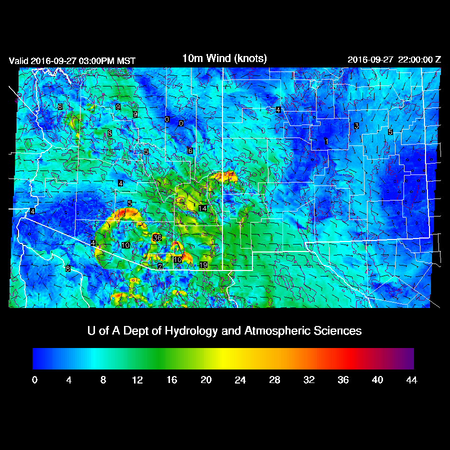
Some low level moisture is present over southern Arizona with 850mb dewpoints in the 7-10 C range, which is fairly high for this time of year.
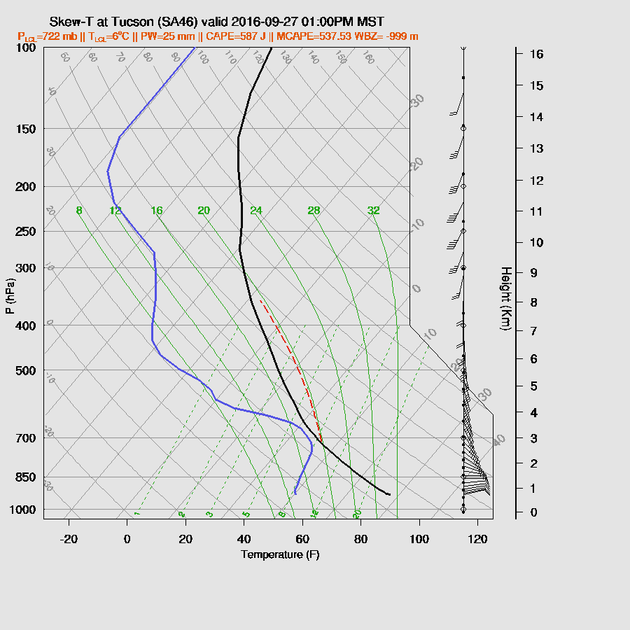
CAPE isn’t all that impressive, but the wind profile certainly is with a Great Plains supercell type of directional shear. Speed shear isn’t as good as was being forecast the other day but is still fair. The PBL becomes deeply mixed by early afternoon thus strong to severe storms are likely from around 1-4pm in and around the Tucson area. There is a risk of large hail. Storms are likely to exhibit rotation with the possibility of funnel clouds or maybe a brief tornado. The 12Z WRF GFS and WRF NAM model runs are quite similar thus there is some confidence in this forecast. The RR is missing at 12Z. I’ll check to see if there is any data available and make a run if that is the case.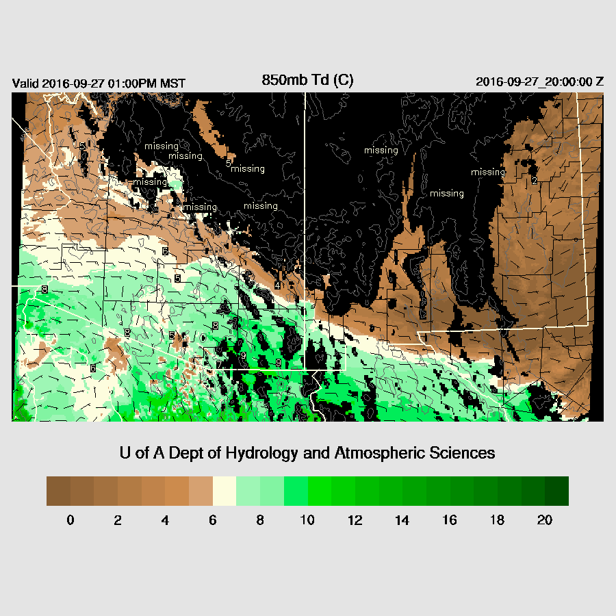
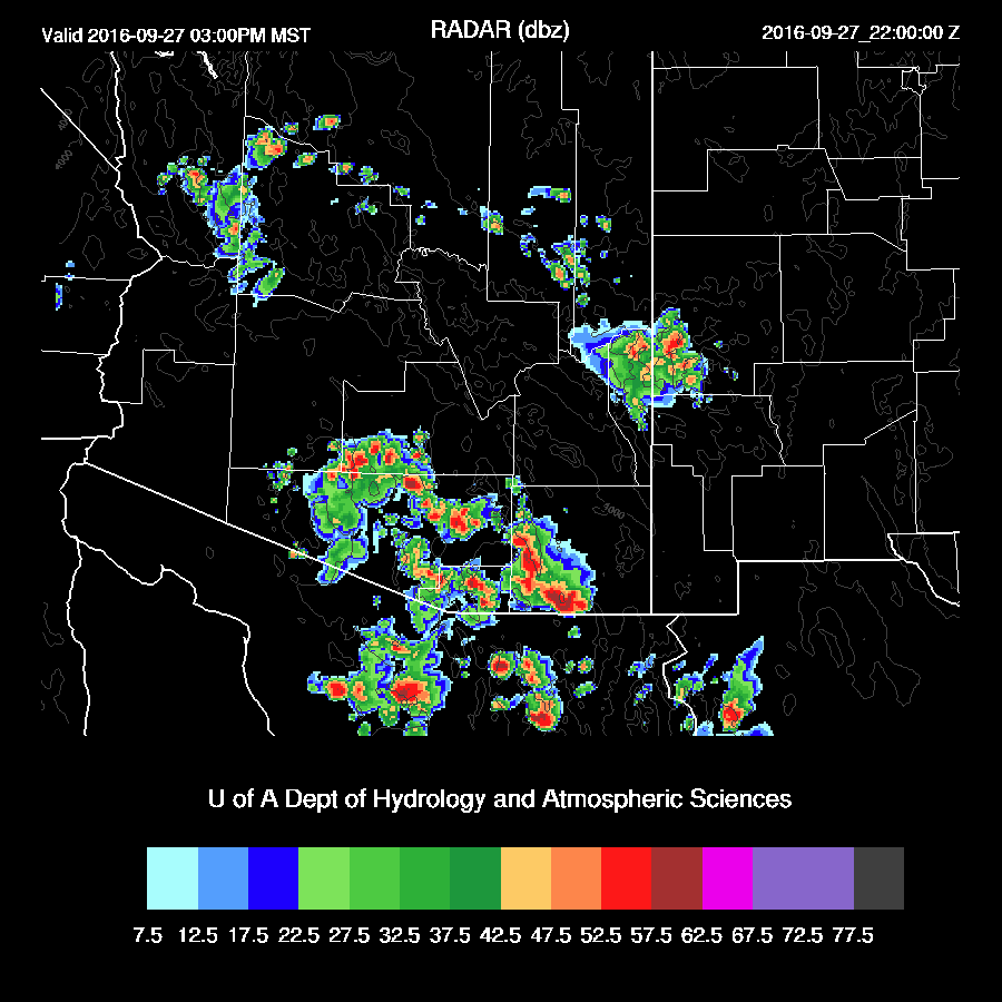
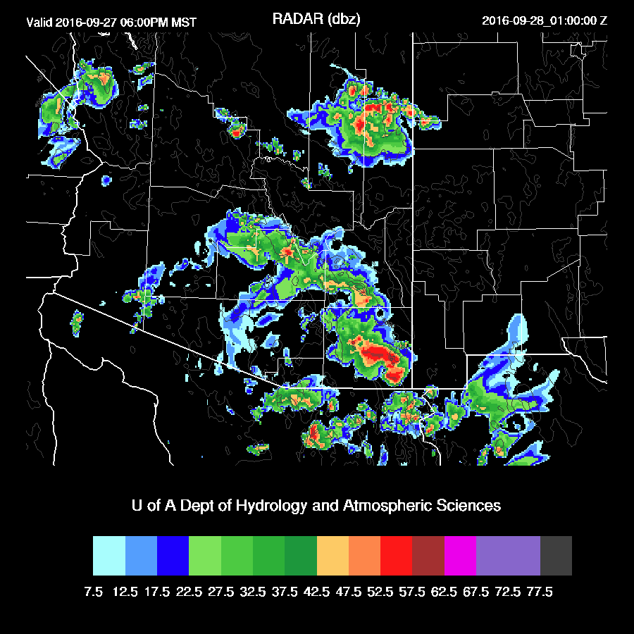
Deep convection initiates around 20Z over the higher terrain of central Pima and Santa Cruz counties. By mid-afternoon, a broken line of strong to severe storms moves to the NW and impacts Pinal, eastern Pima, and western Cochise counties. Again, both models are quite similar with location and timing. The WRFGFS, below, is about an hour faster than the WRFNAM and has strong storms in the Tucson area around 3-4pm.
Thunderstorm winds are expected to be strong with isolated areas of severe winds.
The broken line of storms continues to move to the north and northeast into the early evening. At this point, the model runs diverge with the WRFGFS (below) moving the dissipating storms to the east of Phoenix and continuing strong storms over Cochise county plus another area of storms moving off of the White Mountains.
The WRFNAM is a few hours slower and has storms dissipating over Arizona by 8-9pm.
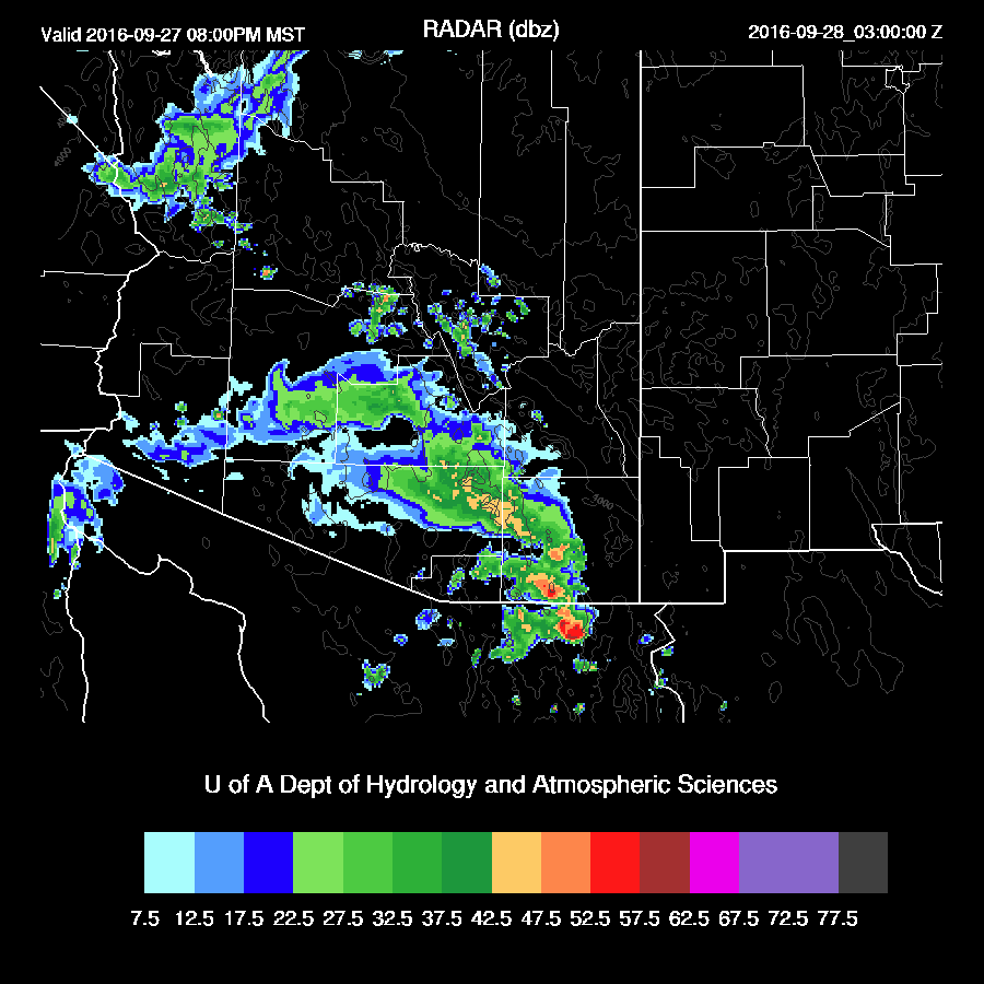
The storms move fairly quickly so rainfall isn’t extreme. However, some locations could see over an inch or more. Mode consistency has been remarkable as all the runs from that last 18 hours have nearly identical solutions. Saying that, there are some issues that have to be monitored. All model runs allow full heating tomorrow and as past history has shown, the model does have issues with insufficient clouds so if we wake up to clouds tomorrow, there may be much less activity than predicted.

No comments:
Post a Comment
Note: Only a member of this blog may post a comment.