Thursday, July 25, 2019

20190725

Previous Forecast
The 15Z WRFRR and 12Z WRFGFS were quite good as they forecast the activity in NW Arizona and in Pima County quite well.   The only issue was the model runs had the storms a bit later in the evening whereas a severe thunderstorm hit Marana around 6pm.  This was the view from mid-town around that time.  No action in Tucson but we did have a magnificent sunset.


Initializations
NAM data from NCEP was corrupted, so no WRFNAM today.  The state is mostly clear, and satellite imagery didn't reveal anything interesting.   The 500mb chart looks about the same as it has the past few days with the anticyclone centered near the Four Corners.

IPW initialization is excellent and today is one of the more accurate initializations so far this season, mainly because it's so simple!

Day 1
Yesterday's runs indicated that today would have limited activity, but looking at the 12Z Tucson sounding, there may be a bit more than was expected.   It's very moist in the lower troposphere as the surface Td is 64F and PW is around 38mm.  This results in a mixed layer CAPE of almost 1400 J/kg.  Steering winds are quite weak but maybe enough to nudge some storms into the lower deserts.  Even Phoenix has around 700 J/kg of MLCAPE.

A surge is underway this morning and is forecast to continue today keeping PW high over much of the state.  The drier easterlies in NM have weakened, and the surge is pushing moisture eastward.
CAPE is high to very high over parts of southeastern and southcentral Arizona.  With plenty of heating, it will be an active day over the higher terrain.  What about lower elevations?

Later in the afternoon, Tucson is forecast to have over 1000 J/kg of CAPE and a PW of 39mm.  Unfortunately, observed PW has dropped to 35mm at Tucson and 34mm at Amado.  We'll have to wait and see if this is a temporary dip or if the drying trend continues.  If it continues, it's likely that the runs will be too active.  Mid-level winds pick up speed and become more favorable for steering storms into the lower elevations.

All runs are nearly identical as they develop scattered storms over the high terrain of much of eastern Arizona by early afternoon and generally move to the west.  A few of these storms move close or into the Tucson area.  This is likely to be too much if the PW continues to drop.

Activity moves into central Pima County and into Mexico by late afternoon.  I'm confused why the WRF runs don't have more activity considering CAPE is so high.  Maybe it's that warm layer around 6-500mb capping deep convection?

500mb temperatures are high at around -5 to -3.   It seems there is always something that screws up a good looking situation.


Day 2
The surge continues and even moves into SW NM.

CAPE is again forecast to be high over much of eastern Arizona with some areas approaching 2000 J/kg.

Hot air continues in the mid-levels over SE Arizona, but there is slight cooling over SW NM.

Like I said earlier, it's always something.  The Tucson forecast Skew-T has good CAPE, shear, and steering, but a shallow mixed layer with inversions at the top of the lowest mixed layer and at 500mb.

With better moisture and lower mid-level temperatures, SW NM is very active with some strong storms.  Scattered deep convection is also over the Rim and White Mountains.

A few strong storms move into far SE Arizona during the early evening.

A big wind event for the Lordsburg Playa looks likely.

Wednesday, July 24, 2019

20190724

Previous Forecast
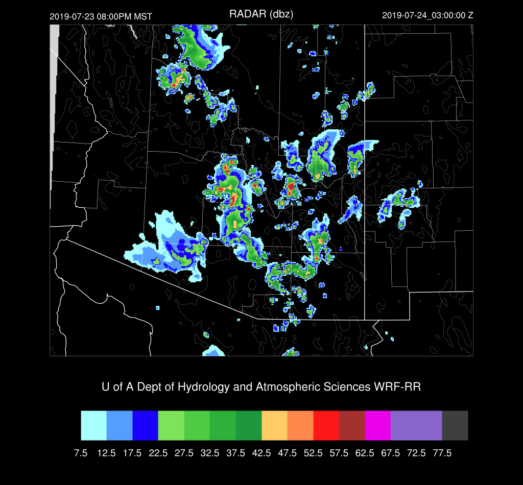
The model runs were all over the place. The 12Z WRFRR was generally too dry, and the other extreme was the WRFNAM which was way too wet.  The 15Z WRFRR was pretty good as well as the WRFGFS as they limited precipitation to the higher terrain.   All that changed after midnight as showers and storms developed over central Arizona in what appeared to be in response to the large MCS over Sonora.  The 0Z runs did pick up on the overnight activity, but a few hours lead time isn't beneficial.

0Z WRFGFS

Initializations
It is a complicated situation due to thick clouds over western Arizona along with ongoing showers and storms.  The MCV from the Sonoran MCS is located over the northern Gulf of California.  The NAM had the worst cloud, but the best MCV initialization.  The GFS and RR did a reasonably good job with the clouds.
There is a problem with the Flagstaff sounding 500mb height, but the wind seems OK and indicates that there is a weak IT/MCV over western Arizona.  This feature was initialized well. 
PW was initialized well except for the NAM.  The initializations and resulting forecasts have been inaccurate so many times that I'm considering reducing the number of times it runs each day. I'd replace some runs with the WRFRR by using the GFS for lateral boundary conditions.  The WRFGFS and WRFRR are the favored model runs today.
Day 1
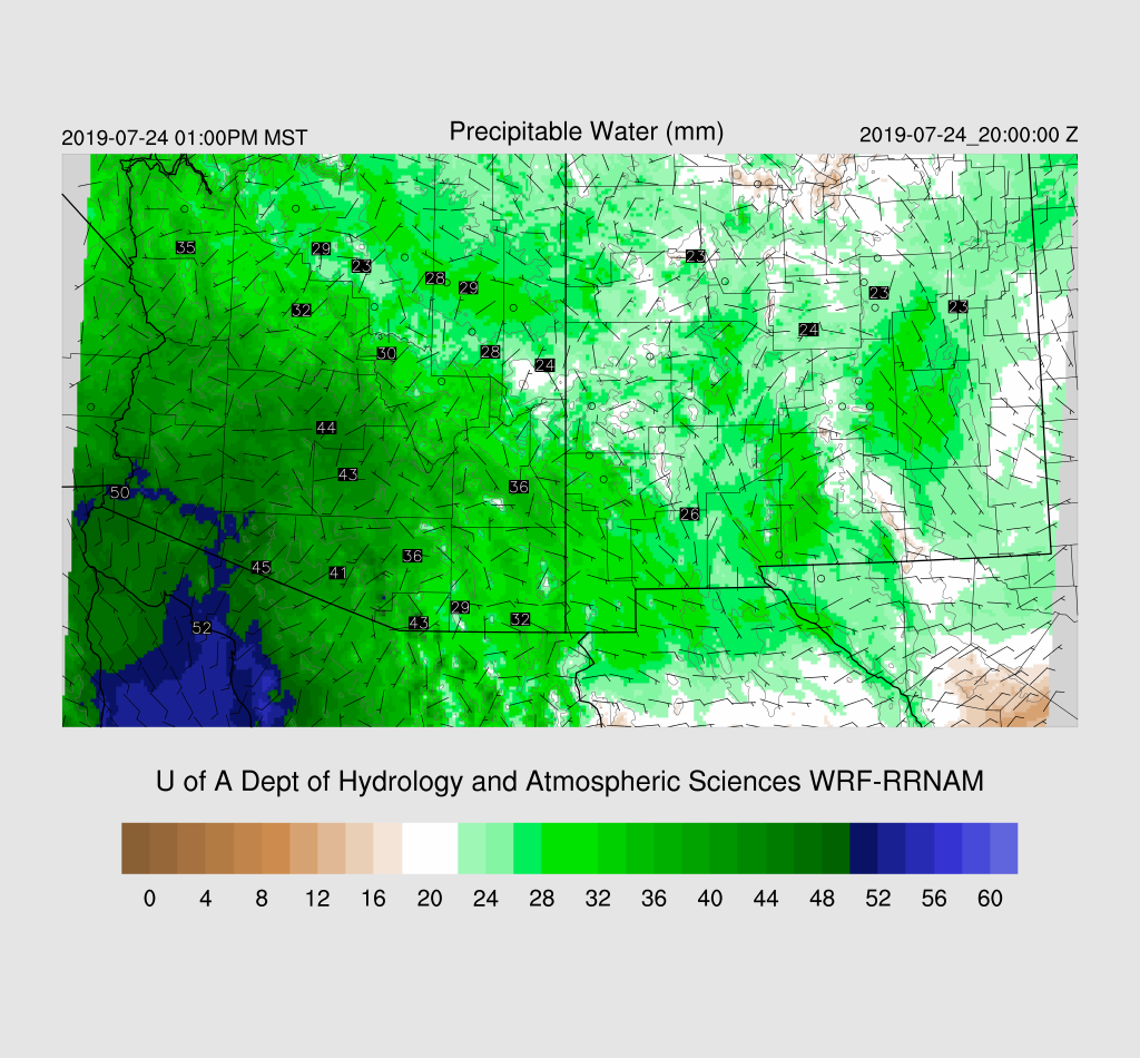
Moisture has increased over southwestern Arizona due to the outflows from the active MCS in Sonora, resulting in PW around 50mm today.  Low-level southeasterly flow is advecting drier air into eastern Arizona.
This dry air advection has reduced CAPE over eastern Arizona, but it's probably enough for some activity over the higher terrain.  Southcentral Arizona up to around Flagstaff has CAPE in the 1500 J/kg range so if those areas can receive some heating resulting in some deep convection, storms could be strong with heavy rain.

The problem is the PBL has been cooled significantly due to the morning activity and the advection of cooler and wetter air from the south.  The afternoon Phoenix Skew-T indicates a shallow mixed layer as well as an inversion. 

Tucson looks a little more favorable, but low-level winds are advecting in drier air resulting in lower PW.  These downsloping drying situations are unfavorable for deep convection in the lower elevations.

The WRFRR runs have very little activity over most of the state today.
The WRFGFS is a bit more active but keeps any significant weather out of the low elevations.

Both runs do increase activity this evening over Pima and/or Pinal Counties  Perhaps a good night for lightning photography?


The 15Z WRFRR reverses the low-level winds, which results in the wind profile becomes more favorable plus PW increases slightly due to moisture advection reversing. We'll have to wait and see if this actually happens.

Day 2
Moist air continues over much of central and western Arizona while drier easterlies are present over the far east.
Once again, favorable CAPE is present over much of central Arizona.  Is there going to be enough heating to mix deeply and break through the stable layer at the top of the PBL?

The PBL isn't mixed very deeply at Phoenix, but there is plenty of CAPE and an OK shear profile.  Mid-level steering is pretty weak though.  I'd say probably not too much activity for the lower elevations.

That appears to be the case through the afternoon as only scattered storms are present over only the higher elevations.  Storms decrease into the evening hours.  All runs have the same general idea.


Tuesday, July 23, 2019

20190723

Previous Forecast
Most of the model runs performed well in spite of the widespread morning cloud cover that I thought may have been an issue, especially for Phoenix.  It was the most widespread event so far, and quite a bit of rain fell in some spots with as much as 2".   Note: I'm uploading images directly into Blogger now so you can click on them to get the full size.

In general, the WRFGFS and 15Z WRFRR were the best runs.

There were quite a few reports of severe winds over southeastern Arizona and several power outages in the Phoenix due to strong winds.  This part of the forecast also verified well. 

I'd like to talk a little about the Phoenix area as the 0Z sounding only had around 700 J/kg of CAPE and a shallow mixed layer. Just going on that, it looked like there wouldn't be much chance for any deep convection.  Another reason to think there wouldn't be any was that the temperature forecast was significantly too warm as the model runs didn't have nearly enough clouds. 
None of that mattered much as a thunderstorm outflow moved in from the south and was sufficient in strength to trigger a few storms across the Phoenix area.  My thinking was that Phoenix would need intersecting outflows, but to me, it appeared to be a single outflow boundary moving in from the southeast.  If anyone has another opinion about what happened in Phoenix, I'd like to hear it.

It was quite cloudy in the Tucson area during the morning hours too, and I was afraid the forecast was going to have too many storms.  It cleared off around noon, and the afternoon observed temperature was quite close to the forecast.

Initializations
The story for today is a worked over airmass plus extensive clouds.  The Tucson morning sounding does show a wet and cool surface layer, but it's not too bad, considering all the activity around yesterday.   Note that the low-level easterlies have made it to Tucson.  These downsloping winds are usually unfavorable for widespread lower elevation storms.

The 500mb pattern has the center of the anticyclone over southern Utah, putting Arizona mainly in southerly to easterly flow.  There appears to be an IT near Flagstaff which may be the MCV that is moving towards Vegas this morning.  Note the excellent upper air sounding coverage today with even Yuma reporting.  The NAM is missing the MCV over west-central Arizona, and no other cyclonic features are apparent in either observed or model data.

Scattered to broken clouds are present over much of the state, especially near the MCV.  By the way, I'm curious why some people think that MCV's enhance deep convection as I've seen this discussed more than once this summer.  It's typically the other way around as they have extensive clouds associated with them plus they are warm-core.   Sometimes, thunderstorms are enhanced in areas that are in the vicinity of an MCV like occurred in far SE NM yesterday.  Note the MCV in EC NM which is devoid of deep convection but over far SE NM, it was very active.  2256Z yesterday with GOES lightning GED overlayed.

The WRFNAM quickly went off the rails this morning as it developed convection over southern Arizona.  Both the RR and GFS initialized clouds well, but the 12Z WRFGFS held on to clouds a bit too long this morning.   I'm a little surprised about the WRFNAM as the NAM PW initialization was actually OK this morning as was the other two models.  I'd say the RR or GFS will be the better runs today.
Day 1
It is still quite wet over much of the state today and including far eastern Arizona where low-level flow southeasterly flow is present.  Even there it's wet as upstream in southern NM remains wet too.  Easterly flow has pushed a bit to the west as the surge has stopped and weak westerly flow is present.  There is still a low-level convergence zone, but it's much weaker compared to yesterday.  Is it enough to act as a zone for initiation for deep convection?  I don't know.

CAPE is quite a bit lower today as most areas have only 500-1000 J/kg.  This is still sufficient to support some storms.

All the runs are warmer than observed, especially around the Phoenix area where they are running 4-7F too warm. My guess is the various runs will be somewhat too active today.  The least amount of activity is in the 12Z WRFRR, and it develops deep convection only over the higher terrain.

Isolated storms continue into the evening hours.

The 15Z WRFRR is now available, and it is quite a bit more active in eastern Maricopa and Pinal Counties this evening.  I think this is less likely because it had very few clouds initialized and its 2m temperatures were also quite a bit too warm. I don't discount it totally as it's been pretty accurate so far this summer.


Day 2
Another surge gets underway and advects very wet air into southwestern Arizona as PW approaches 50mm. 

There is quite a discrepancy with tomorrow's CAPE forecast as the WRFGFS and NAM have around 1500 J/kg over much of the state.  The WRFRR has less over the deserts but is quite high over the higher terrain, so it's likely to be an active day there.  Hopefully, enough rain will fall to help with the Museum fire near Flagstaff.

Scattered storms are present over the higher terrain tomorrow afternoon.  Strong storms forms on the nose of the very high CAPE located over far southern Arizona.

The forecast for the lower elevations is quite uncertain as the WRFGFS/NAM has a lot more CAPE then the WRFRR.  The WRFRR has a substantial warm layer at 500mb reducing CAPE. 

Phoenix looks better than Tucson, for once, as CAPE is higher.  Steering is weak, so my guess is little or no activity for Phoenix in spite of higher CAPE.