Wednesday, July 15, 2020

20200715

Discussion
Moisture has moved back into southeastern Arizona due to outflows from all the activity in northeastern Sonora and northwestern Chihuahua last night. PW has increased to 32-35mm, and surface dew-points are in the mid to upper 50's.

The center of the 500mb anti-cyclone has moved to northern Texas, but the flow is mostly light and variable, which unfavorable for storm movement.  Temperatures have cooled slightly to around -6 to -7C, thus somewhat less hostile form storms.

The morning Tucson sounding has a bit of CAPE present and only weak inversions, but winds are light and variable below 300mb.  Nevertheless, this is one of the better-looking Skew-T's so far this season.

Initializations
Morning satellite imagery indicates that there is an MCV from all that Mexico activity, in far SW NM, moving north.  There are some debris clouds over southeastern Arizona, but they are dissipating.  6Z and 12Z runs initialized both the clouds and the MCV well, which is somewhat of a surprise.  The 6Z NAM had some moderate wet errors with PW in Mexico, but other than that, the initializations look good with no clear favorite. 

Many of the Suominet GPSIPW stations south of Hermosillo are no longer reporting for unknown reasons.  My guess is there are no funds to maintain and troubleshoot them, similar to what I've seen here in the US.   On the other hand, upper air stations have been reporting consistently, at both 0 and 12Z.  However, Chihuahua has had a 20-30m or so, low bias at 500mb. 

Day 1
The focus will be on the moisture boundary over SE Arizona and how it moves throughout the day.  The morning 850mb shows this line very clearly, with Tucson being right on the edge.  Flow to the west of Tucson is still mainly southwesterly and dry.  The rest of SE Arizona is quite wet with a favorable 850mb Td of >=10C, so just based on that, it should be an active afternoon and evening at those locations.

Low to moderate CAPE is forecast over southeastern Arizona for this afternoon and is sufficient to support deep convection.  Tucson is right on the boundary of this unstable air.

The WRFNAM is a bit wetter and more unstable at Tucson as PW is 33mm, and CAPE is around 500 J/kg by early afternoon.  Mid-level steering flow is weak at only 5-10 knots from the southeast.

As would be expected, the models forecast scattered storms to develop in areas that have the most CAPE.  Some storms are quite strong and are likely to produce strong to isolated severe winds as the morning DCAPE on the Tucson upper air data was 1600 J/kg.

The WRFRR develops storms a bit later in the afternoon.

Storms may continue into the evening hours over far southeastern Arizona as an MCS moves in from Mexico.

Day 2
The wet/dry line moves to the west and is almost to Phoenix by mid-day.  850mb dew-points are sufficient for storm activity to the east of this line.

CAPE isn't all that impressive but is sufficient to support scattered storms.

What is impressive are the mid-level steering winds as they are southeasterly at 15-20 knots; thus storms that form over the high terrain will be steered into the lower elevations.  Tucson has sufficient CAPE to support some storms in the area later tomorrow afternoon.  Strong to isolated severe microburst winds will be the primary issue as there is a significant inverted V profile.

The various model runs are similar in that they develop strong/severe storms over the higher terrain of eastern and central Pima county by late afternoon.  Favorable steering should move these storms into the lower elevations.

The models differ on how far the storms make it into Pinal county, but it does look likely that a haboob will impact that area later in the day.

Storms continue over SE Arizona into the evening as it appears that an inverted trough/MCS moves into the area, keeping the storms going well into the evening.


Sunday, July 12, 2020

20200712

Previous Forecast
Tucson got walloped by a severe storm yesterday evening with strong/severe winds and widespread blowing dust.  Most of the 12Z runs did not have enough activity and this seems to be a common problem so far this monsoon season.  The WRFNAM did have a fair amount of activity and lucky for me, I did lean toward it in the discussion yesterday.  Something I saw but didn't mention was the 1900 J/kg of DCAPE on the 12Z sounding.  No wonder the winds were so strong.  What is even stranger is that the previous day forecasts are typically better!  For example, the 15Z WRFRR forecast developed a strong storm over the Rincons and then moved it across Tucson.

Precipitation was mainly light except for just east of Tucson where almost an inch was estimated.
The 12Z WRFNAM was the least bad of the 12Z runs.  The various WRFRR runs have performed the worst so far this season as they typically under forecast, by a lot, storm activity for the first 24 hours.

Discussion
500mb heights have decreased slightly from yesterday so the end is near for the heatwave.  The center of the anti-cyclone is in the vicinity of Flagstaff which puts southern Arizona in decent easterly steering flow again.  However, temperatures are around -7 to -5C.  

Moisture has decreased over southeastern Arizona as PWs are in the mid to upper 20mm range.  The rest of the state has remained about the same as PWs there are in the 30 to 36mm range.

Initializations
The 6Z initialization struggled with moisture as they initialized 3-8mm too wet.  The 12Z NAM also initialized too wet, but not as bad as the 6Z runs.  The 12Z RR was good.  It's possible that some runs may be somewhat too active, but with the low bias, they've had recently, maybe that is a good thing.

Day 1
The backdoor dryline is located around Tucson with dry air advection to the east.  Weak moist advection continues over central and western Arizona.

CAPE is quite low for most of the state except for some moderate amounts along the dryline which is sufficient to support storms over the mid and high terrain.


Scattered activity is present over much of the higher terrain of northern Arizona this afternoon.
The Tucson Skew-T forecast looks much the same as it did yesterday with good steering flow and 500-1000 J/kg of CAPE.  Maybe a repeat of yesterday?  The negative is the warm layer above 500mb.  As it was yesterday, the main risk is very strong winds due to the large inverted V profile.  Morning DCAPE was quite high at 1700 J/kg.
A few storms develop in eastern Pima county by late afternoon and into the early evening.  

Some runs keep them going and moves them into Pinal county which is certainly possible as there is some CAPE present there.  Thunderstorm outflows weren't forecast to be very strong, but they are likely to stir up a lot of blowing dust.

Day 2
The overall situation is becoming more favorable for storms in eastern and southeastern Arizona.  The 500mb monster anti-cyclone moves a bit to the east as another NW CONUS trough moves in.  Mid-level flow is still southeasterly over southern Arizona and 500mb temperatures cool off a bit.
Another favorable development is a Gulf Surge gets underway and PW increases over much of the state, especially southeastern Arizona.

CAPE is sufficient to support storms mainly over eastern and southeastern Arizona.

Strong storms develop over eastern and northeastern Arizona tomorrow afternoon and additional strong storms form over southeastern Arizona during the late afternoon/early evening.


Saturday, July 11, 2020

20200711

Previous Forecast
A bit more activity occurred then was expected as a few weak storms developed around the Tucson area during the evening hours.  The Mogollon Rim was also more active than expected.
 It turns out that the best forecasts were the 6Z WRFNAM and WRFGFS. (left images).  I need to do a better job looking at other runs besides 12Z.

Discussion
You don't see this every day on a 500mb map; 500mb 5990m heights at both Tucson and Albuquerque where it's also -3C.   I bet we see >6000m at 0Z.  An area of clouds and some showers are moving through far southwestern Arizona, due to an MCS that was present over northern Sonora last night.  The rest of the state is mostly clear.  PW is still moderately high, with lower elevation locations ranging from 33-37mm. 
The Tucson sounding is sure depressing.  Multiple inversions exist at below 700mb and around 400mb.  MLCAPE is a pathetic 144J/kg, but the wind profile is quite good with decent mid-level easterly steering flow.

Initializations
The various models were generally initialized well.  The 6Z runs were initialized a bit too wet over Arizona, though.

Day 1
I was debating about writing a discussion today due to the sad 12Z Tucson sounding.  However, there is just enough moisture around that some storms could develop over the mountains and perhaps threaten some lower elevations around Tucson due to the favorable wind profile.  PW remains mainly the same today with little or no additional moist advection from the south.  Dry air from NM continues to advect into eastern Arizona.  Sometimes, this backdoor dryline front can act as an area of low-level convergence and trigger storms.
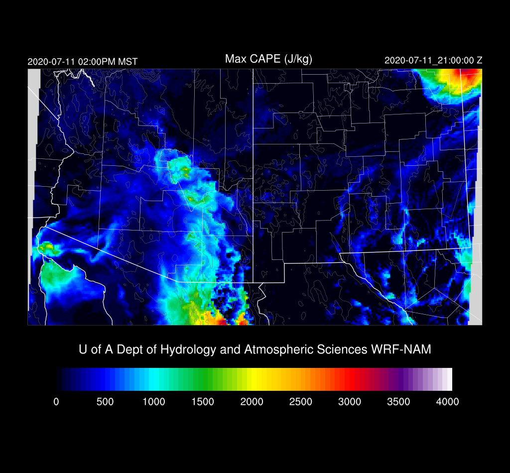
The 12Z WRFNAM has a moderate amount of CAPE along this boundary, enough to support a few storms.  Other runs are similar, but not as much CAPE.

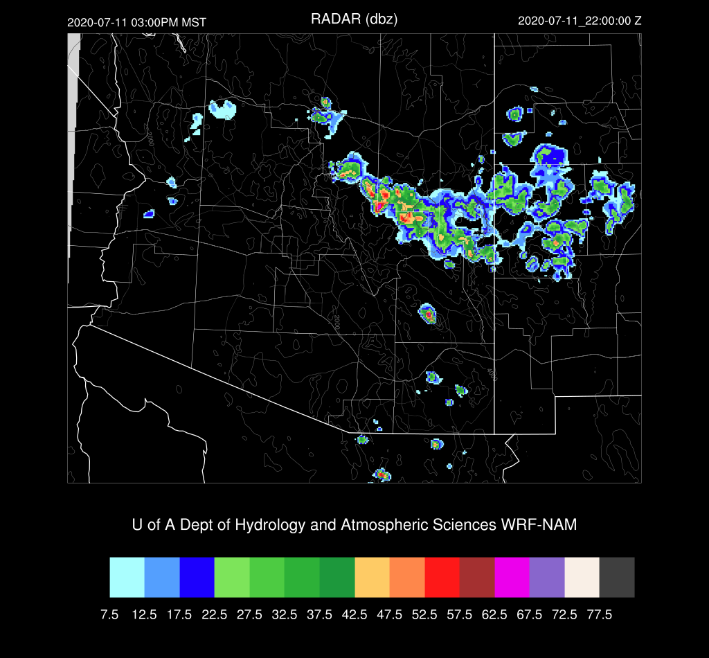
Scattered storms over the high terrain of the White Mountains and Rim are likely this afternoon.

A couple of model runs develop storms in western Cochise County later this afternoon and move them towards Tucson.  However, they die out as they move into the lower elevations.

While unlikely, it is still possible the Tucson may see a storm or two as CAPE is pretty good.  It's going to take a strong outflow to trigger convection as the mixed layer is quite far from the LFC.


Day 2
The 500mb anti-cyclone remains over NE Arizona, as does the hot air, continuing the unfavorable conditions for storms.

The backdoor dryline moves a bit to the west and is located about over Tucson, resulting in some drying.  More bad news for monsoon storms.

Activity is limited to only the higher terrain of Northern/Eastern Arizona.
It is going to be extremely hot.


Friday, July 10, 2020

20200710

Discussion
Moisture and clouds have increased over Arizona due to the outflow from an MCS over Sonora from last night.  Dew-points were above 60F for awhile in Tucson, but are now generally in the mid-50's over much of the southern part of the state.   PW has slowly increased and is now around 32-38mm.  It is very moist in Sonora as the PW at Hermosillo is around 50mm.   Weakening Tropical Storm Christina is SW of the southern tip of Baja, moving WNW and weakening.  It may be close enough to initiate a Gulf Surge into Arizona over the next few days.
 The 500mb high is centered near the 4-corners with heights around 5960m.  Temperatures are around -6 to -4C which are quite warm and are not favorable for a lot of storm activity.
In spite of the moisture increase, there is only limited CAPE, due to the warm midlevel temperatures.  the substance inversion at 450mb is especially unfriendly!   At least the wind profile is looking more monsoon-like with the good southeasterly mid-level flow and weak winds aloft.

Model Initializations
Scattered to broken debris clouds are slowly decreasing over the state.  The 12Z initializations have clouds initialized well.   PW was initialized well, except for the NAM where it was too wet over far southern Arizona and into northern Sonora.  It looks like the RR and GFS have the best initializations.

Day 1
Moisture advection continues into southern Arizona today primarily due to the outflow surge from the overnight Sonoran MCS.  Dry air continues in New Mexico and far eastern Arizona.  

CAPE is low over much of the state, but there is a higher blob around the Flagstaff area which will support some afternoon deep convection.

The afternoon forecast Skew-T diagrams tell the story for Phoenix and Tucson.  As is typical with a moisture surge, the lower boundary layer is cooled which results in a pretty good cap.  Besides the one at 800mb, there is a second inversion around 500mb, which was also seen on the observed upper air data at 12Z.  So, in spite of some CAPE, deep convection, at least for the valleys, is very unlikely.

Very little activity is forecast for today except for a few storms over southern Coconino County.

Day 2
Weak moisture advection continues into the state, but PW generally decreases.  CAPE is also marginal for storms.

While the vertical wind profile is pretty good, CAPE is limited and there are multiple inversions present.  At least the moisture will knock a few degrees of the high temperatures compared to a few days ago.

Most afternoon activity is restricted to the White Mountains and Rim.

A few evening storms are possible for southeastern Arizona.  It's doubtful that they'll make it into the Tucson area.