Initializations
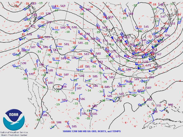
The 12z 500mb analysis shows a strong ridge centered just west of San Diego and a broad weak trough feature over NM and down into northern Mexico. Quite cool 500mb temperatures from -8 to -10C are associated with the trough. The morning 12z GFS/NAM have these features initialized well.
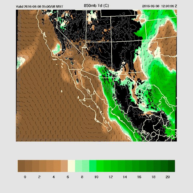
A low level cyclonic circulation is present over Baja with SSE winds present along the coastal regions of NW Mexico all the way into southern Arizona. This is not a monsoon type circulation. It's a little hard to say if the GFS/NAM have initialized this feature properly as there is no upper air data from Guymas. However, La Paz and Mazatlan both have southerly low level flow so I'd say they are OK.
Day 1
Moisture and CAPE are sufficient to support a few late afternoon/early evening storms only in far SE Arizona.
Day 2
A more active day for far southern Arizona as moisture continues to increase due to weak SSE flow, up the GofC and along the coastal regions of NW Mexico. Unusual amount of moisture is present for this time of year as IPW is forecast to be from 20 to almost 30mm.
Mid level flow becomes northeasterly over eastern Arizona, favorable for steering storms from the high elevations into the deserts of SE Arizona. Also, 500mb temperatures are a cool -9 to -10C over the area resulting in steep lapse rates.
At this point, the WRFGFS and WRFNAM start diverging as the WRFGFS is wetter resulting in more CAPE with values as high as 1500 J/Kg over SE Arizona. Below is the more conservative WRFNAM.
Both WRF runs wait until later in the afternoon to ramp up activity as the lower PBL has been cooled slightly due to the advection of wetter/cooler air.
Both model runs move strong/severe storms off of the high terrain of SW NM into Cochise county during the evening. The main threat is very strong winds due to the deeply mixed PBL/inverted V profile. Confidence is high as both runs look quite similar and model initialization are good as well as the simplicity of the situation.
Day 3
I would typically not make a forecast this far in advance but I feel the run to run consistency had been good. Plus, I doubt I'll be able to do any more discussions for this event as I'll be away.
Wow! The amount of moisture forecast to be over southern Arizona on Friday is impressive (30-35mm) with what looks like a classic surge event. A closer look shows that the southerly flow is caused by a weak surface to 700mb non tropical cyclonic circulation located west of Baja so I'd not call this a monsoon type surge. Who cares what it's definition is if it brings enough moisture for big storms!
The mid level flow takes on a more classical southeasterly flow as the 500mb high moves to the 4-corners region as a trough approaches the west coast. 500mb temperatures continue to be cool with around -10C over much of Arizona. It's looking likely that there will be an active day over parts of southern Arizona.
The WRFGFS (below) continues to be somewhat wetter than the WRFNAM. Both have enough CAPE to support storms over SE and SC Arizona.
Both model runs have some strong maybe isolated severe storms in SE Arizona during the late afternoon. Storms will have strong winds associated with them.
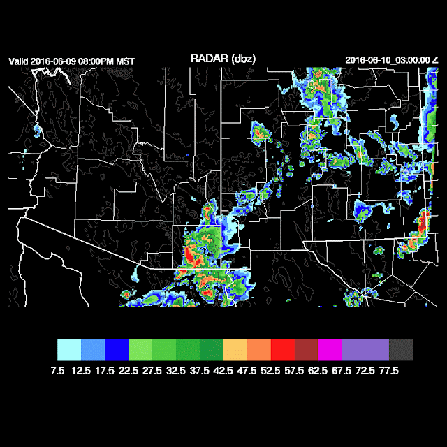
The model runs diverge significantly by early evening as the WRFGFS continues with a few strong storms into Pinal and Maricopa county (below) while the WRFNAM has them die out. It's not possible to say which is more likely.
A dust storm or weak haboob type event is possible in eastern Maricopa and Pinal counties during the evening.
Both Tucson and Phoenix skew-t forecasts indicate a slight bit of cooling in the lower PBL thus a weak inversion is present. Strong outflows or intersecting outflows are going to be needed to provide enough lift to overcome this inversion and/or shallow mixed PBL. My guess are storms will skirt around Tucson and Phoenix area and stick to the higher terrain.
After all is said and done, not much precipitation is forecast for either Tucson or Phoenix. Below is the wetter WRFGFS.


No comments:
Post a Comment
Note: Only a member of this blog may post a comment.