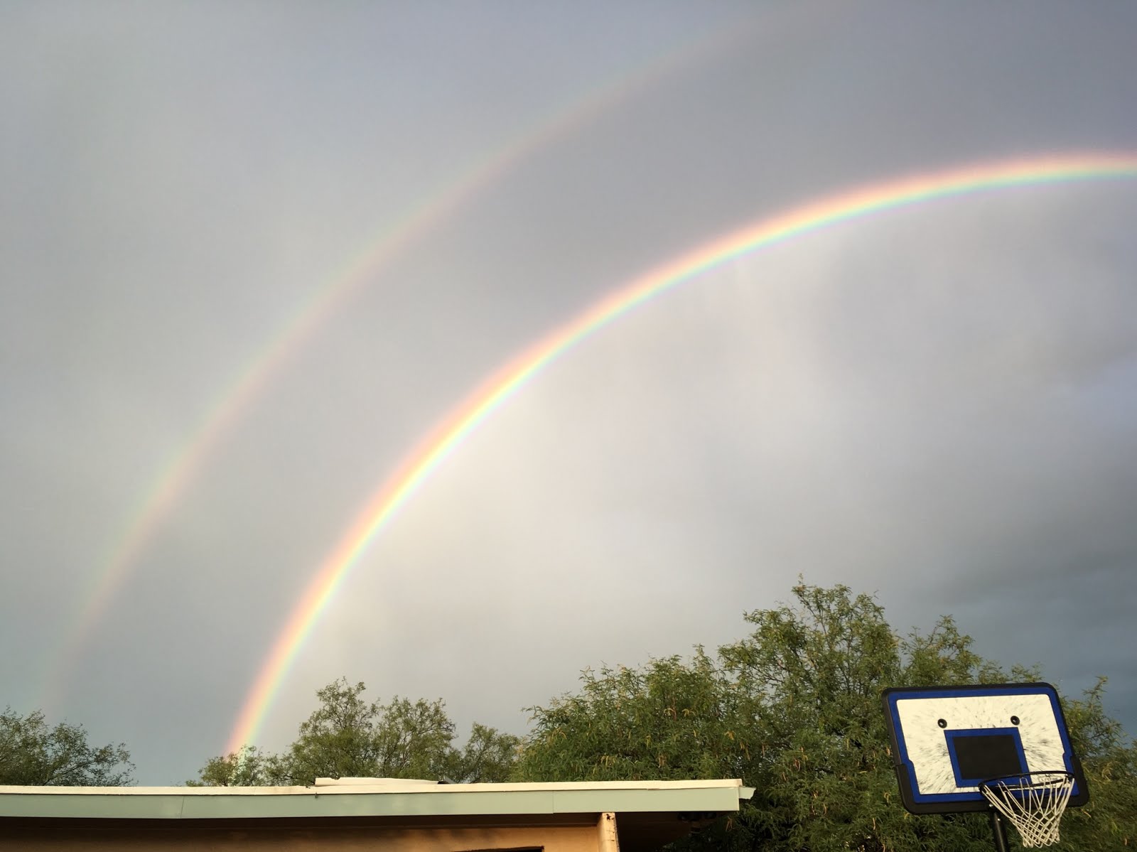
We (the model run and I) have really struggled the past few days as debris clouds have really caused havoc resulting in model flip flops with either too much activity to not enough. Friday, there was quite a bit of activity around SE Arizona which was forecast well by the previous day model runs, but the Friday morning runs had minimal activity partially due to too many clouds. Yesterday, the model runs seemed to have the clouds initialized well and thus had very little activity, but a few strong storms did form anyways and the weather gods saw fit to spite me with .72" and running water in the wash near the house. Nice double rainbow though!

Initializations
Another problem besides the clouds is the weak inverted trough that is over northern Sonora and the occasional MCV that rotate around it. The model runs have no clue about the MCVs and have struggled with the location and strength of the IT. This morning, the IT is well defined in the Water Vapor imagery and is located near Hermosillo while the larger IT/TUTT is located in SW Texas. All the morning model initializations have these two features initialized well. Also, all the initializations have minimal IPW errors. The big problem is the initialization of the clouds. None do this well and all have the cloud band too far to the northwest and allow morning sun over southern Arizona. The 6Z and 12Z WRFNAM are the least bad.
Day 1
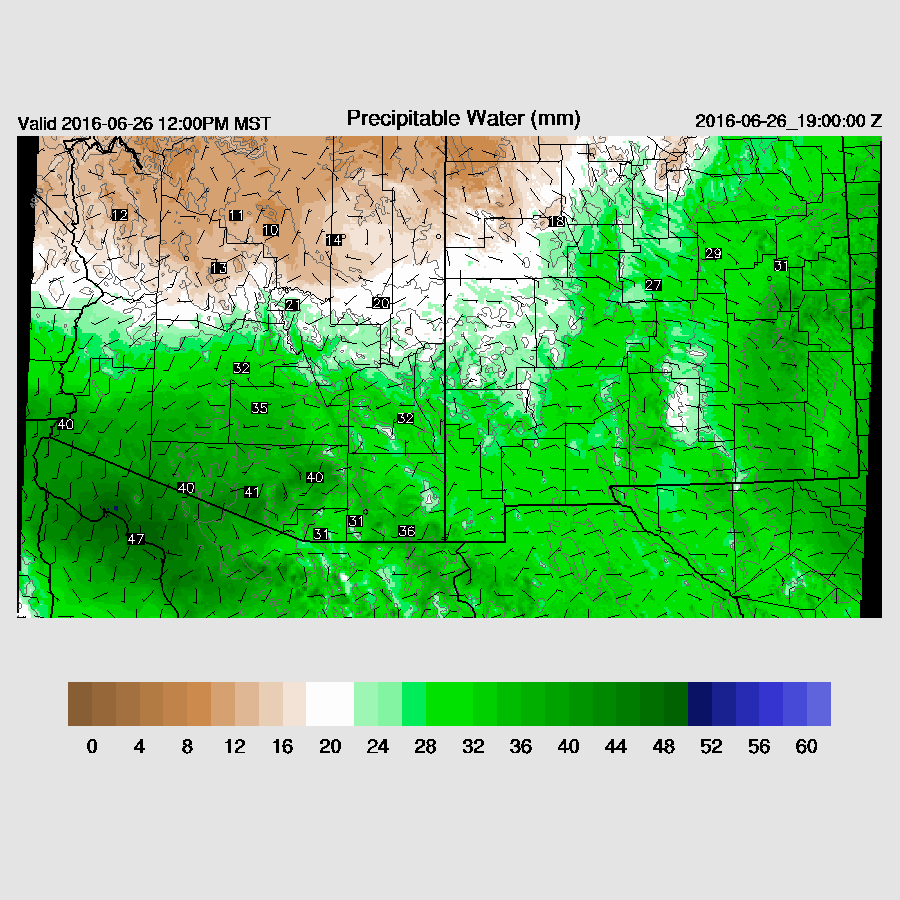
IPW continues to be above normal over southern Arizona with 36mm again at Tucson. It's also come up across southwestern Arizona with around 35mm. By mid-day, IPW increases across much of southern Arizona as weak flow advects in higher IPW that lurks just south of the border.
CAPE is forecast to be moderate to high over far SE Arizona so that looks like the active area this afternoon.

Mid level winds are strong enough to allow some propagation of storms from higher terrain into the lower terrain of SE Arizona as flow is about 10-20 knots from the ESE.

The forecast Skew-T plot for Tucson is quite impressive with high IPW, moderate CAPE and decent mid level steering and upper flow to steer anvils away to the NE. Just based on this, I'd say there is a good chance for storms in and around Tucson today.

The WRFNAM develops storms too early due to too much heating. However, if we can get even some heating, it should still be a fairly active day. It depends on how far the cloud band moves and if it dissipates. As of 15Z, it has become partly cloudy over far SE Arizona so that is the favored location. We will just have to wait and see what happens around Tucson.

Widespread strong/severe winds are not expected as the inverted V profile is not that large. Still isolated strong/severe winds are possible in the vicinity of stronger storms. Also, there is a chance of a moderate outflow into Pinal county this evening that could stir up some dust.

Day 2
The mid level high is centered along the UT-AZ border with cool mid level temperatures and moderate easterly flow across much of the state, favorable for moving high elevation storms into the lower deserts. Somewhat warmer air aloft is present over SE Arizona thus less favorable there.

Plenty of moisture across much of the state including the higher elevations thus a wider coverage of showers and storms.

Most of the activity is restricted to the high elevations along the Rim during the afternoon. It does move to the WSW towards Maricopa county but dissipates in the WRFNAM. The 6z WRFGFS is slightly wetter and does form some storms over the Phoenix area during the evening. SE Arizona remains mostly quite during the afternoon.
 |
| 12Z WRFNAM |
Some strong outflows may make it to the Phoenix area by early evening, but it looks like no precipitation will occur in the WRFNAM as CAPE is insufficient to generate new storms on the outflow boundaries. As noted above, the WRFGFS does develop a few storms. Hopefully, there will be a better model consensus tomorrow.

Some late evening showers and a few storms develop in SE Arizona. I'm not exactly sure why.

No comments:
Post a Comment
Note: Only a member of this blog may post a comment.