Friday, August 3, 2018

20180803

Previous Forecast
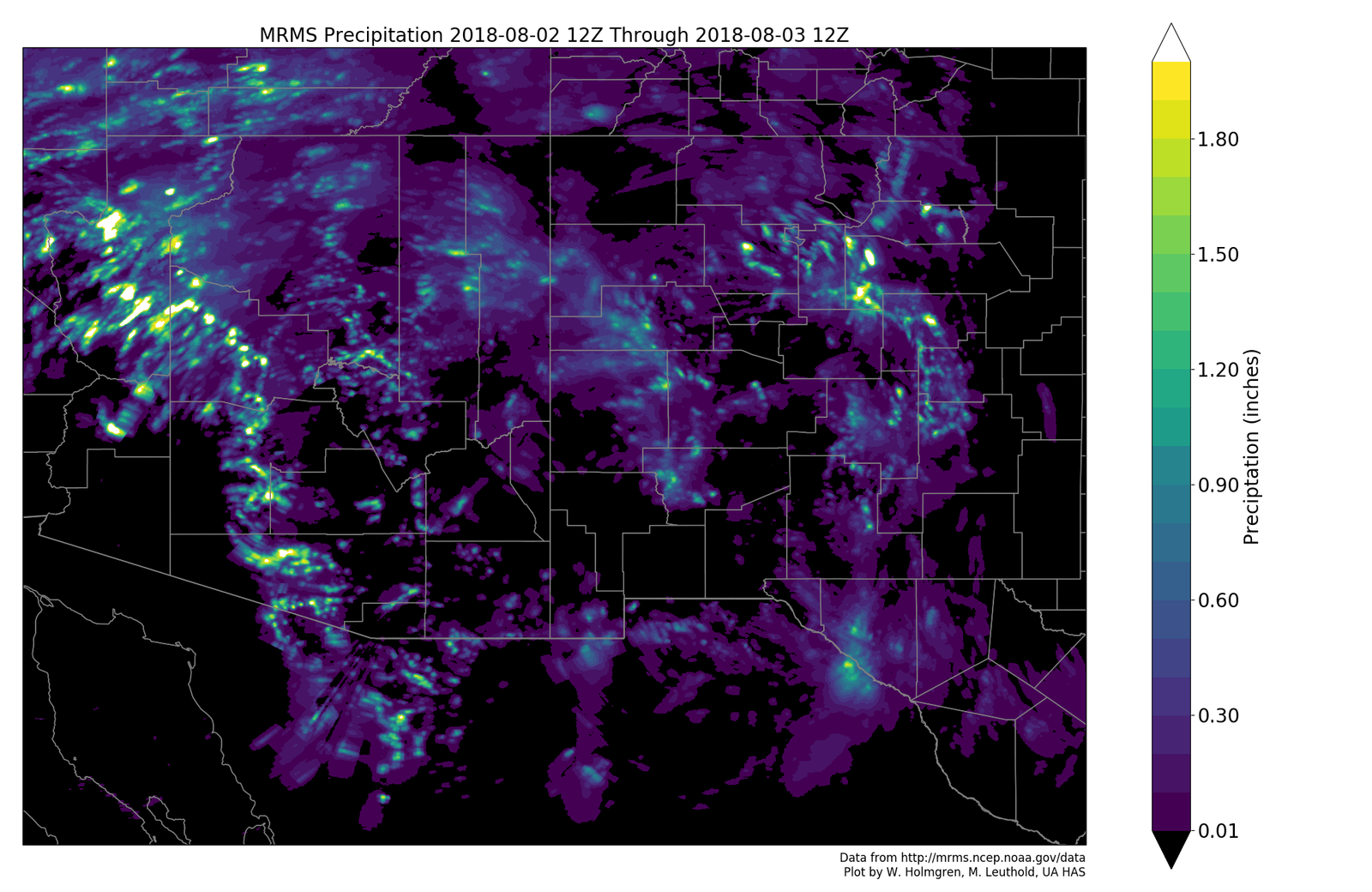
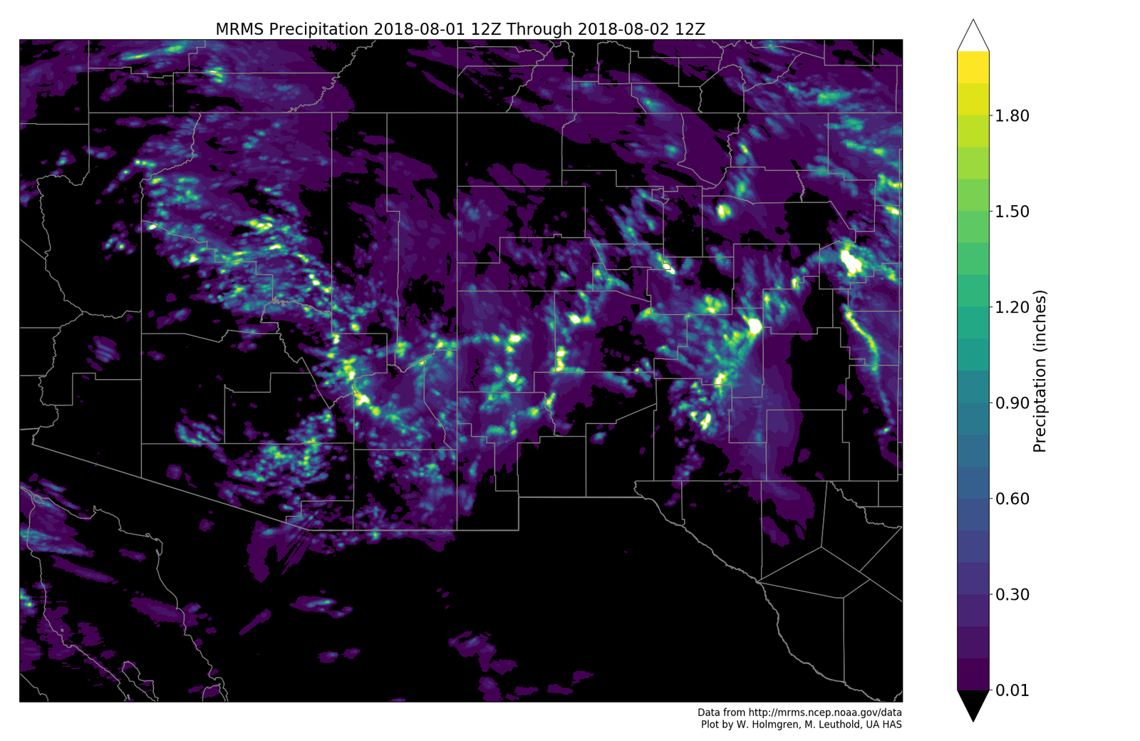
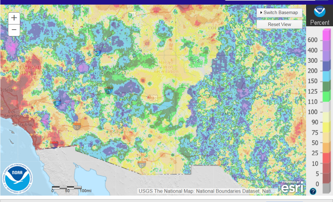
It was very active from central Pima county up through Phoenix and northwest of there as storms developed along the border during the afternoon and then propagated to the NNW.


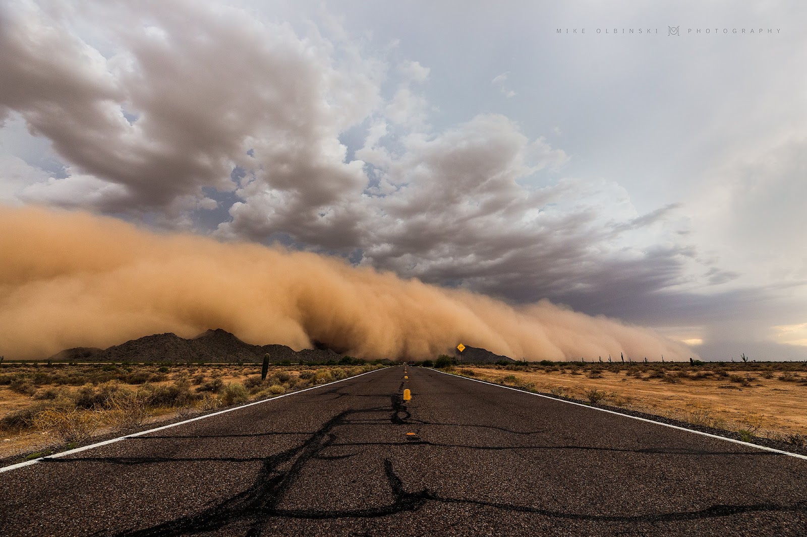
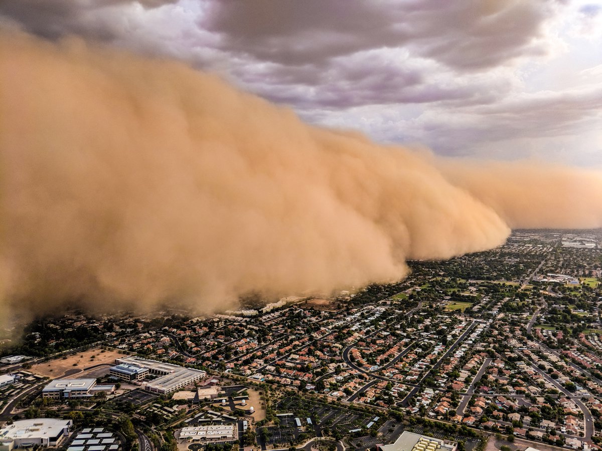
A massive haboob moved into the Phoenix area during the early evening. (Mike Olbinski)


Chopperguy.com


Bryan Snider has a great video showing the birth of the haboob.


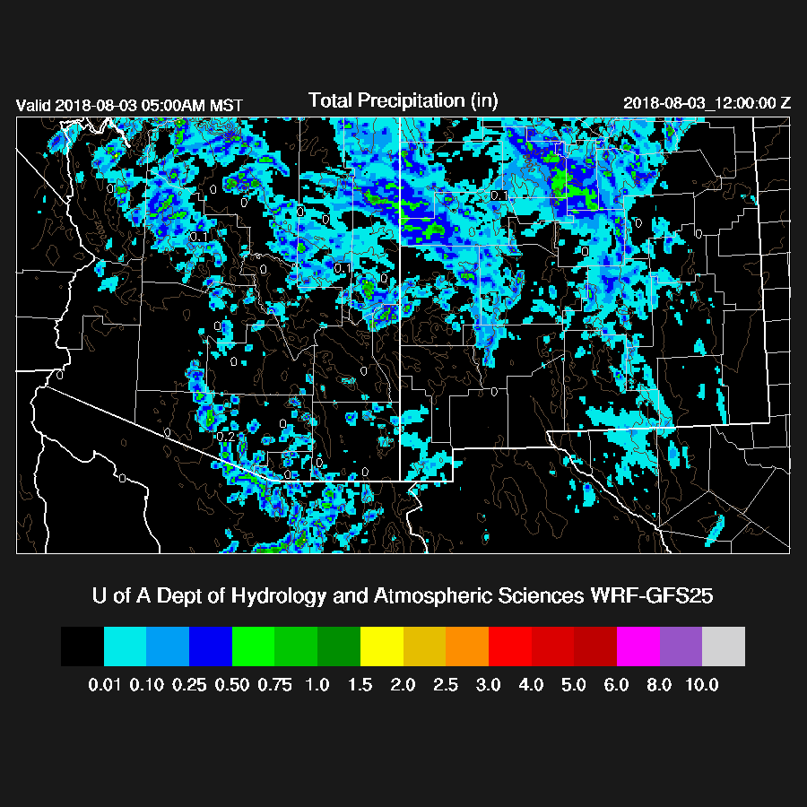
None of the morning runs were quite strong enough with the activity around Phoenix and the 12Z WRFGFS and 15Z WRFRR were the closest.  Most of the runs busted around Tucson as no deep convection formed either during the evening or overnight. The best run was the WRFGFS as it had limited Tucson area activity and it had some strong storms in the Phoenix area (but not a lot of precipitation).


The 12Z HRRR was pretty good as it had storms around the Phoenix area during the evening as well as a moderate outflow boundary.  


Initializations
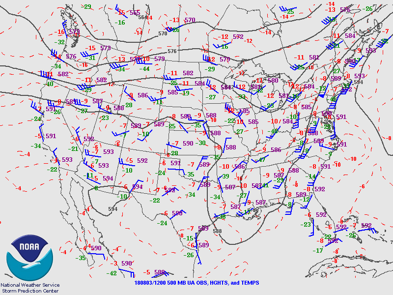
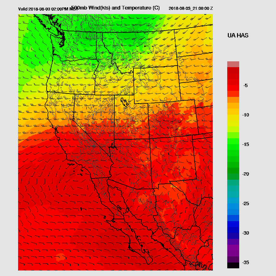
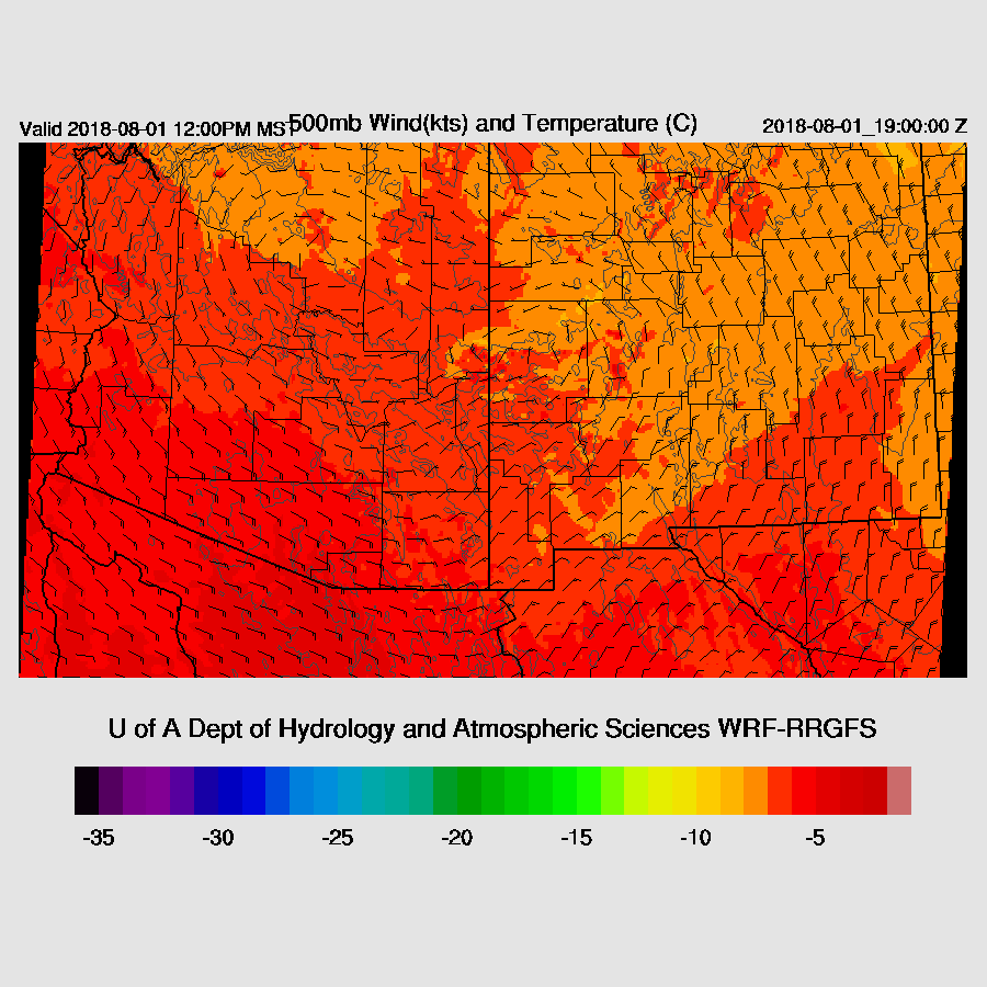
The 500mb high center now south of Arizona in far northern Arizona resulting in light westerly flow and warm air with temperatures from -6 to as warm as -4 upstream in California.  The state is mostly clear except for some clouds over NW Arizona which are probably associated with the eastward moving shortwave. The RR and NAM have initialized the clouds well.


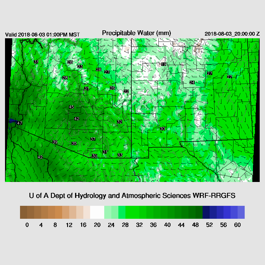
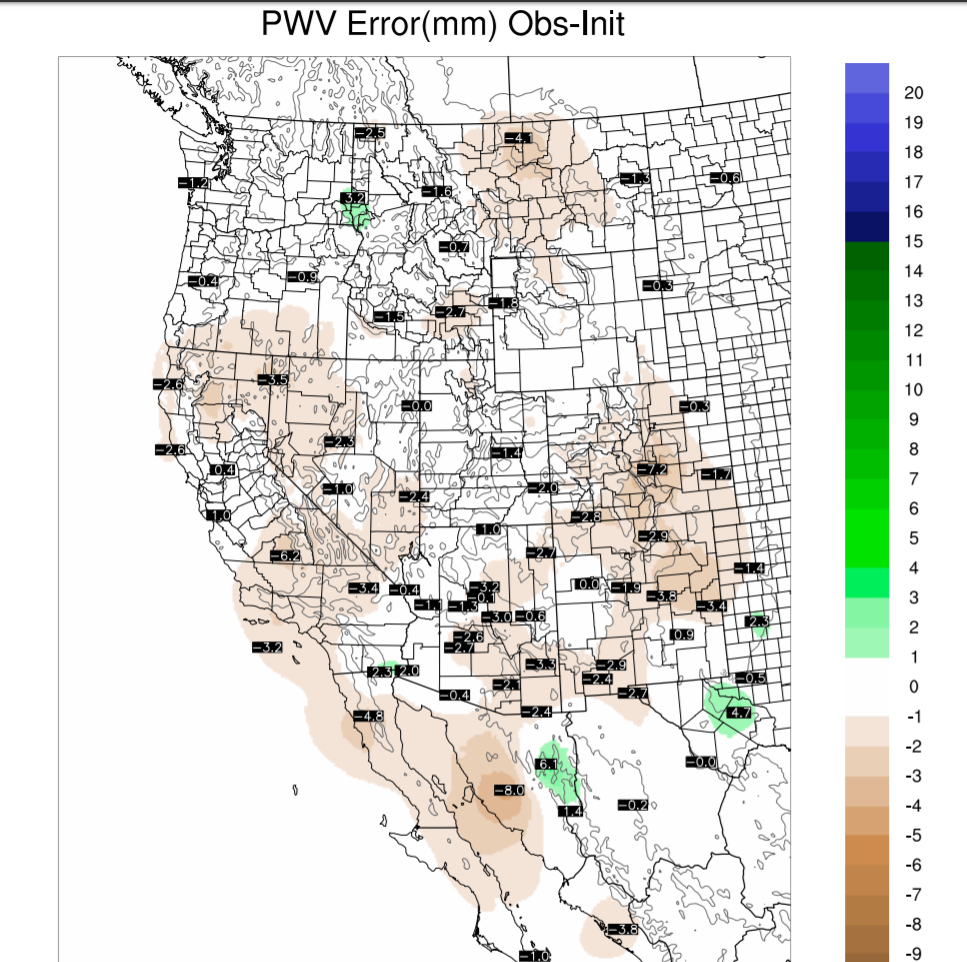
PW initialization errors are also small thus confidence is high for both model runs.


Day 1
In general, PW has trended down over the past 12 hours and that continues into the afternoon.  Unfortunately, the PW forecast for today is quite a bit lower than the forecasts created yesterday thus it looks like less activity then was forecast by those runs.  No surprise as this has been a common occurrence lately. The difference was 6mm drier at Tucson and 6-9mm around the Phoenix area.


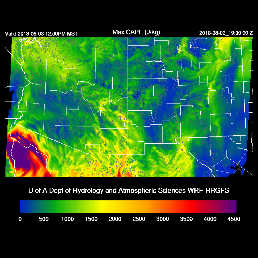
CAPE is lower today too and the lower elevations have only low amounts so not much, if any, activity is expected there.  It looks like the best bet is far SE Arizona.


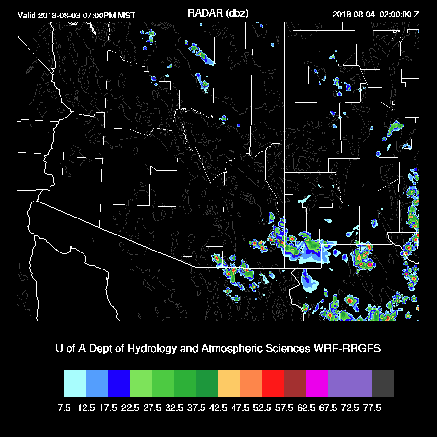
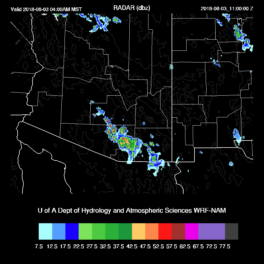
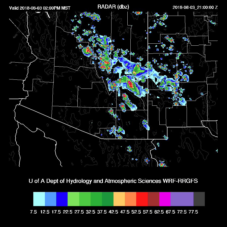
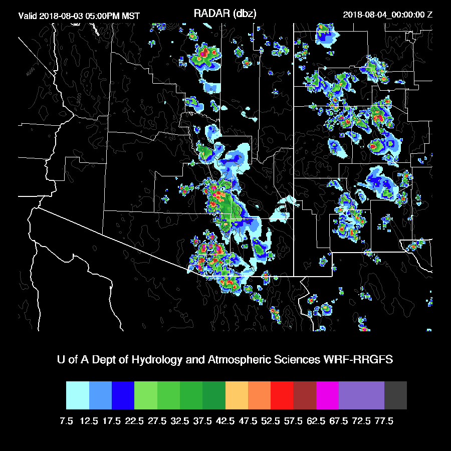
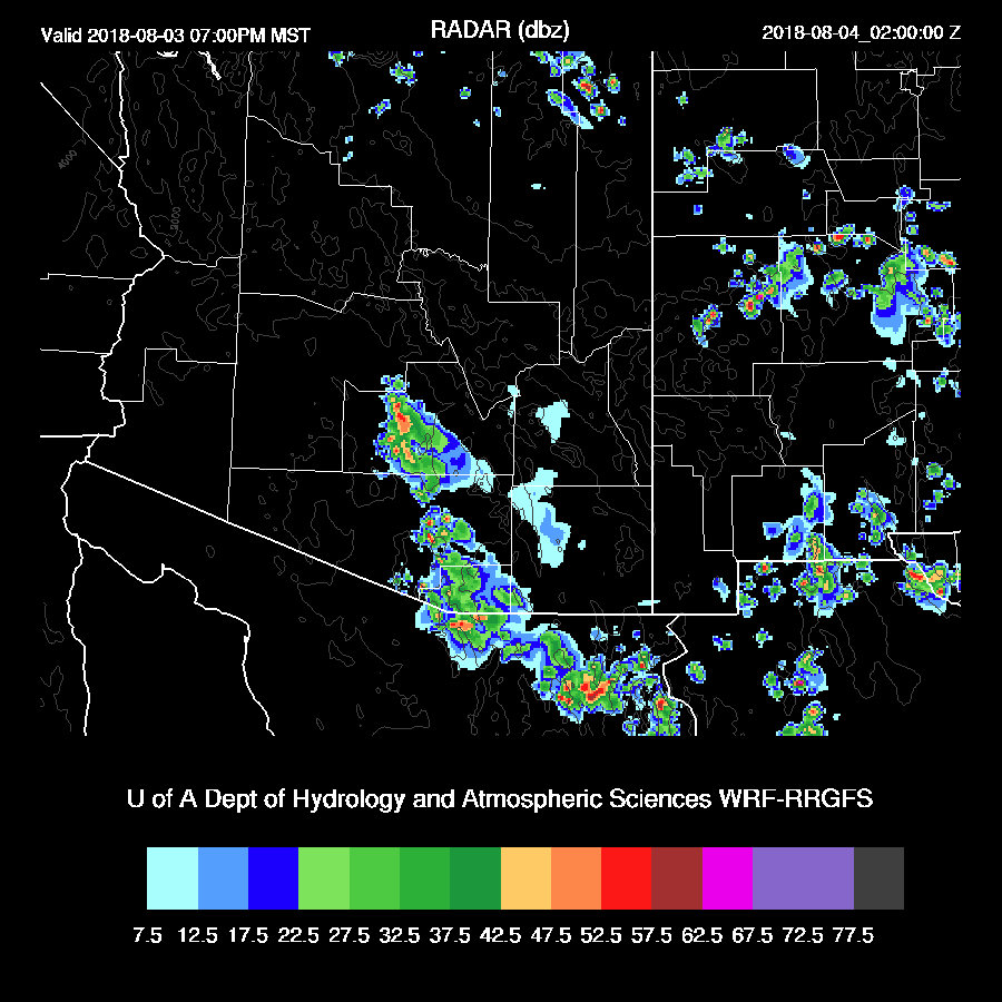
Both runs have scattered storms over only far eastern Arizona.   Not much of a transition event as many times troughs in the westerlies enhance the thunderstorms before it dries out.


Activity decreases during the evening hours with only a few storms over far SE Arizona.


Day 2
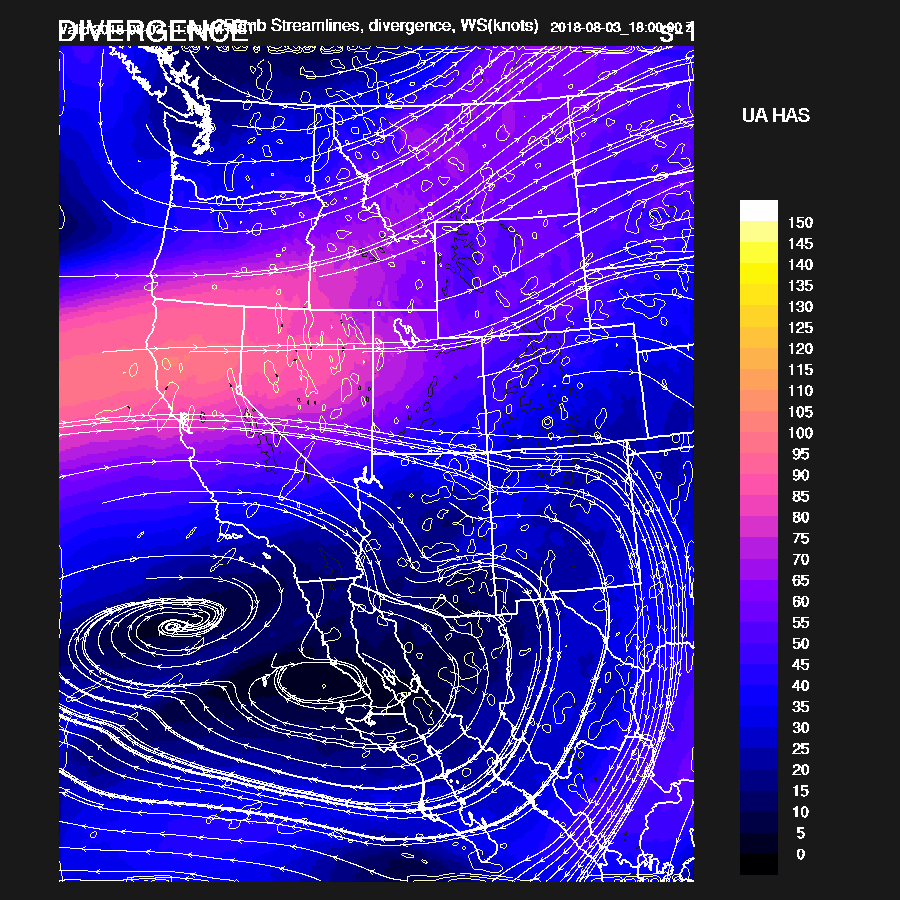
The drying trend continues and only isolated storms are expected only over the high terrain of eastern Arizona.  This will be the last discussion until significant activity returns.


Thursday, August 2, 2018

20180802

Previous Forecast
Activity mostly remained over the higher terrain of the state with some areas of very heavy rain.  The exception was around the Tucson area where storms developed during the evening.
All of the 12Z runs performed fairly well as they all had the general idea of most activity remaining over the higher terrain.  The WRFRR seemed to be the best as it was more active over the western Rim.

Initializations
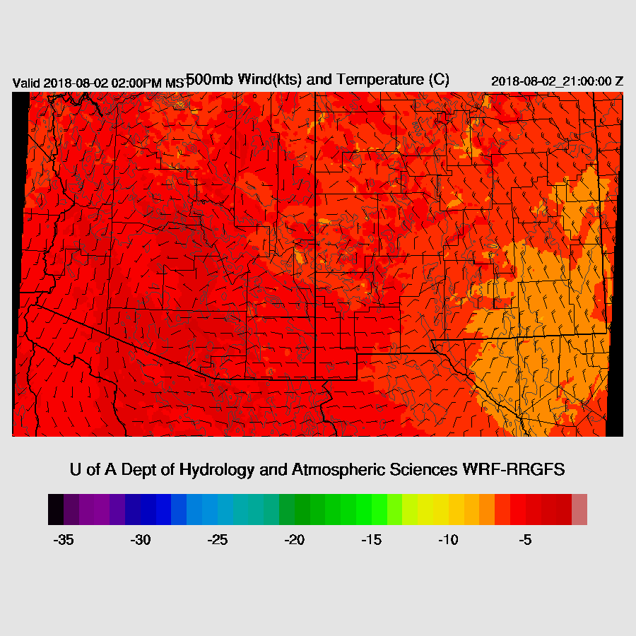
The 500mb high center is right over central Arizona thus steering is mainly light and variable.  There is a weak trough over west Texas but this feature is likely to be no factor in Arizona as it should move off to the SW and over northern Mexico.  Scattered to broken mid-level clouds are present from the Tucson area up towards the Rim and the White Mountains and may be associated with a possible weak MCV over the Flagstaff area.  The NAM and RR have the 500mb situation initialized well but neither has near enough clouds. Generally, these sorts of clouds burn off during the morning hours and are not a problem but they seem to be taking their sweet time today.  The RR PW initialization had minimal errors. The NAM was a bit too wet in NM and into Mexico but much better than it has been over the past few weeks. I’m a bit concerned about the lack of clouds in the model runs and this could result in too early and widespread convection in those areas where it’s partly cloudy.

Day 1
Part of the story today is where the 500mb high center ends up as that will define the steering flow.  By early afternoon, the WRFNAM moves it into west central NM placing southern Arizona in generally weak SE flow.  The WRFRR does not have a well-defined center but the axis stretches from south of Phoenix to western NM thus it has little or no steering over the state.

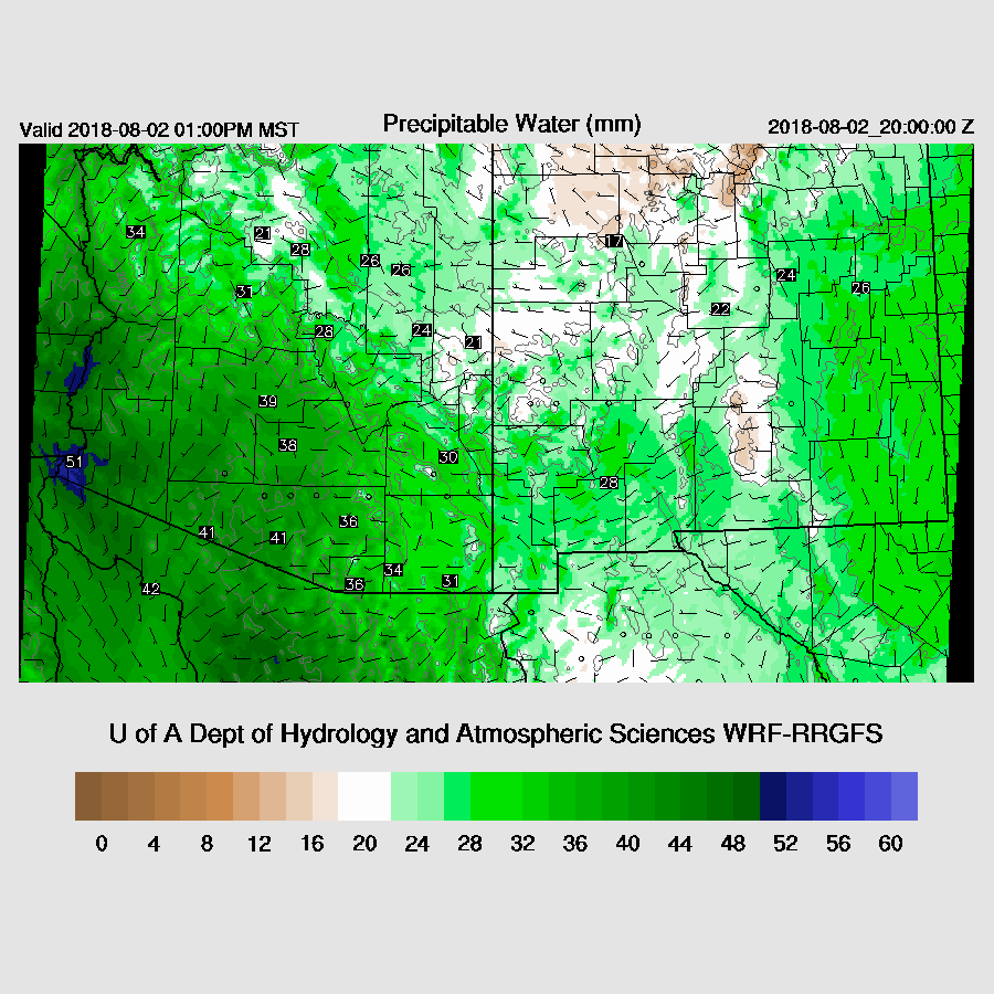
PW has remained mainly steady and is wettest over far SW Arizona as Yuma is around 50mm.  Elsewhere in the lower elevations, it’s mainly from 35-45mm. Unfortunately, Puerto Penasco is down and this has resulted in the two runs having a 10mm difference in PW in that area.  I’m going to go with the drier WRFRR because looking at other stations, it seems to have the best forecast of PW so far. PW remains about the same into early afternoon along with weak flow from the GofC and some moisture has pushed westward into far SW NM.

CAPE is moderate over eastern Arizona while very high over western Arizona and the higher terrain of central Pima County.  That may be a hotspot for storms today.

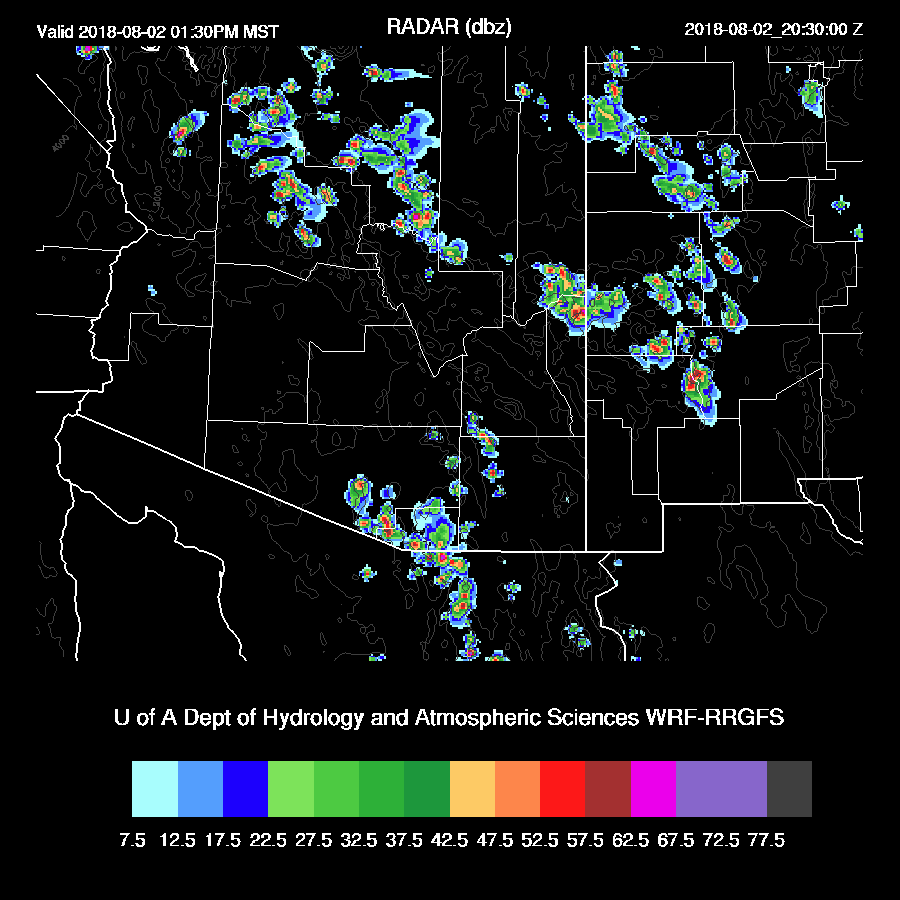
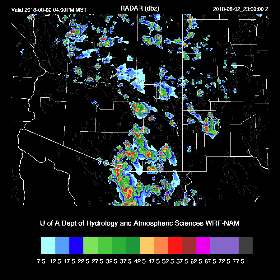
Both runs develop storms over the high terrain from west central NM to Yavapai County and over the high terrain of Santa Cruz county during the afternoon.


By late afternoon, strong storms are underway over central Pima County.

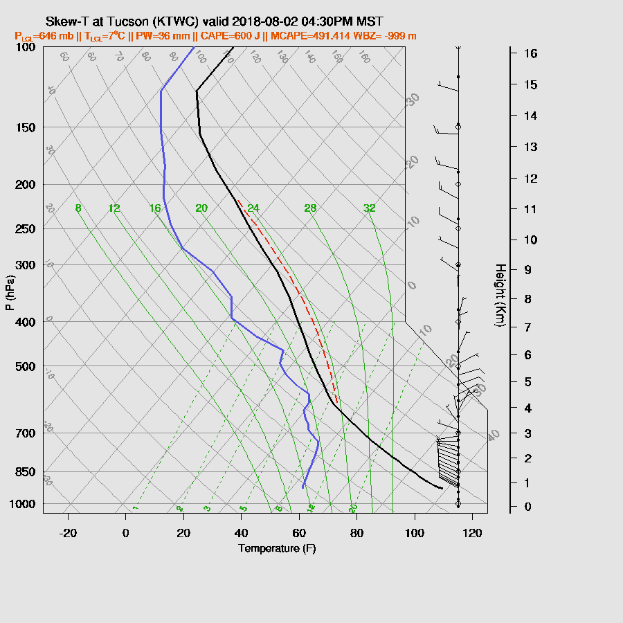
Tucson late afternoon CAPE is only around 600 J/kg, mid-mid level steering is weak, and the PBL isn’t mixed very deeply thus it’s looking unlikely for any significant storms. NW upper winds may also spread anvils over the Tucson area.  

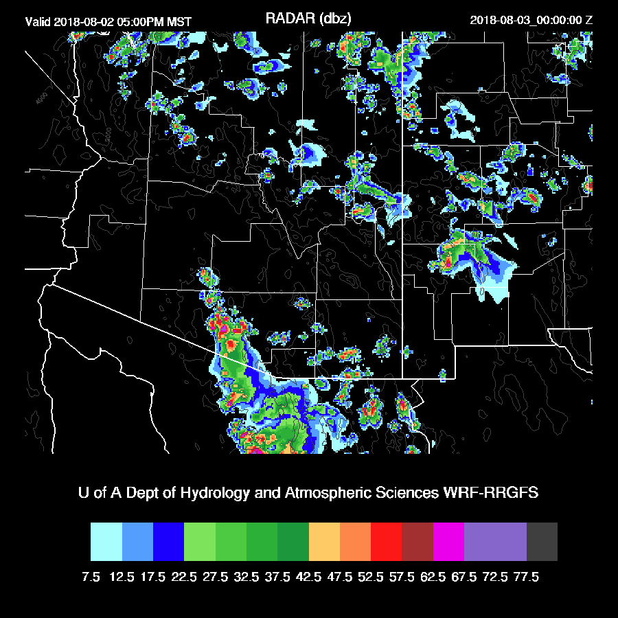
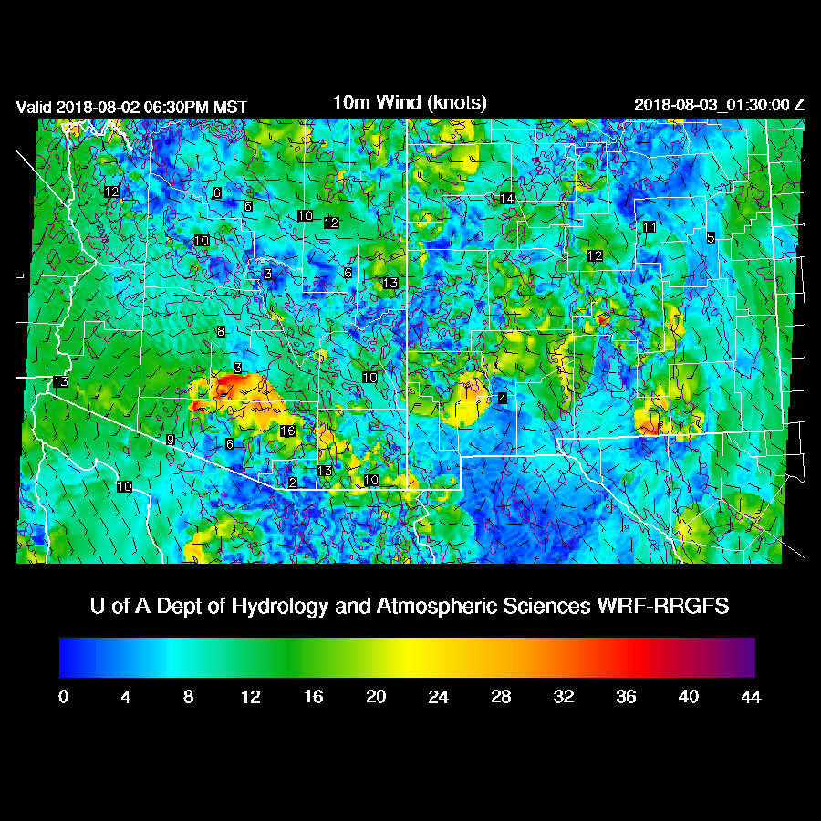
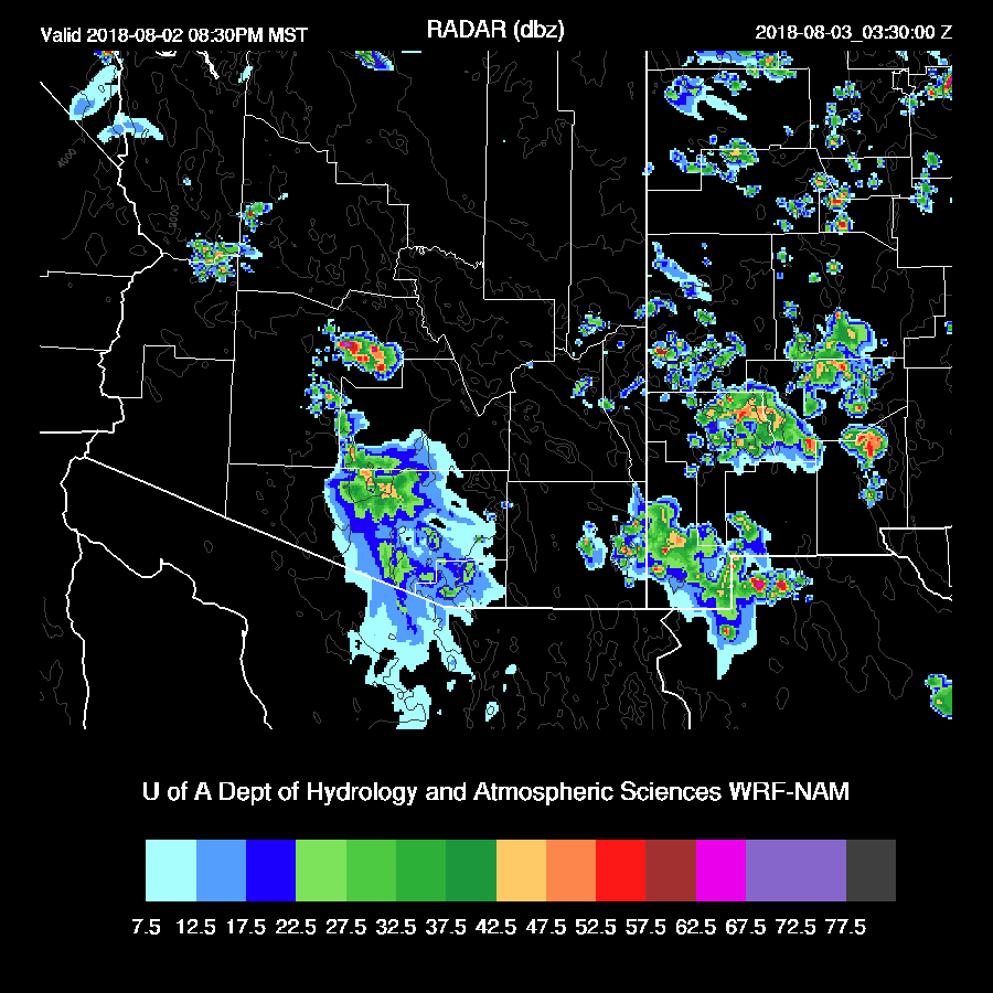
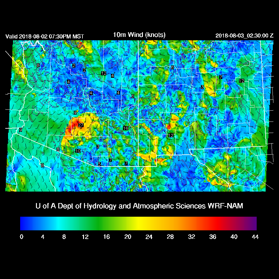
The storms over central Pima County eject a strong outflow into eastern Pima and Pinal counties tonight, so it looks like a big dust storm or even a haboob is likely for Pinal and southern Maricopa Counties.

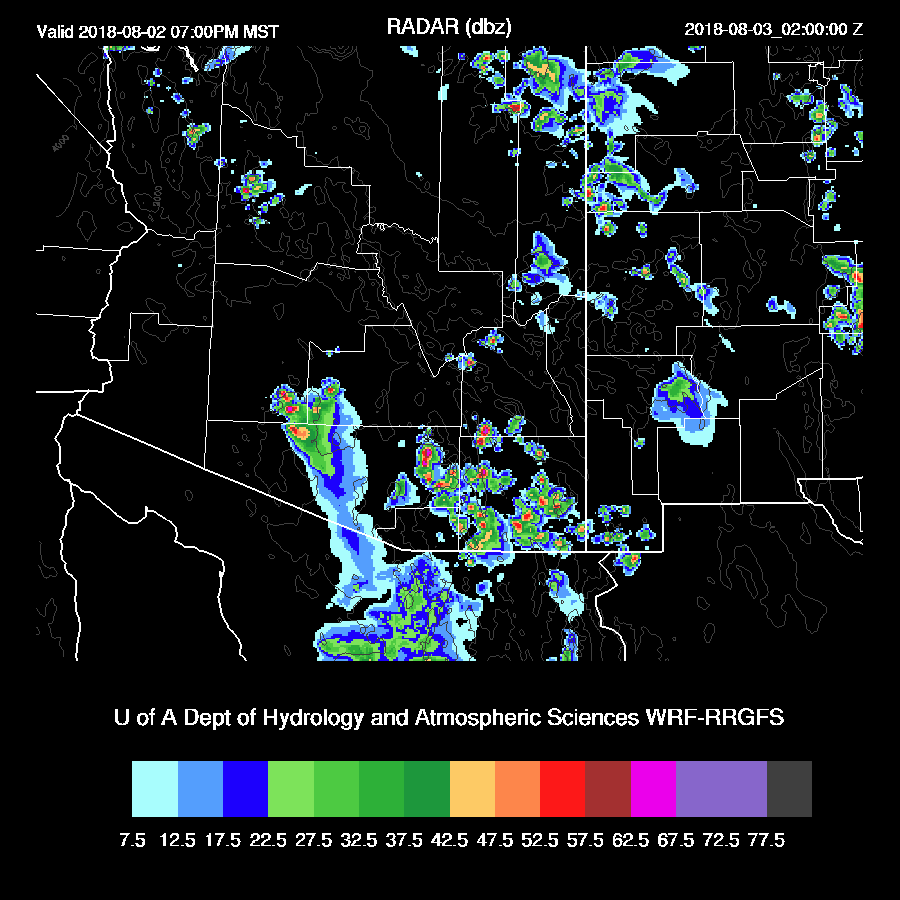
In spite of marginal CAPE, this outflow manages to trigger scattered convection around the Tucson area this evening.  The probability of this happening isn’t high as this only occurs in the WRFRR run but as we saw last night, in spite of marginal CAPE, Tucson had quite a bit of activity.

As the outflow moves towards Phoenix, it weakens and only triggers a few storms.  However, the PBL is mixed nearly to the LFC plus there is around 1400 J/kg of CAPE. So in spite of neither run developing much activity in and around Phoenix, it is certainly possible that there could be some storms.  The 15Z WRFRR will be interesting to see (yesterday it forecast a big outbreak in Phoenix for today). Also, all of the overnight runs also had at least some storms in Phoenix this evening.

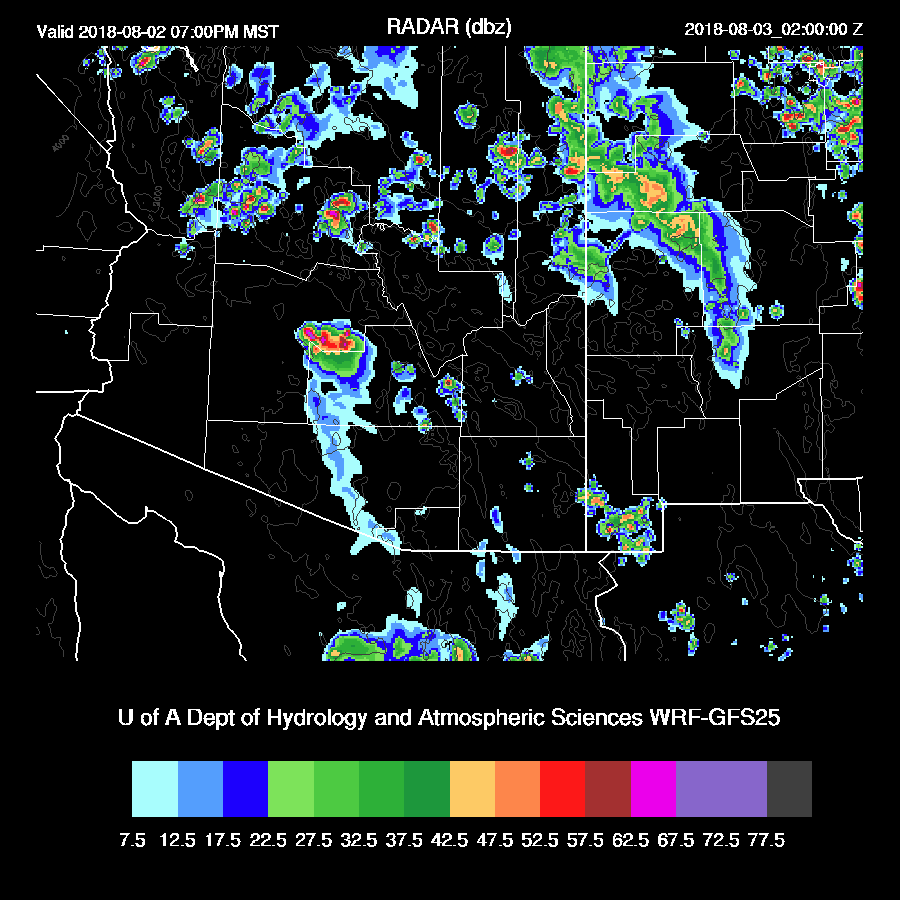
The WRFGFS just became available and it has some strong storms in the Phoenix area this evening.

Another possible scenario for the Tucson area is round of late night elevated CAPE storms.  While the WRFNAM didn’t do much around Tucson during the early evening, it does develop scattered storms early tomorrow morning.  This is unlikely to happen if Tucson gets storms earlier.

Day 2
Here comes the beginning of the end of the monsoon (at least for a little while) as a strong trough over the NW CONUS begins to suppress the ridge.   The 500mb anticyclone is centered just off of San Diego thus placing the northern ½ of the state in NW flow while southern Arizona is mainly light and variable.  

A weak upper trough moves over eastern Arizona during the afternoon thus providing a bit of upper divergence and enhancement to eastern Arizona afternoon storms.

PW remains mostly the same at around 35-45mm.

CAPE is very high over the high elevations so expect a very active day there.  

Some strong afternoon storms are present. Maybe some mini-supercells over eastern Arizona?


By late in the afternoon, activity develops over parts of SE and SC Arizona.

Storms die out during the evening hours and Phoenix is unlikely to see much if any activity.

Wednesday, August 1, 2018

20180801

Previous Forecast
It was a down day for most of the state except for the higher elevations of the NW part of the state.  The model runs, for the most part, were accurate. The 12z WRFRR developed some strong storms along the border and the 15Z went even further and developed some deep convection over the Tucson area and both were completely wrong.  


Initializations
The long wave pattern remains mostly the same as the 500mb high center is located over southern Utah/northern Arizona while a deep trough, for this time of year, is located over the Mississippi River.  A broad weak IT is located over northern Baja along with a weak MCV over the far northern GofC. Both the NAM and RR have the MCV initialized too far south but this error shouldn’t matter. Skies are clear over all of the SW which was initialized correctly.   IPW was initialized much better by the NAM as most errors were small but there still appears to be an overall bias (below). Perhaps the email I sent to NCEP yesterday describing this problem helped? The RR PW was well initialized.


Day 1
PW has increased slightly across the state with lower elevations reporting mainly 35-42mm.  However, Yuma is up to 50mm as a surge continues. It’s weak but enough to keep it wet over much of the state today/tonight.


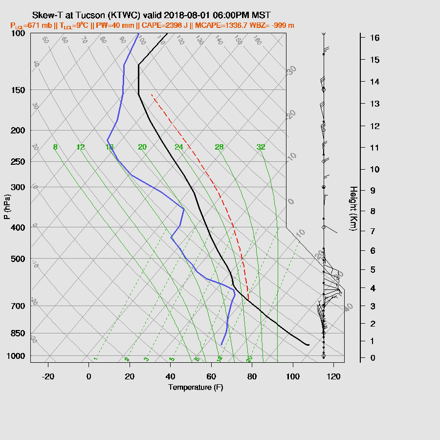
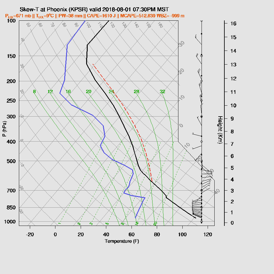
CAPE is higher today and is very high at some locations like Tucson and Phoenix. Both the morning Tucson and Phoenix soundings have 1300-1500 J/kg of MLCAPE so this high forecast Max CAPE seems realistic.  Again, it’s more stable over far SE Arizona as low-level SE flow is again causing drying and stabilization, so storms are likely to struggle there.


The 500mb anticyclone is located over northern Arizona which provides only light E to SE flow over the southern ½ of the state, so storms won’t move much but at least it’s easterly.


It’s quite active over the high terrain during the afternoon and a few storms over the higher terrain west of Tucson.  As CAPE is low in Cochise county, there isn’t much activity there (none in the WRFRR).


By early evening storms have moved off of the higher terrain into SE Arizona.  Both the WRFRR and WRFNAM are similar so there is some confidence in this forecast.


The mixed layer looks a bit strange as there seems to be a fairly shallow surface-based mixed layer and an elevated layer.  In any case, mid-level steering is around 10-15 knots so is sufficient in moving storms from the east into the Tucson area this evening.  Upper winds are northerly so as long as there isn’t too much activity to the north, anvil shading shouldn’t be a problem. CAPE is sufficient to support storms as it’s forecast to be around 900 J/kg.  


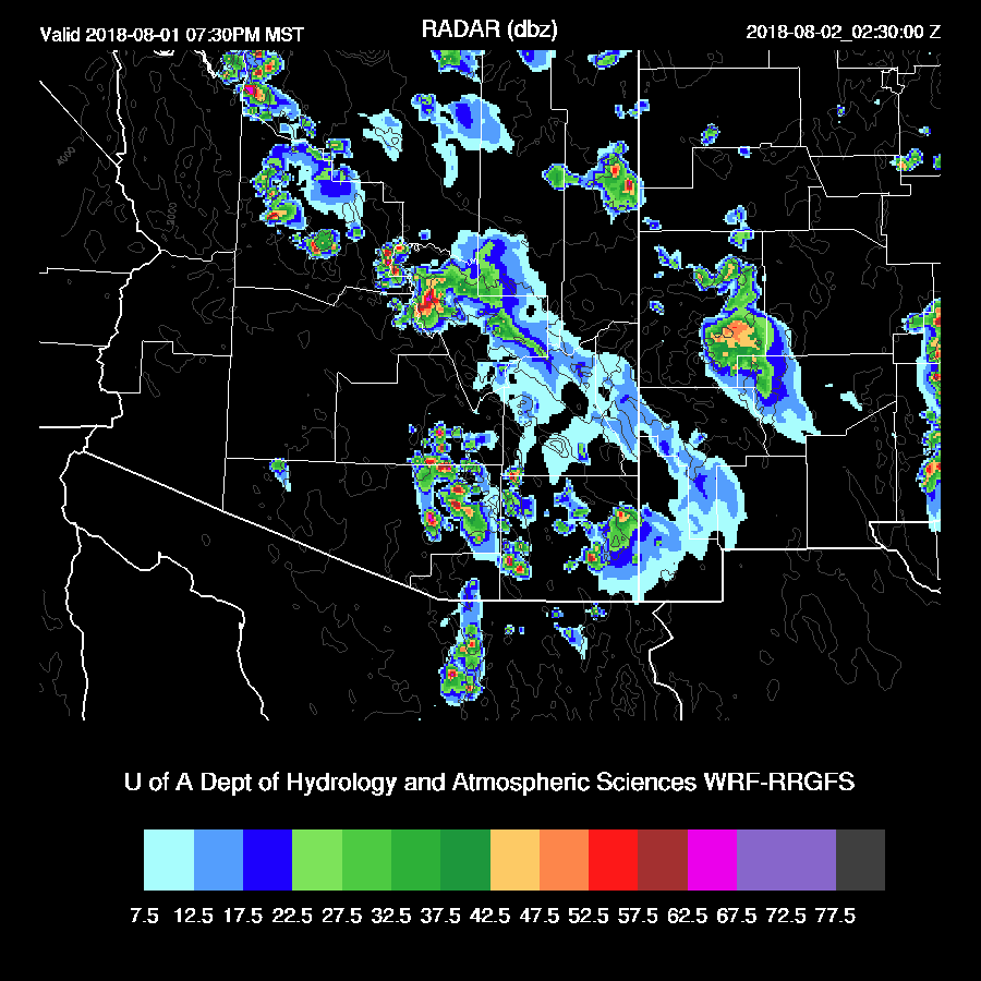
Both the WRFNAM and WRFRR have scattered storms in and near Tucson this evening.  Other storms are north and east of Phoenix.


Based on the forecast skew-t, I’d say deep convection in the Phoenix valley is unlikely.  The inversion at the top of the PBL is strong plus the PBL isn’t very deeply mixed.


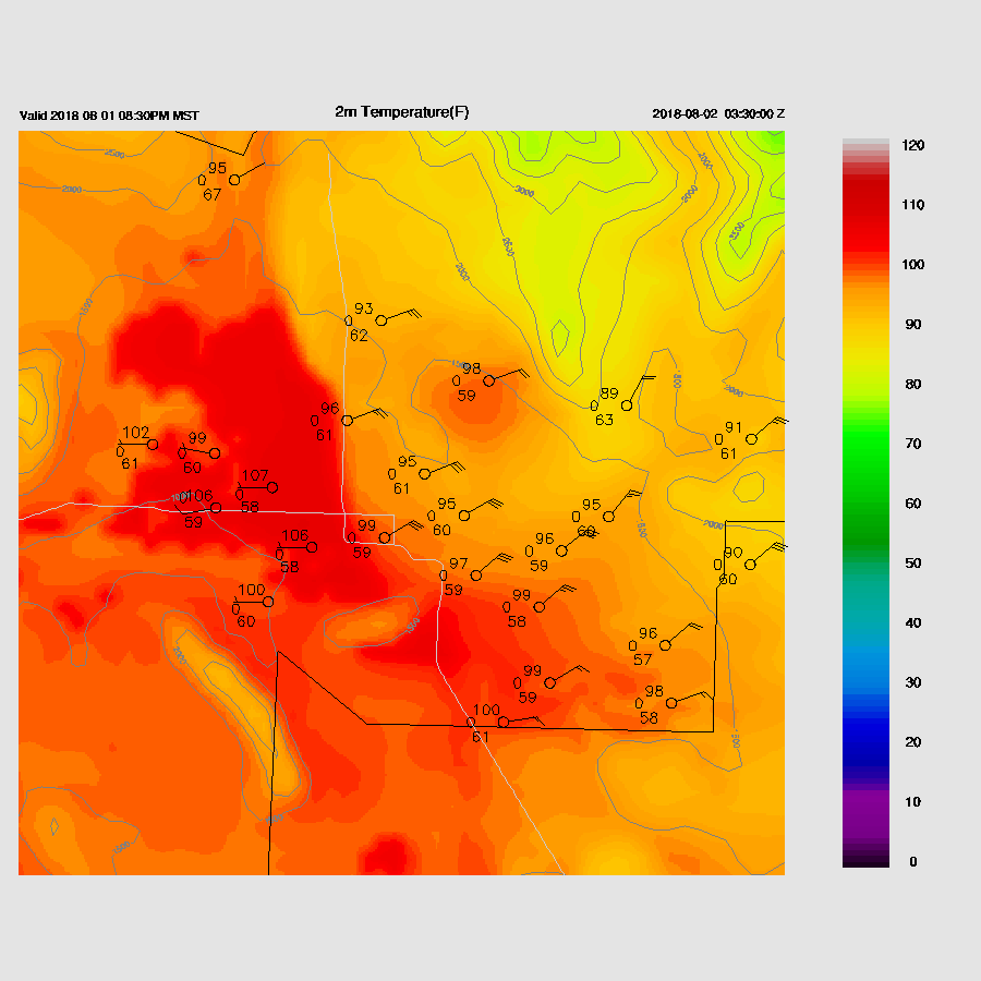
Both runs eject outflows from the nearby deep convection into the valley during the evening.  WRFRR outflows are quite strong but are probably insufficient to trigger deep convection. It’s not impossible, though!


Some activity continues in Pinal and west of Tucson into the evening.


The 15Z WRFRR just became available and it does develop a few storms in the Phoenix area as strong outflows move across the area this evening.


Day 2
Moisture generally increases over the state, including southeastern Arizona, as low-level winds shift back to westerly and a weak surge continues to advect moisture into the state.  It’s depressing that we’ve had such high moisture values but so little to show for it over most of the lower elevations.


The 500mb high center is near the Flagstaff area keeping southern Arizona in the light easterly flow.


CAPE is again moderate to high over the lower elevations but pretty low over far eastern Arizona.  Of interest is the low-level moist and unstable air moving northward up the valleys of NE Sonora into Cochise county.
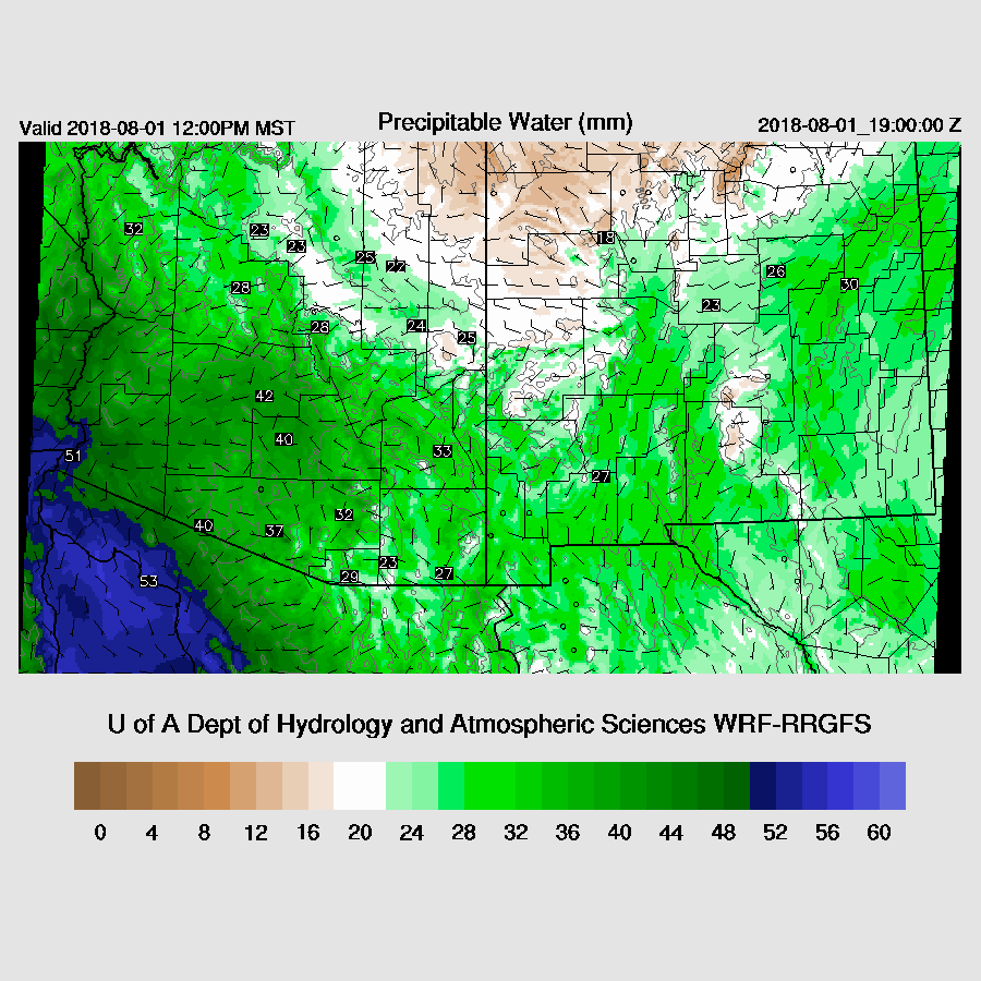

The WRFNAM and WRFRR have significantly different forecasts for SE Arizona as the WRFNAM is much more active during the late afternoon.

The WRFRR becomes quite active over SE/SC AZ during the evening hours instead, so it looks like the Tucson area is likely to see activity at some point.


It’s the same story around the Phoenix area as the PBL is not well mixed but at least there doesn’t seem to be an inversion present thus a strong outflow or two may be enough to trigger deep convection.  


The WRFNAM does manage to fire up a few storms during the evening as a strong outflow boundary moves into Phoenix from the south.  There is a chance of a dust storm and/or a haboob.