Thursday, July 6, 2017

20170706

Previous Forecast

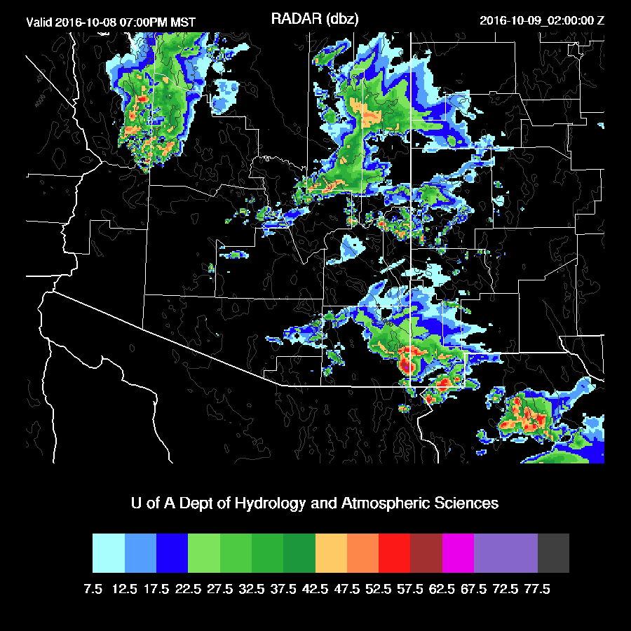
Not much to say as there has been very little activity.  Thunderstorms in Sonora caused an outflow surge into southern Arizona overnight which was forecast well by the various runs.  

Initializations
The monster high pressure that had been forecast to build over the western CONUS is here as Flagstaff and Grand Junction reported 5980m 500mb heights this morning.   Neither Empalme or Chihuahua have been reporting at 12Z recently which is likely to be a major problem for model accuracy.  I contacted my friend, Luis Farfan, and he called around and found that both sites are out of sondes and gas and will hopefully be resupplied in 2 weeks.  Let’s hope!

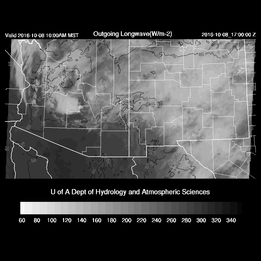
Almost no clouds were present over Arizona or northern Sonora except a few near a weak IT/MCV moving westward across northern Baja.  All morning model initializations look good, but it’s an easy day to get right.

Day 1
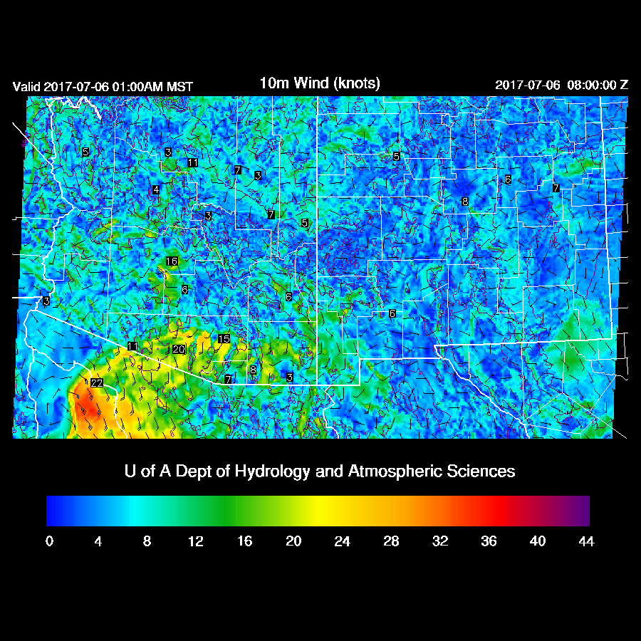
In spite of the weak outflow surge last night, moisture decreases today as low-level easterly winds develop due to the strong high to the north of Arizona.  

A few areas of deep convection do develop over east central Arizona and along the border from Nogales westward along a low-level convergence boundary.

Day 2
The situation improves somewhat tomorrow as some moisture moves into eastern Arizona from southern NM.
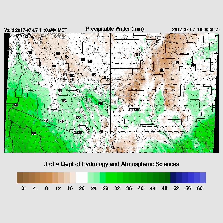
It doesn’t look like much when looking at the IPW plot, but 850mb Td plot shows 8 to 10C air moving into eastern Arizona which is enough to support deep convection.

This increasingly wet air does support more widespread convection over the White Mountains and by afternoon quite a few storms are present.
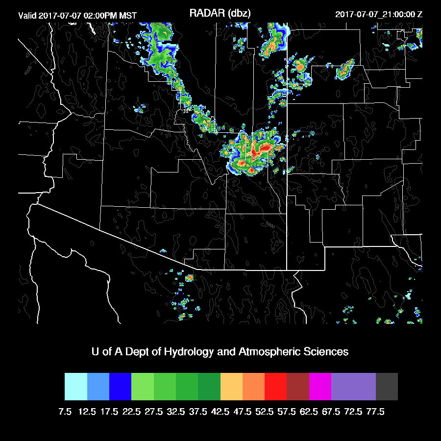
Mid level flow is ideal for steering these high elevation storms into the lower deserts as long as there is sufficient moisture/CAPE.

Tucson (and Phoenix) becomes very deeply mixed by late afternoon with a few hundred J/Kg of CAPE which may be enough to support some deep convection in the area.  In spite of the mid level steering being very good, there isn’t much low-level shear as the flow is unidirectional

By late afternoon, scattered storms do move close to both Tucson and Phoenix.  

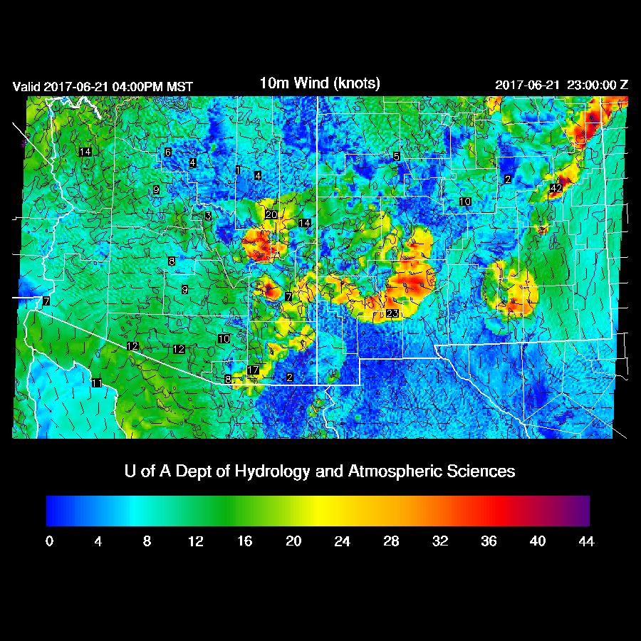
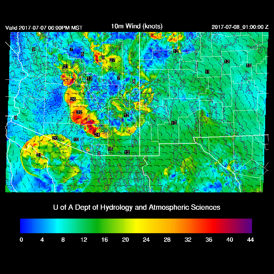
It is looking likely that some very strong outflows will move across Maricopa, Pinal, and eastern Pima during the early evening due to very deep inverted V vertical profiles in the lower deserts.  Forecast confidence is high as all 4 of the most recent runs have very similar solutions.  Finally, some action!

A few storms continue into the evening over the higher terrain of south-central Arizona.  They appear to skirt the Tucson area.

There is an experimental 1.5km inner domain running over the summer to determine if the additional resolution produces better deep convection forecasts.  So far, the difference between the 1.8 and 1.5km domains has been minimal.  However, tomorrow, the 1.5km domain brings a more organized area of deep convection into far southern Pinal and into the northern parts of Tucson.   
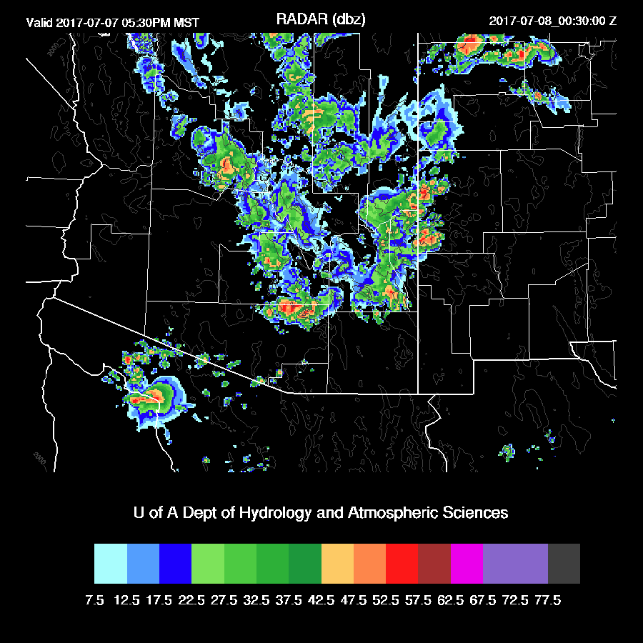
The storms don’t produce a lot of rain but do produce very strong winds.  It will be interesting to see throughout the summer if the additional resolution will improve the accuracy of the forecast of deep convection.
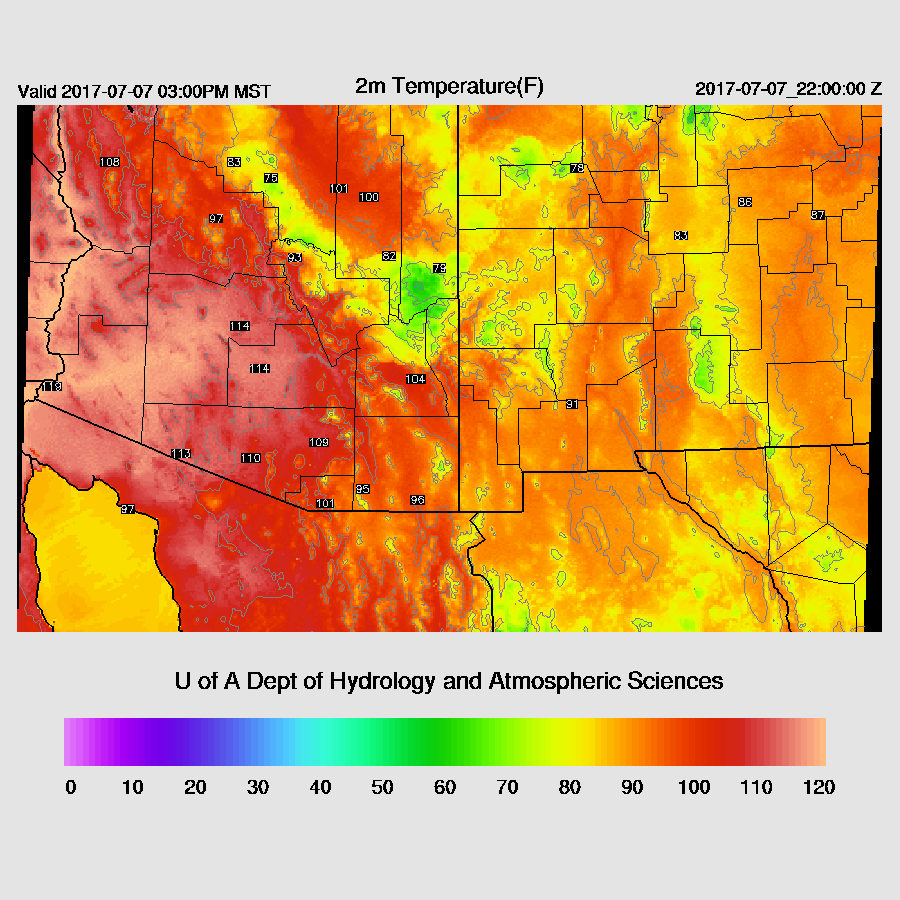
The other big news is the excessive heat tomorrow.  114-116 in Phoenix and almost 110 in Tucson.

Monday, July 3, 2017

20170703

Previous Forecast

A very active afternoon and evening along the border and down into Sonora.  Strong/severe storms formed over the high terrain of far south central Arizona and moved southwest.  The Q2 QPE OU/NOAA product is no longer publically available thus I'm using the lightning data to estimate model performance.

The 12Z runs performed well as they developed storms over Arizona and then much stronger deep convection over Sonora later.  WRFNAM

Initializations

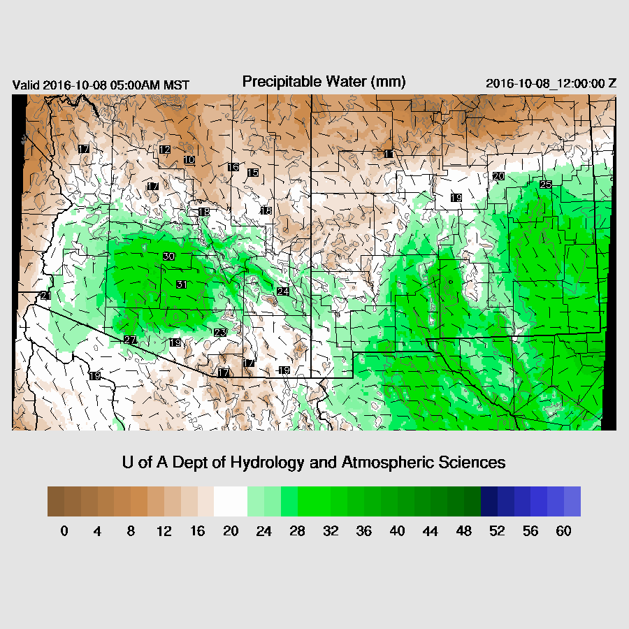
Moisture continues to increase over the state due to a combination of a Gulf Surge and thunderstorm outflow surges.  Surface dewpoints are in the mid 60's at Yuma and IPW values are around 30-35mm over much of the southern 1/2 of the state.  Unfortunately, a fair number of IPW sites are missing as well as any upper air data from NW Mexico.   Satellite imagery indicates an MCV and associated debris clouds are located near Hermosillo and is moving slowly west.  The clouds are remaining in Mexico.   The morning 500mb plot has the high center just west of Tucson with temperatures around -8C which is fairly cool.

Both the 12Z GFS and NAM initialize a weak vortex located in central Sonora and the GFS has cloud initialized well (for once).  The NAM has some clouds, but not enough.  Arizona is clear so no problem there with cloud initializations.   Most GPSMET IPW stations have minimal errors.  However, no sites except for Puerto Penasco reported in NW Sonora.  Overall, Both the WRFNAM and GFS initialized well and model confidence is high.

Day 1

Moisture continues to advect into much of southern Arizona due to the ongoing surge and IPW increases slightly during the day.

850mb dewpoint temperatures are above 10C over all the lower deserts so there is enough moisture to support deep convection.  However, as is typically the case with the first 24 hours of s surge, cooler air in the lower troposphere and warmer air above, stabilizes the atmosphere.

Both Tucson and Phoenix have significant CAPE by afternoon, but an inversion is present on top of the cool layer preventing deep convection.

1000 to nearly 2000 J/Kg are forecast for this afternoon.

Eventually, deep convection does initiate over the higher terrain of SE Arizona and the White Mountains.  Yesterday, the WRF was a few hours slow and that may be the case again so formation might be a little earlier.

Activity continues into the evening to the SE of Tucson.

The potential is there for Tucson, but the mixed layer remains shallow and will need some mesoscale lift to realize convection.  Outflows, while locally strong, are not strong enough once they reach Tucson as the PBL heights don't support very strong winds.  Storms also aren't moving that much due to the light and variable winds between 400 - 600mb.  A wasted opportunity!


Day 2

The surge weakens tomorrow, but enough moisture remains to support deep convection if there is enough heating and lift.

The low levels recover somewhat and by afternoon, Tucson becomes quite deeply mixed along with some CAPE.  Mid-level steering winds continue to be poor thus it's likely to see deep convection over the mountains, but not move into the lower elevations.

The WRFNAM and WRFGFS diverge as the WRFNAM is active in central Pima County while the WRFGFS has activity only in Cochise County.

By early evening, a few storms are possible close to the Tucson valley.  Not much activity expected, but perhaps some cooling from thunderstorm outflows.  I'll take anything at this point!


Wednesday, June 21, 2017

20170621

Previous Forecast
Not a good day for the model runs and I neglected to pick up on some clues that indicated they were going to be too active.  Stronger storms were mainly restricted to the higher terrain of parts of SE Arizona with very weak activity around Tucson.  Below is the lightning plot as the QPE product from NOAA/OU (http://nmq.ou.edu/) is no longer available.  For whatever reason, NOAA had decided to make those products internal and not available to anyone else.  I've tried to get access but have been denied.


As mentioned, there were quite a few clues that the forecasts were going to be bad.  The first was that Tucson area IPW started dropping during the late morning hours while the model held steady or even increased slightly.  Another problem was the IT the model runs had initialized south of Douglas was not there.  Later in the morning, I could find no evidence when looking at cloud motions and I should have looked harder when evaluating the initializations.  The area of clouds that moved through during the morning also restricted heating a little.  By late morning, it was clear there was too much forecast activity by just looking at the lack of development.  Not a good way to start the season.

Initialization
No significant errors noted.

Day 1
500mb heights have come down a little so not quite as hot today but moisture has increased slightly.  Even a weak Gulf of California moisture surge is underway as dewpoints are in the 50's there.   Quite a bit of moisture is lurking just to our south over western Mexico and some of this continues to trickle into Arizona today.

In spite of this low-level increase, only far eastern and southeastern Arizona have sufficient CAPE to support deep convection.

 Scattered storms are present during the afternoon for this area.

 The Tucson forecast vertical profile has only minimal CAPE and unfavorable winds.  Mt Lemmon might see a quick afternoon storm though. A deep inverted v profile will again cause storms east of Tucson to have very strong winds associated with them.

By late afternoon, areas of EC and SE Arizona as well as into SW NM may experience very strong winds.

Day 2
No significant weather expected as moisture is limited over higher terrain.  A weak surge continues to advect low-level moisture which will increase dewpoints into the 50's in western and central Arizona.


Tuesday, June 20, 2017

20170620

Previous Forecast
The various model runs were quite good forecasting the strong outflows over far southeastern AZ and SW NM where there was a terrible accident where the freeway crosses the Lordsburg Playa.  I was driving back from Paradise on I-10 shortly after the dust storm and at that point, the freeway had been closed.  It was spooky driving on an empty I-10 except for occasional tow trucks and emergency vehicles going the other way towards NM.  WRF-GFS was the best and is below.


Initialization/Discussion
The WRF runs are not all configured for the summer convective season yet and may have some issues with forecasting convection correctly.  Most runs will be transitioned over the next few days.

Southern NM was very active last evening which resulted in debris clouds advecting in over southern Arizona.  The key for today is if these clouds will thin out enough to allow sufficient heating for afternoon convection as IPW has increased to 26mm at Tucson.   Unfortunately, far SE AZ and far SW NM do not have any functioning GPSMET IPW stations so it's hard to say what is immediately upstream from us.  Demming is 28mm so southern NM is wet.

Of course, the first day back is tough as no model run has enough clouds; even the one that uses the new setting that is supposed to improve cloud coverage.  Because of overnight warmth, we got a head start on heating so, in spite of clouds, we're pretty close to the models.   


Looking at upper level maps, there does seem to be a weak inverted trough between Tucson and El Paso which is either a leftover MCV or an inverted trough.  In any case, this trough should help organize convection.  The 12Z NAM has a fairly sharp 500mb trough located just south of Douglas which looks OK.  The 6Z GFS is similar.   The 6Z WRFGFS also had the best cloud coverage of the morning models, but still not enough.  Model confidence is quite high as the clouds over SC Arizona are burning off quick enough to not be a big factor.
Day 1
Moisture continues to slowly increase over eastern Pima and Santa Cruz during the morning hours and is more than enough for deep convection.
CAPE is also very high for this time of year in SE Arizona with some values exceeding 2500 J/Kg.  NM also have very high CAPE.  
Deep convection forms over the high terrain of Santa Cruz County by early afternoon.

As mentioned by Dan Henz this morning, the mixed/sub cloud layer is very deep, extending to nearly 500mb.  The lower/mid level wind profile is also very good with mid-level easterlies and low-level northwest winds.  CAPE is low in the Tucson area but may be enough to support storms even in the lower elevations.
Storms are present over eastern Pima County later this afternoon while storms over the White mountains are just getting started.

Winds are going to be very strong with gusts above 50 knots in eastern Pima County with these storms.  It appears storms will put the break on temperatures so perhaps Tucson won't have record highs. 

The rest of SE Arizona becomes very active by late afternoon as outflows converge across Cochise County, triggering new development.  The big story is the winds as it looks like a repeat of yesterday with very strong outflow winds. 

A few storms form in far eastern Pinal County and eject outflows into the Phoenix area this evening accompied by a dust storm.  Strong winds continue over SE Arizona.

Due to slightly cooler/wetter air, it looks like Phoenix won't make it to the 'magic' 120 mark.  It's going to be close and maybe KLUF can do it.

Looks like the outflows provide some cooling for Phoenix this evening.

A Day 2 update will follow later this morning.

Friday, October 7, 2016

20161007

Another round of strong to possibly severe thunderstorms are possible over parts of the state tomorrow as moisture pools in the vicinity of a backdoor front. Activity gets off to an early start as a blob of moisture is forecast to be present over the Phoenix area around sunrise with some CAPE present.
surface_td_24.gif

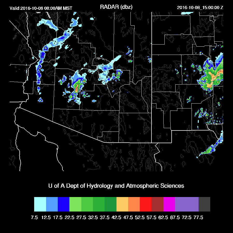
Showers and few storms may form around 6-10am in the Phoenix vicinity.
mdbz_27.gif

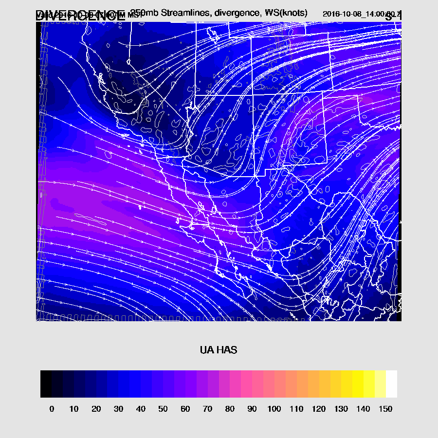
This activity is being forced by a weak trough over SW Arizona as upper divergence is quite strong along the trough axis.
250_32.gif
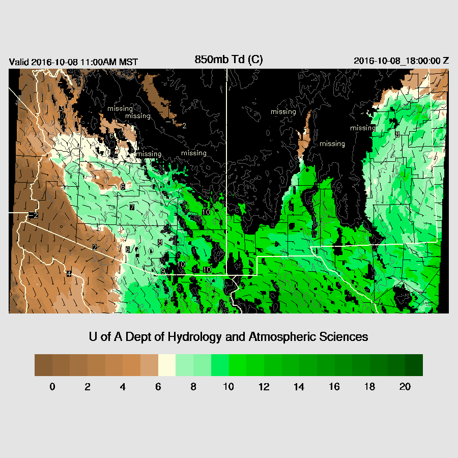
By early afternoon, moisture continues to increase over SE Arizona/SW NM with impressive 850 dewpoint temperatures around 10C.
850_30.gif
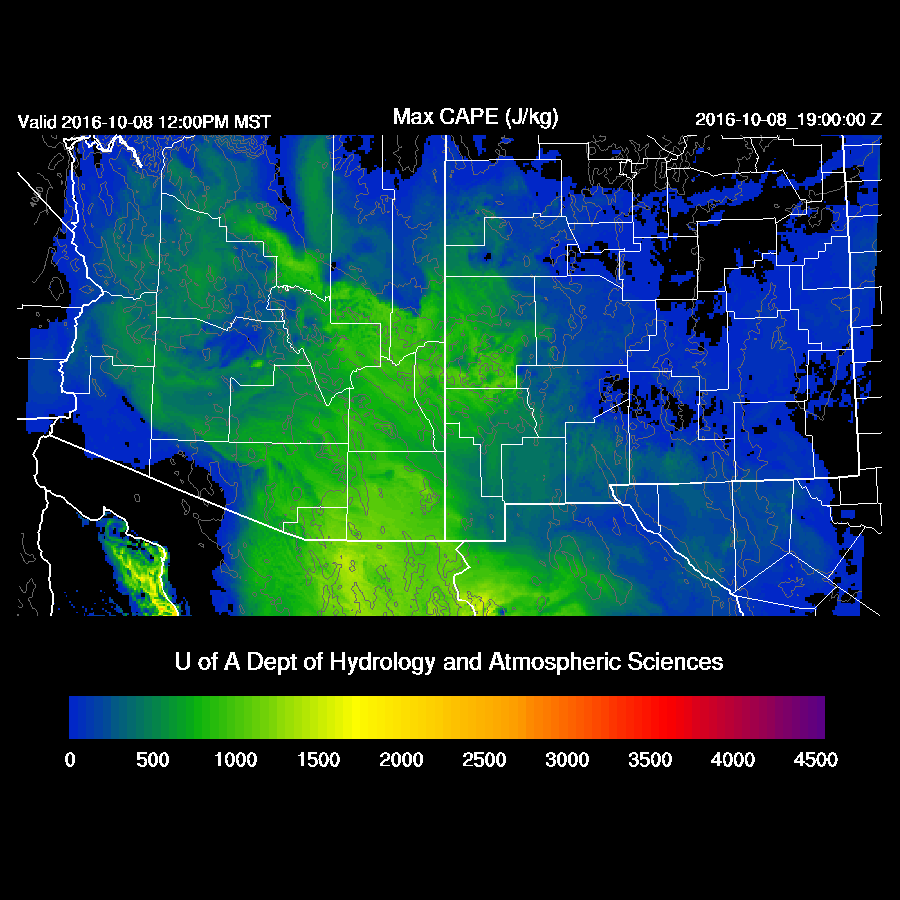
CAPE is also impressive with 1000 J/Kg and higher over SE Arizona.  CAPE is also present over the White Mountains up towards Flagstaff which will also support strong storms.
mcape_31.gif
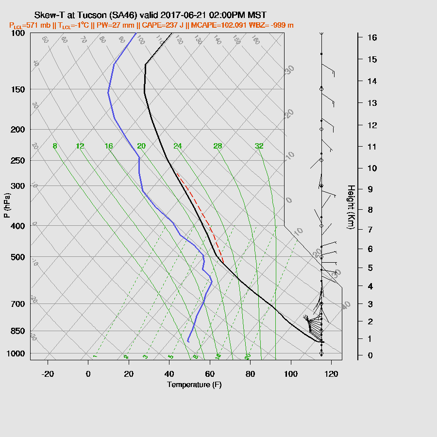
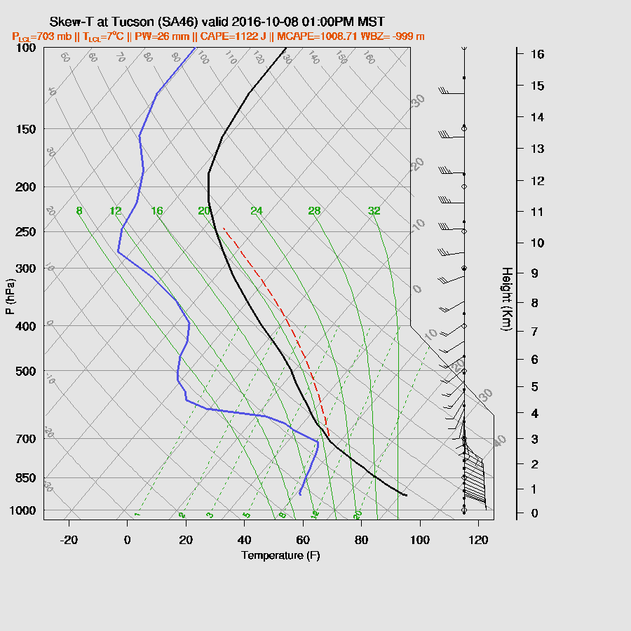
As Bob Maddox pointed out, the wind profile is excellent with strong directional shear and with 1000+ CAPE, strong to severe storms are likely with isolated strong wind and some hail possible.  This is one of the more impressive vertical profiles I’ve seen this transition season due to high CAPE and good directional shear.
skewt_1_32.gif

Deep convection develops over the high terrain of the Rim/White Mountains during the afternoon.
mdbz_33.gif
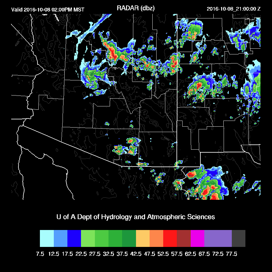
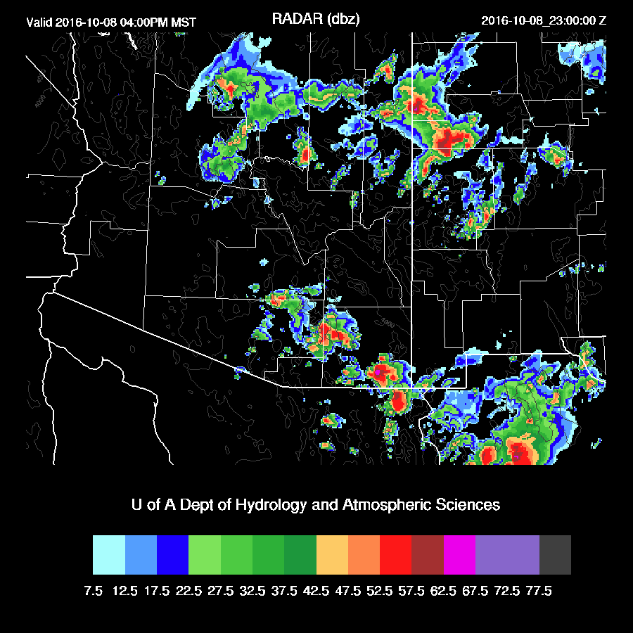
Later in the afternoon, deep convection forms over the higher terrain of SE Arizona.  Some of these storms become severe with the main threat being hail.  All the runs over the past 24 hours have been quite consistent with this solution.  The big question is if Tucson will see storms and the answer is unclear as some runs have storms in the valley while others (WRFNAM below) keep them over the higher terrain.
mdbz_35.gif

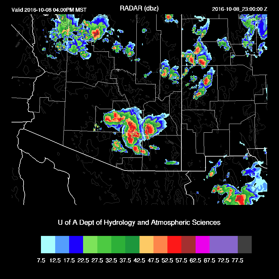
The WRFGFS does have strong storms in the Tucson valley and up into Pinal county by late afternoon.  So, the message is that some strong to severe storms are likely around SE Arizona, but exactly where is unclear.
mdbz_35.gif

A few strong storms continue over far eastern Arizona into the early evening.
mdbz_38.gif

The concern, as it always seems to be, is if there will be clouds restricting heating during the morning hours.  This is definitely a possibility as morning storm activity is possible around Phoenix as well as a large area of clouds overnight.  These clouds are forecast to move out during the morning hours thus there is nearly full heating in the model.
mcin_29.gif