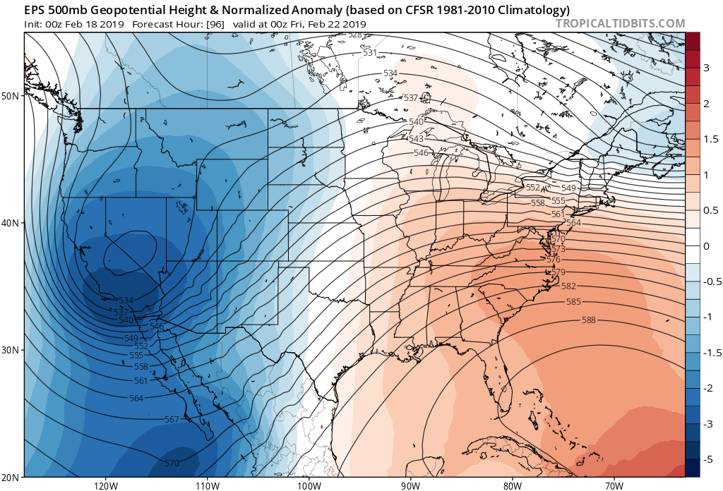
Another highly unusual weather event is expected to impact Arizona and eastern Pima county starting early Friday morning. Another strong and cold short wave drops down into the western CONUS longwave trough. Normally, I wouldn’t forecast this far in advance but the global models have been very consistent the past few days bringing this trough far to the south. Below is the EPS from the 0Z run which shows remarkable consistency among the ensemble members.
The 0Z GEFS location is nearly identical but not quite as deep.

The operational ECMWF moves the trough far to the south along the AZ/Sonora border during the day Friday which is an ideal location for a big snow event for SE Arizona. 
This system is much drier compared with last week’s storm but with such cold air and strong dynamics, precipitation amounts are again expected to be quite high with widespread mountain precipitation over 2 inches and lower elevations around .5 to one inch. Note that the below plot also includes amounts from the current storm so subtract off about ½ inch over the Rim and White Mountains.

The big story with this storm is the low snow levels, the significant accumulation of snow at lower elevations of SE Arizona, and the big accumulations at high elevations. 
Most of the WRFGFS runs over the past few days forecast significant accumulations in Tucson with some areas possibly receiving 4-8 inches of snow. Timing is good for a snow event as a strong cold front moves through just before dawn changing the rain over to snow. Note that the station plot does not account for snow. It’s also possible that all the precipitation falls as rain but I’m leaning snow as the ECMWF is a little deeper and colder than the GFS. The event will be in the range of the WRFNAM soon and it will be interesting to see what those runs have to say. 
No comments:
Post a Comment
Note: Only a member of this blog may post a comment.