Previous Forecast
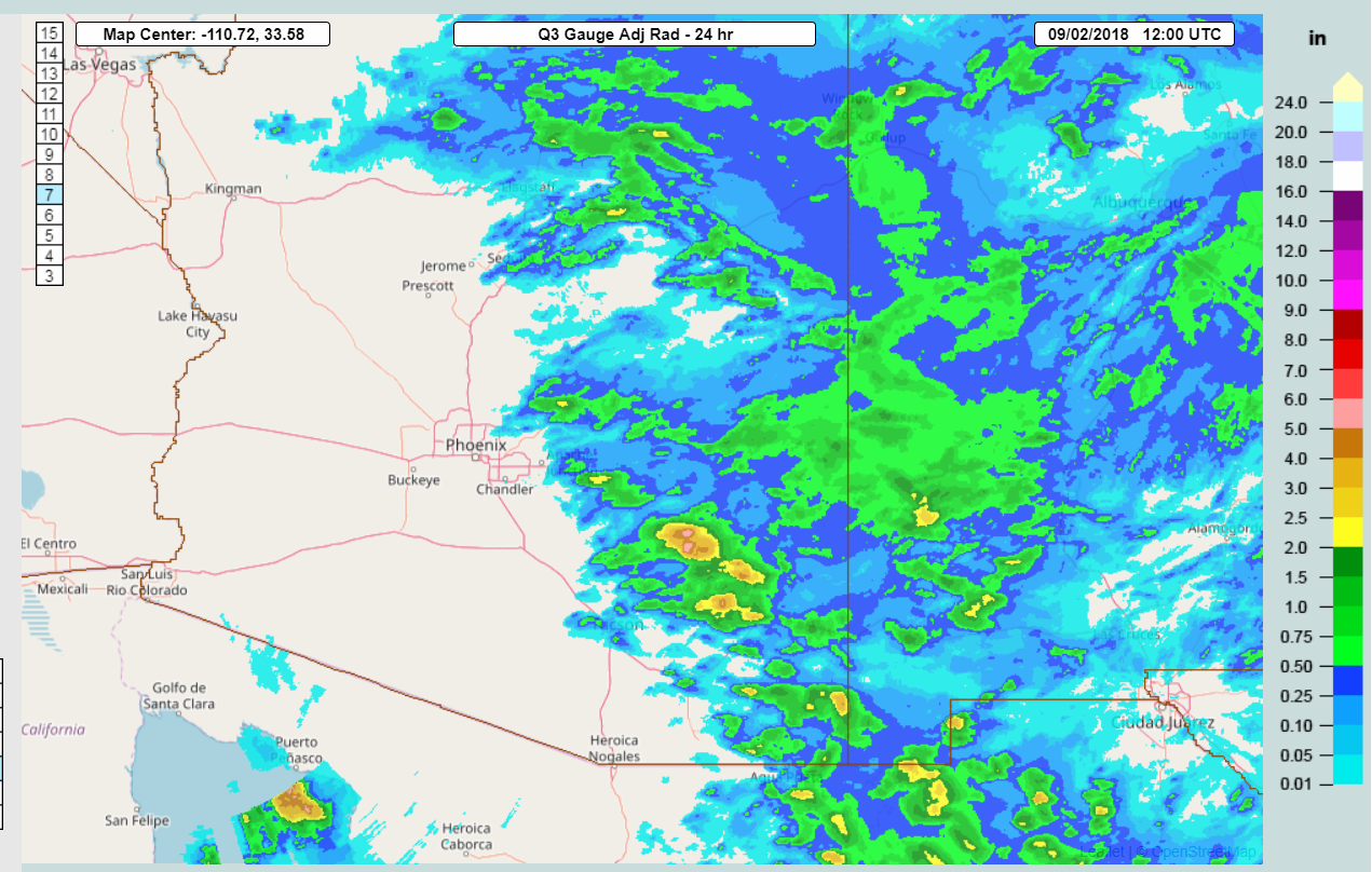
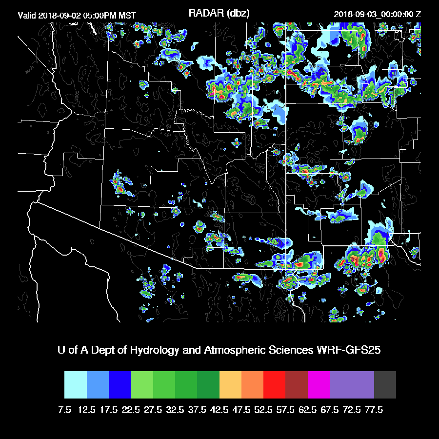
Storms were active across much of eastern Arizona yesterday all the way until this morning. In general, the WRF runs had the right idea but were off a bit in location as the heaviest precipitation occurred just to the NE of Tucson instead of farther east. Radar estimates were as high as 6 inches. Just across the border in Rodeo NM, one of my “neighbors” here in the Chiricahuas, Kim Vacariu, reported 3.85” as I counted 6(!) separate RADAR echos that trained over that area.
Initializations
A broad but weak trough is located over the SW US which has quite cool air associated with it as 500mb temperatures are around -10 to -12C.

An upper-level jet continues over California with the exit region over southern Arizona thus continuing favorable upper divergence.

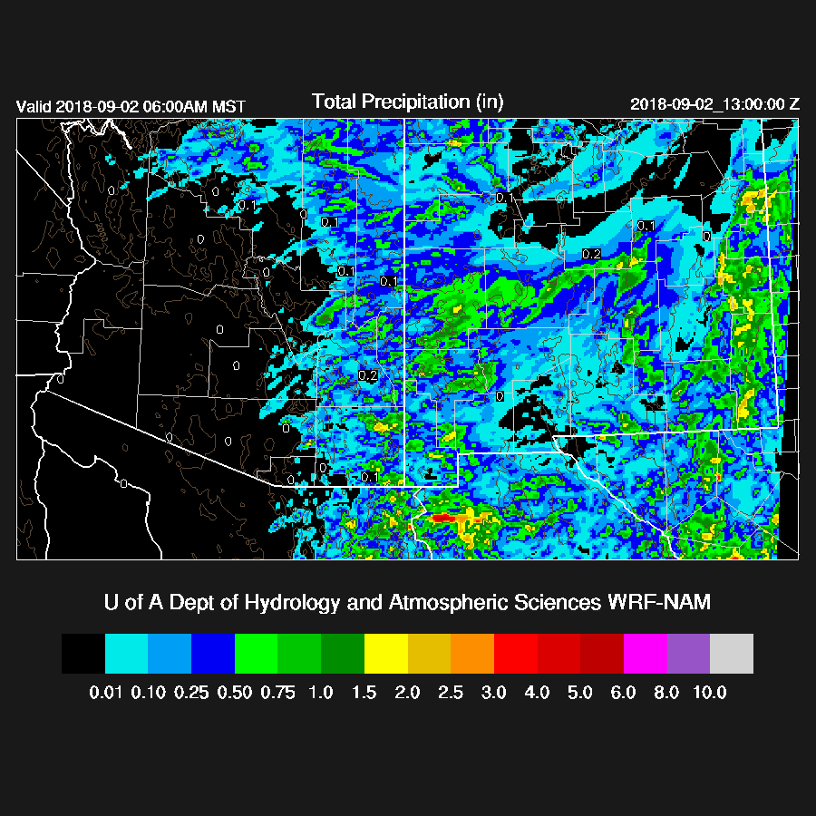
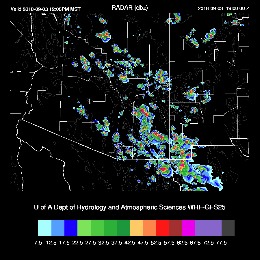
Clouds, showers, and thunderstorms are present over far SE Arizona but skies are clear elsewhere. The NAM and RR initialized well while the GFS didn’t have enough activity. The NAM is a bit too wet over all of Arizona and into NW Mexico while the RR and GFS have only minimal errors. The WRFRR is the model of choice but the other two aren’t too bad except for the GFS in far SE Arizona as it was too clear there.
Day 1
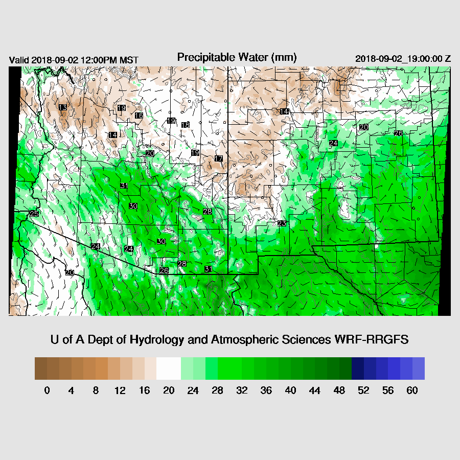
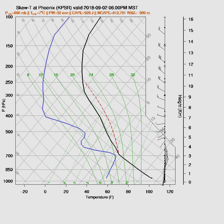
PW has decreased over SE Arizona but has increased over central Arizona. By mid-day, low-level SE flow continues across southcentral Arizona and keeps PW in the low 30mm range which is sufficient to support storms. As moisture has decreased, the threat for heavy rain is less.
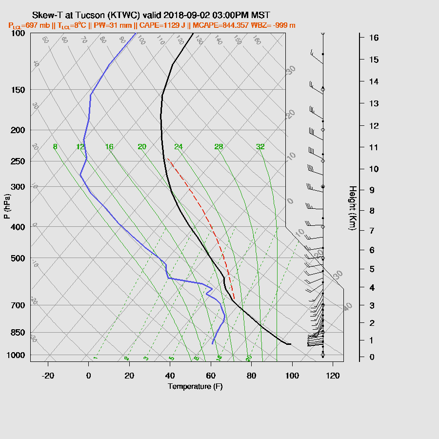
CAPE is still high over southern Arizona as the cooling mid-levels have offset the drying at low-levels.

The various runs are having a difficult time with the vertical profile as some mix it deeply and some do not. The WRFGFS seems the most realistic and had moderate CAPE and a good vertical wind profile this afternoon which is likely to support some storms around the Tucson area. That 600mb inversion is still hanging around which is keeping widespread deep convection in check.
As with the Skew-T, the runs vary with regards to activity as the WRFNAM has quite a big in and around Tucson while the WRFRR hardly has any. The WRFGFS is in the middle with a few storms around later this afternoon.
The WRFNAM continues storms into the evening in eastern Pima and Pinal Counties and the WRFRR becomes much more active and includes eastern Maricopa County.
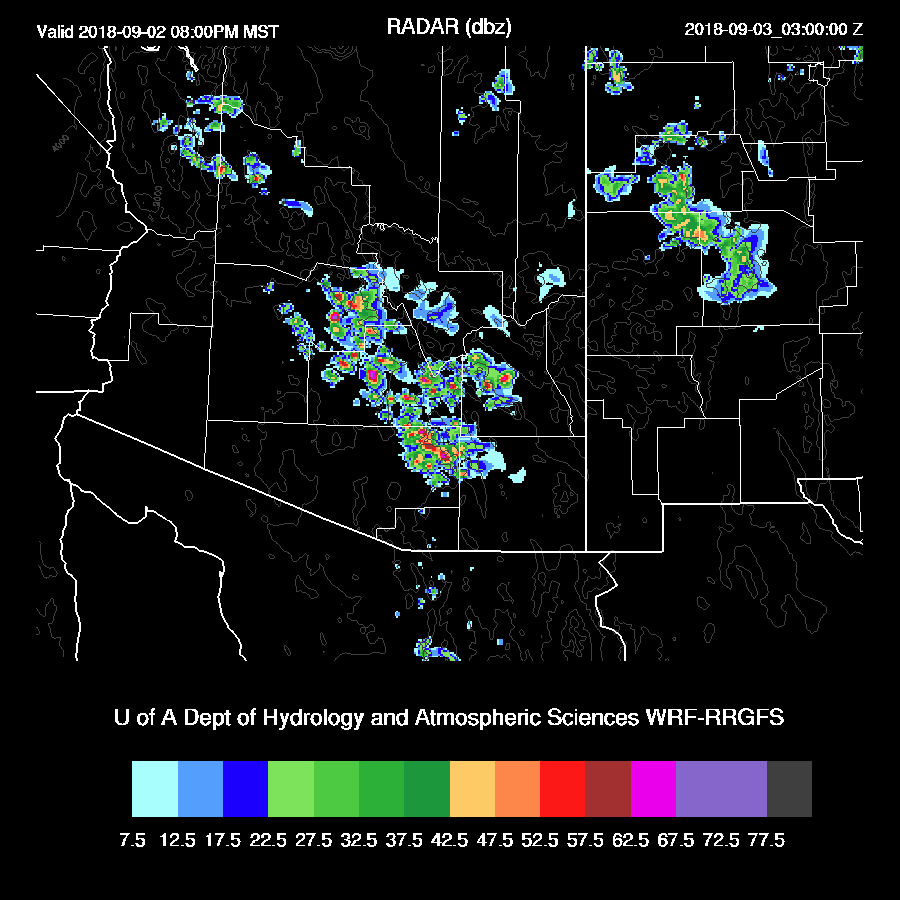
While CAPE isn’t that high, it’s enough to support activity in and around Phoenix. The PBL is mixed deeply and approaching the LFC. Winds do have a fair amount of directional shear but mid-level steering is weak so storms may not move much thus some possible heavy rains. (in spite of what I said earlier) Also, some strong winds are possible as the sub-cloud layer is quite deep.
Day 2
The broad trough continues over the western CONUS with another shortwave somewhere near Vegas and another somewhere over western NM. 500mb temperatures increase slightly over Arizona so activity is less likely over central and southwestern Arizona.

250mb doesn’t look much different as Arizona is still in the exit region of the nearly stationary CA jet.

I’m sounding like a broken record as (but that’s good!) as wet air continues to be advected into southern Arizona. I wonder if the younger generation gets that analogy. 850mb Td increases back to around 15C tomorrow.

The corresponding CAPE is high over much of SE and SC Arizona.

The Tucson forecast vertical profile looks excellent for strong/severe organized convection with 2000 J/kg CAPE and excellent directional shear profile. Have we been transported to the Great Plains in the spring???

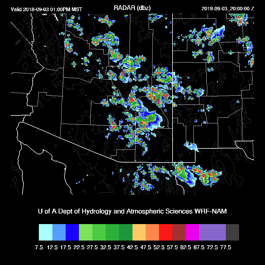
It’s hard to say exactly when or where for tomorrow but it looks like big storms over parts of eastern and southeastern Arizona during the early afternoon. Below are the WRFNAM, RR, and GFS.

None of the model runs have much for Phoenix but it’s not out of the question that some storms could form with a Skew-T looking like this. The vertical shear profile is excellent and there is plenty of CAPE.

No comments:
Post a Comment
Note: Only a member of this blog may post a comment.