Previous Forecast
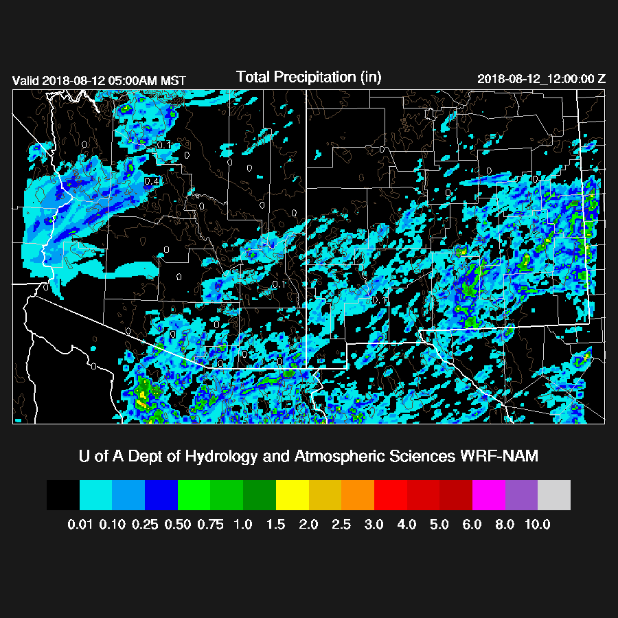
There was a fair amount of activity over western and northwestern Arizona as well as over SE Arizona. Most runs did not have enough activity except for the WRFNAM. I wasn't paying much attention yesterday as I needed to take a day off.
Initializations
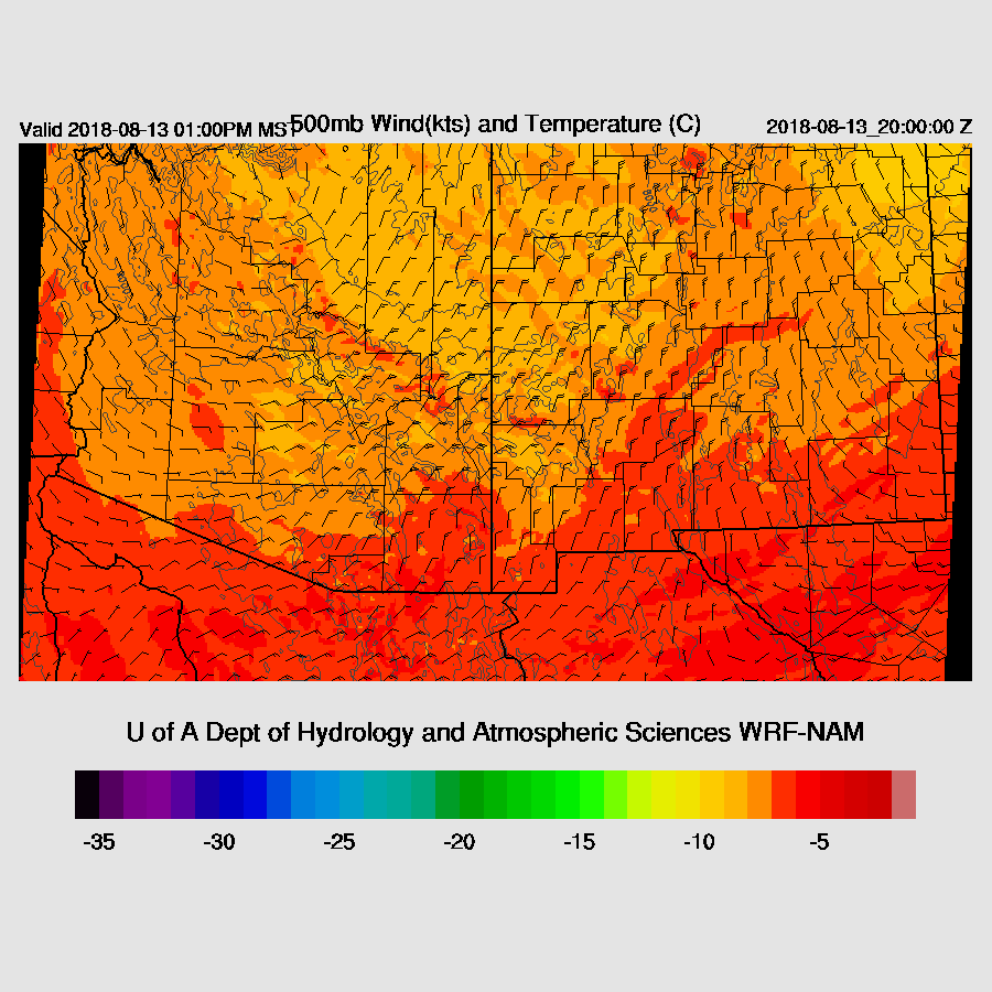
The center of the 500mb anticyclone is located over South Dakota but the ridge axis extends all the way back to the California coast. A broad inverted trough is located over west Texas and eastern NM and an upper level trough is also located over NM which is placing central Arizona in a slightly divergent flow aloft thus providing some support for storms. The RR and NAM have initialized the large scale well. 
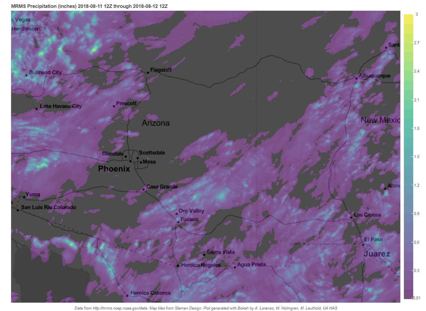
Overnight clouds and showers have mainly dissipated except for far southern Arizona. There is an area of ongoing convection over far southern Sonora and satellite imagery indicates that there is a cyclonic circulation in this area. The initializations don’t have much of a circulation in that are but other than that, clouds have initialized well. PW sites are missing for SE Arizona and SW NM this morning. The NAM has a slight wet bias over Arizona while the RR and GFS have mainly minor errors. There are no major initialization errors thus the morning runs should perform well.
Day 1
Over the past 12 hours, PW has increased over much of central and western Arizona while decreasing over SE Arizona. Dry air has moved into far eastern Arizona from NM while weak southerly flow continues moist air advection into western and central Arizona.

Morning sounding have a limited amount of Mixed Layer CAPE at Tucson and Phoenix but Phoenix has quite high elevated CAPE of 1500 J/kg. CAPE is also quite high over the high terrain of the Rim and out into western Arizona thus it looks like those areas will be most active initially but the forecast CAPE for the lower elevations is also high by mid-day.

The synoptic situation is favorable for steering storms that form over the high terrain into the lower elevations of central and western Arizona this evening as 500mb winds are 15-20 knots over eastern Arizona. Winds are not as strong over western Arizona but are still sufficient to move storms.
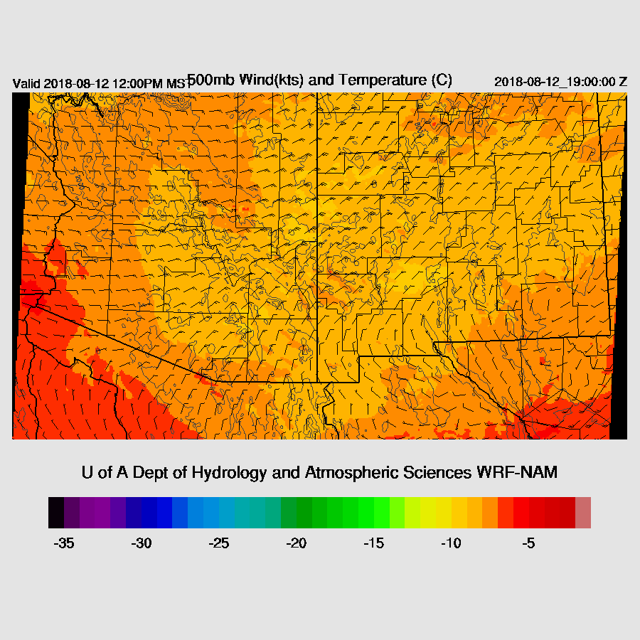
Upper flow becomes NNW over the state which is quite a bit different than it was at 12Z and becomes mainly confluent and not favorable like it was earlier today but does steer anvils at 90 degrees away from the storm motion.

A few strong storms are over the higher terrain to the NE of Phoenix during the afternoon and mainly quiet elsewhere.

Tucson has sufficient CAPE to support storms this afternoon. Winds are also fairly good with favorable low-level shear, 15-20 knot easterly flow, and NW upper flow to keep anvils from spreading out ahead of the storms. However, it’s generally dry and quiet upstream from Tucson so storms will have to form over the nearby high terrain
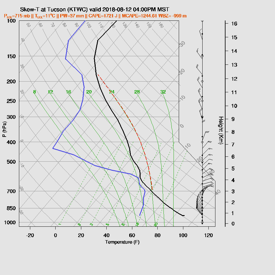
Both runs develop some storms in and around the Tucson area later this afternoon and into the early evening with storms being very strong.

By early evening, the PBL becomes deeply mixed at Phoenix. CAPE is good at around 1400 J/kg and winds are also favorable for steering, low-level shear, and keeping anvils away. Based on just the forecast skew-t, it looks likely for storms in and around Phoenix this evening. With a fairly deep mixed layer and decent CAPE, strong to isolated severe winds are again a possibility.

I don’t ever remember such a long duration of good NE mid-level flow. Typically we have a few days at the most and so far it has now been almost a week straight. There were other periods earlier this summer too, but not as good or as long in duration. The 12Z runs all have different solutions for Phoenix from not much activity, (WRFNAM), strong/severe storms just north and south of Phoenix (WRFGFS), to strong storms that develop up on the Rim and move rapidly into the Phoenix this evening. This is my favorite as this has been the typical scenario recently.

Winds are forecast to be very strong with some isolated severe likely.

Day 2
The pattern remains about the same tomorrow with a trough over in Texas and one high center over far northern Arizona which results in very favorable 20-knot steering flow over much of the state.
Flow from the GofC increases somewhat resulting in an increase in moisture for the eastern ⅓ of the state. We are in the “sweet spot” as moisture isn’t too high to be “too wet to rain” but more than enough for widespread activity and good CAPE.

CAPE is again high over the lower elevations while far eastern Arizona is still quite low. The model runs are quite a bit different as the WRFNAM has the wet air and increased CAPE farther to the east. The amount of lower desert activity is dependent on what happens today as an active day will leave the atmosphere worked over and lower CAPE, thus deep convection is less likely but with this synoptic setup, certainly possible

The potential is certainly there again as CAPE, moisture, and the vertical wind profile are excellent so we’ll just have to “wait and see” for tomorrow.

No comments:
Post a Comment
Note: Only a member of this blog may post a comment.