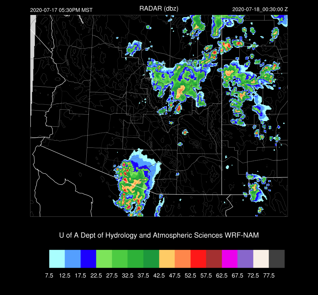
Scattered storms occurred over the higher terrain of much of southeastern Arizona over the past 24 hours. The WRF runs were fairly accurate and had the overall pattern of precipitation. WRF didn't have enough activity over the Rim though. Only light rain fell in Tucson accompanied by a weak outflow boundary.


Discussion
The overall 500mb pattern is about the same as the large anti-cyclone continues to be located from Texas and eastward. What is of interest for Arizona is the inverted trough located in NW Mexico. The model runs saw this feature yesterday and moved it towards Arizona where it helped enhance storm activity today.


PW is about the same over eastern Arizona as it was yesterday with values in the low 30mm range. Drying has occurred in western Arizona. The Tucson 12Z sounding has only minimal CAPE and a poor wind profile. The approaching IT should improve the wind profile later today.

Model Initializations
Much of eastern and northeastern Arizona is cloudy while the rest of the state is clear. I don't see an MCV in the cloud pattern, but something must be forcing all the clouds and light showers. 6Z WRFNAM has too wide of coverage of clouds in southeastern Arizona, associated with a strong MCV. 6Z WRFGFS is much better as clouds and showers are in the correct location. The 12Z WRFRR also has quite a strong MCV or IT in SE Arizona this morning, The 12Z WRFNAM is a bit better as clouds are in the right place. It too has quite a well defined IT moving northward over Cochise County. Looking closely at visible and WV imagery, I see no circulation that far south.
IMO, the Mexican IT seems initialized somewhat too weak and too far to the southwest by all the initializations.
PW is initialized fairly well by all the initializations except the 6z WRFNAM, which is too wet. Overall, I'd say the 6Z WRFGFS and the 12Z WRFNAM have the better initializations.
Day 1
There continues to be a sharp dividing line from central Pima County northward between fairly moist air and quite dry air. GOES lower-level WV imagery does show this boundary moving slowly westward. In any case, moisture is sufficient over east of this line for scattered storms today.

CAPE is low to moderate in this same area and is sufficient to support storms.

This morning, most runs develop showers and storms in advance of the anomalous SE AZ IT/MCV, which at least at 16Z is in error. The 6Z WRFGFS has the least amount of activity and seems to be performing the best. By mid-afternoon, scattered storms have developed over some of the high terrain of mainly the eastern 1/2 of the state.

The Mexican IT is not close enough to southern Arizona to enhance the mid-level steering flow, at least during the afternoon hours. Tucson has only about 10 knots of ESE flow at 500mb. CAPE is sufficient to support storms around with maybe a few in the valley. The situation is not looking nearly as good as was forecast by the model runs from yesterday, but with all the initialization problems, forecast confidence is low.


Scattered storms continue into the evening for eastern Arizona.

Some storms over southeastern Arizona are likely to produce very strong outflow winds. Blowing dust at the Wilcox and Lordsburg Playas is likely.

Day 2
The Mexican IT makes it's way into Arizona and by midday, it's located somewhere just south of the border. Steering is somewhat better for southern Arizona as it's easterly at 10 knots. Mid-level temperatures are not too warm at around -6 to -7C.

A strong surge gets underway resulting in a significant increase in moisture for all of the state.

Eastern Arizona is quite worked over because of the previous day's activity so CAPE is minimal there. CAPE is quite large over southwestern Arizona but strongly capped.


All this results in only limited activity over far southern Arizona and over northeastern Arizona.
No comments:
Post a Comment
Note: Only a member of this blog may post a comment.