Scattered storms were present over mainly far eastern Arizona and a few over the Rim. New Mexico was very active, lucky dogs.

The model runs had activity near/in Tucson, which wasn't the case as storms remained just to the east.
Discussion
The 500mb pattern has finally begun to change as a ridge builds over the western CONUS. A weak trough is still present over California, which keeps generally light southerly flow over Arizona. 500mb temperatures continue to be abnormally warm with -3 to -6C over the southwest.


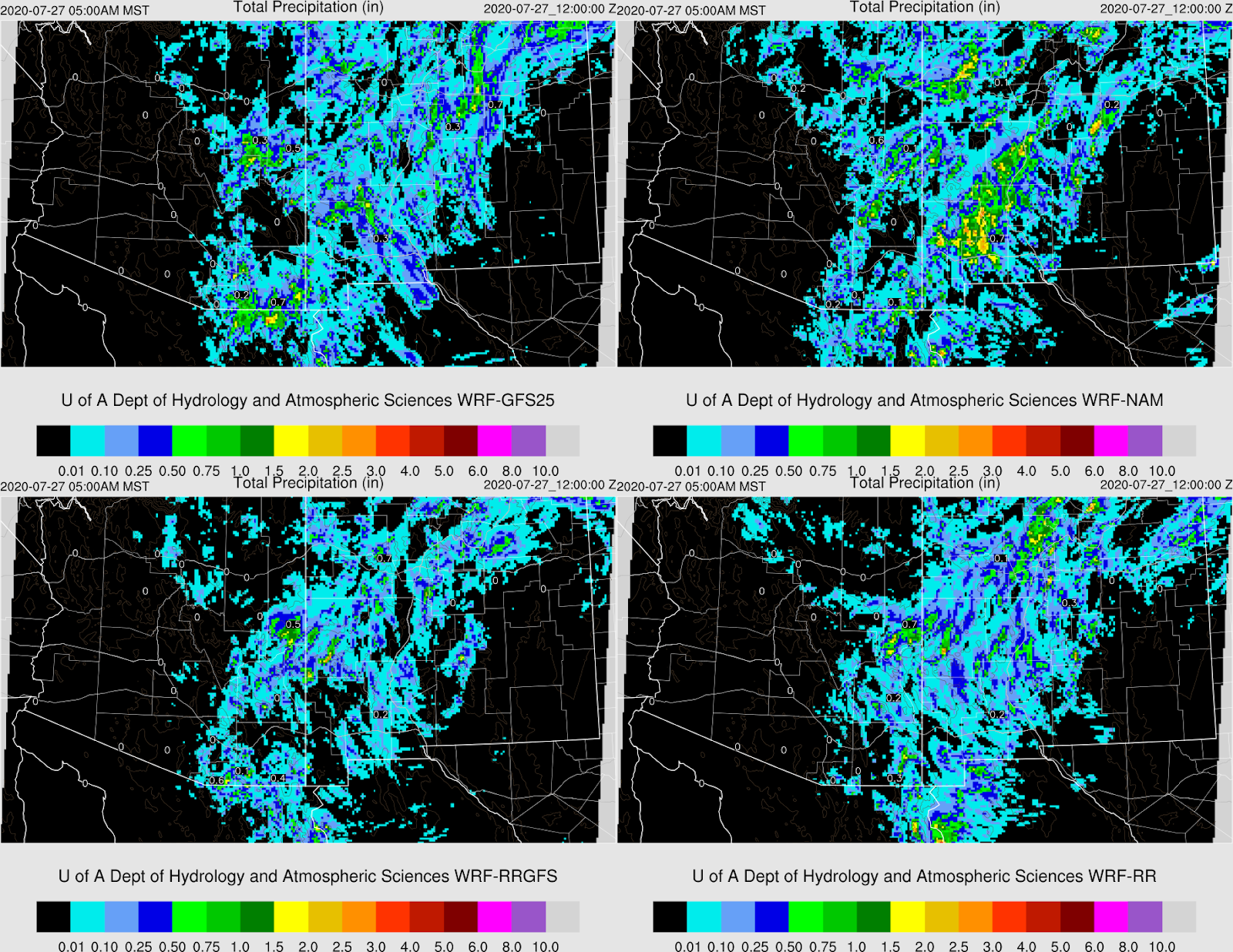
Initializations
It is a quiet morning with only a moderate amount of clouds over southeastern Arizona. All initializations did well. The NAM PW is too high over parts of southern Arizona, but I've seen worse. The GFS and RR initialized well. No small scale inverted troughs or MCV's were noted, and none were initialized.
Day 1
Low-level southeasterly flow advects moisture all the way into central Arizona today. However, drying was noted in NM and was once moist advection, is now dry advection through the "Chiricahua Gap" into far SE Arizona. 850mb dew-points are sufficient to support some activity west of there.

CAPE is mainly below 1000 J/kg so don't expect too much from storms today.

Storms mainly develop over the higher terrain of eastern Pima and Pinal Counties this afternoon.

CAPE increases around the Tucson area and is around 1000 J/kg by mid-afternoon. The wind profile is still terrible, so storms mostly stick to the higher terrain. Outflow boundaries move through the valley and could be strong enough to kick off some lower elevation activity.

A few storms continue over the higher elevations into the early evening.

What is somewhat surprising to me, is that most runs redevelop scattered showers and a few storms over southern Arizona during the early morning hours. I've not looked into why except there continues to be 3-500 J/kg of CAPE present.

Day 2
The big dry out has begun, and moisture levels decrease. 850mb dew-point temperatures are at best, marginal for storms over only eastern Arizona.


No comments:
Post a Comment
Note: Only a member of this blog may post a comment.