Tuesday, September 5, 2017

20170905

Previous Day
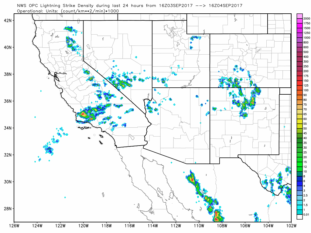
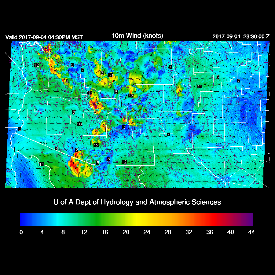
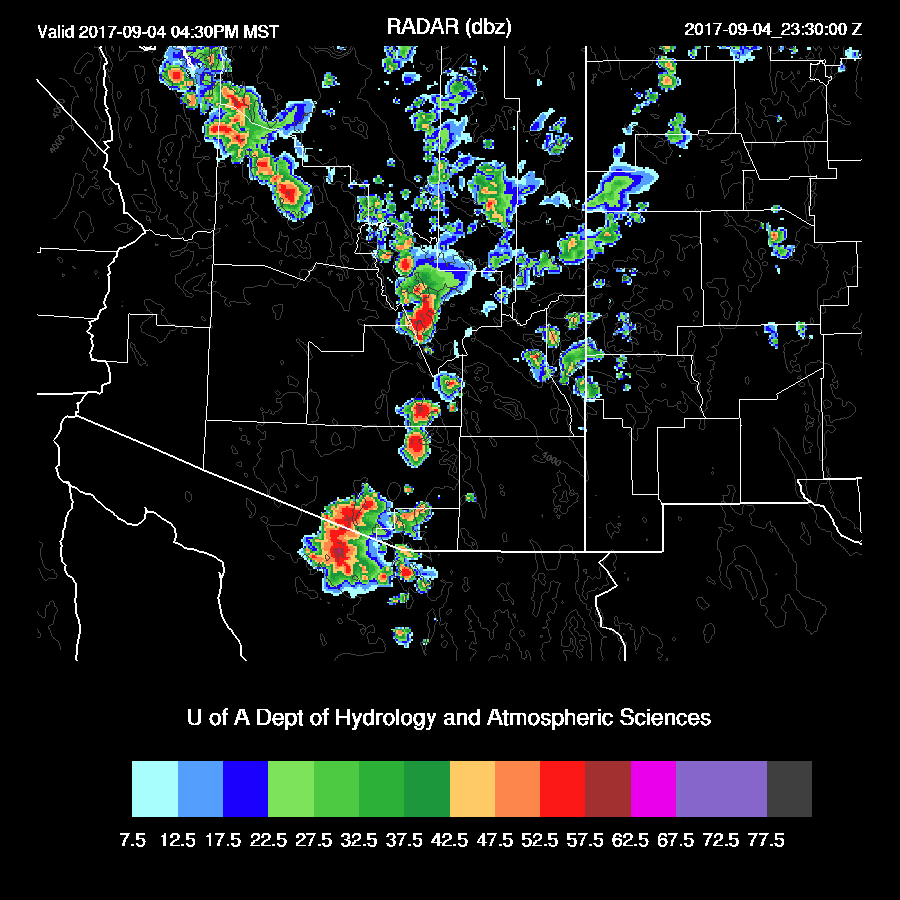
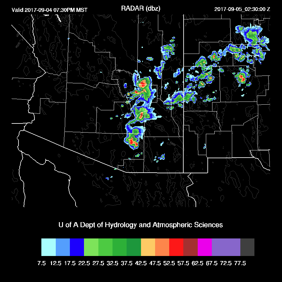
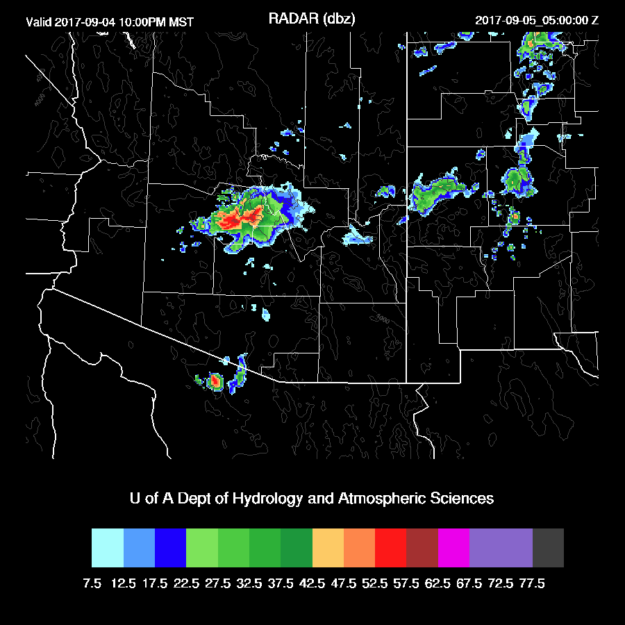
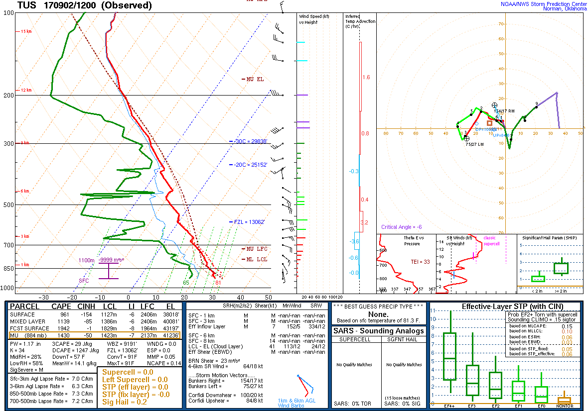
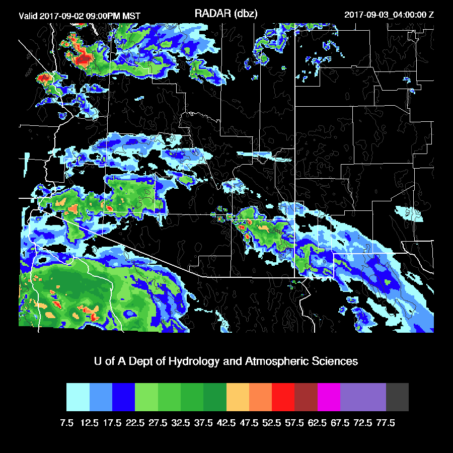
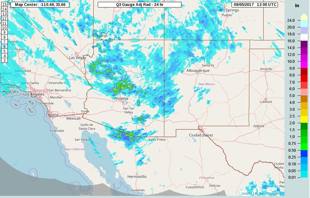
The model runs were a bit too optimistic with their storms around the Tucson area as the strong storms that were over the higher elevation did not make it into the city.  No wonder as the LFC was very high at around 650mb and I should have picked up on this earlier.  The forecast for big storms north of Phoenix did verify as well as a moderate outflow through the city.  Severe winds did occur as a site north of Phoenix had a wind gust to 78mph.
Untitled.jpg

The 12Z WRFNAM and WRFGFS performed well as did the 15Z WRFRRx (below).


Initializations
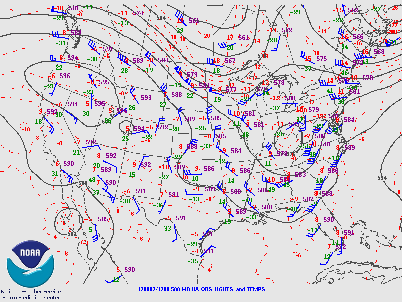
No significant change in the long wave pattern since yesterday as a 595dm ridge is centered over northern NV and a broad inverted trough is located across northern Mexico.  The remnants of Lidia are located off the CA coast as a weak low to mid level cut off low.  This feature may be of interest as longer term model runs have it moving south over the next few days.  All three 12Z model initializations have the large scale features initialized well.


Much of the SW US is clear so no problems with clouds in the initializations.   IPW is initialized well by all the 12Z model initializations.  Model performance should be good today.

Day 1
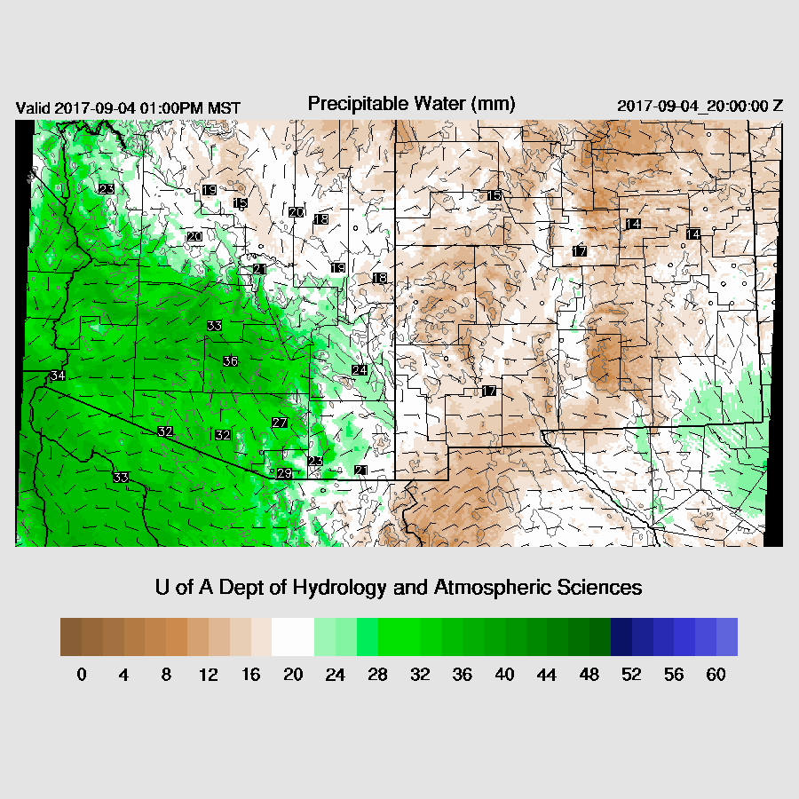
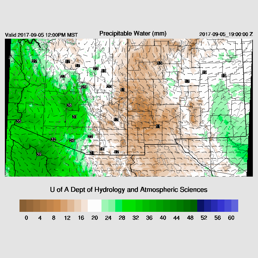
It is a battle again between dry air to the east and somewhat wet air to the west.  Tucson has been slowly drying since yesterday.  The Phoenix area is still holding on to some moisture but the 12Z sounding showed very minimal CAPE and a high LFC.  This setup continues today with a pronounced dryline from Nogales up to around Winslow.  This has been one of the longest lasting low-level dry easterly events I can remember.  I said the same about the 3+ weeks of very high IPW back in July too so either this has been a very unusual monsoon season or my memory is bad.  It could certainly be the latter!
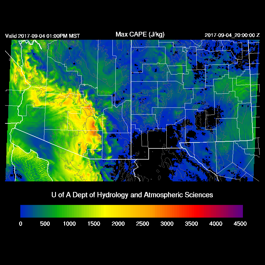
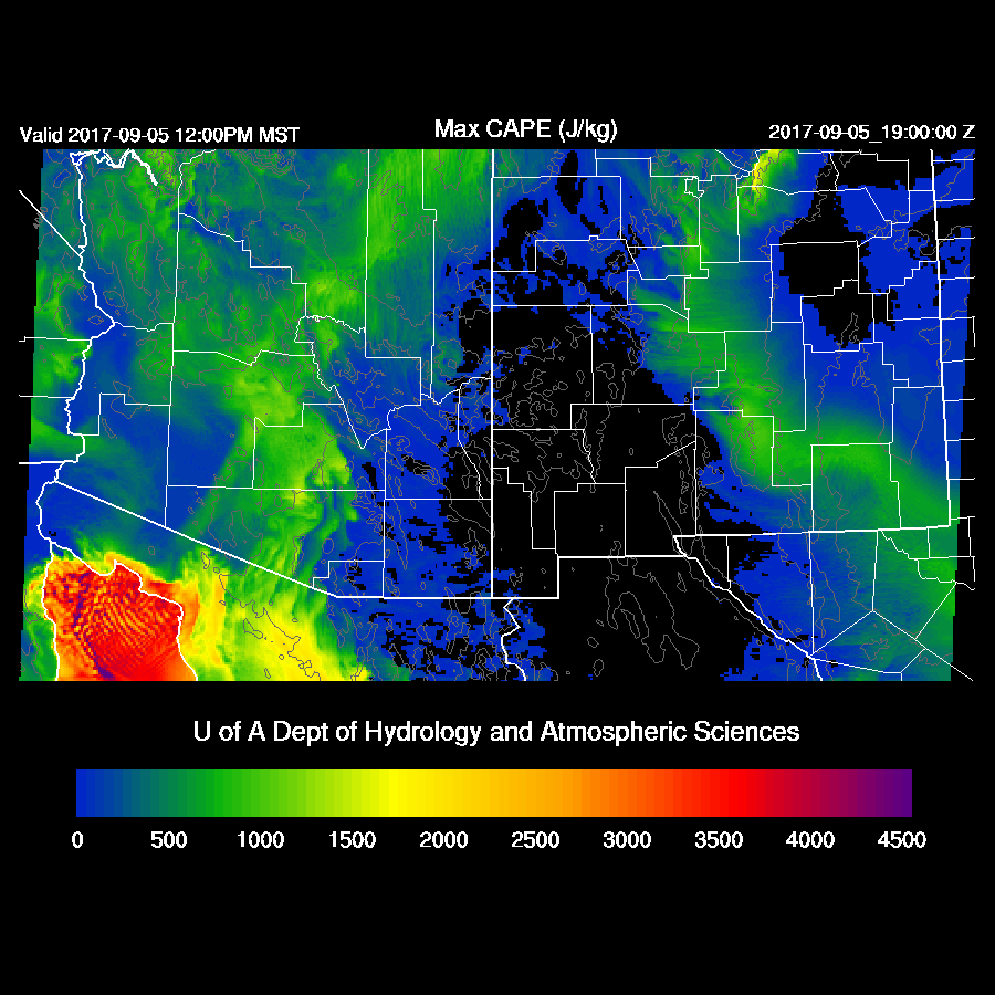
Moderate amounts of CAPE are forecast for just west of this line thus some of these areas could be quite active again today, mainly north and south of Phoenix. Maybe in Phoenix, if there are some intersecting outflow boundaries.
Steering flow is again favorable for moving storms from the high terrain into the deserts.  Temperatures continue to be cool thus even with marginal moisture, there will be some CAPE.

In general, model runs develop deep convection to the west of the dry line over the higher terrain of far southern Arizona and north of Phoenix.  The 12Z WRFRRx goes especially wild over southern Arizona which seems unlikely.  The 12Z WRFRRx has been unreliable at times while the 15Z WRFRRx is usually one of the better runs.  I attribute this to additional data assimilation as the 12Z RR runs are so early that all the 12Z upper air data may not get in.  WRFGFS below.


It looks unlikely for any activity around Tucson today as IPW is less than 24mm and CAPE is nearly zero as dry easterlies dominate the PBL.


Phoenix remains in the somewhat shallow low-level moisture which results in a moderate amount of CAPE.  Again, it’s going to take significant lifting to realize deep convection in the valley due to the high LFC as well as the relatively shallow moist layer.  Areas over higher terrain near Phoenix are likely to see storms that produce very strong winds and maybe some hail today.

By early evening, strong storms continue to move slowly west and into the lower elevations of central Arizona.  

Thunderstorms will have some very strong/severe winds associated with them again today.  The WRFGFS (below) does forecast intersecting outflows over the Phoenix area by early evening.

The WRFNAM keeps most deep convection over the higher terrain over SW and NW Arizona and only weak outflows into the Phoenix area.  It will be interesting to see the 15Z WRFRRx.

The WRFGFS does develop a few storms in and near Phoenix this evening but not anything widespread.
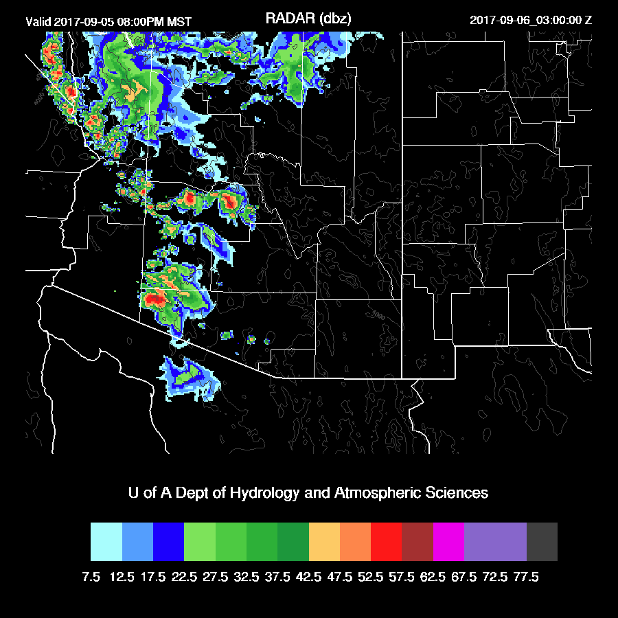
Both the WRFGFS and WRFNAM continue deep convection into the late evening over western Arizona.

This just in…..
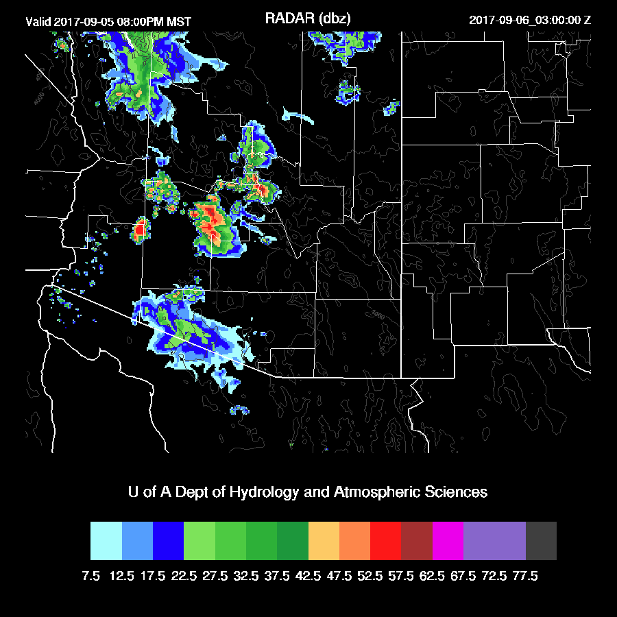
The 15Z WRFRRx is nearly as active around Phoenix as the 12Z run.  I still think it’s too active but who knows!?
Day 2
The dry air wins the battle as low-level easterlies push farther to the west.  This time of year it is supposed to be the westerlies that cause drying, not easterlies!  There is some spread with the model solutions so perhaps the dry air won’t push as far to the west as the WRFNAM forecasts below.


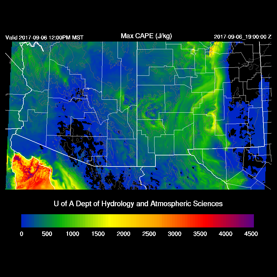
Of course, CAPE is minimal for most areas.
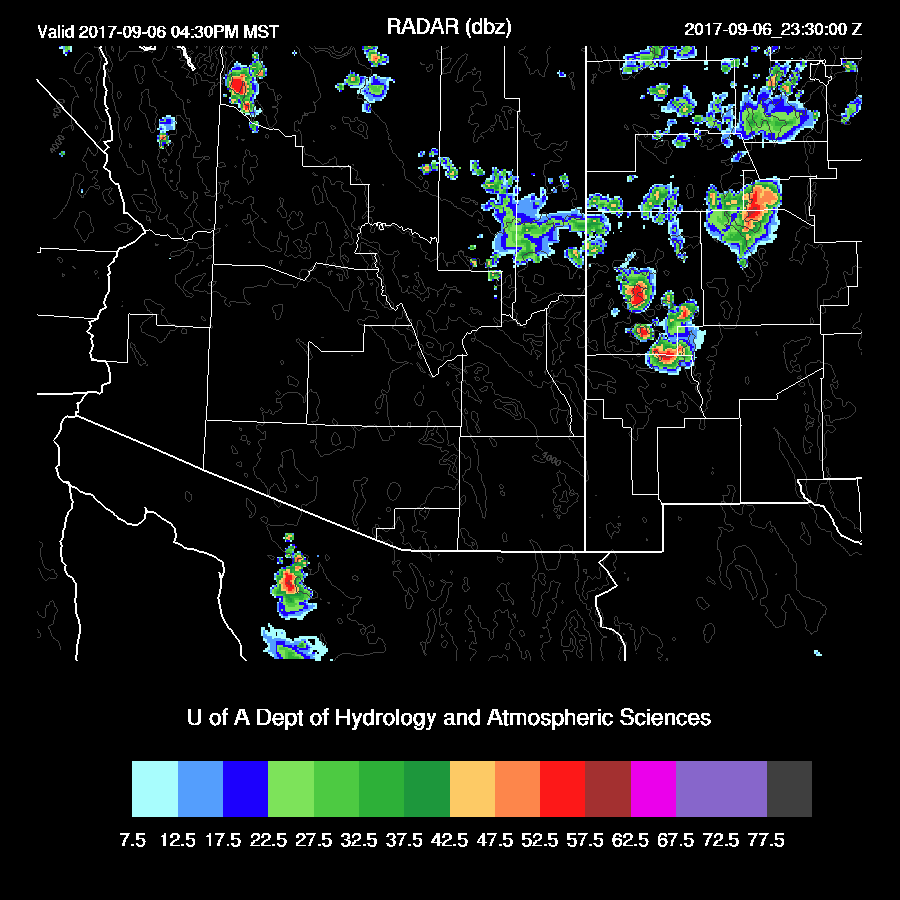
Very little activity expected tomorrow.

Monday, September 4, 2017

2017074

Previous Forecast
As expected, the 12Z WRFRRx was too active and there was only minimal activity except for NW Arizona.  All the other model runs performed well.


Initializations
The dominating ridge over the western CONUS continues with the center stretching from Idaho to the Four Corners.  The Big Bend IT is now somewhat stretched out over Chihuahua and northern Sinaloa.  An area of clouds is present over far eastern Arizona and is associated with a possible weak wave. All initializations look good as they have all the main features initialized well.  IPW also was initialized well.  Model confidence is high today.

Day 1
The forecast for yesterday was for increasing moisture for eastern ½ of Arizona as the dry east winds that have plagued Arizona recently have finally stopped.  Surface dewpoint are mainly in the 60s in the low deserts and 40s in the mountains.  IPW is only 29mm at Tucson and 33mm at Phoenix, thus the moist layer is shallow and this is verified by looking at the morning soundings.  A weak surge continues to advect in moisture during the day keeping IPW about the same.

Mid level temperatures are a coolish -7 to -8 thus with only moderate amounts of moisture, CAPE is quite high from NW Arizona down to the south of Tucson and some storms are likely to be very strong today.


Mid level winds become favorable for steering higher elevation storms into the lower deserts today as winds are easterly or northeasterly at 10 to 20 knots.  CAPE is low over the higher terrain but probably enough to support some storms.  Mid level temperatures continue to be cool at -7 to -9C.

All the model runs do develop storms over the Rim and White Mountains during the early afternoon.

An impressive amount of surface based CAPE exists over Tucson this afternoon as it’s over 2000 J/kg.  Mixing it out gives about what I would estimate about ½ that.  A weak inversion is present on top of the shallow mixed layer so some lifting via an outflow boundary is going to be needed to trigger convection.  

The various runs are in general agreement about moving scattered storms towards the lower elevations during the afternoon.  Outflow winds are forecast to be very strong and will provide the lift necessary for some storms in the lower elevations.

By later afternoon scattered strong to severe storms continue with storms present in the Tucson area.

There is a spread of 10 mm for the forecast of IPW at Phoenix.  The middle of the road is 34 mm, which results in around 1200-1500 J/kg and is plenty to support storms.  As in Tucson, a strong outflow boundary or multiple intersecting ones is necessary to trigger deep convection.  

Scattered strong/severe storms continue into the evening over central Arizona. WRFNAM below.
The WRFGFS has an especially strong storm just north of Phoenix. I just took a quick look at the WRFRRx 15Z and it is similar.  All of the model runs have only limited low elevation activity as the inversion on top of the shallow mixed layer doesn’t break in spite of strong outflows.


This storm ejects a strong outflow into Phoenix which should be able to trigger a few storms there and blowing dust, of course.

Storms this afternoon and early evening are likely to be severe with hail due to the deep mixed layer, high CAPE and cool mid level temperatures.  

Day 2
Winds remain favorable for steering higher elevation storms into the lower elevations around Tucson and Phoenix.  Temperatures continue to be a cool -9 to -7C.

It’s the “Return of the Dry Easterlies” as dry air moves into much of eastern Arizona.  This is one sequel I don’t want to see!  There is some disagreement among the runs so maybe the WRFNAM (below) is too dry.


Storms mainly over NW and SW Arizona where moisture is highest.

Sunday, September 3, 2017

20170903

Previous Forecast
Only a few storms formed over SW Arizona, less than what the WRFRRx had predicted but more than the WRFNAM.  Clouds around Tucson kept heating to a minimum and dry SE flow moved into Phoenix decreasing moisture to less than 24mm resulting in no CAPE.  All model runs did verify in NW Arizona.


Initializations
An enormous 500mb ridge continues to dominate the western CONUS with heights as high as 5960m. An inverted trough is over the Big Bend region and is moving slowly to the SW.  TD Lidia is located off the coast of far northern Baja with thick clouds across far SW and SC Arizona and scattered to broken clouds elsewhere.  All the models have initialized clouds fairly well.  The NAM is back to being too wet at many sites including NW Mexico, in spite of a sounding from Empalme.  The GFS and RRx had minimal errors for the most part and I’d say those are the two favorites for today.
Day 1
IPW continues to be elevated as the lower deserts have from 32 to as much as 50mm (at Yuma).  By midday, there is a clear moisture continues over the southwestern ½ of the state while dry air returns to the east due to low-level flow.  The important convective initiation points along the Rim, White Mountains, and high terrain of SE Arizona are all dry.
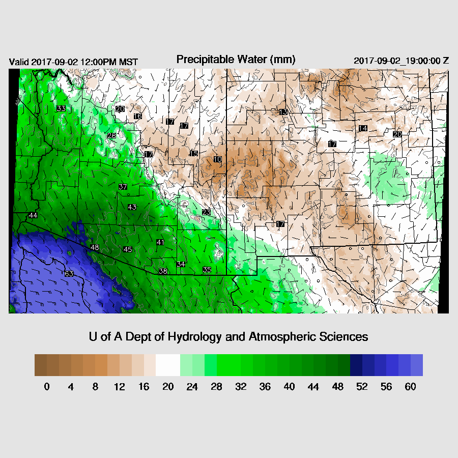
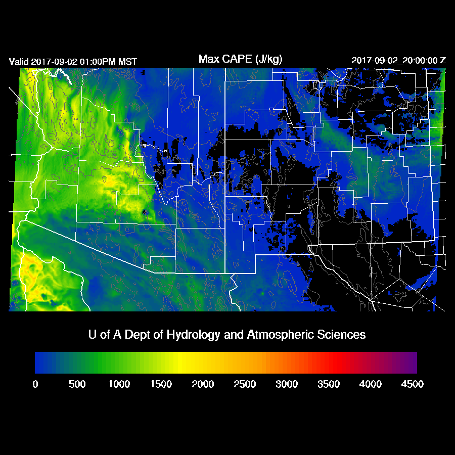

Steering flow is decent over the state as it’s mainly ESE at 15 to 20 knots so if there were storms over the higher elevations, they would be steered into the lower elevations.  


High elevation storms look unlikely due to limited CAPE.


Both the WRFNAM and WRFGFS have limited or no activity today except for a repeat of far NW Arizona storms.  Why did I write this then???


I started this discussion because the WRFRRx tricked me as it had a lot of activity around Tucson and Phoenix this afternoon.  I now find that forecast to be unlikely and would bet that the 15Z WRFRRx backs off on activity.

Day 2
The low level easterly flow decreases and allows moisture to increase over much of the southern ½ of the state as a weak surge is underway.


Another favorable development is mid-level flow becomes northeasterly over much of the eastern ½ of the state along with some cooling.


CAPE is marginal over the higher terrain but quite high in the Tucson and Phoenix areas.  If storms can form over the high terrain, they will be steered towards this lower level CAPE and some strong storms may be able to form.

A few eastern Arizona storms do form by later in the afternoon.


Some of the models do forecast scattered low elevation storm during the evening in/around Tucson and Phoenix.  Finally some interesting weather!

Saturday, September 2, 2017

20170902

Previous Forecast
Yesterday’s WRFNAM forecast for today appears to not have enough moisture and too strong low-level easterly winds as the morning sounding from Tucson is quite wet in the lower troposphere along with over 1000 J/kg of CAPE.  The WRFGFS and 15Z WRFRRx forecast sounding looks more accurate and these model runs were more active for storms this afternoon.
15Z WRFRRx

Initializations
I am traveling later this morning so I don’t have time to wait for all the 12Z runs.  The tropical storm appears to be just inland over central Baja and continues to have deep convection in this area.  A large mid/high-level cloud shield has moved into SE Arizona and these clouds will play a critical role in today’s deep convection chances.  The 6z WRFGFS cloud forecast is quite good this morning while the 6z WRFNAM doesn’t have quite enough in southern Arizona.  Both have Lidia a bit too far to the west but it’s not easy to find the exact location so it’s hard to say for sure.  The 12z RRx clouds appear to be initialized well and also has the center a bit too far west.  There was a sounding from Empalme this morning which will increase model initialization accuracy in NW Mexico and this may have resulted in the very good IPW initializations especially at 12Z.  Overall, the initializations seem to have handled the complex situation well so model confidence is high.  I just took a quick look at the 12Z NAM and it has done a very poor job initializing the TS as it’s way too strong.  It’s cloud initialization is also poor so I’m not going to use it.

Day 1
Moisture increased rapidly overnight, into the upper 20s to nearly 40mm at Yuma.
It does appear that the dry low-level easterlies have weakened somewhat thus allowing more moisture to remain over southern and southwestern Arizona this afternoon.  

CAPE is low to moderate over far southern Arizona but quite high over central and western Arizona thus with enough sun, it could be an active day over parts of the state.

It appears Tucson remains cloudy for much of the day thus not much heating or much CAPE in spite of a wet 42mm of IPW as mid and upper levels are warm.  However, if there is more heating, there certainly could be a few weak storms around.

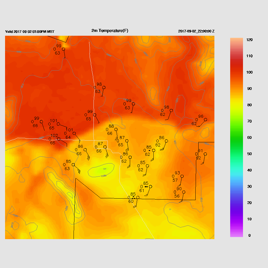
It’s a different story at Phoenix as it remains mostly clear which allows good heating.  Afternoon CAPE is quite high at around 1200 J/kg thus it’s possible there will be storms in and around the Phoenix area this afternoon.

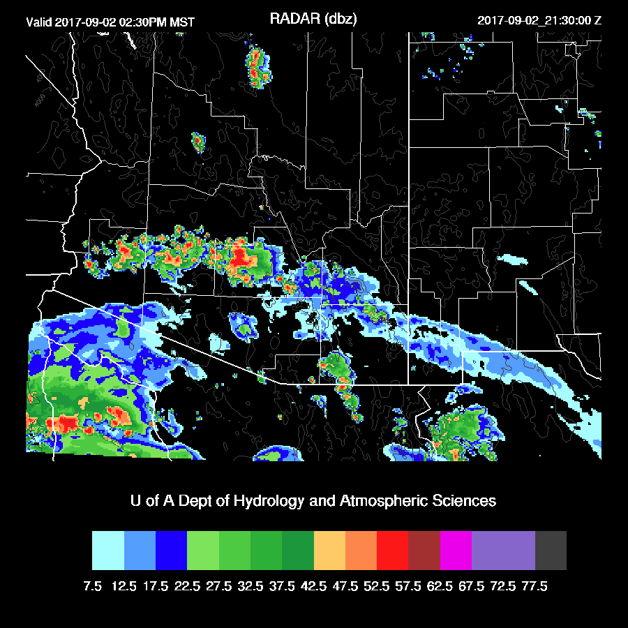
Storms develop in the clear areas of central Arizona this afternoon with some being quite strong.  The 6Z runs are similar with locations and timings.

Depending on the location, there could be a big dust storm/haboob in Phoenix this afternoon as the forecast Skew-T has a moderate inverted V profile thus outflow winds may be strong.

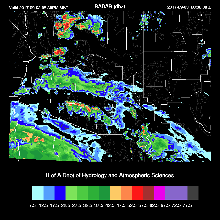
Scattered storms continue across southern Arizona into the late afternoon with strong storms developing over NW Arizona.

A few weak storms continue across southern Arizona into the evening hours and a few strong storms are forecast to be in the vicinity of the CO River near Bullhead City.