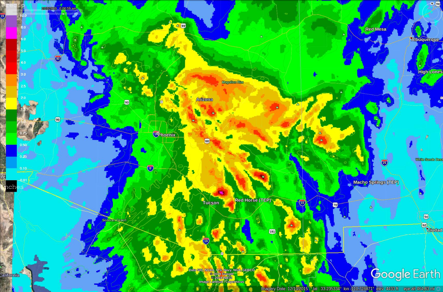
Remarkably, the forecast track of the storm and overall precipitation amounts have not changed all that much since the last discussion on Monday. However, it is uncertain how much snow may fall in Tucson. This forecast is going out to both the utilities and Pima County as there is something for everyone. I'll start with the precipitation as once again, some truly remarkable amounts fall over the mountains due to a combination of strong upper low plus lifting by air forced up the sides of mountains. Many mid and high terrain locations will see at least 1.5 inches with isolated areas above 3 inches. Mt Lemmon and Mt Graham may see as much as 4-6 inches of liquid water. However, it's not going to fall as rain like last time and I'll get to that later. Even the lower elevations do well with widespread 1/2 to over on- inch amounts. The below plot is an ensemble average/most likely of the last 6 or so Arizona Regional WRF runs with amounts in solid colors. The contours are maximum amounts/worst case amounts.
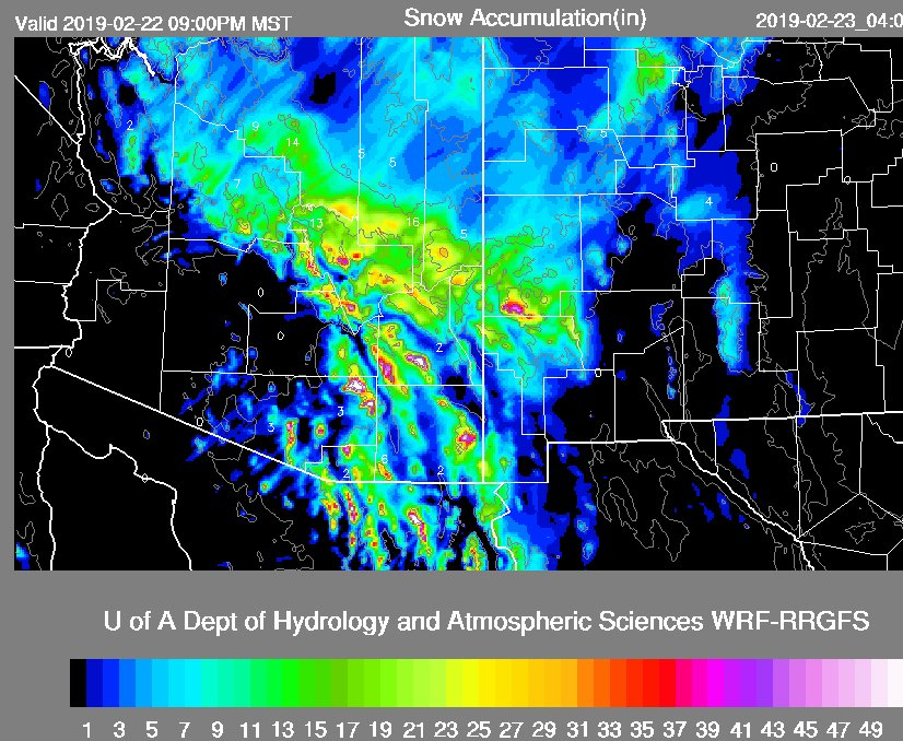
Temperatures are much colder with this storm and the snow level will be as low as 2500 ft. At high and mid elevations, snow amounts will be extreme especially because the snow to water ratio will be high, 10:1, at least. Amounts for Mt Graham and Mt Lemmon go off the top of the scale of the plot, above 50 inches. Of note to APS, a moderate amount of snow accompanied by cold temperatures will impact the Cholla power plant.
Precipitation starts over the state during the morning hours tomorrow and continues throughout the day. There is just enough instability for a few weak thunderstorms to form over much of southern Arizona which will result in some isolated heavy rain, occasional lightning, and small hail.
The big question is regarding snow in Tucson. Model runs say it's about a 50-50 chance. What is most likely is a cold rain with snow mixed in and then changing over to all snow for a few hours on Friday morning when the cold front moves through with accumulations of an inch or two of wet snow. I now think it's unlikely for any significant accumulation above a few inches.
No comments:
Post a Comment
Note: Only a member of this blog may post a comment.