The forecast remains on track for a major winter precipitation event over Arizona starting tomorrow morning. The accuracy of the model runs from two days ago is remarkable as the most recent forecast has the deep and cold trough moving into far southern Californa during the day on Thursday much like was predicted 2 days ago.

Moisture is limited especially compared to the last storm as PW is around 12-18mm. However, the Herman rule is in effect as it’s well below the -21C threshold at San Diego. -21C or colder means that the low-level moist marine air is able to mix deeply and above coastal mountains of SoCal and northern Baja and allow it to move into Arizona.

With the increasing cold air aloft and an increase in moisture, a little CAPE is present over southern Arizona during the day Thursday which may result in a few weak storms accompanied by small hail and occasional lightning.


Precipitation continues into the night over much of the southern ½ of the state along with a few weak storms over the far south.

The big question in Tucson is if it will snow? My guess is most precipitation will be rain with maybe some snow mixed in at times and then changing over to all snow sometime during the early morning hours when the front moves through. Maybe an inch or two?
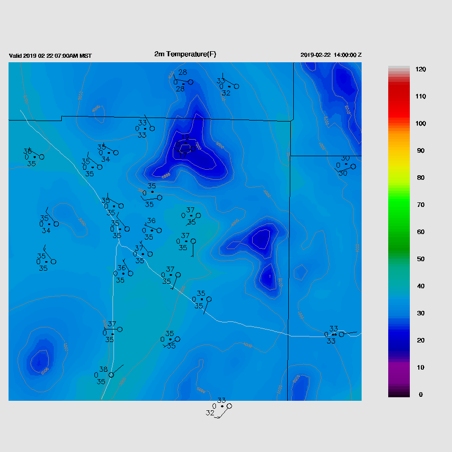
Accumulated precipitation is expected to be significant for the lower elevations for the Tucson and Phoenix areas with over an inch in some areas. High elevations of SE Arizona are again forecast to receive extreme amounts up to 6” liquid equivelent.

Some plume diagrams from the time-lagged ensemble system are below. There is quite a spread in the Phoenix area.


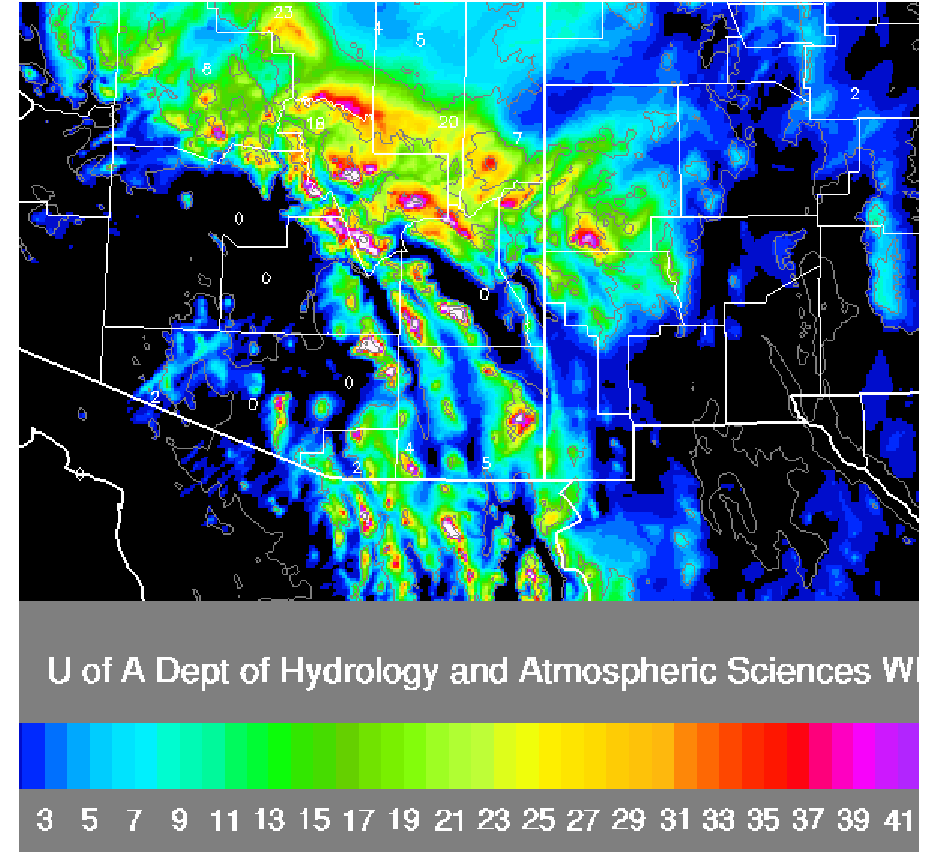
Extreme amounts of snow are predicted above 7-8k feet with more than 50 inches (white). The scale only goes up to 50” but with a 10:1 snow to water ratio, amounts could be as high as 60”.
No comments:
Post a Comment
Note: Only a member of this blog may post a comment.