A few storms developed over eastern Arizona and moved towards eastern Pima county where there was a little activity around sunset. The nonsoon continues.

The various WRFRR and WRFGFS were reasonably accurate. The WRFNAM had too much activity.

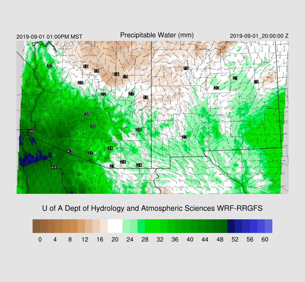
Initializations
The 500mb anticyclone center has consolidated over the Four Corners resulting in moderate mid-level steering over the southern 1/2 of the state. Satellite imagery indicates that there is an MCV over central Sonora as well as a general area of storms over the southern Gulf of California due to a northward moving MCS. The RR initialized these small scale features well. PW was initialized well except for the NAM which was too wet in Sonora. Initializations look good with the best being the RR.

Day 1
Moisture has generally increased over the southern 1/2 of Arizona during the past 12 hours resulting in increasing CAPE. Tucson reports 1100 J/kg and PHoenix 600 J/kg of MLCAPE. There is a deep layer of mid-level easterly winds as well as an area of subsidence above 500mb.

A weak surge continues to import moisture into Arizona, and by early afternoon, moisture has made its way over much of western Arizona. Southeastern Arizona is under the influence of low-level drier easterly flow.
850 dewpoint temperatures are quite high over southern and central Arizona with some areas above 15C. This area has the best chance for activity today and tonight.

CAPE is moderate to high in these areas, and storms that form could be very strong to severe. DCAPE is over 1300 J/kg at both Tucson and Phoenix so intense outflow winds are possible. The problem is getting storms to form, which has been so often the case this summer.

Scattered storms develop by mid-afternoon over the eastern Rim and the White Mountains as well as intense storms in central Pima County. CAPE is very high there as well as local convergence from the back door dryline.

Some model runs from yesterday were predicting a severe weather outbreak in/around Phoenix today, and that continues to be the case. The potential exists as CAPE is moderate at 700 to 1400 J/kg, plenty of low-level shear, and easterly steering flow. The problem is the PBL is shallow and will need significant lifting to reach the LFC.

The WRFNAM, which has had issues with too much activity, really looks impressive by late afternoon. Note the significant difference for the forecast PW, 41 vs. 32mm. I doubt the WRFNAM is correct but wanted to illustrate the issues it's been having.

The storms in western Pima County die out at they move into the strongly capped environment over western Arizona. Storms struggle to make it into the Phoenix area as well, but some activity gets underway just to the northwest of Tucson.

Some outflow boundaries to move into the Phoenix vicinity during the early evening. Will these boundaries provide enough lift for storms?

The 15Z WRFRR develops some storms in the Phoenix area this evening as does the WRFNAM. Not very widespread, but the few storms that form are likely to produce very strong to severe winds.


Neither the WRFGFS or 12Z WRFNAM have any activity for the Phoenix area, but keep storms going around the Kingman area.

Day 2
Due to model problems and all the time I spent looking at Day 1, I only briefly looked ahead to tomorrow. Dry air moves farther west while very high CAPE is present over southwestern Arizona.

Very big storms form on this boundary over southern Arizona and northwest of Phoenix. I'm skeptical as WRF has had a bad high activity bias for Day 2 recently.

Storms die as they move into the capped lower elevations, but maybe a few for the Phoenix area later in the evening.

No comments:
Post a Comment
Note: Only a member of this blog may post a comment.