Not a good day for the model runs and I neglected to pick up on some clues that indicated they were going to be too active. Stronger storms were mainly restricted to the higher terrain of parts of SE Arizona with very weak activity around Tucson. Below is the lightning plot as the QPE product from NOAA/OU (http://nmq.ou.edu/) is no longer available. For whatever reason, NOAA had decided to make those products internal and not available to anyone else. I've tried to get access but have been denied.


As mentioned, there were quite a few clues that the forecasts were going to be bad. The first was that Tucson area IPW started dropping during the late morning hours while the model held steady or even increased slightly. Another problem was the IT the model runs had initialized south of Douglas was not there. Later in the morning, I could find no evidence when looking at cloud motions and I should have looked harder when evaluating the initializations. The area of clouds that moved through during the morning also restricted heating a little. By late morning, it was clear there was too much forecast activity by just looking at the lack of development. Not a good way to start the season.
Initialization
No significant errors noted.
Day 1
500mb heights have come down a little so not quite as hot today but moisture has increased slightly. Even a weak Gulf of California moisture surge is underway as dewpoints are in the 50's there. Quite a bit of moisture is lurking just to our south over western Mexico and some of this continues to trickle into Arizona today.

In spite of this low-level increase, only far eastern and southeastern Arizona have sufficient CAPE to support deep convection.

Scattered storms are present during the afternoon for this area.

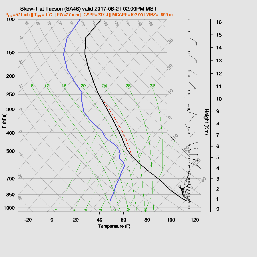
The Tucson forecast vertical profile has only minimal CAPE and unfavorable winds. Mt Lemmon might see a quick afternoon storm though. A deep inverted v profile will again cause storms east of Tucson to have very strong winds associated with them.
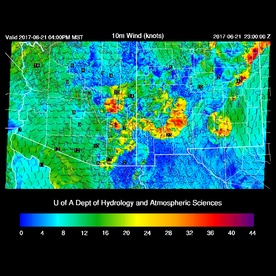
By late afternoon, areas of EC and SE Arizona as well as into SW NM may experience very strong winds.
Day 2
No significant weather expected as moisture is limited over higher terrain. A weak surge continues to advect low-level moisture which will increase dewpoints into the 50's in western and central Arizona.

No comments:
Post a Comment
Note: Only a member of this blog may post a comment.