Overall, WRF forecasts were mostly accurate as supercell thunderstorms developed in western and central Arizona. The MRMS website is not available this morning, so I can't say exactly how the precipitation forecasts verified. I can say that the WRFRR was too wet for the Tucson area, as it had isolated 4-6 inch amounts over far eastern Pima County. The maximum I could find was 3.5" in Vail. Generally, the valley received less than an inch. The WRFGFS was the most accurate for Pima County.
Initializations
The cut off low is located over the far northern Gulf of California. It is responsible for ongoing showers/storms and thick clouds over southern Arizona and into northern Sonora. Getting these features initialized correctly is going to be important as heating will make a big impact on forecast accuracy. Unfortunately, the 12Z NAM was very poor as it had no activity and clear skies over southern Arizona. The 12Z RR wasn't much better. 6Z runs had some activity this morning, but it was too far to the west. The 15Z WRFRR was much better and had deep convection and clouds initialized farther east and more or less in the right locations. The PW initialization was also good, so it's the favored run, by far, for today.
Day 1
PW as increased since yesterday and it back into the 30-35mm range as moisture from Mario was advected into the state overnight. PW is forecast to remain about the same into the early afternoon as the southeasterly flow continues over much of the southern 1/2 of the state.
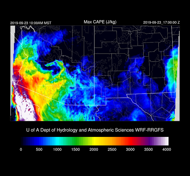
CAPE was only a few hundred J/kg at Yuma at 12Z. It doesn't get much better by this afternoon except for areas near the Mexican border. This is quite a bit different from earlier forecasts which had moderate CAPE as far north as Coconino County.
Afternoon storms are restricted to mainly southwestern Arizona.
The cut-off low moves a little northwest and by early evening. Note the front side speed max which may mean it will start to move out to the north over the next day.
This speed max can also be seen at 250mb. This jet is in a favorable location to help organize storms for central Arizona, as long as there is any CAPE available.
CAPE does increase over central Arizona somewhat this evening.
Storms form by early evening over Pima county and move rapidly north.
Phoenix does appear to have sufficient CAPE to support evening activity as well as a deeply mixed PBL. The surface to 400mb vertical wind profile does exhibit some directional and speed shear, so storms could be organized.
Scattered storms, some strong, move through the Phoenix area this evening.
The 15Z WRFRRx is now available it has more clouds around during the day, including the Phoenix area. It doesn't develop storms until a bit later in the evening, and not as widespread.
Storms rotate around the upper low and move into western Arizona by late in the evening.
CAPE is sufficient to continue the risk of thunderstorms into the early morning hours from western Pima and all the way up to the western Rim.
Day 2
The low moves slowly north and is south of Vegas by 18Z tomorrow.
CAPE continues to be sufficient for scattered thunderstorms over much of the western 1/3 of the state.


